Saturday, June 16, 2018

20180616

Previous Forecast
Showers and a few thunderstorms were widespread overnight with mainly light to moderate rain.  I got over 1” during a thunderstorm around 7am. In general, the models did an OK job overnight considering the complex situation but nearly all runs missed the morning convection.  

Initializations
The main issue is going to be how much heating will occur in southern Arizona.  As of 16Z, rain is ending across the Tucson area and skies are partly cloud across far south central to SW Arizona.  The 12Z(WRF)NAM did a pretty good job initializing the clouds and precipitation but the 6Z WRFGFS did not have enough clouds and showers during the morning hours so is likely to be too active.  WRFNAM IPW was initialized well and in spite of the complex initialization, the WRFNAM initial conditions look pretty good.

Day 1
Wow, is it wet.  Tucson PW peaked at around 44mm last night and Buckeye at 46mm.  Moisture begins to decrease and by early afternoon drier air is moving into the southern part of the state but plenty of moisture is still available for showers and storms.

The upper-level low is over western Arizona by early afternoon with quite cool air over central and southern Arizona which will create steep lapse rates and some CAPE.

As was forecast yesterday, CAPE is moderate over much of Arizona thus storms are likely for areas that receive some heating and perhaps even for areas that don’t.

Scattered storms develop by late morning from Phoenix down to Tucson and continue throughout the afternoon.

Activity decreases around the Phoenix area by late afternoon with storms continuing around SE Arizona (WRFNAM below).  There is quite a bit of uncertainty due to the issue with clouds/heating and it’s possible that there will be less activity, similar to the 12Z WRFGFS, which just became available.  

The main threat this afternoon is heavy rain as some storms will produce over 1”/hour.

Day 2
The airmass dries out rapidly thus no activity is forecast.  

Friday, June 15, 2018

20180615

Previous Forecast
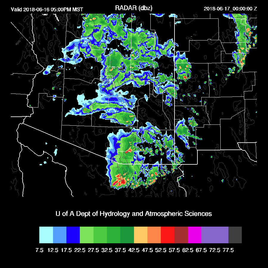
Scattered storms formed over mainly over the high terrain of the eastern quarter of the state, which was similar to the WRF forecasts.  The WRFNAM was too early with the very strong storms that formed just south of the border.

Initializations
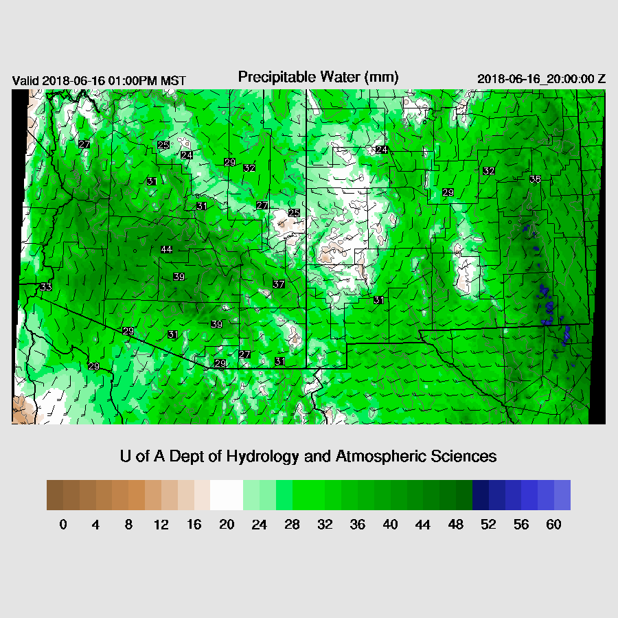
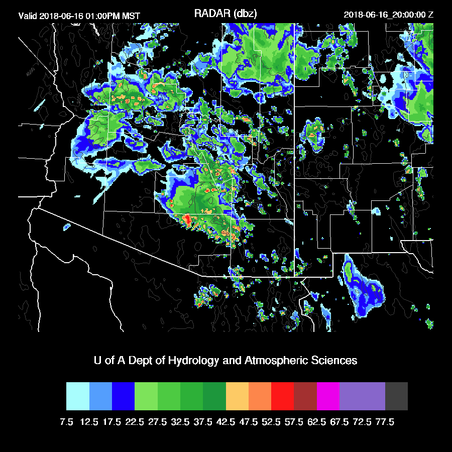
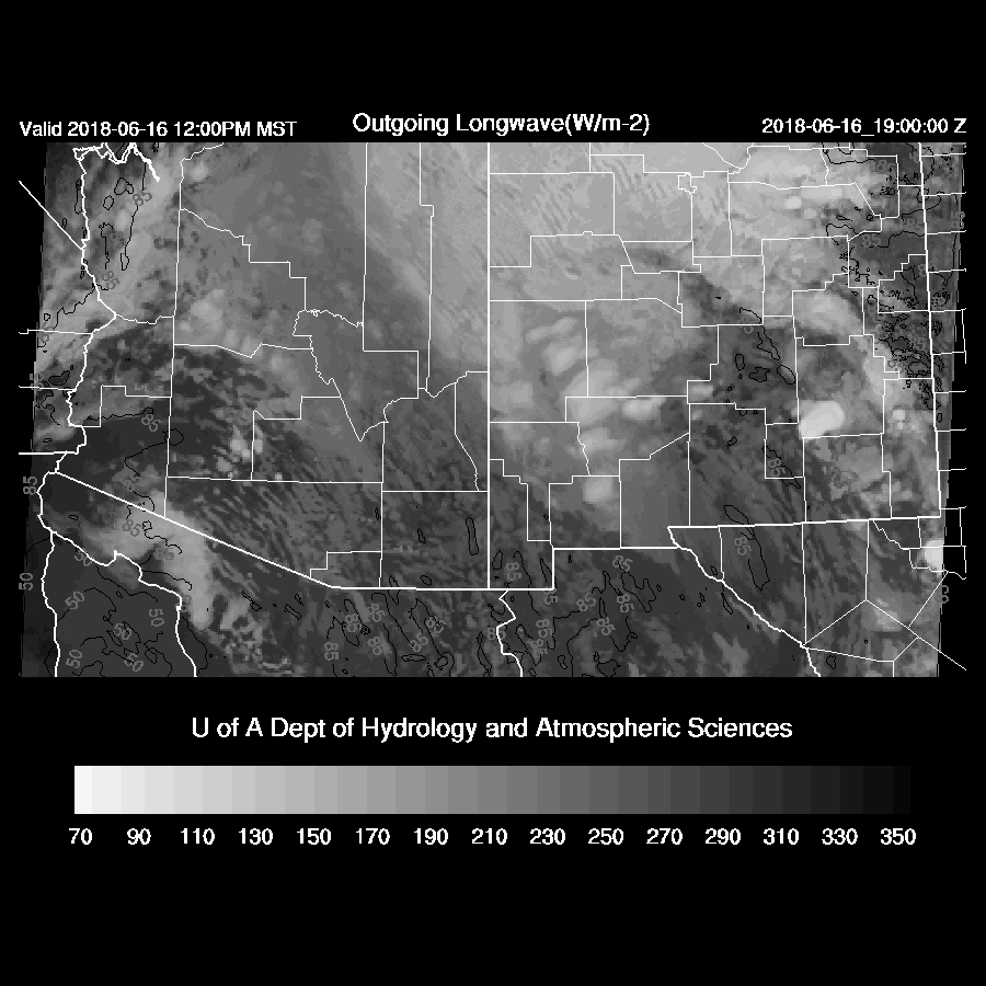
NHC says Bud is a minimal tropical storm with winds at 30 knots.  This is less than yesterday’s model forecasts called for, though I figured they were too strong.  Bud is located about where the forecasts said it would be, over the south central Gulf of California.  Model initializations of Bud look good. The closed upper trough is located a few hundred miles WSW of San Diego and is moving slowly to the east. It also appears well initialized.   Clouds are widespread across the southern ½ of the state but there is some clearing over the far SE. Thus, as was the thinking yesterday, that area is likely to see more activity this afternoon.   Both the 6Z WRFGFS and 12Z WRFNAM are struggling as they have the thickest clouds over SE Arizona rather than central Arizona. So, forecast confidence is decreased. The 6Z WRFNAM looks pretty good so that may be the go-to model run for today.  IPW initializations were mainly good with only the 6Z WRFGFS having a slight wet bias. Showers and storms are ongoing across the southern ⅓ of Arizona. The 12Z WRFNAM did a poor job initializing this activity while the two 6Z runs were a bit better.  There is a WRFRAP in the queue and perhaps it did better. At this point, I’ll mainly rely on the 6Z runs.

Day 1
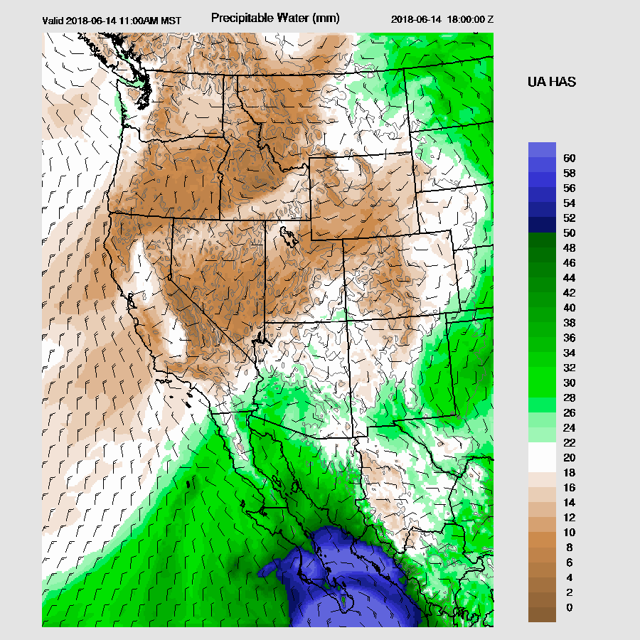
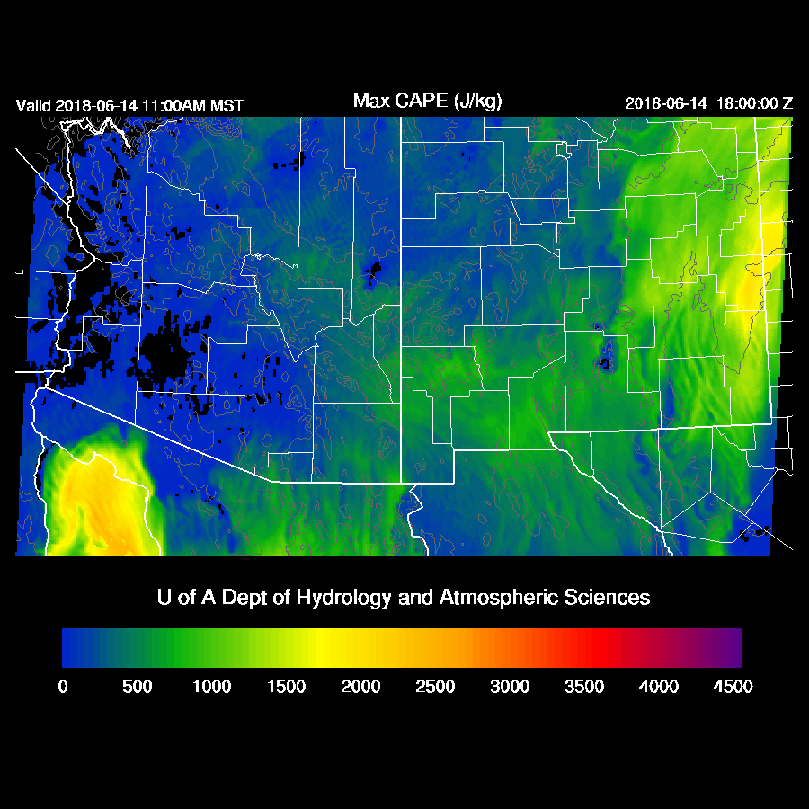
Forecasting these tropical systems is NEVER easy.  IPW is up to 33mm in Tucson and 34-35mm from Phoenix to Yuma so there is plenty of moisture around.  High to very high 850mb Td air is over much of south central Arizona by mid-day. But what about CAPE?  CAPE is usually limited in tropical systems and that is the case today. The exception is in far SW Arizona.  

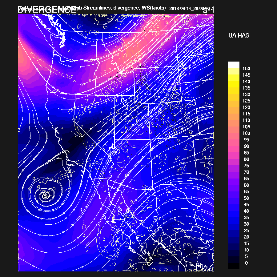
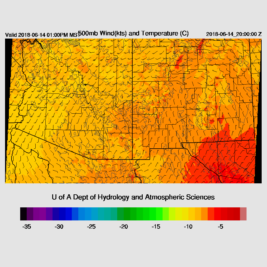
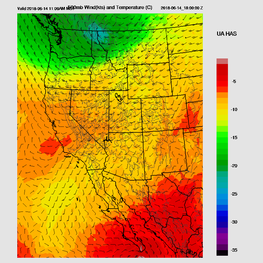
The upper trough and associated cooler air inches its way to the east during the day.  Temperatures are less than -10C which will provide some steep lapse rates once it gets over the state.  Steering flow is mainly weak across the state, but it’s quite good in SE Arizona with 20-25 knots thus some organization and propagation of storms is possible there.

The Tucson vertical profile doesn’t look very good for deep convection as CAPE is quite limited.  However, directional and vertical shear are good, plus a 80 knot upper jet due to the proximity of the trough.

Phoenix is also lacking CAPE and surface heating.  As with Tucson, the wind profile is good. Plenty of moisture so mainly showers with lifting provided by the incoming trough.

It’s hard to pin down timing and locations due to the complex situation.  The best I can say is increasing shower and a few weak storms over the southern part of the state during the afternoon.  The active area should be SE Arizona where it is clear now and a little CAPE is present.

Mainly light rain over much of southern Arizona this evening.

24 hour precipitation amounts are mainly light except for far southern Arizona.

Day 2
It remains wet over much of Arizona and into New Mexico with drying beginning to move into far western Arizona.

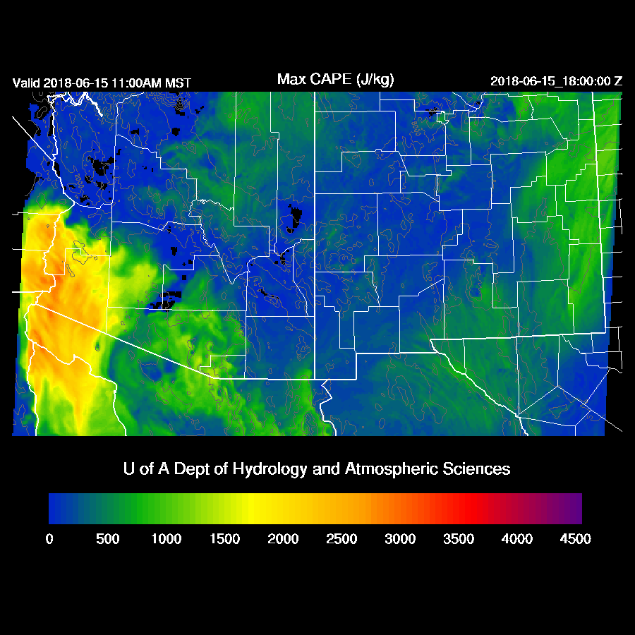
The upper trough moves across the southern part of the state during the day. Temperatures are below -10C at 500mb and provide a steeper lapse rate and larger CAPE values.

CAPE is moderate to high over much of central and SW Arizona by mid-day. There is potential for some strong storms.

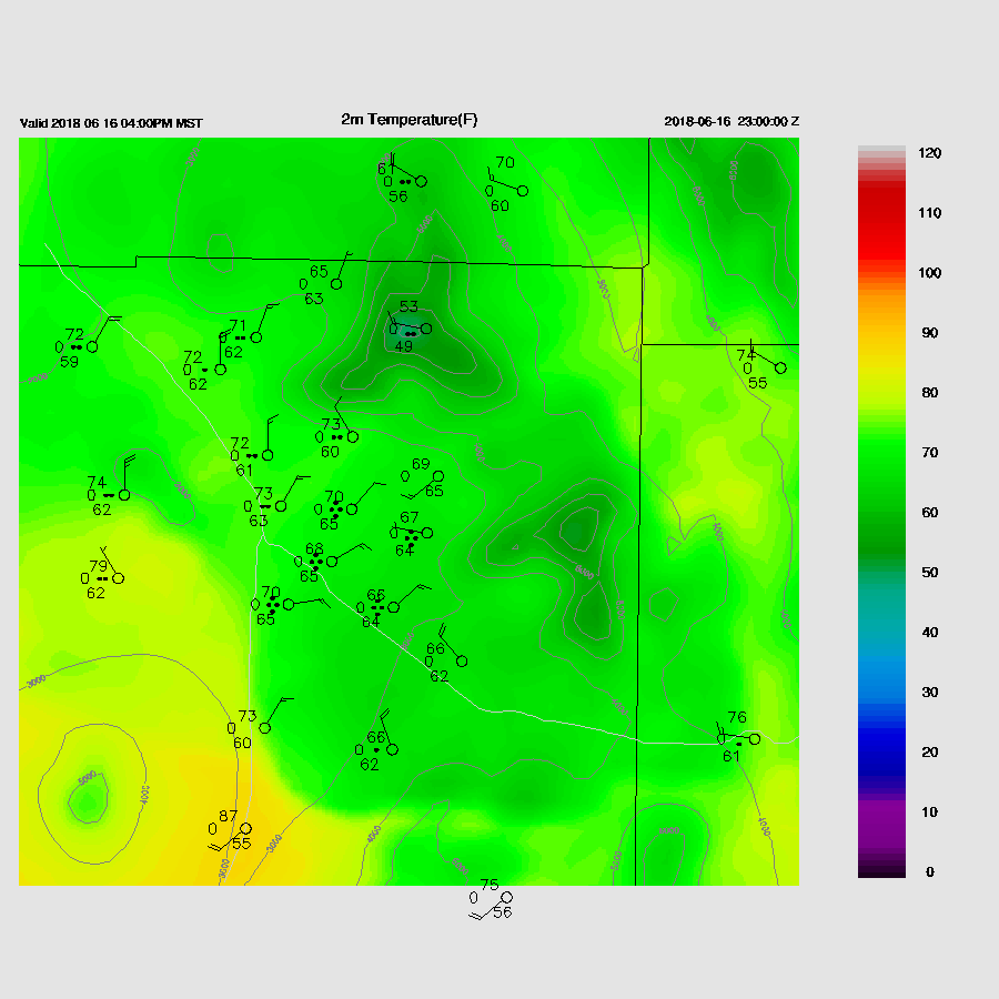
So, moisture, CAPE, and weak dynamics are present.  What about heating? WRF moves the thickest clouds off to the NE, so much of southern Arizona sees partly cloudy skies and some heating.

Phoenix does have moderate amounts of CAPE forecast and the profile is quite close to convecting by mid-day.  The wind profile looks a bit chopped up thus storms may not be all that organized. Heavy rain seems to be the main threat if convection does form.

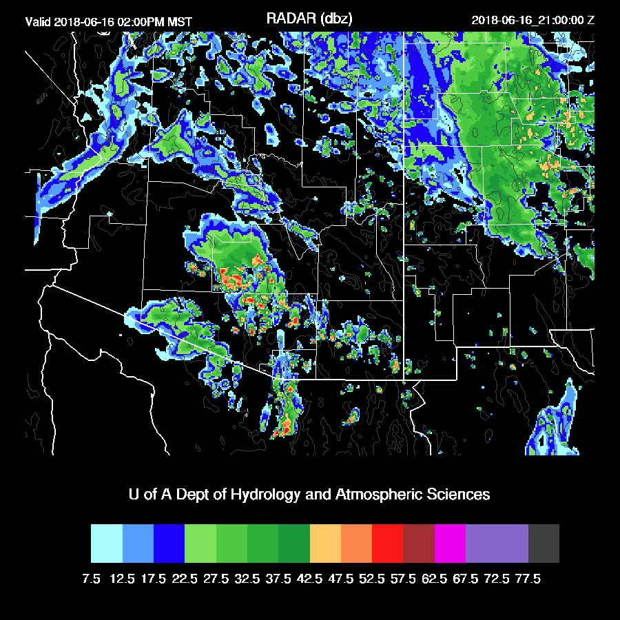
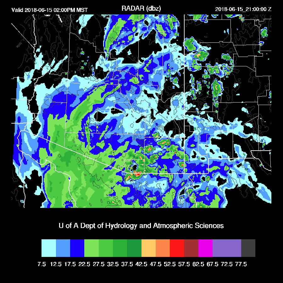
Quite of bit of deep convection develops over the southeastern ⅓ of the state by mid afternoon, including the lower elevations.

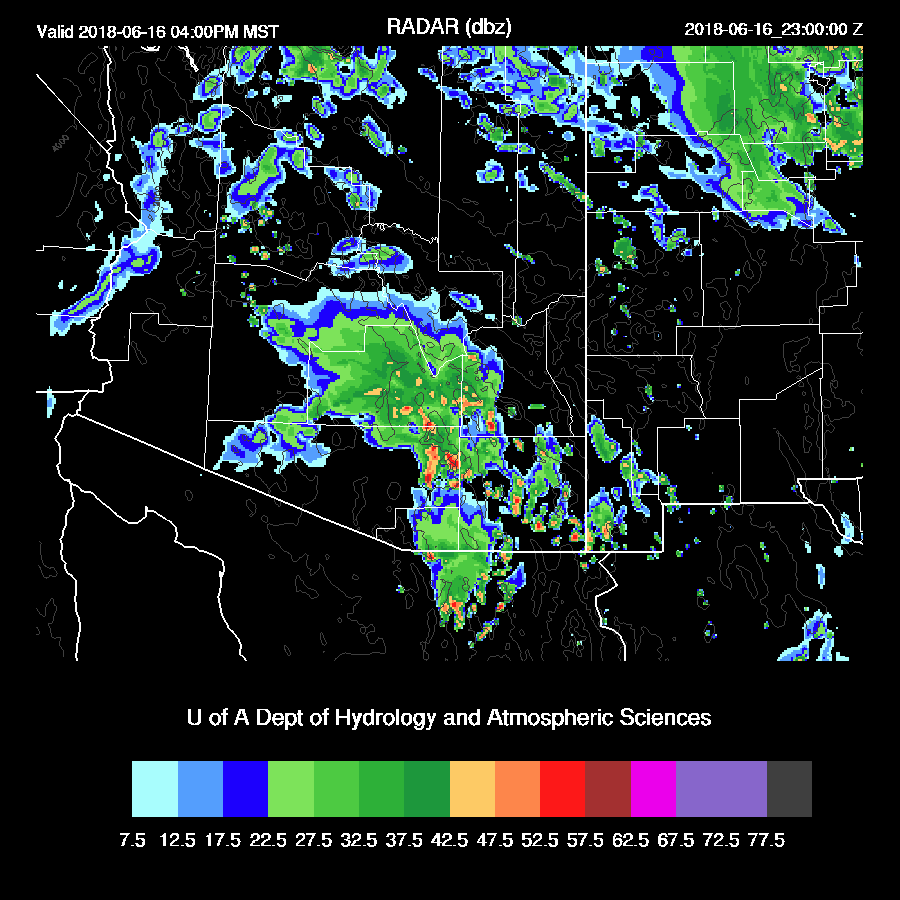
By later in the afternoon a broken line of storms moves through SE Arizona.

Tucson could see some strong storms with very heavy rain later tomorrow afternoon.

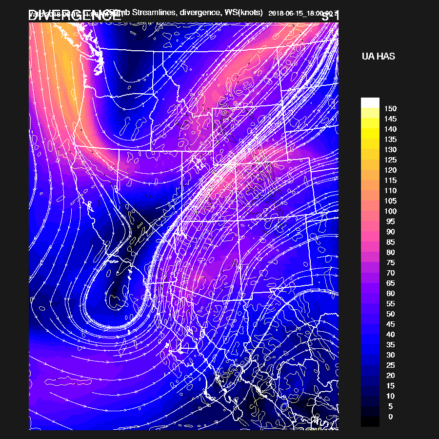
Storms move rapidly to the east and are mainly into NM by sunset.


More or less, the various model runs have the heaviest precipitation in western NM but parts of SE Arizona may see over an inch. This particular model shows 1.4” at KTUS, but don’t bet the farm on it.

Thursday, June 14, 2018

20180614

Previous Forecast
It was quite active in southern NM during the afternoon and into the early evening which resulted in a big dust storm for far SW NM and SE Arizona as outflows moved through.  Both the WRFGFS (below) and WRFNAM did a decent job forecasting this event. The WRFNAM was a few hours too slow though.


Initializations
Bud is just south of the southern tip of Baja this morning and the NHC says it continues to have winds around 40-45 knots.  The NAM has it initialized well. The mid/upper trough off the coast has become more obvious in satellite imagery and even has some lightning associated with it as moisture increases.  It is located a couple hundred miles SSW of San Diego and is more or less initialized in the correct location. Arizona is mostly clear except for some mid-level cloud from SW AZ to the 4 corners and initialized well.  Overall, initializations look good.


Day 1
Here comes the moisture from Bud.  By early afternoon, very wet air begins to move into far SE Arizona with Td > 10C just south of the international border. Bud continues to move slowly towards southern Baja.


The upper trough off the coast has consolidated into a closed mid/upper low with a speed max approaching southern Arizona.  This pattern looks more like October then mid-June!


Enough CAPE is forecast over far SE Arizona to support some deep convection.  Much higher CAPE is just south in far NE Sonora thus it’s likely for some big storms there.


The 500mb high is positioned right over SE Arizona so storms that form shouldn’t have much organization to them.  Light easterly flow over Sonora should steer high elevation storms off to the west with some organization.


Scattered deep convection initiates over the high terrain by early afternoon and mainly wanders about over far SE and eastern Arizona.  Strong storms develop in the high CAPE just south of Douglas and move westward.


The Tucson forecast vertical profile indicates a very deep mixed layer with a pronounced inverted V profile thus some storms in SE Arizona are likely to have some very strong winds associated with them.  For Tucson, CAPE is limited but some high-based storms are possible later in the afternoon. These storms will mainly produce strong winds.


By late evening, a few light showers are possible over southern Arizona.  The big story is very wet air (for this time of year) moves into much of the southern ½ of the state.


Day 2
Light showers and thick clouds develop over much of southern Arizona overnight and into the morning.  No significant accumulation is expected.


The mid/upper low begins to move to the east as a strong trough moves into the NW CONUS. This will provide some dynamics/synoptic scale lift over the state.  A very rare event for June!


Bud continues to move NNE and is located over the southern Gulf of California.  I don’t know what the SSTs are there but I would assume they aren’t high enough to help Bud out.  If this was later in the season, Bud could possibly maintain strength over the open waters. Over 10C Td air is over much of southern Arizona by tomorrow afternoon.


Widespread clouds are present over much of the state.   Areas that see sun may see some storms. Clouds are forecast to be thin over SE Arizona so that is the likely location.


As is typical with tropical systems, CAPE is mainly low thus no severe storms are expected in spite of the proximity of the trough.  


Clouds over SE Arizona are fairly thin and do allow some heating which results in scattered storms during the afternoon.


Mainly light showers continue over much of the state into the late afternoon with some embedded stronger storms mainly over the eastern ⅓ of the state.


Widespread light to moderate precipitation continues overnight which starts to add up as the 48 hour forecast has many locations in SE Arizona over ½ inch.


Wednesday, June 13, 2018

20180613

Initializations
It’s a new year and I’m not quite ready for monsoon-like activity as I just got back from a few weeks in Italy.  Hurricane Bud is located due south of La Paz and is slowly moving north. It doesn’t look all that impressive on satellite images this afternoon and I see NHC has downgraded it to a Tropical Storm.  I can’t say how well Bud is initialized by the 12Z WRFGFS or WRFNAM as it’s a bit south of the southern boundary of the outer domain, but a quick look at the actual models have the location OK. It’s also hard to judge the 12Z intensity too. The GFS was a bit weaker and may be more accurate in this regard.  Also of interest, is the weak upper trough located 500 miles or so WNW of central Baja. The NAM and GFS initialized this feature a bit farther to the south of what the WV imagery indicates.

Day 1
Day 1 is already nearly over as of this post.

Day 2
Bud approaches far southern Baja by midday and its track is nearly ideal to trigger a Gulf Surge. The surge is underway by this time, increasing the IPW into 20mm-30mm range across the southern parts of Arizona.

The weak trough off of Baja remains mostly stationary with SW mid level flow across much of the SW US along with fairly cool air at 500mb as temperatures ard around -10C.  This trough is may interact with the moisture from Bud in a few days.

CAPE is quite limited tomorrow with only New Mexico and far SE and eastern Arizona having sufficient amounts to support deep convection.

A few storms do initiate during the afternoon in these areas with some localized strong winds.  Note that I am using a different microphysics scheme (Thompson) which testing has shown to decrease the high reflectivity bias frequently seen with the Morrison MP scheme.  Thompson also produces smaller areas of heavy precipitation and less widespread areas of light precipitation.


I ran both schemes today to show the difference.  Below is the Morrison MP scheme.

Thompson Scheme.  Note that the extent of the light precipitation amounts is much smaller and areas of heavier precipitation are more compact.

Day 3
The 12Z runs are remarkably consistent with the track of Bud and place it over the southern Gulf of California by 18Z on Friday.  Both still have some 45-50 knot winds associated with the TS which I find a bit too strong as it has already weakened significantly and has to travel across southern Baja.

The two main issues for the next few days are going to be the trough and how cloudy it’s going to be. Too many clouds will not allow enough heating for deep convection.  However, if there is interaction with the weak trough and cool mid level air, that may be enough to form showers and storms. The weak trough and associated cool mid level air is located over the SW US and out west of Baja.

By Friday, the models look quite a bit different as the WRFNAM (below) has much more CAPE over southern and far SW Arizona.  It’s hard to say which is right and we’ll just have to wait and see.

Heating is going to be an issue with all the clouds around on Friday.  I do see a problem with the new configuration as it appears upper level anomalous waves are being introduced perhaps due to boundary issues.  The new configuration also increases the amount of clouds produced by WRF thus improving the issue we’ve had over the years of insufficient model clouds.

It’s a very complex situation and confidence is low.  My best guess is showers and some thunderstorms, perhaps strong, over mainly SE Arizona during the afternoon as the cooler air aloft and weak trough offset the lack of heating due to extensive clouds.