Previous Forecast
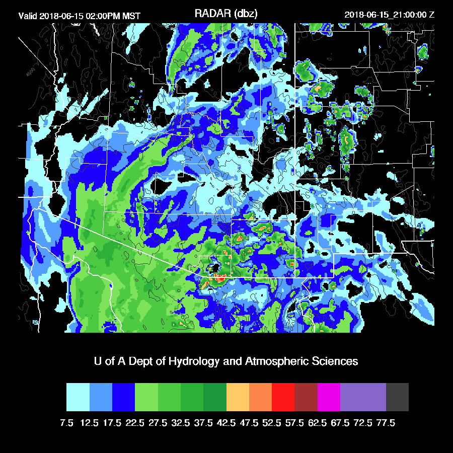
It was quite active in southern NM during the afternoon and into the early evening which resulted in a big dust storm for far SW NM and SE Arizona as outflows moved through. Both the WRFGFS (below) and WRFNAM did a decent job forecasting this event. The WRFNAM was a few hours too slow though.

Initializations
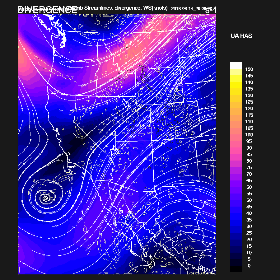
Bud is just south of the southern tip of Baja this morning and the NHC says it continues to have winds around 40-45 knots. The NAM has it initialized well. The mid/upper trough off the coast has become more obvious in satellite imagery and even has some lightning associated with it as moisture increases. It is located a couple hundred miles SSW of San Diego and is more or less initialized in the correct location. Arizona is mostly clear except for some mid-level cloud from SW AZ to the 4 corners and initialized well. Overall, initializations look good.
Day 1
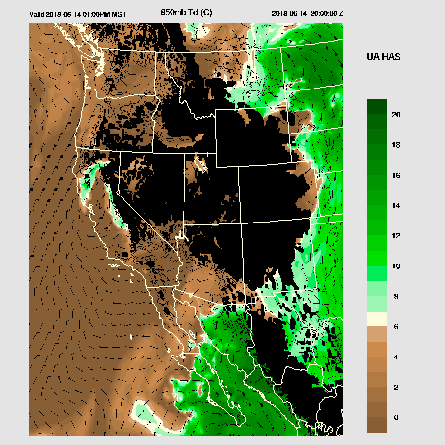
Here comes the moisture from Bud. By early afternoon, very wet air begins to move into far SE Arizona with Td > 10C just south of the international border. Bud continues to move slowly towards southern Baja.
The upper trough off the coast has consolidated into a closed mid/upper low with a speed max approaching southern Arizona. This pattern looks more like October then mid-June!
Enough CAPE is forecast over far SE Arizona to support some deep convection. Much higher CAPE is just south in far NE Sonora thus it’s likely for some big storms there.

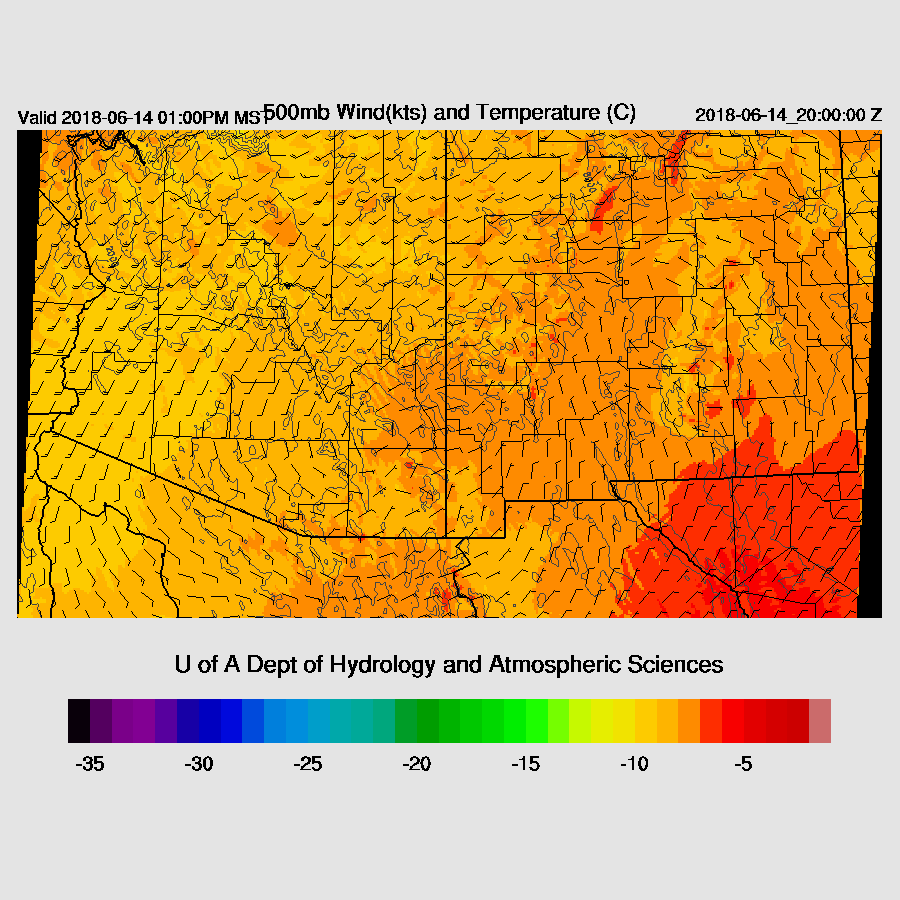
The 500mb high is positioned right over SE Arizona so storms that form shouldn’t have much organization to them. Light easterly flow over Sonora should steer high elevation storms off to the west with some organization.
Scattered deep convection initiates over the high terrain by early afternoon and mainly wanders about over far SE and eastern Arizona. Strong storms develop in the high CAPE just south of Douglas and move westward.

The Tucson forecast vertical profile indicates a very deep mixed layer with a pronounced inverted V profile thus some storms in SE Arizona are likely to have some very strong winds associated with them. For Tucson, CAPE is limited but some high-based storms are possible later in the afternoon. These storms will mainly produce strong winds.


By late evening, a few light showers are possible over southern Arizona. The big story is very wet air (for this time of year) moves into much of the southern ½ of the state.

Day 2
Light showers and thick clouds develop over much of southern Arizona overnight and into the morning. No significant accumulation is expected.

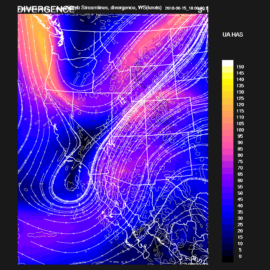
The mid/upper low begins to move to the east as a strong trough moves into the NW CONUS. This will provide some dynamics/synoptic scale lift over the state. A very rare event for June!
Bud continues to move NNE and is located over the southern Gulf of California. I don’t know what the SSTs are there but I would assume they aren’t high enough to help Bud out. If this was later in the season, Bud could possibly maintain strength over the open waters. Over 10C Td air is over much of southern Arizona by tomorrow afternoon.

Widespread clouds are present over much of the state. Areas that see sun may see some storms. Clouds are forecast to be thin over SE Arizona so that is the likely location.

As is typical with tropical systems, CAPE is mainly low thus no severe storms are expected in spite of the proximity of the trough.

Clouds over SE Arizona are fairly thin and do allow some heating which results in scattered storms during the afternoon.
Mainly light showers continue over much of the state into the late afternoon with some embedded stronger storms mainly over the eastern ⅓ of the state.

Widespread light to moderate precipitation continues overnight which starts to add up as the 48 hour forecast has many locations in SE Arizona over ½ inch.

No comments:
Post a Comment
Note: Only a member of this blog may post a comment.