Previous Forecast
It was the most active day so far, and both Phoenix and Tucson saw significant precipitation.
Some of the model runs had the right idea of moving/developing storms in the Tucson and Phoenix areas, but generally, underpredicted amounts. The 15Z WRFRR and the 6Z WRFGFS looked pretty good.
The HRRR was pretty good over southern Arizona but missed the Phoenix area activity. It is a close one, but I'll give it to the WRF because many runs forecast activity there.
Discussion
I have only a limited time for the discussion today, which is fortunate as it appears not much will happen despite extremely high PW values, nearly 50mm! (24-hour max of 54mm) The 500mb pattern looks more like a typical monsoon pattern as the high center is in southern Utah, putting the state in generally easterly mid-level flow. All upper-air data is missing from Mexico-I didn't know the 4th of July was a holiday there too! Satellite imagery indicates that a broad IT is still over far southern Arizona into Sonora.
This is about as wet and tropical that it gets here in Arizona. Amazing for so early in the season. A lot of CAPE is present, along with a favorable wind profile with good NE steering. However, moisture and CAPE are so high that with only minimal heating, convection will initiate, which is already has as of this writing, resulting in widespread debris clouds, and an early cut of to solar insolation resulting in a lack of lower elevation storms. The other rule of thumb is the day following a big day (or 2!) is usually much less active.
Initializations
Widespread debris clouds are over western and central Arizona. The 12Z initializations were all somewhat too cloudy, but the 12Z WRFRR did burn of cloud fairly quickly. The 6Z GFS was the best, though. All initialized the location of the Sonoran IT well but varied on the strength. The NAM from 6 and 12Z looks too strong. I think the MCV from yesterday is still present, spinning over SW Arizona and all initializations have a weak circulation there. The NAM at 6 and 12Z had some large PW errors over parts of the SW US. The others had only minimal errors. I'm going with the 6Z WRFGFS and 12Z WRFRR, in that order, today.
Day 1
According to the Tucson Skew-T, it should be an active day, but that appears to not be the case. Moisture is certainly more than enough, and as mentioned earlier, it may be too much.
CAPE starts to tell the story a bit better. It becomes quite low over western and central Arizona this afternoon. Only eastern Arizona has a decent amount to support deep convection.
Not only that, dry advection is underway over central and western Arizona, as seen on the 850mb Td forecast.
Combine that with a worked-over atmosphere, and the result is little or no activity, except for eastern Arizona. Note that the 6Z WRFGFS (upper left) has an issue where it doesn't go out far enough. The WRFNAM does bring a few storms close to Tucson later today, but my confidence in the NAM initialization was low.
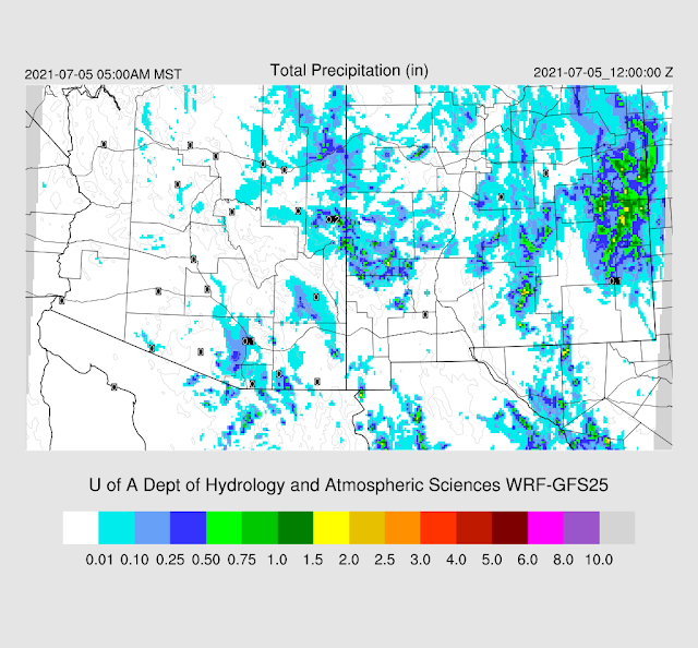
Here's the 6Z. Note that the precipitation in eastern Pima County was from last night.
Day 2
It looks like that is it for a while. Warming aloft along with slowly decreasing moisture results in little or no activity except for far eastern Arizona.


No comments:
Post a Comment
Note: Only a member of this blog may post a comment.