Previous Forecast
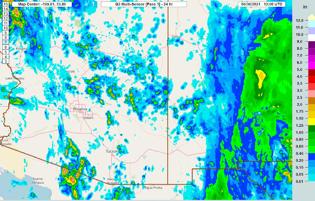
Storms were restricted to mainly the higher elevations of the state. Strong storms developed over central Pima County and south into Sonora.
The WRFGFS and NAM were the better performing runs as the WRFRR generally didn't have enough activity.
Discussion
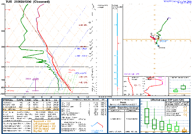
I'm having major issues with the incoming initialization data resulting in many missed and delayed runs. Thus, I'll be making this discussion very short. The 500mb pattern is quite complex as a closed low is located over southern Utah, under the Omega block. Arizona is in generally light westerly flow and favorable temperatures of around -8 to -9C.
There is a weak trough over western Arizona, and this appears to be responsible for the showers and a few thunderstorms over western Arizona.
Day 1
Moisture has continued to increase over central and western Arizona, and by early afternoon, PW is in the low 40mm range.
With more moisture and coolish air at 500mb, CAPE is quite high over central and southwestern Arizona. Much of eastern Arizona had downslope easterly flow, and despite quite wet air, CAPE is low. It looks like an active day for areas to the west of this dividing line.
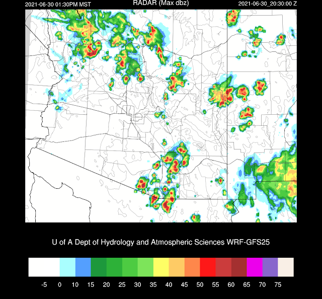
Storms are active by early afternoon, with quite a bit of activity around the Tucson area.
The 12Z WRFNAM is just now out far enough to look at this afternoon, and it has a bit less activity for the Tucson area.
The WRFGFS continues to expand the area of storms over southern Arizona into the evening hours, similar to yesterday's runs.
The 12Z WRFNAM has much less activity this evening. I have no idea which is more accurate.
No Day 2 forecast at this time.


No comments:
Post a Comment
Note: Only a member of this blog may post a comment.