Initializations
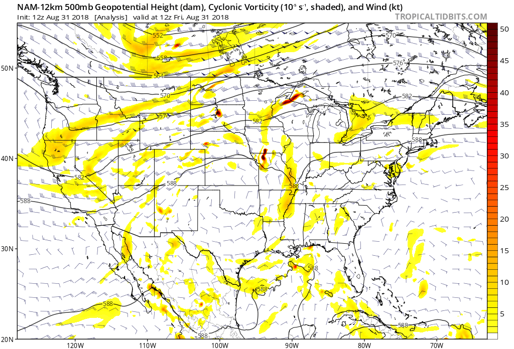
The 500mb and Vorticity plot from the 12Z NAM this morning shows a trough moving towards Arizona from CA and this will be a big influence on the weather of eastern Arizona over the next few days.
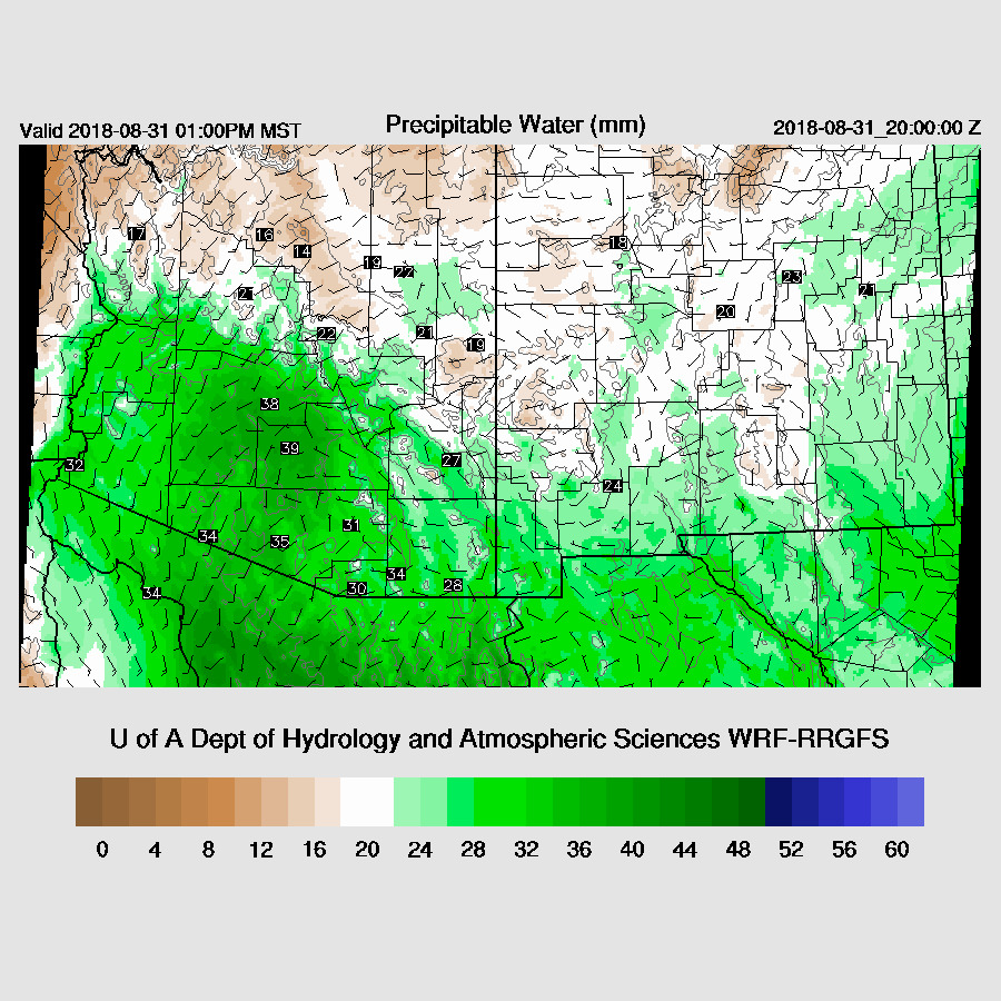
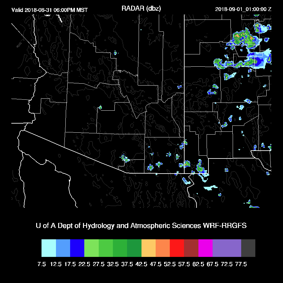
Moisture has increased over much of the state over the past 36 hours mainly due to outflow from a large MCS the night before last. Nearly all of the GPSPW sites are reporting including SW NM and SE Arizona. NAM PW is initialized fairly well except for a bit of a wet bias in NW Mexico and the RR and GFS are also good. All three initializations look good as there are no obvious errors and model confidence is high.
Day 1
As mentioned above, moisture has returned to the state on southerly low-level flow which continues today.
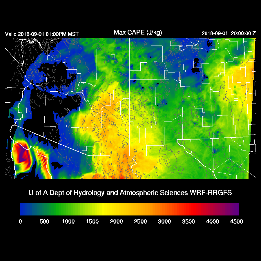
CAPE is low over the higher elevations so not too much activity is expected there. CAPE is a bit higher over central Arizona, but the Phoenix vertical profile forecast will be more informative if deep convection is possible in Phoenix.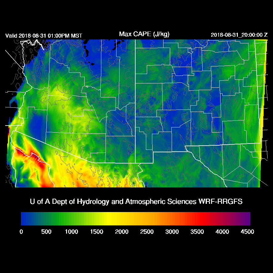
The western trough inches closer to Arizona but most of the southern part of the state is quite warm aloft. Cooler air isn’t far away though.

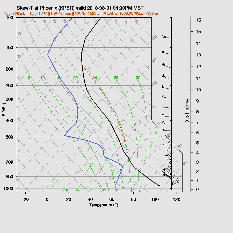
The Phoenix late afternoon profile doesn’t look too bad. There is quite a bit of CAPE present but mid-level steering is poor and from the WSW so no higher elevation storms will make it into the valley. There is also a weak inversion at the top of the PBL which will keep storms from forming unless there is a strong outflow or some other lifting mechanism. The situation is more unfavorable in Tucson as the mid-levels are quite warm and CAPE is low, so little or no activity is expected there.
Only a few showers and weak storms are present over far SE Arizona later this afternoon.
The odd man out is the WRFGFS as it has quite a bit more CAPE later this afternoon and overnight for central Arizona. Looking at the current PW vs the forecast, WRFGFS PW is running a few mm too wet thus CAPE is probably too high. While I find it unlikely, it’s not out of the question that a few strong storms could develop during the early morning hours somewhere over central to eastern Arizona as the trough begins to interact with moisture.

Day 2
The west coast trough begins to move into Arizona along with positive vorticity advection thus providing both synoptic scale lift and mid-level cooling.

Drying occurs over western Arizona but the SE part of the state continues to be quite wet.

Woah Nellie! CAPE is very high over much of SE Arizona which has the potential to support very strong to severe storms. All three of the morning runs are quite similar so confidence is high for this CAPE forecast.
The nose of the upper jet is over southern Arizona with areas of upper divergence and difluence. I’m not very good at predicting situations like this with strong upper jets but from what I remember, the left exit region is where the best upper divergence occurs and that the jet will force the trough to the south. 
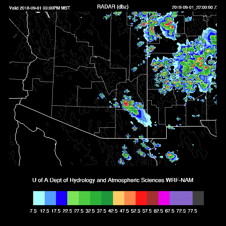
Under this favorable upper divergence, storms form during the morning hours and move rapidly to the NE. The different models disagree on the exact location with the WRFGFS being as far west as the Phoenix area or eastern NM like the WRFNAM. The WRFNAM is kind of between the two as it develops some storms over parts of SE Arizona during the morning hours.

Fortunately, I am plotting a Skew-T for San Simon in far SE Arizona and it has quite a bit of CAPE present as well as a deeply mixed PBL but quite a strong inversion just below 500mb. The wind field isn’t that impressive for organization as winds are mainly unidirectional with little directional or speed shear (WRFNAM below). This is not the case with the WRFRR as it has more CAPE and more directional and vertical shear thus more likely storms would organize with possible mini-supercells, but who knows which is correct.

The Tucson Skew-T also exhibits a strong inversion just below 500mb as well as high CAPE. The wind profile is better with both directional and vertical shear. The problem is Tucson is located right on the boundary between dry air to the west and moist to the east so it could go either way.

The 15Z WRFRR is the most active and has some storms in the Tucson area during the early afternoon.

The various runs develop a few organized storms over SE Arizona during the afternoon which will possibly be severe with the threat of hail and strong winds. Exactly where or when is hard to nail down.
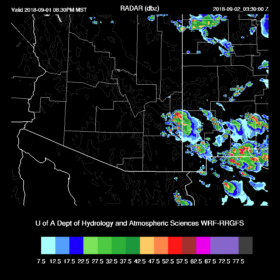
A few strong storms continue over far SE Arizona into the evening.
No comments:
Post a Comment
Note: Only a member of this blog may post a comment.