Previous Forecast
Storms were restricted to SE Arizona and SW NM and another dust storm hit the Lordsburg playa and closed the freeway. A stray storm or two popped up in the Tucson area just after sunset.
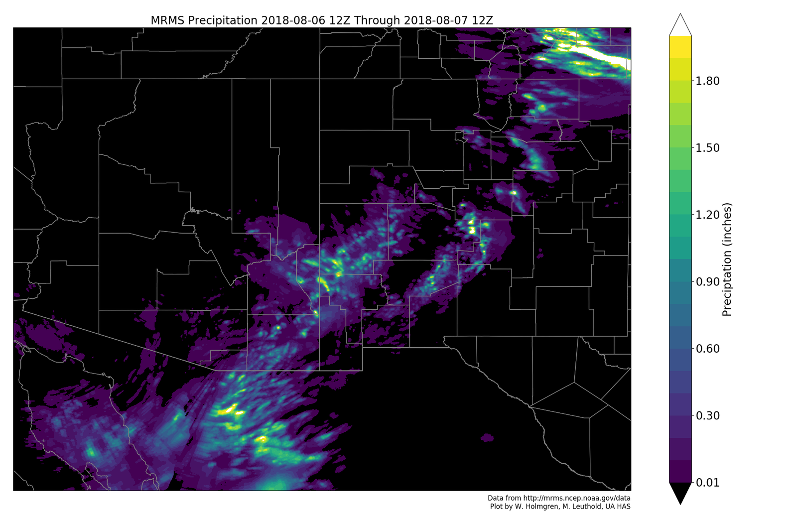
All the morning runs had the right idea except for the 12Z WRFRR and this was expected as it was noted, in the discussion yesterday, that it had a poor initialization. This is a good example of the importance of at least briefly looking at the model initializations as it was obvious that the 12Z RR did not initialize mid-level temperatures well. The WRFGFS had the best overall forecast of coverage and intensity. The models also correctly forecast the large MCS over Sonora yesterday afternoon and evening.
Initializations
The west coast ridge continues to slowly build but the center is still located somewhere over central Arizona. Aug 5 was supposed to be the resumption date of the Empalme sounding but I’ve seen nothing yet. However, Suominet is in better shape now and mostly fully functional thanks to Teresa Vanhove at UCAR and thanks to SRP who has stepped up with some funding to keep them going. In my fantasy land, I would like to see some sort of arrangement made to keep the Empalme site operational during the monsoon season via funding or supplies from one or more U.S. agencies, either private or governmental. Anyways, back to the weather. The Sonora MCS has dissipated but the broad IT continues to spin over the central Gulf of California. Both the NAM and RR have the IT initialized as an open wave which looks too weak. The Empalme sounding would of been a great help initializing this feature correctly today! Other than that, the mid-level initializations look fine.
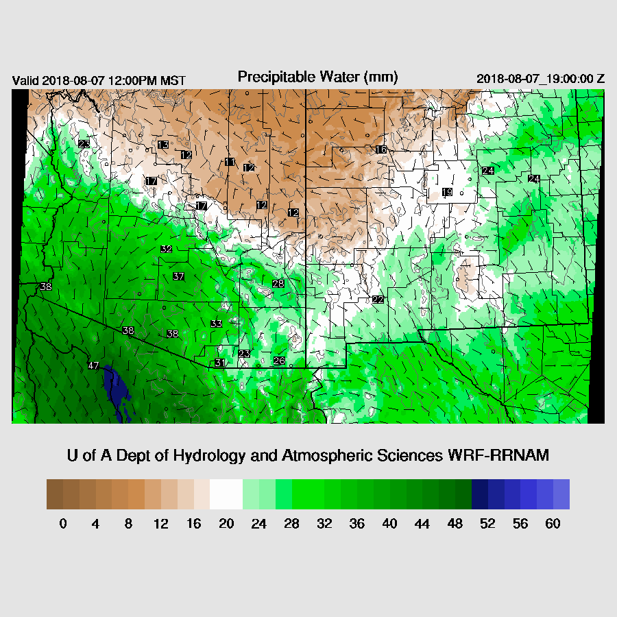
PW has increased slightly and is mainly from 32 to around 40mm. There is a surge underway as seen on the Yuma 12Z sounding, but it’s quite shallow and wind speeds not that strong. Due to all the activity in Sonora the past 12 hours plus the lack of any upper air data, the initializations have some large errors. The RR is much too wet over the northern GofC while the NAM is too wet over the southern GofC. It is also too wet over SE Arizona and into NM. The 6Z WRFGFS initialized PW better so I’ll probably include it while forecasting today. The other two aren’t terrible and should be fairly accurate. The 12Z GFS is now available and a quick look indicates that PW initialized well and the Mexican IT was initialized as a closed circulation thus it may be the model of choice.

Day 1
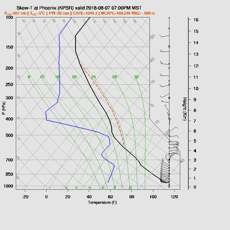
As mentioned above, PW has increased somewhat but with the big MCS in Sonora, I would have expected more. The Tucson sounding has only a shallow moist layer and a fairly dry elevated mixed layer from yesterday. MLCAPE was only around 300 J/kg but mid-level steering winds are ENE and 20 knots so storms should easily move off of the high terrain and towards the lower elevations around Arizona.

The surge intensifies throughout the morning but continues to be shallow thus PW increases only slightly. North of the Rim, it is very dry and it is fairly dry over far SE Arizona.
CAPE doesn’t increase all that much throughout the morning and is mainly moderate with a few higher areas over 1500 J/kg. Very high CAPE is just south of the Arizona border and it’s likely that big storms will form here later today.

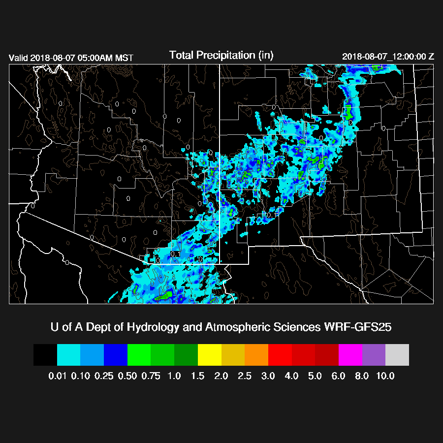
Once again, the previous day model runs look to be much too active as the WRFRR is especially devoid of activity this afternoon except for along the border. The forecast reversal today is quite surprising and it’s my guess that WRFRR has too little Arizona activity.

It’s two against one as the WRFGFS and WRFNAM have quite a bit more activity over the high country of eastern Arizona. This is good for the Tucson area as now there are storms to steer that way. By the way, the “Early” 12Z WRFGFS is now available on the web page. Strong storms are along the Arizona Sonora border in the area of extreme CAPE.
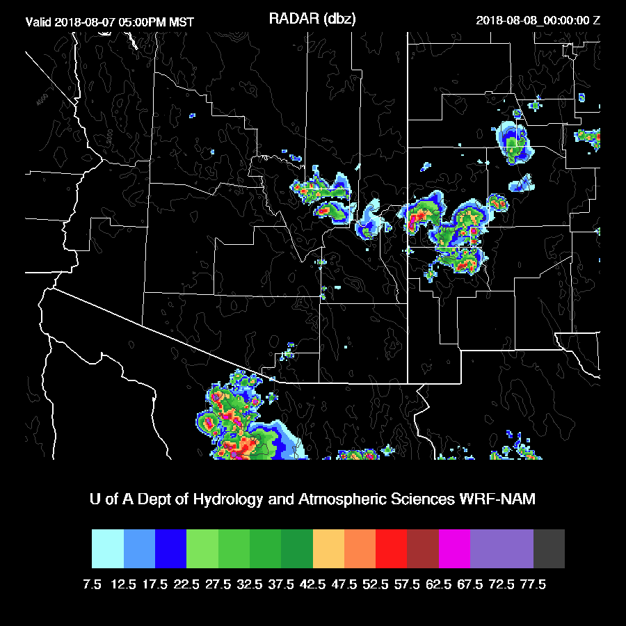
The Tucson area is mixed nearly to the LFC by early evening with around 1200 J/kg of CAPE and a good vertical profile with low-level shear, light mid-level ENE steering, and upper westerlies to keep anvils away. Moisture convergence too, as PW increases to around 35-40mm Looks very good to me for activity in and around Tucson this evening. Recent HRRR runs support this idea as well.

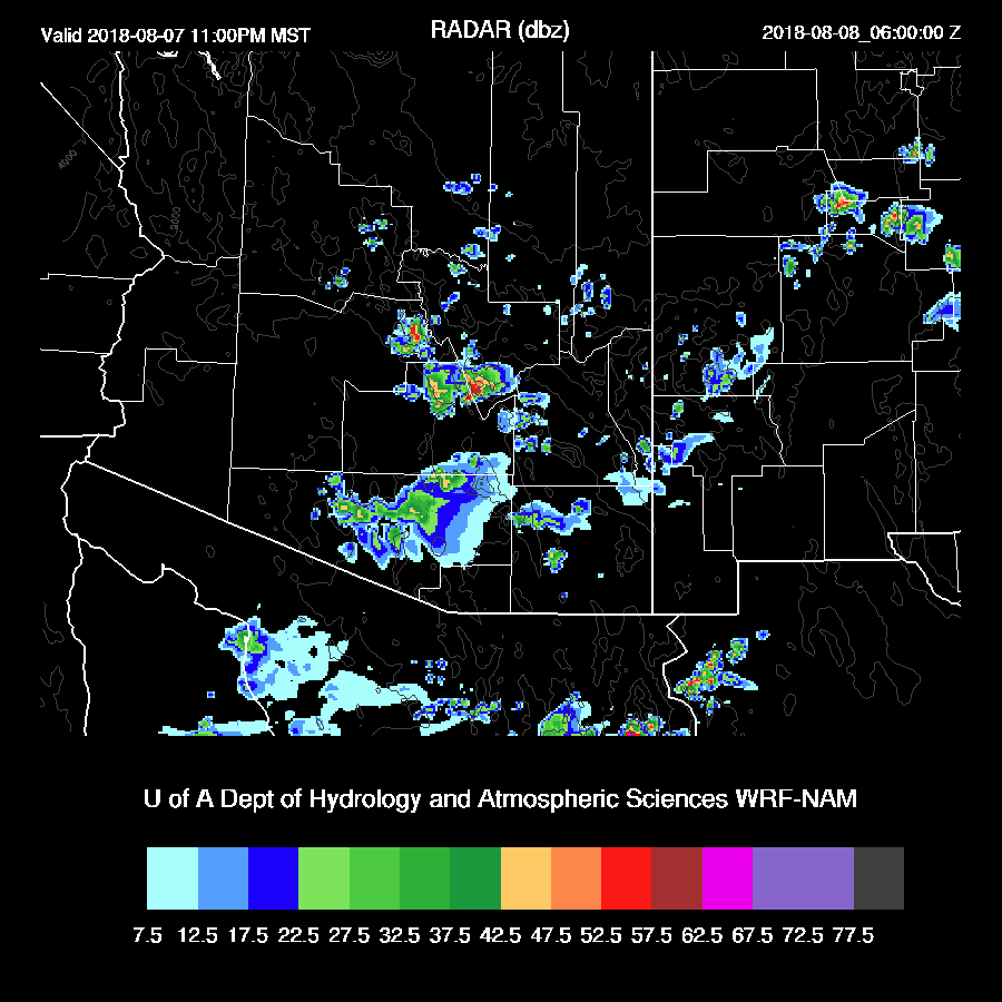
The WRFGFS and WRFNAM are nearly identical as they eject a very strong outflow boundary from the strong/severe activity along the border which then interacts with the few storms moving SW out of eastern Arizona.
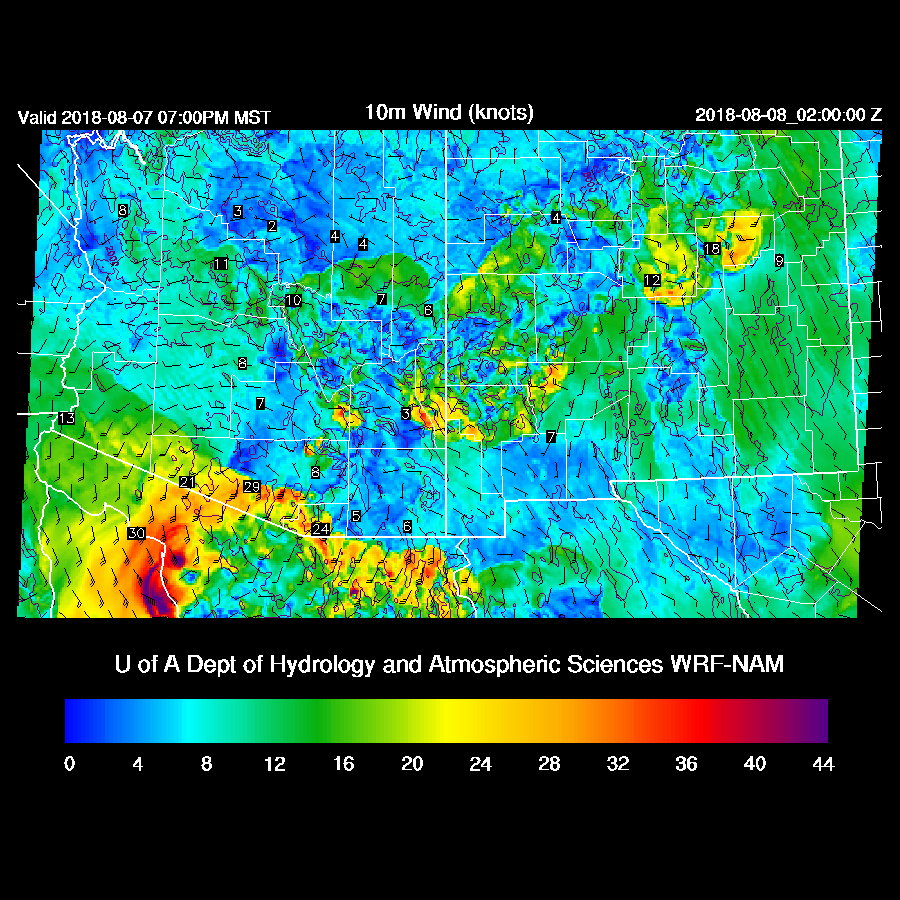
Scattered strong storms develop in and around the Tucson area during the evening hours. With the deep mixed layer, isolated severe winds are likely with a few of the storms. The WRF Lightning Forecast Algorithm is predicting high flash rates with the Arizona storms and extreme rates with the Sonora storms.

It looks like quite a widespread event for Tucson.
The massive outflow boundary moves into Pinal and southern Maricopa during the evening. With the wind speeds as high as they are, I would think Phoenix is in for a haboob and a massive dust storm as the highest winds go right over the dust source region of Pinal County.
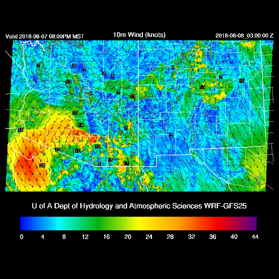
It looks like dust is all most of Phoenix is going to get out of this as CAPE is only around 1000/J/kg and there is a moderate inversion at the top of the only moderately deep mixed layer. Still a few storms are possible mainly over the higher terrain.
This is the case with both the WRFNAM and WRFGFS as a few storms develop late this evening just to the east of Phoenix.
Day 2 will follow later this morning.
No comments:
Post a Comment
Note: Only a member of this blog may post a comment.