Previous Forecast
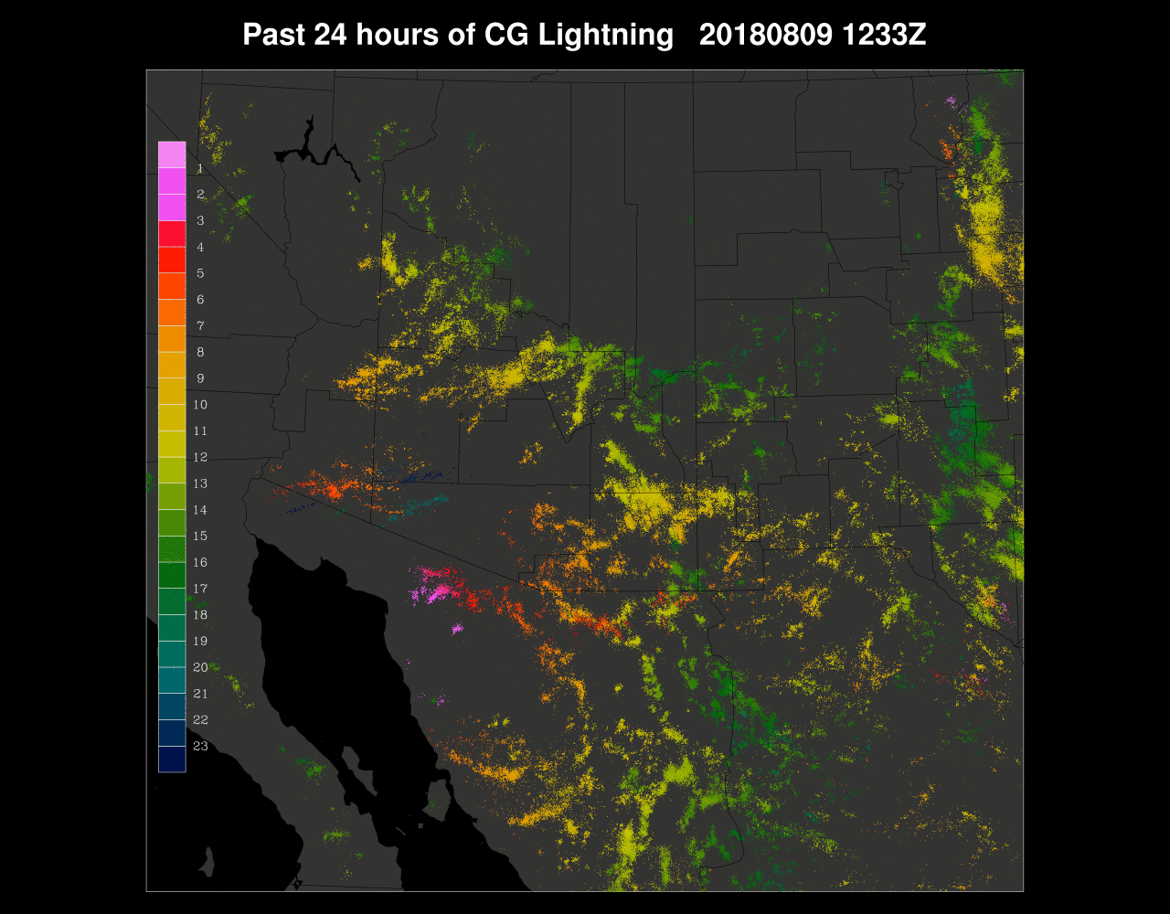
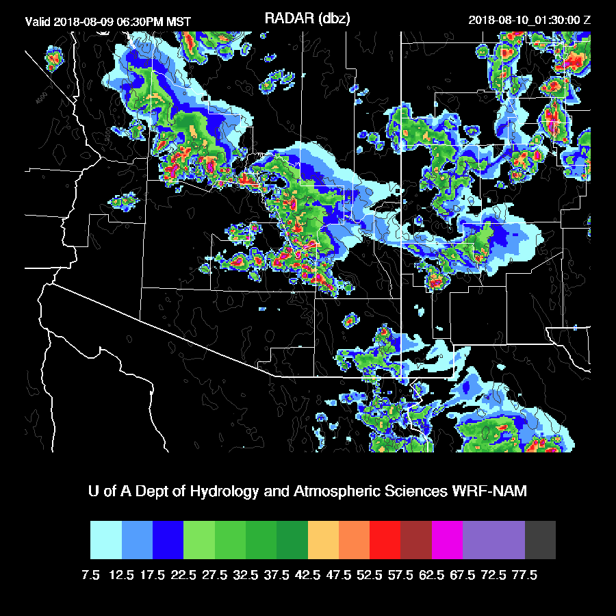
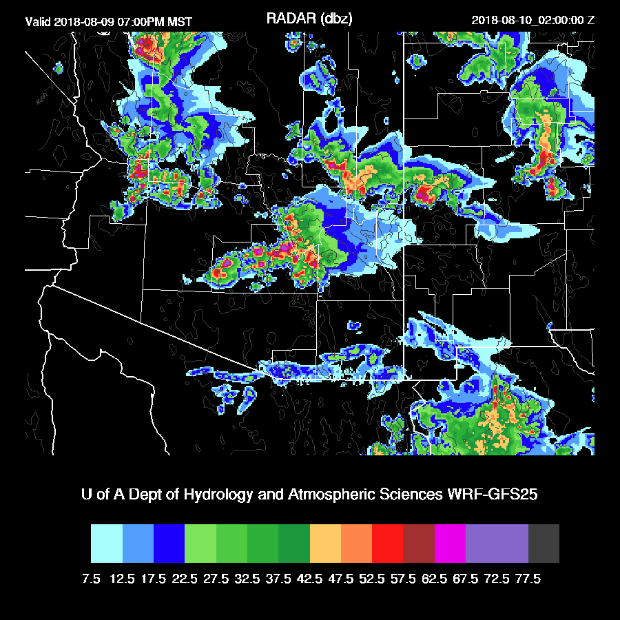
Scattered storms moved south off of the high terrain into the Phoenix area during the evening and scattered storms developed late in and around the Tucson area. This was in spite of the widespread clouds and cooler conditions over much of south-central Arizona which I thought may keep lower elevation deep convection to a minimum. The most active areas were where it was mostly sunny, like Cochise county.
The 12Z runs weren’t much good as they didn’t predict much/any activity for Phoenix or Tucson. However, the 6Z runs were quite active and the 6Z WRFNAM turned out to be fairly accurate. In fact, the previous day forecasts were also fairly good for the Phoenix area after many days of generally predicting too much activity.

Initializations
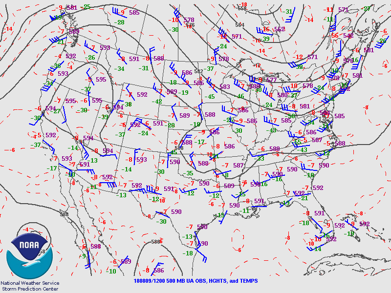
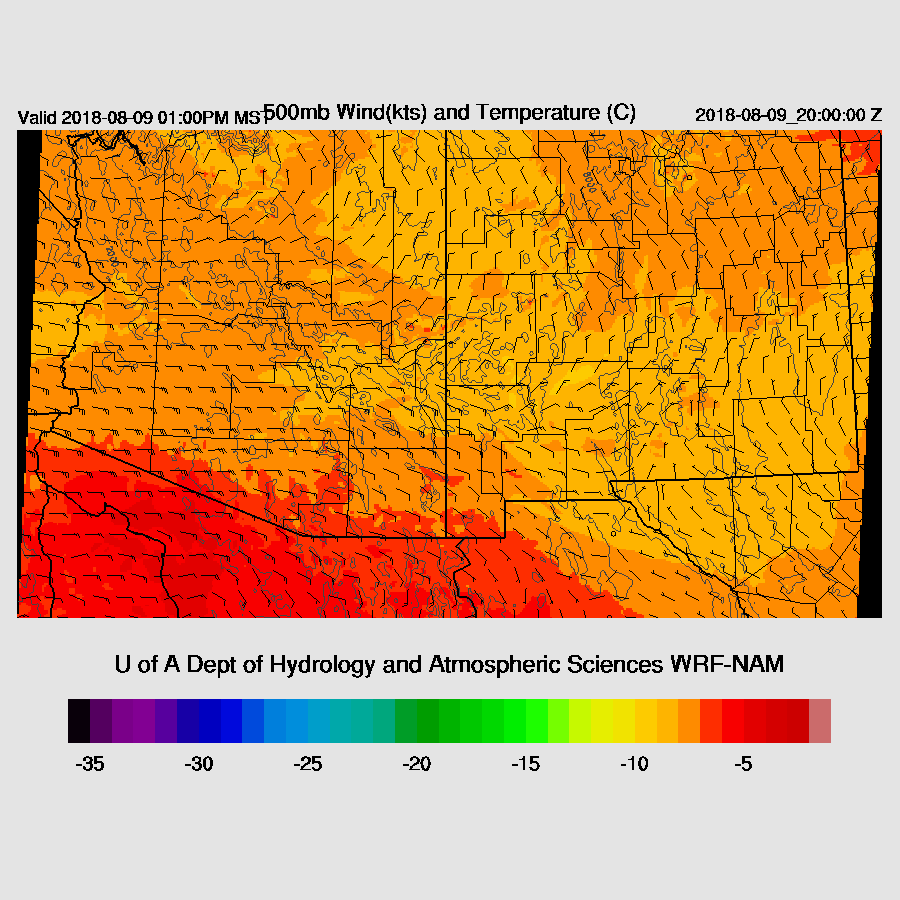
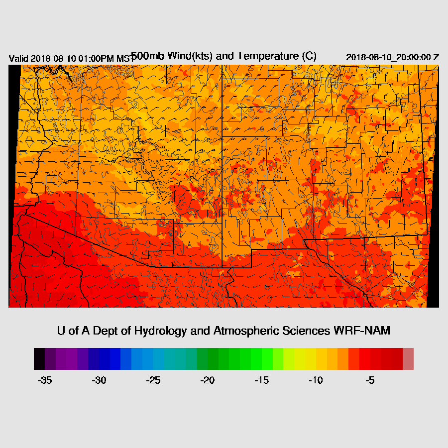
The center of the 500mb west coast anticyclone is located over northern NV which places much of Arizona in moderate to strong easterly flow. Temperatures are around -7 to -9 C so it’s quite cool. A broad trough is located over Colorado and New Mexico with another cyclonic circulation over northern Sonora with a couple of embedded MCVs. The weakening hurricane is off the west coast of southern Baja. As discussed yesterday, there is a weak upper jet breaking under the upper anticyclone over the NW CONUS with a shortwave over western CO. This certainly is an unusual pattern! The RR and NAM have all features initialized well.
The Sonora IT once again, is responsible for widespread clouds and some showers over much of southern Arizona but unlike yesterday, recent satellite imagery indicates some dissipation except for far SE Arizona. RR cloud initialization was pretty good and the NAM was okay except for SE Arizona where it was too clear. A peek at the 6Z runs shows that the WRFNAM cloud coverage is quite good but it has some quite large PW errors over Sonora and into Arizona so its accuracy may be in question.
RR PW was initialized well. The NAM was a bit too wet in Sonora but not bad elsewhere. Overall, there isn’t a lot of confidence in the runs for today as the situation is so complex but neither the RR or NAM have obvious errors.
Day 1
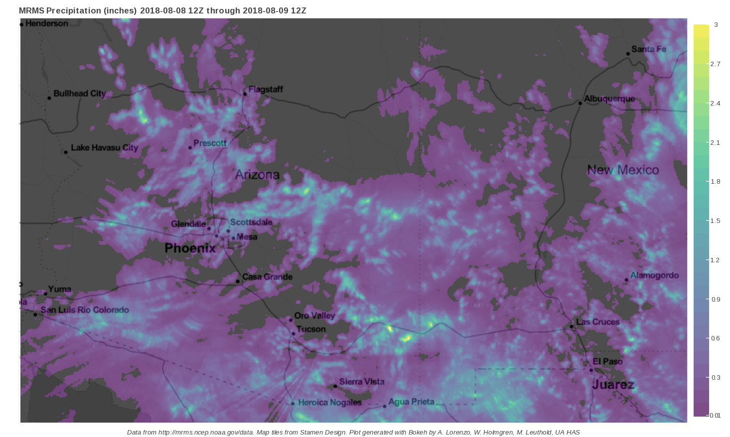
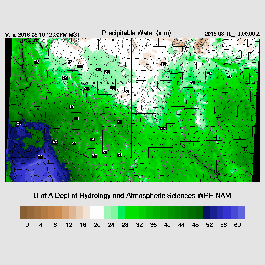
PW continues to be high over much of the southern part of the state and is in the range of 38 in Tucson to almost 50mm in Yuma. Moisture continues to be weakly advected into SW Arizona today which keeps PW steady.

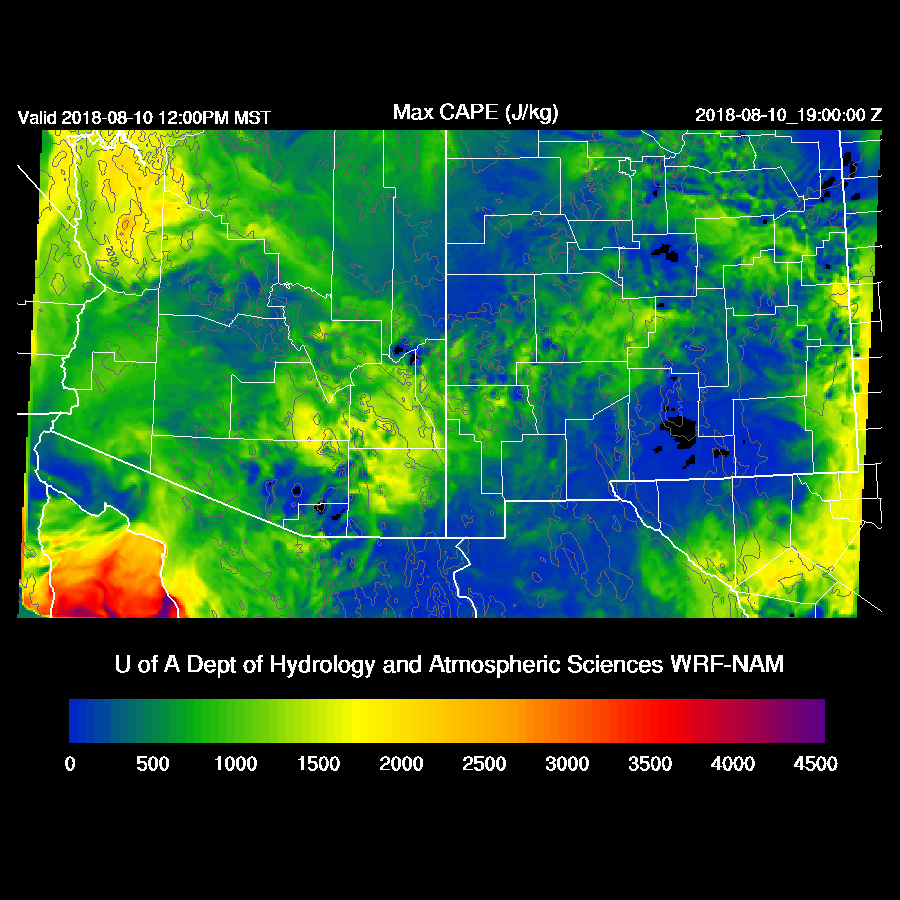
The WRFRR and WRFNAM have quite different CAPE forecasts with the WRFNAM having less over southern Arizona which seems more realistic as it’s still cloudy and cool there. CAPE elsewhere is moderate to high and again, the high country will have a lot of storms today.

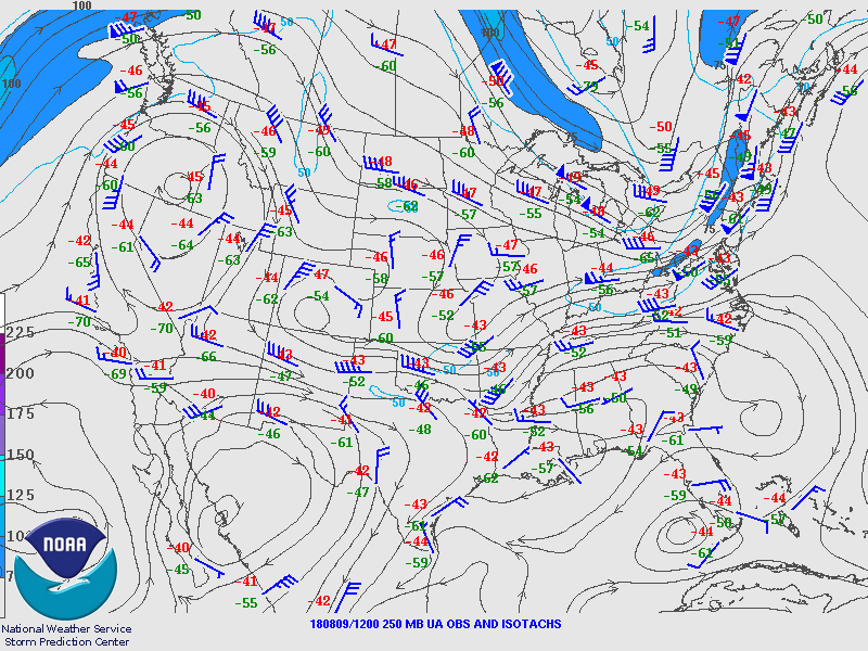
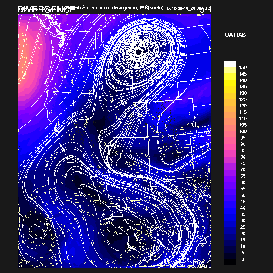
The early afternoon 500mb flow is from 10 to 20 knots from the east and favorable for steering storms into the lower elevations. Temperatures are also cool with -10C in NM. The IT continues to be mainly stationary over northern Sonora.
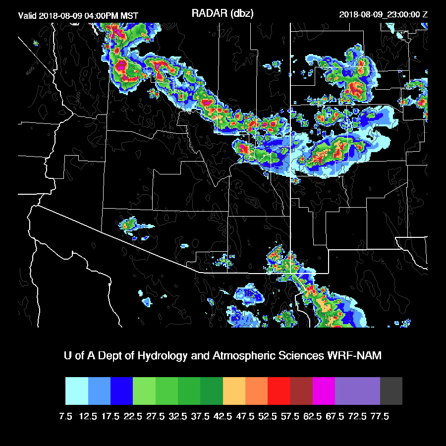
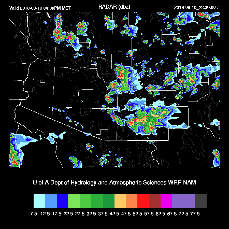
Later in the afternoon, widespread very strong storms are underway over the high terrain from west of Flagstaff and eastward into NM. Hail is likely with some of the storms.
The morning Tucson sounding is nearly saturated all the way up and has only limited MLCAPE so it’s not looking good for activity here.
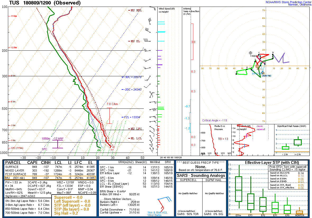
By late afternoon, there is a moderate amount of CAPE so the potential is there. With the IT in the vicinity, I think some deep convection is not out of the question.

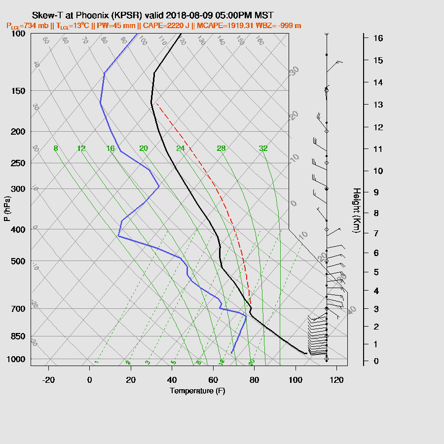
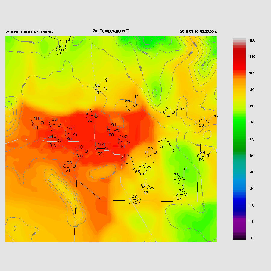
Many of the runs over the past 24 hours or more have been forecasting a major severe weather outbreak for Phoenix. That is still the case, at least for some of the morning runs. The WRFNAM late afternoon forecast vertical profile certainly supports severe weather for Phoenix as CAPE is around 2000 J/kg, there is an excellent vertical wind profile, and the mixed layer nearly to the LFC which the morning sounding was just above 700mb.
The WRFNAM has an especially good setup for a major storm event for Phoenix as the valley has strong storms nearly surrounding the valley thus optimal outflow intersections which will be more than sufficient to convect the airmass.
All these outflow interactions develop strong to severe storms over areas of Pinal and Maricopa County during the evening hours. Severe winds are forecast for the Phoenix area with model winds around 50 knots which may result in gusts to 75 knots. Hail is also likely with the strongest storms.
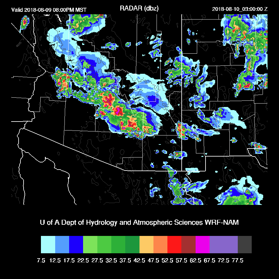
The WRFNAM continues to move a squall line like feature to the SW throughout the evening.
Saying all that, many runs have severe storms elsewhere. I think the above scenario is possible but with such a complex situation, about anything could happen. The 6Z runs and the 12Z WRFRR and WRFGFS develop strong/severe storms farther south in Pinal and Pima counties and west of Phoenix. What it comes down to is the atmosphere is primed for severe weather somewhere in the lower elevations of Arizona this evening.
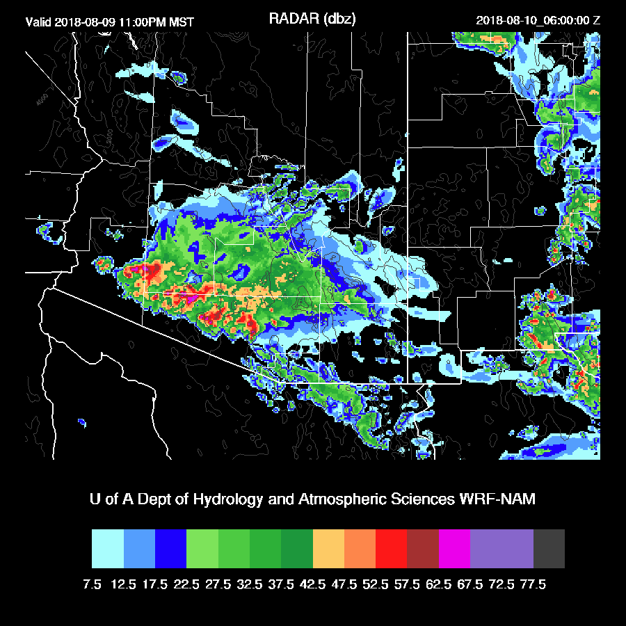
The WRFGFS does eventually develop activity in the Phoenix area as outflows do interact over the valley.
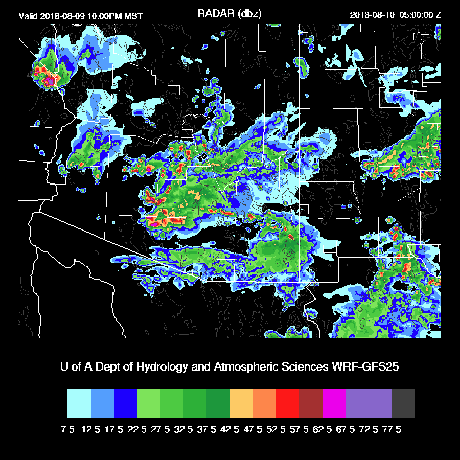
The WRFGFS is very similar to the 14Z HRRR as big storms are east and west of Phoenix during the evening with development occurring later.

Day 2
I hesitate to write too much about tomorrow as model accuracy is very poor during complex situations like this so I’ll just broad brush things. Moisture continues to be about the same as it was today except a bit more makes it into NE Arizona.
CAPE is a big question as it’s likely to be quite low due to the activity from tonight. The WRFNAM seems to have a plausible forecast with low to moderate CAPE over much of the state except for the SE and NW where there was limited activity forecast for today.
The 500mb pattern is a bit of a mess over the SW as there appears to be a weak trough over NM and then back over southern Arizona with a high center to the north and south. This trough and associated cool air are likely to support widespread storms for higher elevations and areas that see good heating.
What a weird pattern! Much of eastern Arizona is under the influence of the upper trough.
Storms over NW and SE Arizona tomorrow afternoon.
No comments:
Post a Comment
Note: Only a member of this blog may post a comment.