Previous Forecast
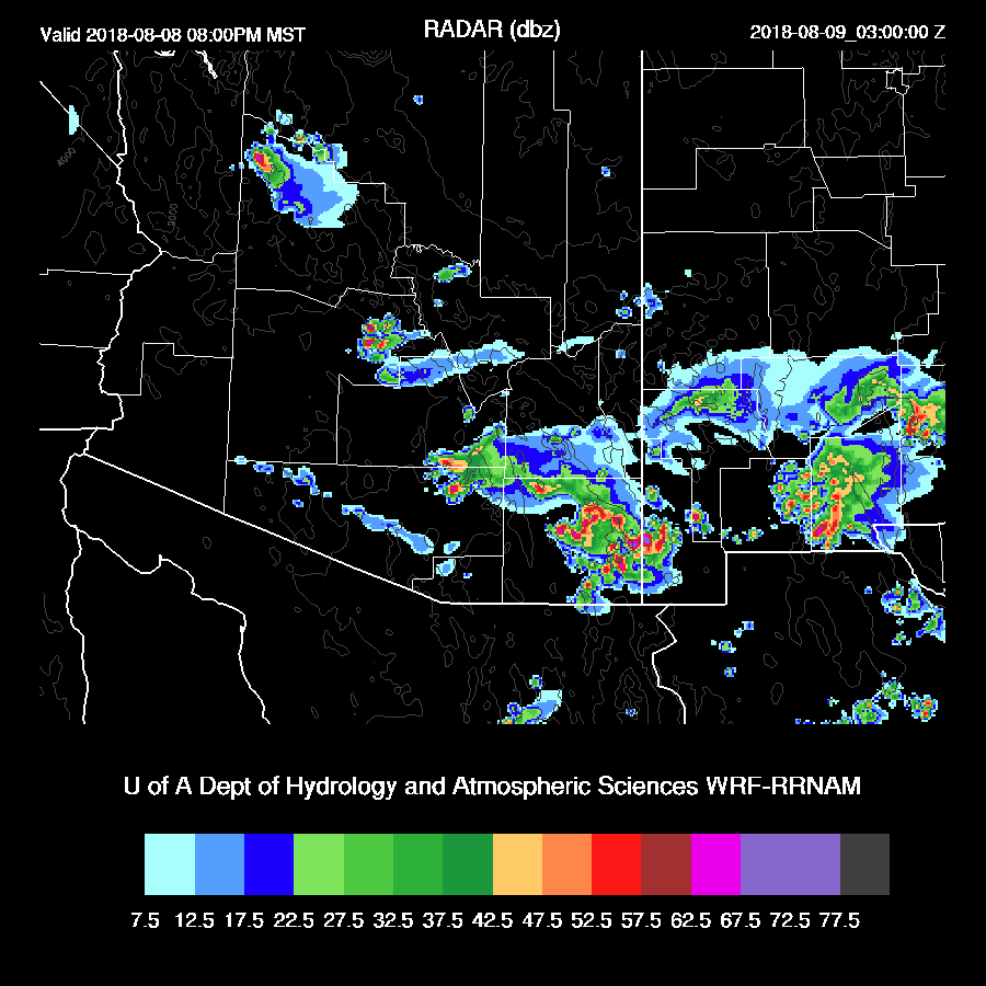
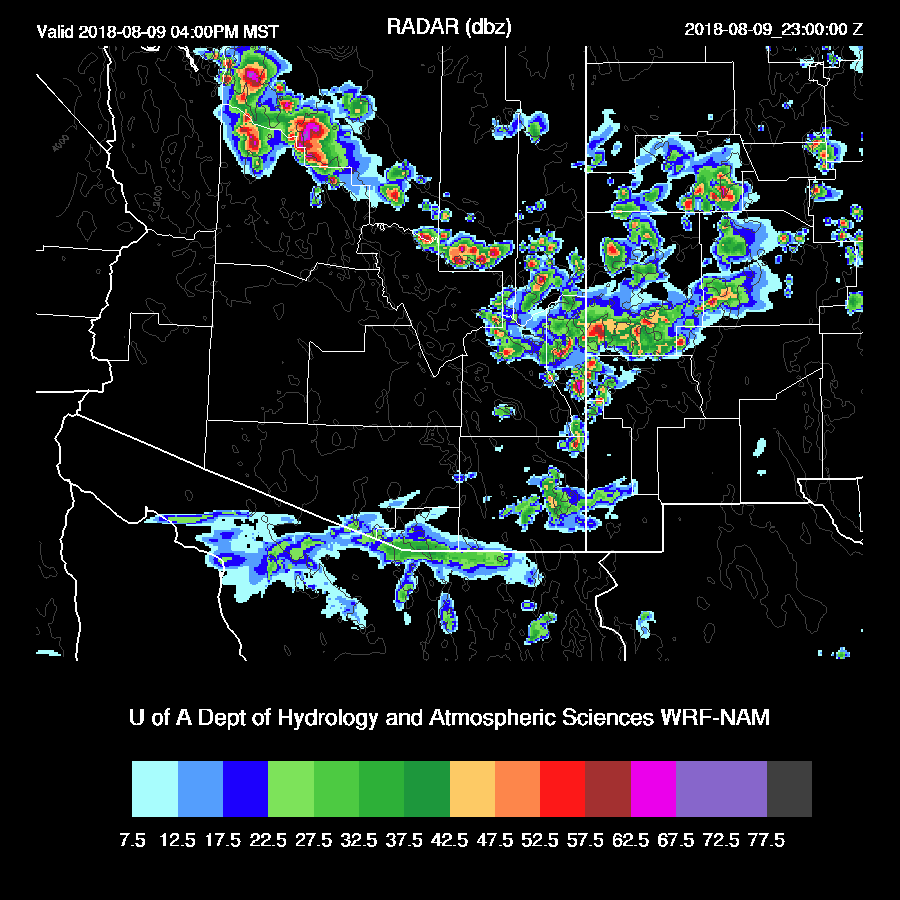
It was very active over much of SE Arizona yesterday afternoon and evening. The far south side of Tucson had a severe storm but most of the city was missed. The east side of Phoenix had scattered storms late and were triggered by the outflows from all the activity to the south. Lightning flash rates were very high and areas just south of the border really got hammered.


Overall, the forecasts were pretty good except for some notable exceptions. Most runs had more activity in the Tucson area which didn’t occur and there was a bit more activity in the Phoenix area than forecast by some of the runs. The 15z WRFRR was the best but unfortunately, was not available in time for the discussion. It had scattered activity around the Phoenix area and continues scattered showers and storms into the early morning hours.
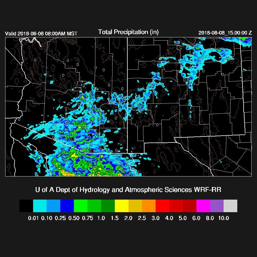
The 15Z HRRRX was also quite good as it had the late evening activity in the Phoenix area.
Initializations
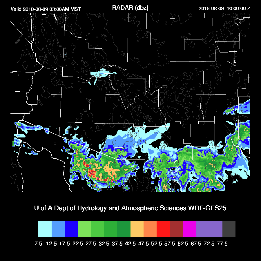
I went outside to get the paper this morning and I knew immediately that the previous day’s forecast just went into the trash can. It was nice outside! Cool and cloudy, due to a large MCS that persisted much of the night over northern Sonora. As of 16Z, thick clouds with a few showers continue across much of southern Arizona and satellite trends have cloud coverage increasing slightly. Both the RR and NAM did a nice job initializing the clouds and showers but by 16-17Z both runs began to dissipate the clouds rapidly which doesn’t seem to be happening.
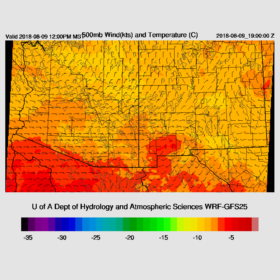
The 500mb ridge continues to amplify over the western CONUS with the center somewhere between Vegas and Albuquerque. Southern Arizona is in moderate to strong easterly flow as a large IT/MCV is located south of the border over far north central Sonora as seen on the satellite imagery. It’s not obvious on the 500mb map. Of note is the cooler air at 500mb as Arizona is mainly around -8C now. Will that be enough to offset the cooling from the MCS and lack of heating because of the clouds? Probably not, but we’ll see what the model runs say here in a bit. Both the RR and NAM have the IT initialized well.

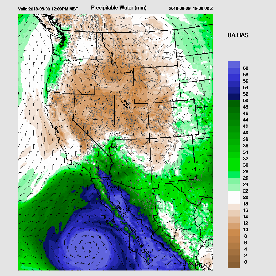
The NAM PW initialization was fairly good with only far SE Arizona showing a significant wet bias. The RR was OK except for in northern Mexico where there was a general wet bias. The WRFGFS just started running and its PW initialization had only minimal errors. A fast look at the rest of the GFS indicates clouds were initialized well but the IT was initialized about 200 miles too far south.
Overall, confidence is low mainly because of the issue with the clouds. If they burn off in the next few hours, maybe the model runs will be better for southern Arizona. For other areas, they should perform fairly well.
Day 1
Moisture has increased and PW is around 35-45mm over most of the lower elevations. A surge continues over much of the southern part of the state and the Yuma sounding indicates it is a bit deeper than yesterday as it almost makes it to 850mb. By mid-day, the surge peters out but PW remains similar to the morning hours.

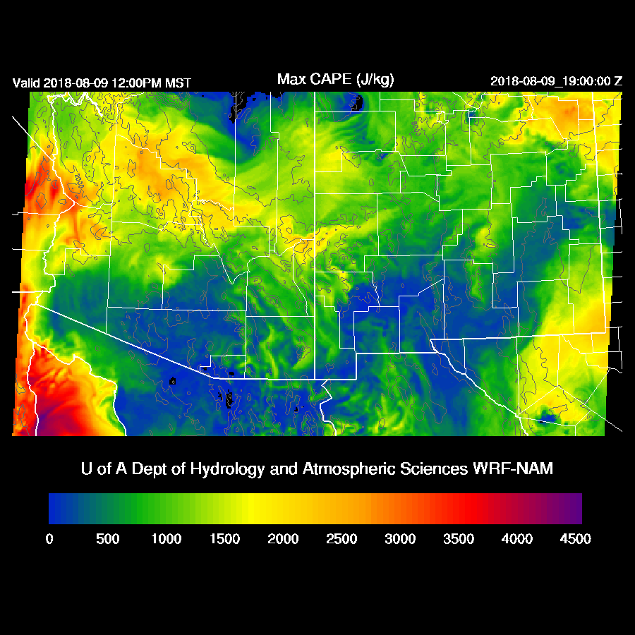
It looks like the WRFNAM has the right idea of limited CAPE over the lower elevations but moderate to very high over the higher terrain of Yavapai County and eastward to the White Mountains.
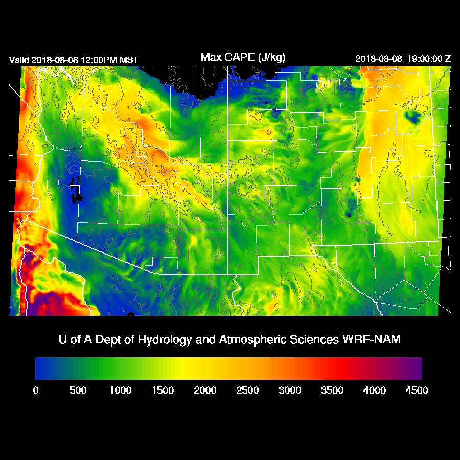
It takes awhile to get deep convection going over the high terrain and by late afternoon, the storms are very strong to severe and simulated RADAR reflectivities indicate hail is likely.

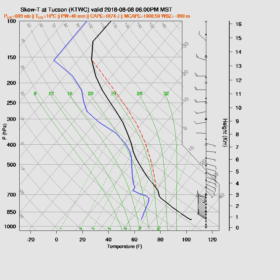
The Tucson early evening Skew-T has quite a bit of CAPE from around 1000-1800 J/kg. There is a pronounced inversion at the top of the PBL. It may be stronger in reality as the model runs are likely to have too much heating. In spite of good CAPE and a favorable wind profile, deep convection is unlikely but not impossible.
On days like this, I like to check to see how well 2m temperature forecasts are doing to see how far off the model is and so far this morning. It’s not good! The WRFNAM is the worst as it’s 3-10F too warm at stations in the cloudy areas of southern Arizona. The WRFRR and GFS are better but still to warm from 3-6F. The WRFNAM develops big storms into the Tucson area during the evening but I think it’s going to be more like the WRFRR which moves storms close but they die out as they move into the lower elevations.
Like Tucson, Phoenix has a moderate amount of CAPE but an inversion at the top of the PBL. CAPE is sufficient to support storms if strong outflows can provide lift but I think that is unlikely.

One thing that all the morning runs agree on is another overnight MCS in northern Sonora which, again, is likely to have a big (negative?) impact for southern Arizona tomorrow.
Day 2
Right off the bat, forecast confidence is very low. All the runs have been consistently too active for the Day 2 forecasts and that may again be the case depending on how well they handle clouds and cooling. I haven’t even mentioned the hurricane yet as it didn’t really have much of an impact on the day 1 forecast. It really never strengthened (so far) as much as forecast and satellite presentation isn’t all that great. By midday tomorrow, it’s off the southern coast of Baja and close enough to trigger a Gulf Surge into the state.
The Sonora MCS leaves behind quite a few clouds as well as minimal CAPE over southern Arizona. What looked like an excellent chance for some decent rains seems to be evaporating! Higher terrain should be very active though as CAPE is again high and it should be mostly clear.
Positives are quite cool temperatures at 500mb at around -8 to -10C. Also, there is a sharp IT located from SW NM into Sonora. Steering flow is also good at around 10-20 knots from the NE.
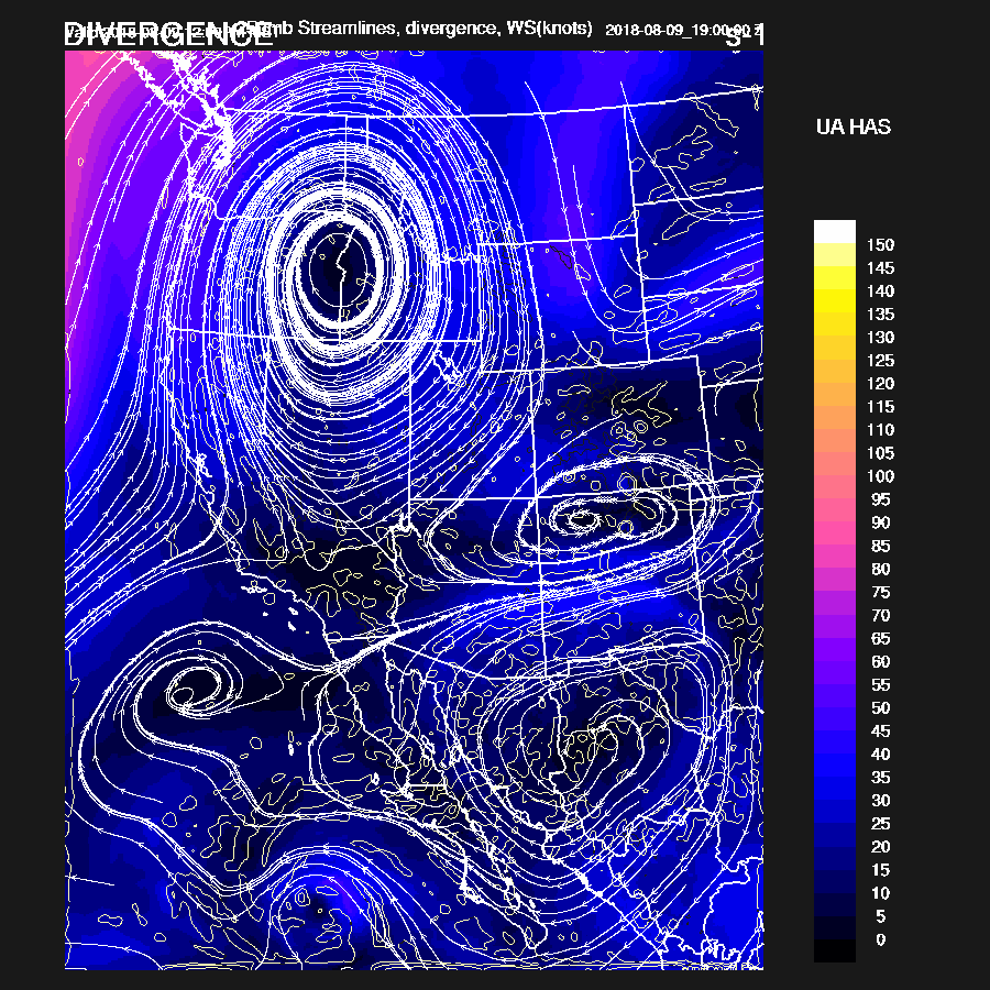
The 250mb ridge becomes very amplified with the center way up in Idaho which forces a weak trough to the SSW and is over the Four Corners. This places central Arizona in the entrance areas of a weak jet streak with areas of northern Arizona in the upper divergence area.
All three of the 12Z runs develop widespread strong to severe storms over Yavapai, Mohave, and western Coconino Counties tomorrow afternoon and scattered strong storms back to the east. The setup looks excellent so I don’t think the models are overdoing it but the image of Lucy pulling the ball away from Charlie Brown keeps running through my head for some reason.
All the runs mix Phoenix deeply and are forecasting high CAPE by early evening thus a big event looks possible or even likely.

All runs move strong to severe storms into the lower deserts of Maricopa and Pinal Counties during the evening and maybe as far south as Pima County. The WRFNAM is the least active of the three.

The other extreme is the WRFRR which has a squall line moving through Phoenix.

Widespread damaging winds are present in this model run with model wind speeds over 50 knots which translates into isolated gusts to around 75 knots.
No comments:
Post a Comment
Note: Only a member of this blog may post a comment.