Previous Forecast
The infamous SPC “Slight Risk” curse was looking to verify as there were only a few evening thunderstorms over the lower deserts and they were dying off after sunset. However, one area of strong storms developed near Show Low and moved rapidly southwest and into the Phoenix area after 11pm. There were a few reports of severe weather but it wasn’t the big outbreak like the model runs were forecasting. At least it wasn’t a total bust.
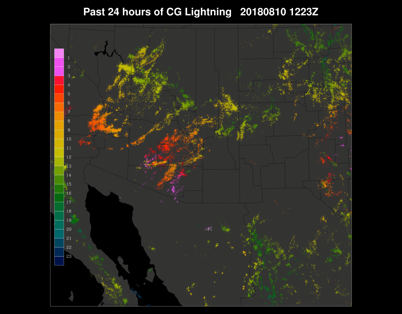
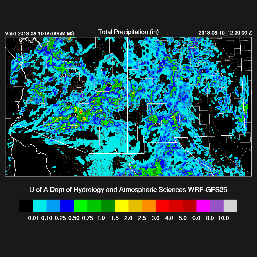
My guess of what went wrong was a combination of the forecast PW being 2-3mm too wet plus surface temperatures a few degrees too cool. Another negative was PW decreased slowly throughout the day around SW Arizona including the Phoenix area. It spiked back up as moisture convergence kicked in ahead of the approaching area of storms. This complex regime has certainly challenged both man and machine and not having any upper air data from all of northern Mexico at 12Z certainly doesn’t help. The WRFGFS, while too active in Pinal County and too early, performed better than some of the other runs. The 6Z runs had very little activity over the lower deserts which was correct initially, but then they missed the late night activity.

Initializations
The western CONUS is dominated by a high amplitude ridge with the center located over ID. A broad inverted trough lies across southern NM and Arizona with temperatures in the -6 to -9C range. The remnants of hurricane John are west of central Baja and slowly moving NW and it is too far away to have any direct impact on moisture flow into Arizona. The RR and NAM initialized the large-scale features well.

Morning showers and clouds are present over much of south-central Arizona and were initialized well by the RR. The NAM initialized these too far south thus south-central Arizona was too clear. RR PW errors were minimal and NAM also had minimal errors except for western Arizona where it was too wet. So the RR is the favorite as it has initialized well. A quick look at the 6Z runs indicates that the WRFNAM did a good job with the early morning activity thus it may also be useful today. There have been computer problems this morning so the WRFGFS and 15Z WRFRR will be very late plus the 12Z WRFRR was truncated at about 24 hours.
Day 1
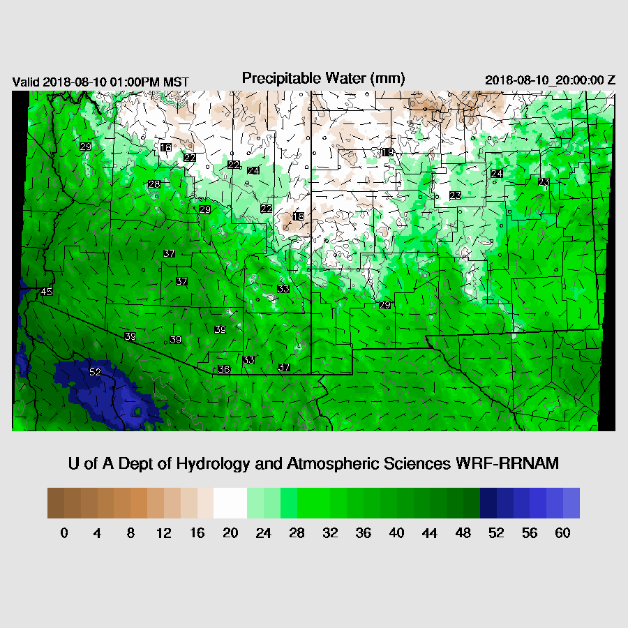
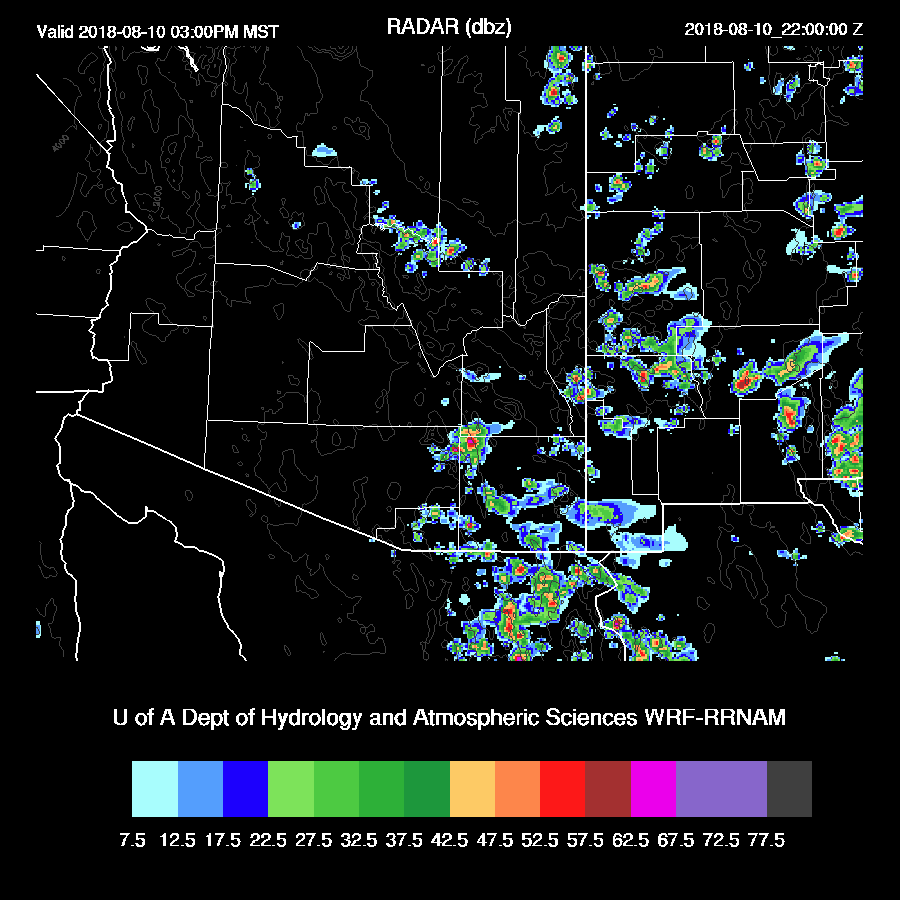
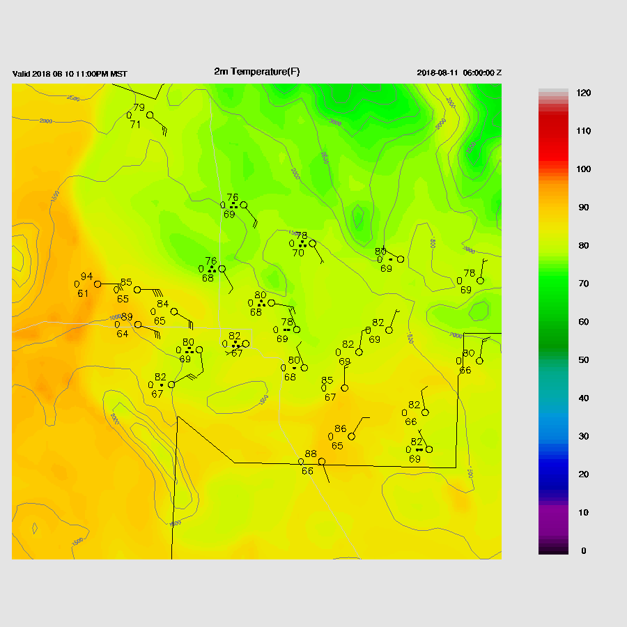
PW has generally increased over SE Arizona (35-42mm) while decreasing around the Phoenix area and to the west as it is in the range of 35mm around Phoenix to 46mm at Yuma. Moisture remains about the same throughout the day as the import of moisture from the south has ceased. Light low-level easterly flow is again present over far SW NM and into far eastern Arizona which may again dry that area out.
It’s very wet at 850mb thus storms are likely to have very heavy rain associated with them, especially in SE Arizona.

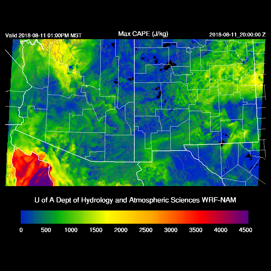
CAPE is generally lower than it has been over the past few days but there are still some areas of moderate CAPE, mainly over SE and NW Arizona.

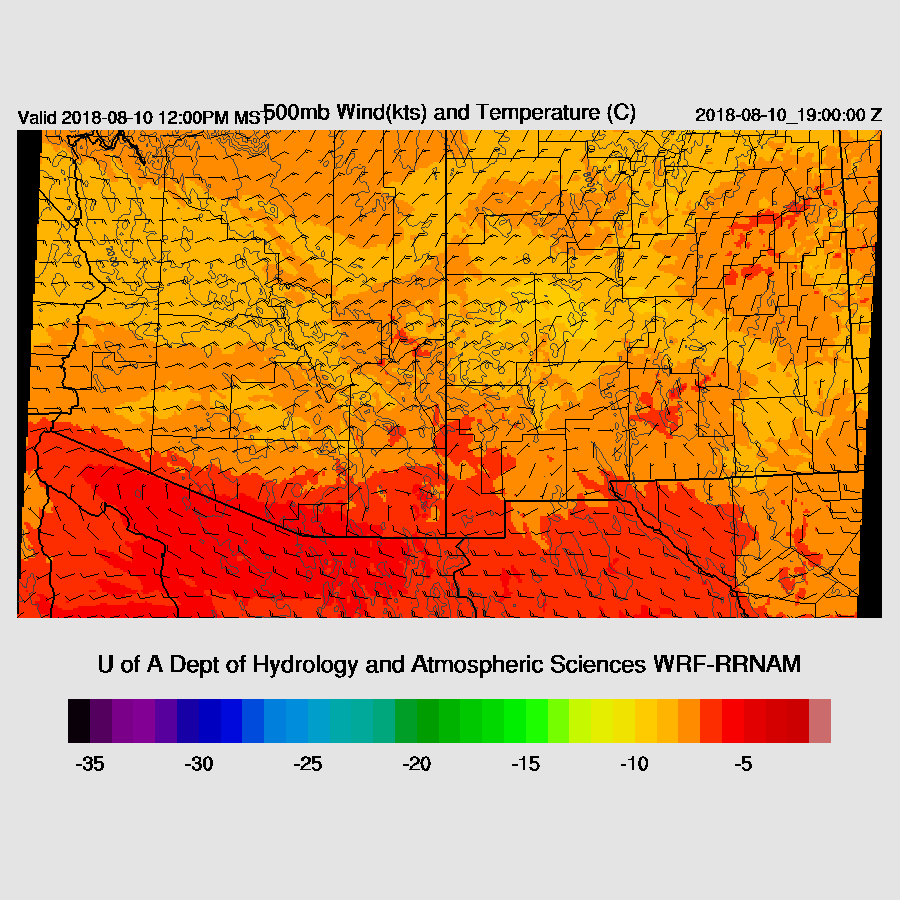
Much of Arizona continues to be in favorable northeasterly flow as well as moderately cool air at 500mb. Again, any storms that develop will be steered towards the lower elevations.
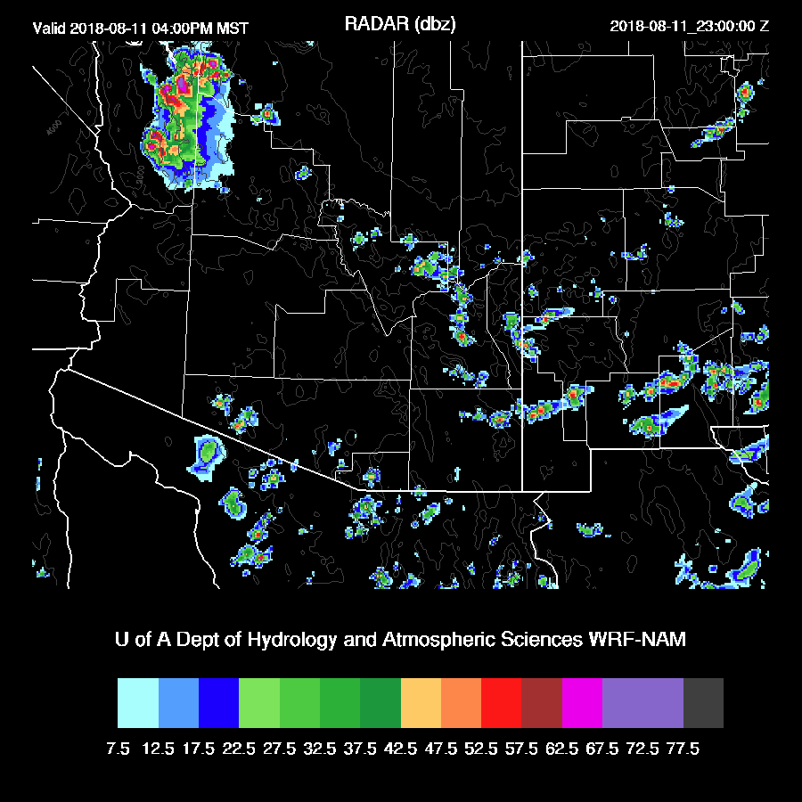
Storms develop mainly over SE Arizona during the afternoon.
The morning sounding from Tucson indicates that the profile is nearly saturated all the way up which results in a narrow, but tall, tropical CAPE profile. This sort of tropical airmass produces very heavy rains and typically convects with only limited heating. Often this sets up leads to deep convection over the nearby mountains and then clouds cutoff additional heating and the valley sees little or no activity ("too wet to rain"). Another unknown is the presence of the IT over southern Arizona. By afternoon, Tucson continues to be very wet and depending which run you look at, CAPE is moderate to high. The wind profile continues to be good with a deep layer of NE flow while upper flow is westerly which will keep anvils blowing out in front of storms. This profile looks favorable for strong storms in and around the Tucson area during the afternoon hours.
Speaking of upper flow, a broad upper trough continues over Arizona with a weak jet streak over southern Arizona which may act to enhance activity.

Forecasting specific events in this regime is difficult thus it’s just a guess when and where storms will occur but I’ll make an effort at it anyways. The WRFRR does have some activity around the Tucson area later this afternoon which makes sense based on the above skew-t. The WRFRR keeps much of the Rim/White Mountains quiet during the day while the WRFNAM is just the opposite with little or no activity in SE Arizona (doubtful) and a few storms over the Rim/Whites.
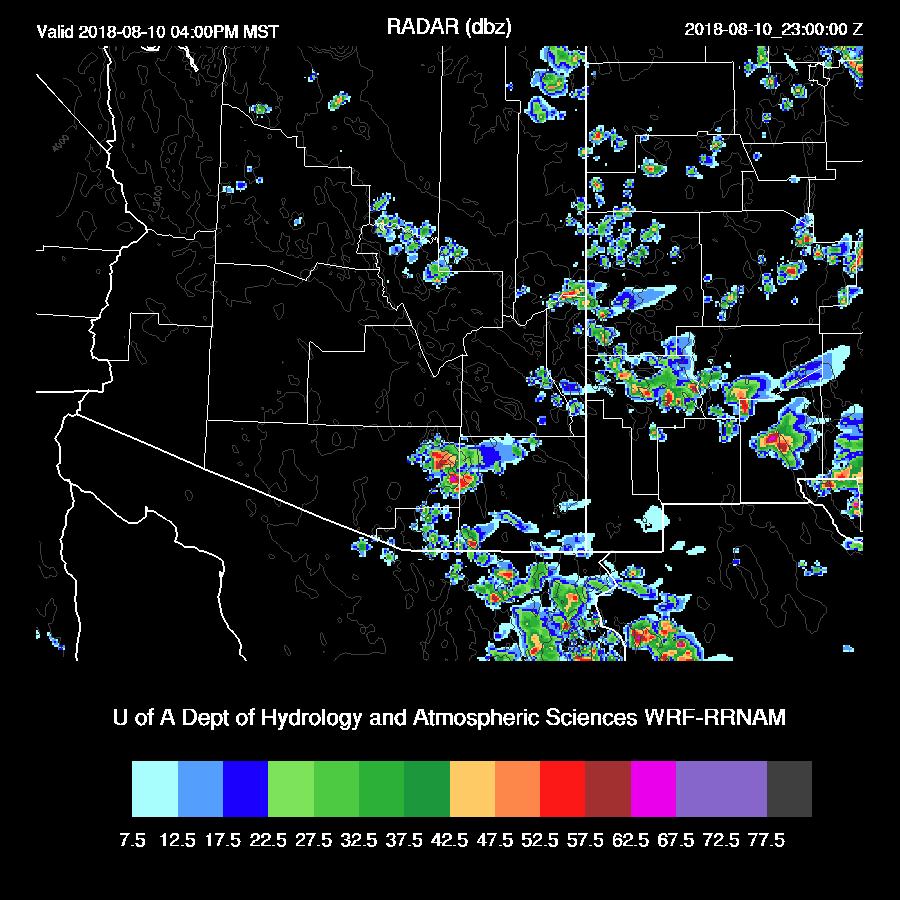
By tonight, both runs increase activity over the high country and move the storms towards the deserts.
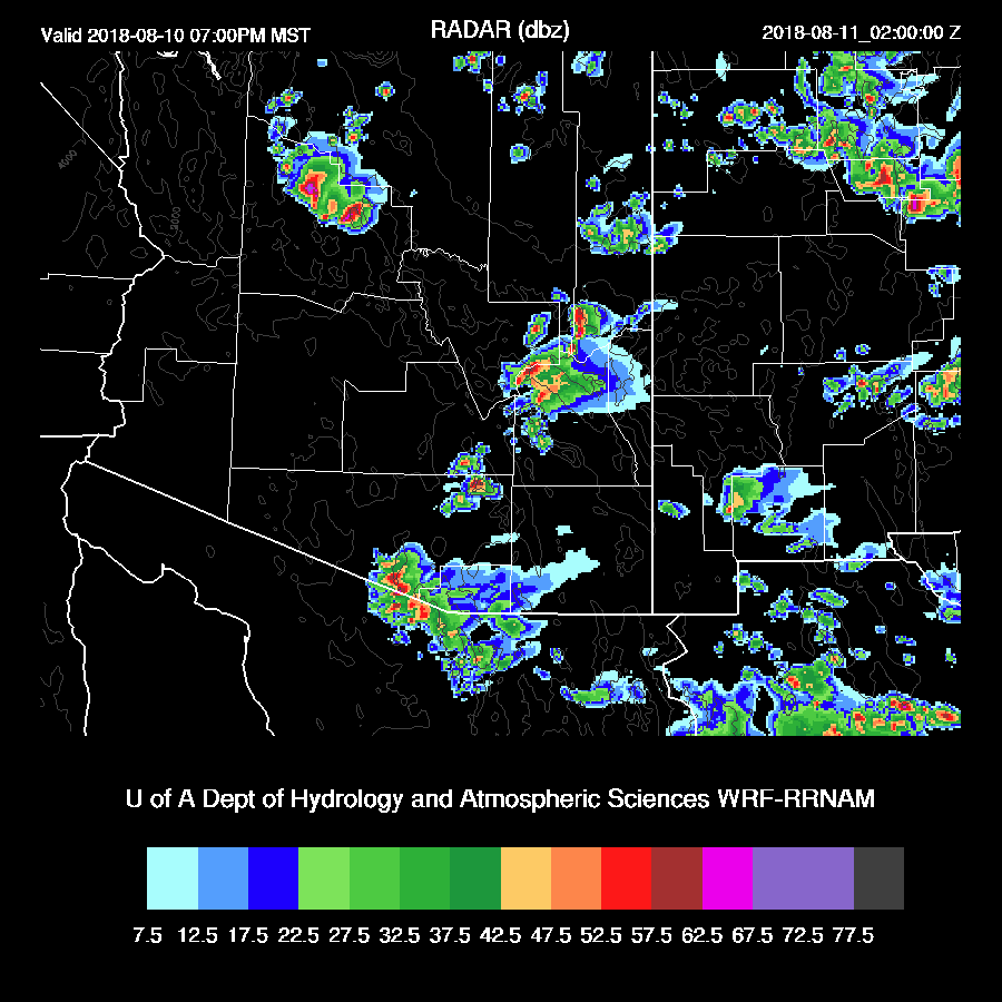
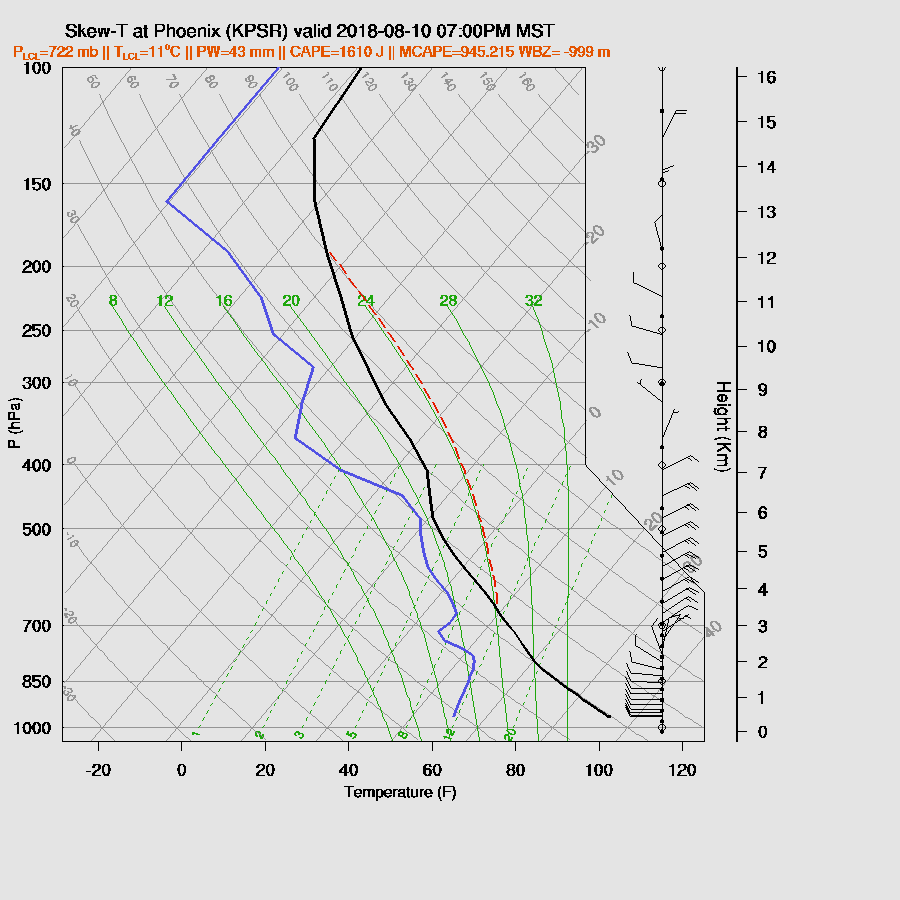
So, could it be another night of storms for the Phoenix area? It looks that way based on the forecast vertical profile as CAPE is around 1600 J/kg, a minimal capping inversion, and and excellent wind profile. I question if PW is going to increase back into the low 40mm range as the morning sounding has the green onion shape to it indicating a worked over PBL.
Both the WRFNAM and RR move big storms through Maricopa County later this evening.

Again, the storms will have very strong (isolated severe?) winds, very heavy rain, and maybe some hail.
Both the 6Z and 12Z WRFNAM keep storms going all the way to Yuma overnight.

Day 2
A trough is moving onshore over the NW CONUS while the ridge moves eastward into the Dakotas with a ridge axis stretching back towards Vegas and a closed cyclonic circulation is over west Texas. The complex pattern continues! Arizona continues to be in moderate to strong NE flow between the ridge and Texas/NM low.

In general, assuming it is quite an active night, CAPE is minimal over much of the state except for the far NW thus that appears to be the only area where significant activity is expected.
No comments:
Post a Comment
Note: Only a member of this blog may post a comment.