Initializations
The 500mb high center has moved to the Arizona/NM border thus placing southern Arizona under more favorable SE steering flow. Mid-levels are still warm at around -5C. An IT or MCV is located over far southern Sonora while a large upper troposphere trough is located over southern Sinaloa. There is some confusion as what the wave in Sonora is as the NAM looks like an MCV. The RR has characteristics of an IT as it has some cooler air associated with it, and the GFS is between the two. As there is no upper air data in that location, who really knows?
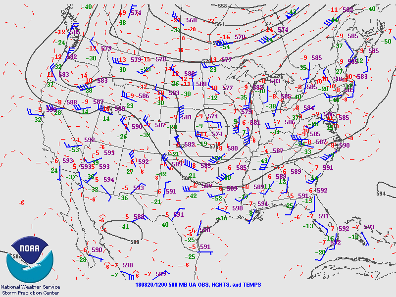
Skies are mostly clear over the state except for a little cirrus along the border. Recently, I’ve discovered that WRF’s icloud scheme had been creating thick cirrus at and above the tropopause. I’ve fixed that bug as of yesterday. All models have initialized clouds well.
Suominet continues to have frequent partial or full outages. Fortunately, much of southern Arizona and NW Mexico sites were available at 12Z but areas near the IT were initialized up to 14mm too wet. The correction routine is unable to handle errors of this magnitude thus the WRFNAM will be suspect especially for day 2. The RR (below) also struggled in NW Mexico but wasn’t as bad. Due to the lack of data, a large area over NM, CO, and WY had a false correction applied as there was only a single station in that area with a 7mm wet bias. That error shouldn’t impact Arizona as that area is not upstream of us today.

The 12Z GFS had mainly small PW initialization errors as did the 6Z GFS thus they may be better, especially for tomorrow. Due to the various issues, forecast confidence is medium, with the WRFGFS being the favorite.
Day 1
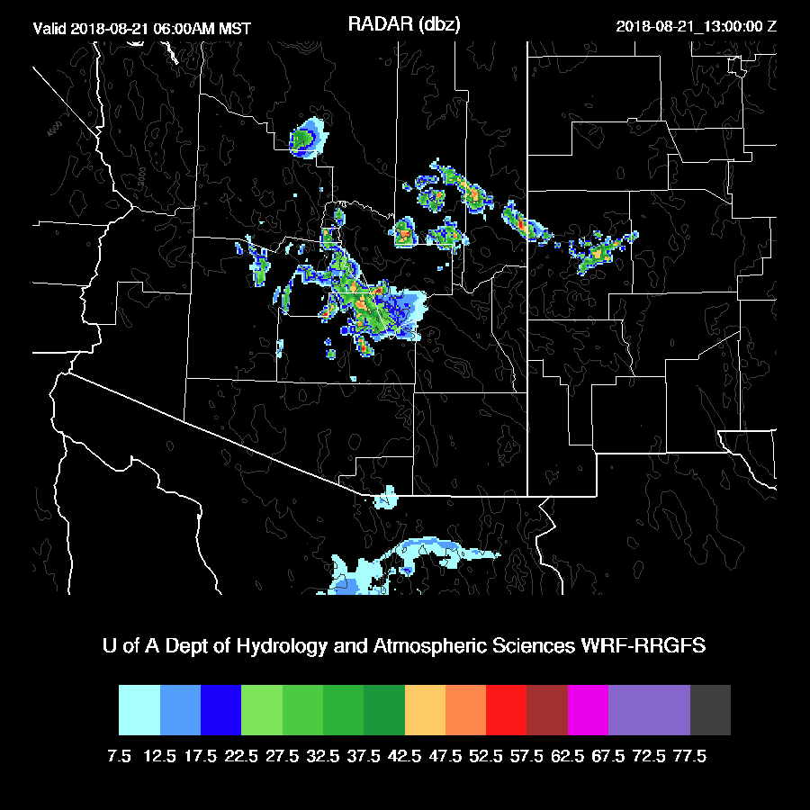
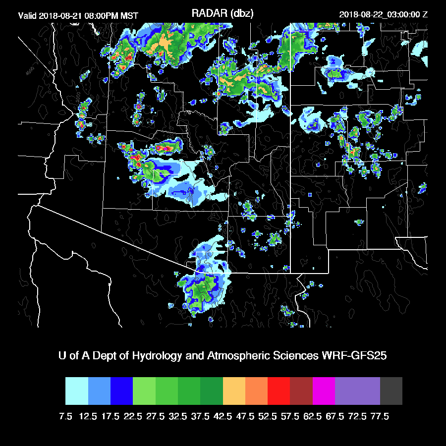
It was very active in NW Mexico yesterday afternoon and evening which resulted in an outflow driven surge into Arizona this morning. PW has begun to increase with the lower deserts ranging from 35 to 40mm. By early afternoon, the weak surge continues to advect moisture into the state.
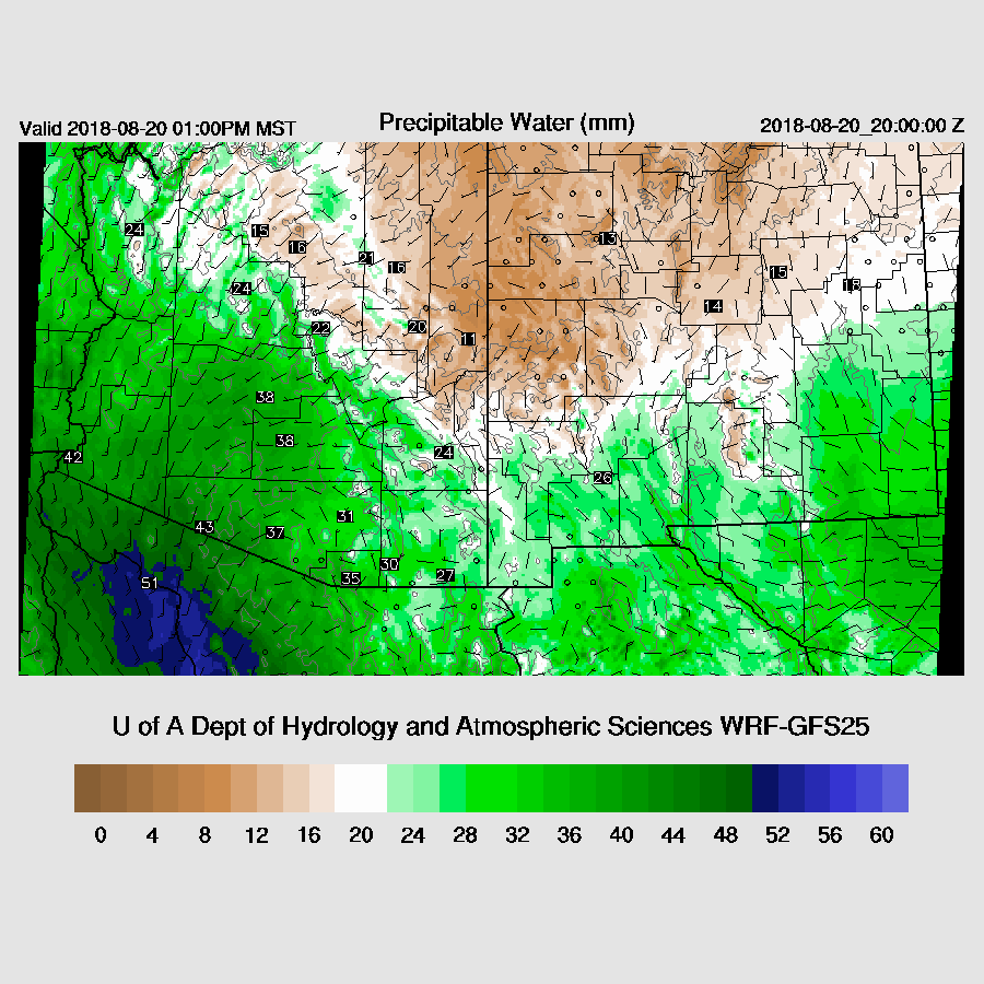
850mb dewpoint temperatures are quite high over south-central and central Arizona resulting in plenty of moisture in the lower troposphere. Another interesting feature is the low-level convergence zone between the somewhat drier SE flow in SW NM and the moist NW flow over much of SE Arizona. This convergence zone appears to stretch from Safford to Douglas and may act as a focal point for storms. This slightly drier SE flow out of NM has been a frequent occurrence this year.

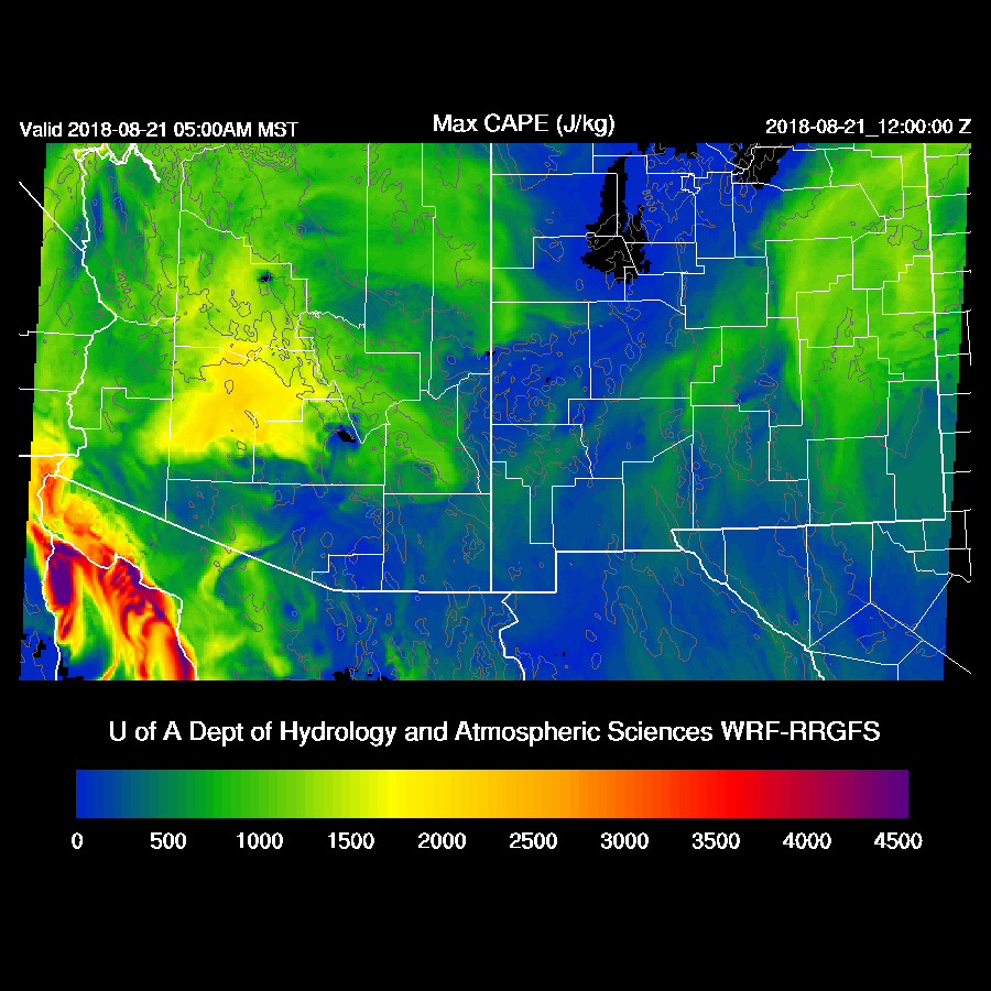
CAPE is high to very high over much of the southern ½ of the state with SE Arizona and along the Rim being especially high. All three of the 12Z runs are very similar.
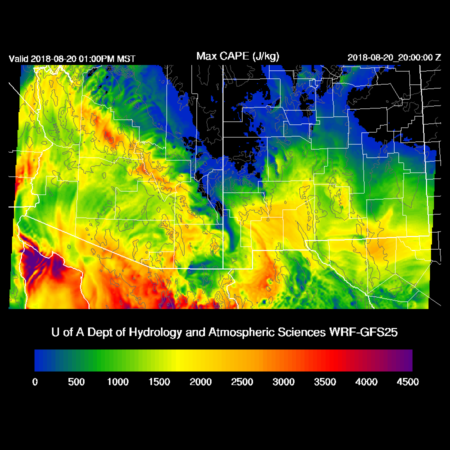
So, the big question is how much of a cap will there be in the low deserts? This has been a frequent problem this summer as the surges have been so strong/wet/cool. The morning soundings from both Tucson and Phoenix don’t have any noticeable cooling of the lower troposphere (yet) and do both have decent MLCAPE with Tucson being especially high at around 1600 J/kg. Just based on the sounding and wind profile, it looks likely for big storms in and around Tucson today.

The WRFGFS is the drier of the 3 runs and has the least amount of CAPE, but it’s more than enough to support deep convection in and around Tucson later today or tonight. The wind profile is good with low-level shear, some mid-level SE steering flow. SW upper flow may be good or bad, depending on where storms form first.

Deep convection initiates over the higher terrain of SE Arizona during the afternoon. The timing is a bit different between runs as the WRFNAM and RR develop storms earlier. A potential issue for Tucson is that big storms develop over Santa Cruz County and then move westward thus placing Tucson under the storm anvil later in the afternoon due to SW winds aloft.

The WRFGFS does develop a few storms in the Tucson area by late afternoon/early evening.

The WRFNAM and WRFRR are more active in the Tucson area and some of those storms are very strong with isolated severe winds and very heavy rain. It will be interesting to see what the 15Z WRFRR has today later this morning.
The Phoenix forecast is for a strong cap at the top of the mixed layer and another negative is weak steering flow. CAPE is pretty good at around 1400 J/kg. You can never rule out a few storms when it’s this high but a big outbreak is unlikely.

A few storms move into Pinal county this evening but die out as they move toward Phoenix where the cap exists.

Some of the runs have storm activity for parts of central Arizona as elevated CAPE becomes quite high there. The WRFRR has over 1800 J/kg of CAPE at around 850mb so activity is certainly possible. These events are notoriously difficult to forecast and with the PW initialization errors in Mexico, confidence is low.
The WRFRR is the middle of the road as it has showers and a few storms around the Phoenix area during the early morning hours.
Day 2
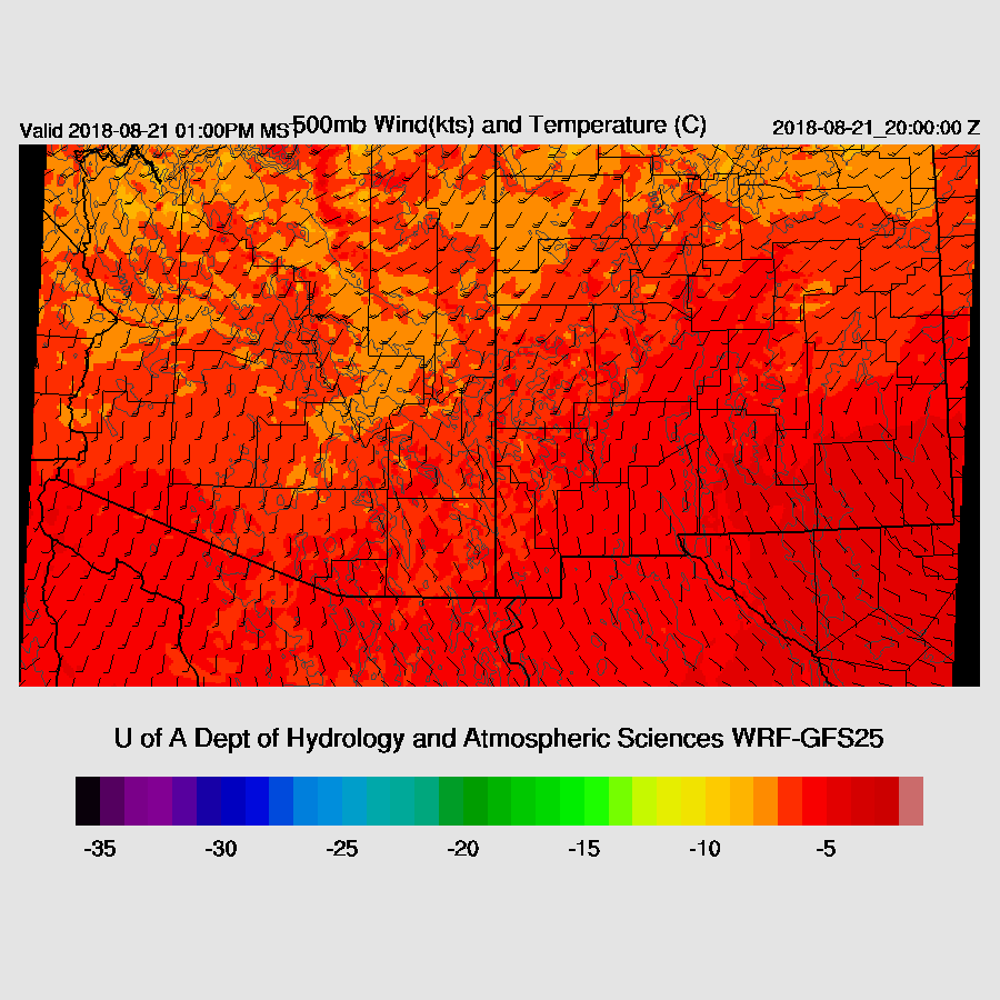
Due to the complexity and uncertainty, the day 2 forecast confidence is low. The 500mb high continues to move to the east which places southern Arizona in mainly 15 knot southerly flow. Not great, but not bad.
SE flow in NM advects dry air into far eastern Arizona while weak southerly flow keeps central and western Arizona very wet.
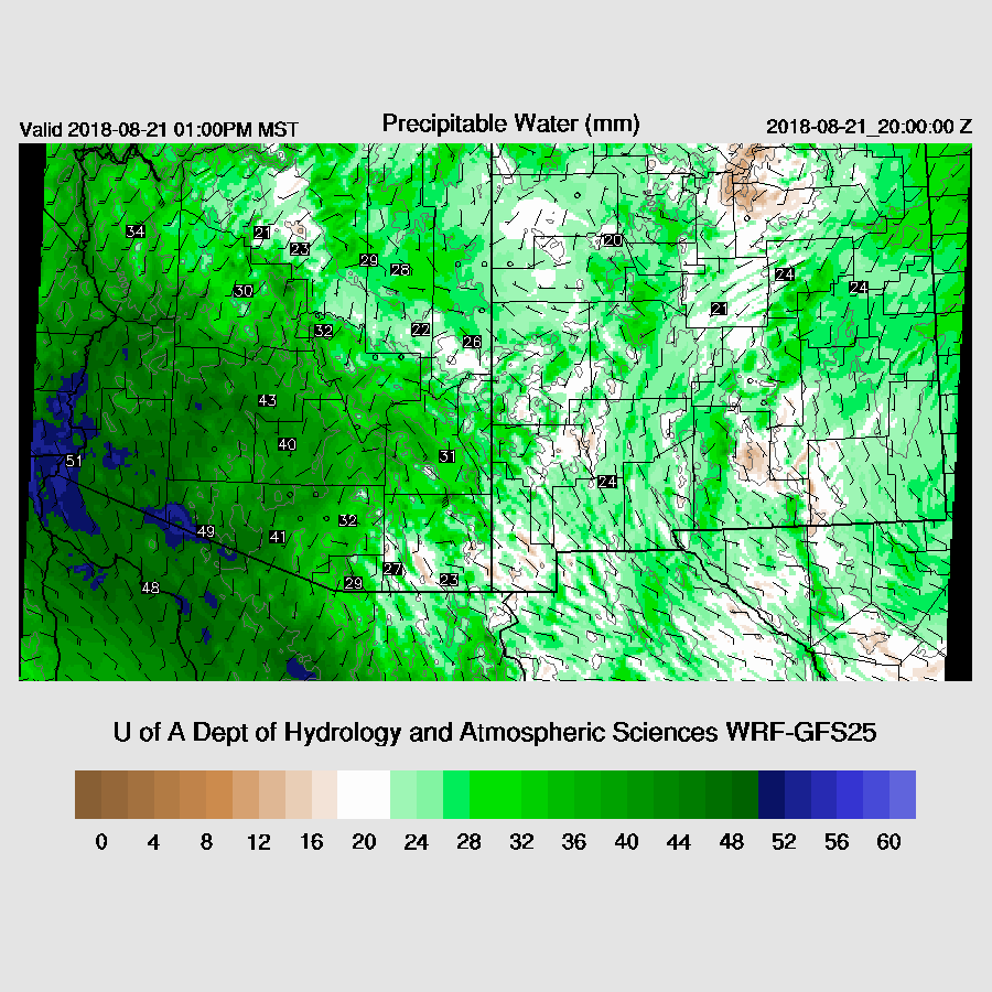
CAPE is high over much of western Arizona so that is the area where most activity is expected. Areas around Tucson were most likely worked over and eastern Arizona has only minimal amounts of CAPE so not much activity is expected there.

It looks like Phoenix has a relatively good chance of evening activity.
No comments:
Post a Comment
Note: Only a member of this blog may post a comment.