Previous Forecast
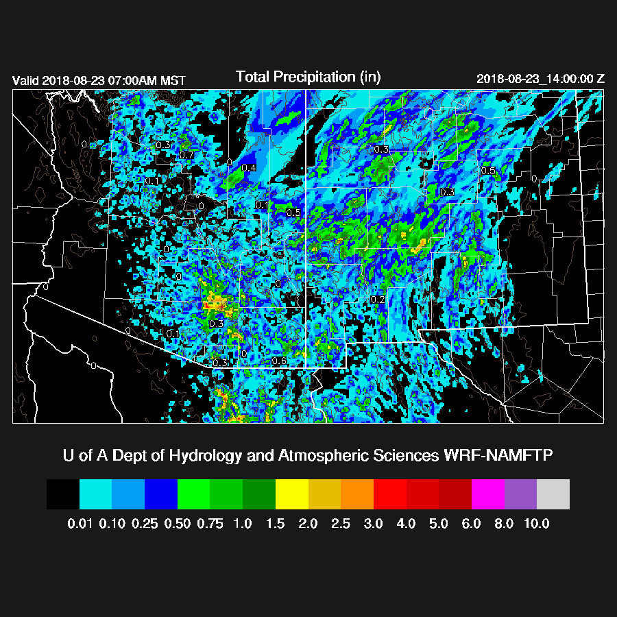
It was mainly a quiet day and evening for much of the state due to the widespread clouds over southern Arizona and the worked over atmosphere from the morning convection over central and northern Arizona. The far NW was very active though. As expected, none of the model runs were any good as they had way too much activity over southern Arizona. They also did a poor job with the NW Arizona deep convection. Yesterday was a good example of how one can get burned by just relying on the models and how important it can be to examine the model initializations to judge their accuracy. The southern Arizona MCV was initialized either in the wrong place or not at all and this resulted in widespread precipitation over much of southern Arizona when in fact, there was almost none. Also, one needs to understand that a MCV is a warm core system so unless the clouds dissipate quickly and decent heating is realized, deep convection is not going to happen. The only place that deep convection formed was in the clear areas over far southeastern Arizona.

The 12Z WRFGFS was especially bad.

Initializations
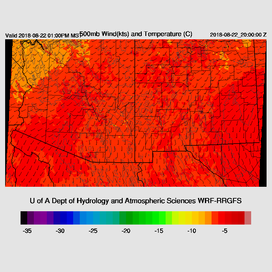
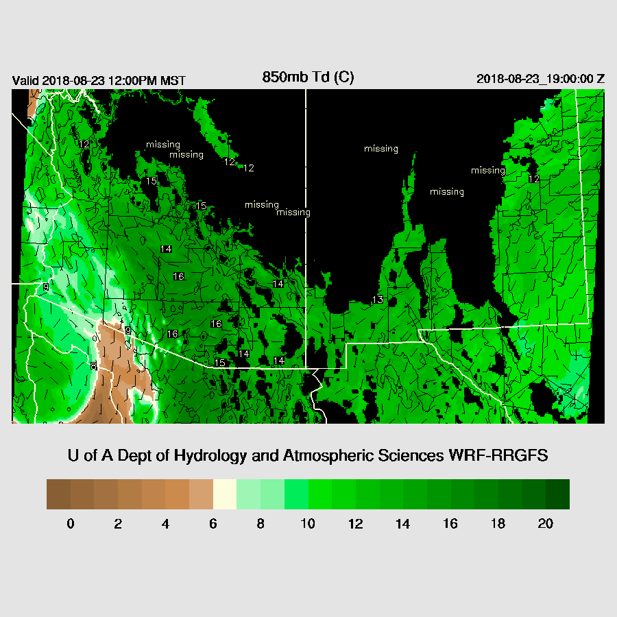
Weak SW flow continues over the SW US between a trough over Idaho and the 500mb high center in Texas. There may be a cyclonic circulation over central Sonora and it just may be a weak MCV leftover from the overnight MCS. NCEP LDM data is still out and it is taking a long time to ftp data so runs are quite delayed and I’m forced to use the 6Z runs. The 12Z WRFRR is also available. The NAM initialized this Mexican IT quite well while the RR has a broad IT over southern Baja. The GFS had only a weak trough over southern Sonora. As flow is SE over Sonora and then SW over Arizona, this feature may eventually work its way into Arizona.
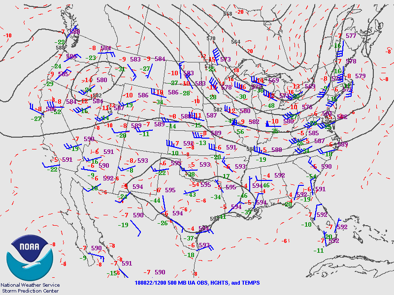
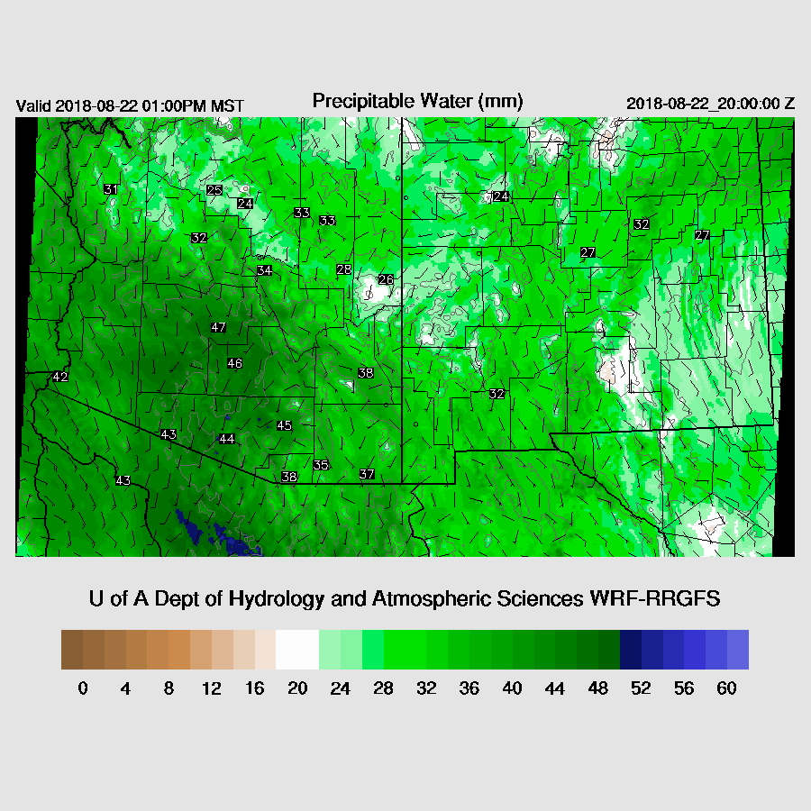
Cloud cover is quite extensive over northern and eastern Arizona while partly cloudy over the south and the west. The 6Z runs had clouds in the right locations but not enough coverage and the RR was pretty good except for far SE Arizona where it was too clear. The RR PW initialized well. The 6Z GFS was too wet over western Arizona but was fine elsewhere. The NAM had its typical widespread wet bias with some quite large errors over Arizona and into northern Mexico which will be difficult to correct. Overall, the WRFRR looks to be the best and had a good initialization for the most part. The WRFNAM is suspect due to the large PW errors.
Day 1
It is certainly wet with PW increasing to 43-50mm over much of south-central Arizona. The exception is Yuma where it’s dropped to 38mm. A moderate surge continues during the day which results in very wet air over much of the state.
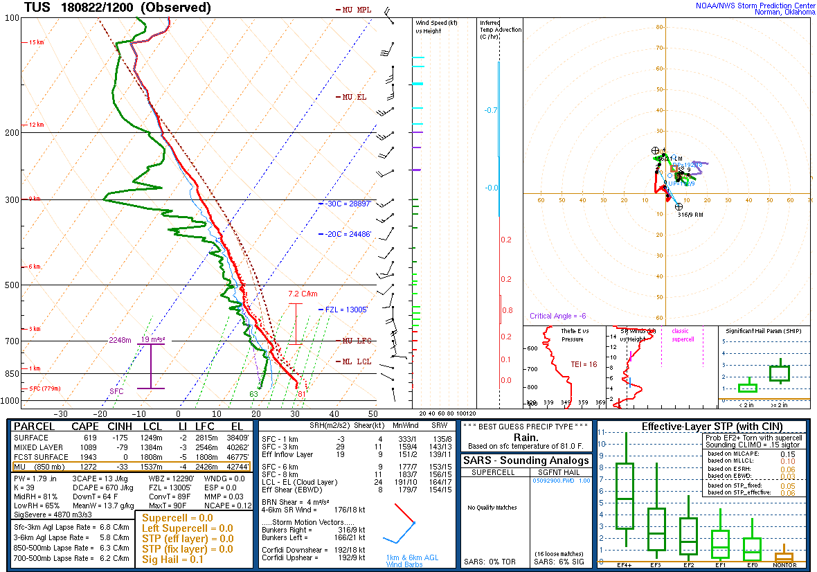
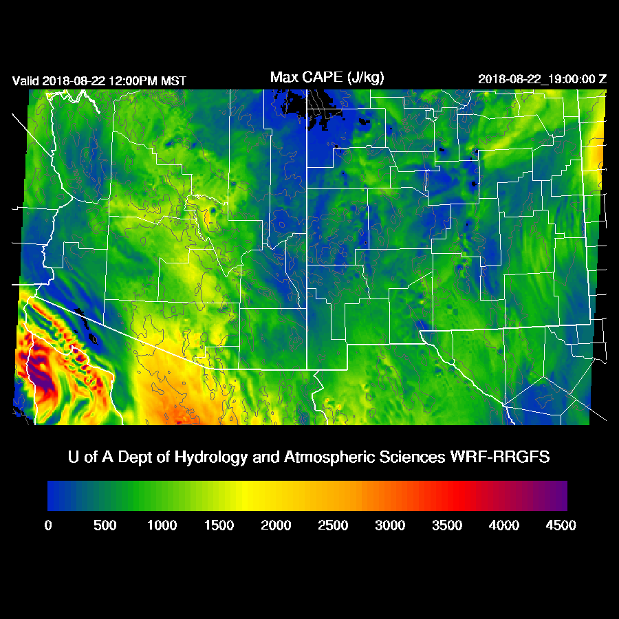
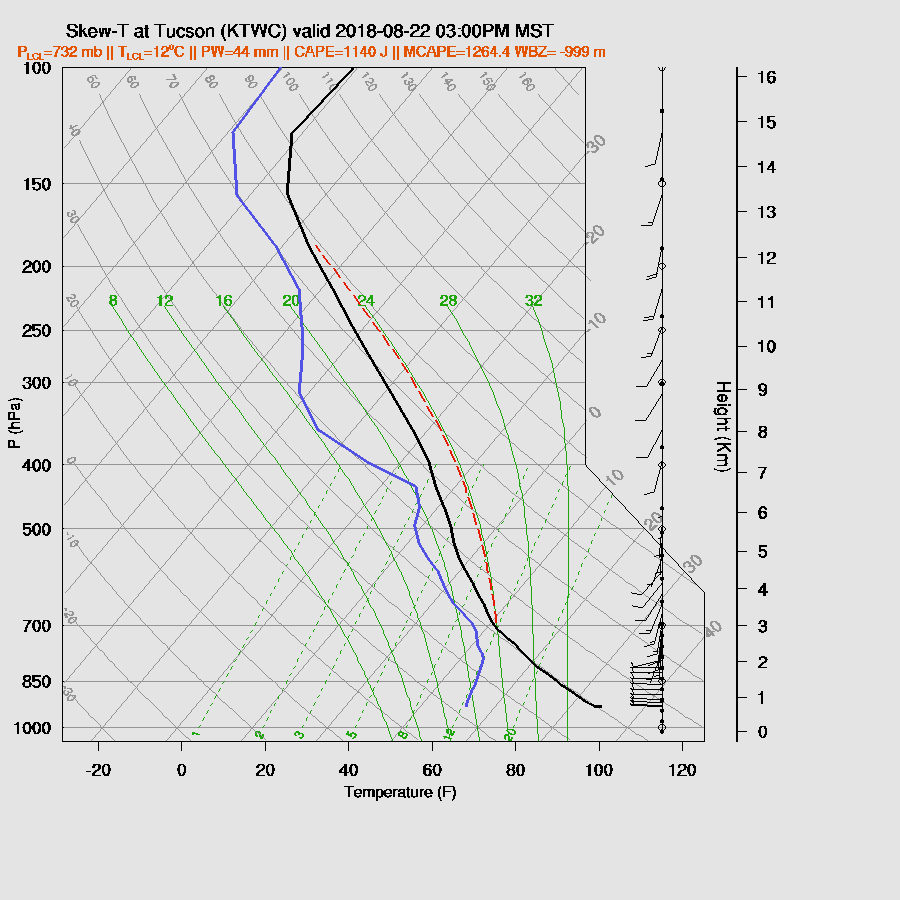
Observed MLCAPE from the Tucson sounding is much improved over yesterday and is fairly high at around 1000 J/kg. Mid-level steering is weak and from the SW which isn’t very good for storms. CAPE is high from south-central Arizona up to the Grand Canyon and that should be the more active storm areas today and tonight.
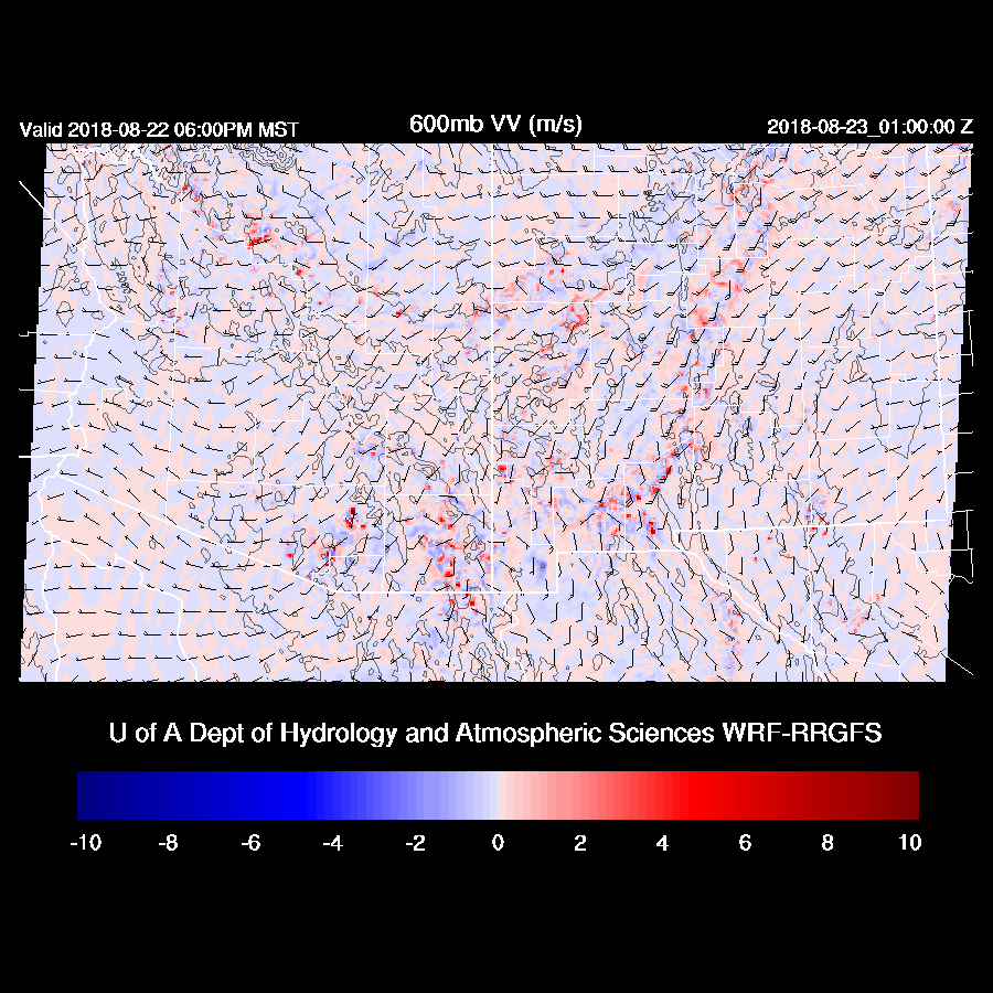
The mid-level pattern doesn’t get any better this afternoon as winds continue to be weak and the possible IT is nowhere to be seen at least in the WRFRR and WRFGFS.
The forecast Skew-T for Tucson has plenty of CAPE to support storms as well as a fairly deep mixed layer but winds are poor as they are mostly unidirectional from the SW which isn’t a good direction. However, with this amount of CAPE and moisture, some storms could certainly pop up in the valleys or drift off the nearby higher terrain. Very heavy rain is likely with storms.
Scattered storms are present over much of the mid and high elevations during the afternoon but don’t show much organization.

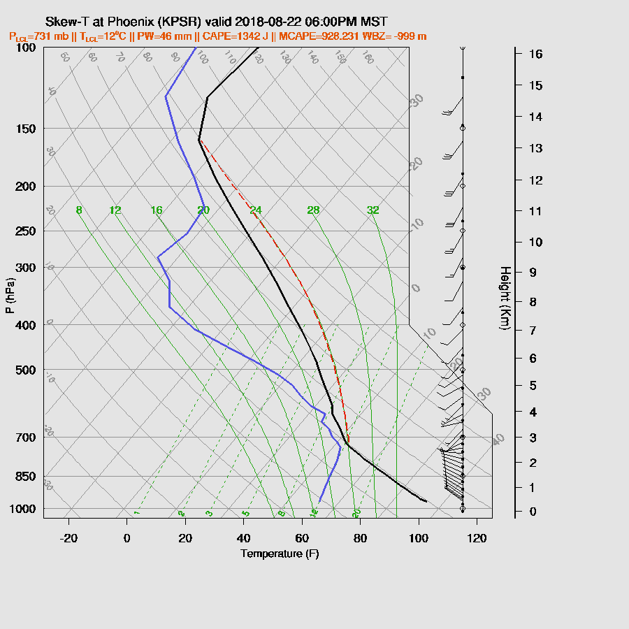
Like Tucson, Phoenix is deeply mixed along with moderate CAPE, and a poor wind profile. It might be possible for a few storms to develop in and around the valley during the early evening hours.
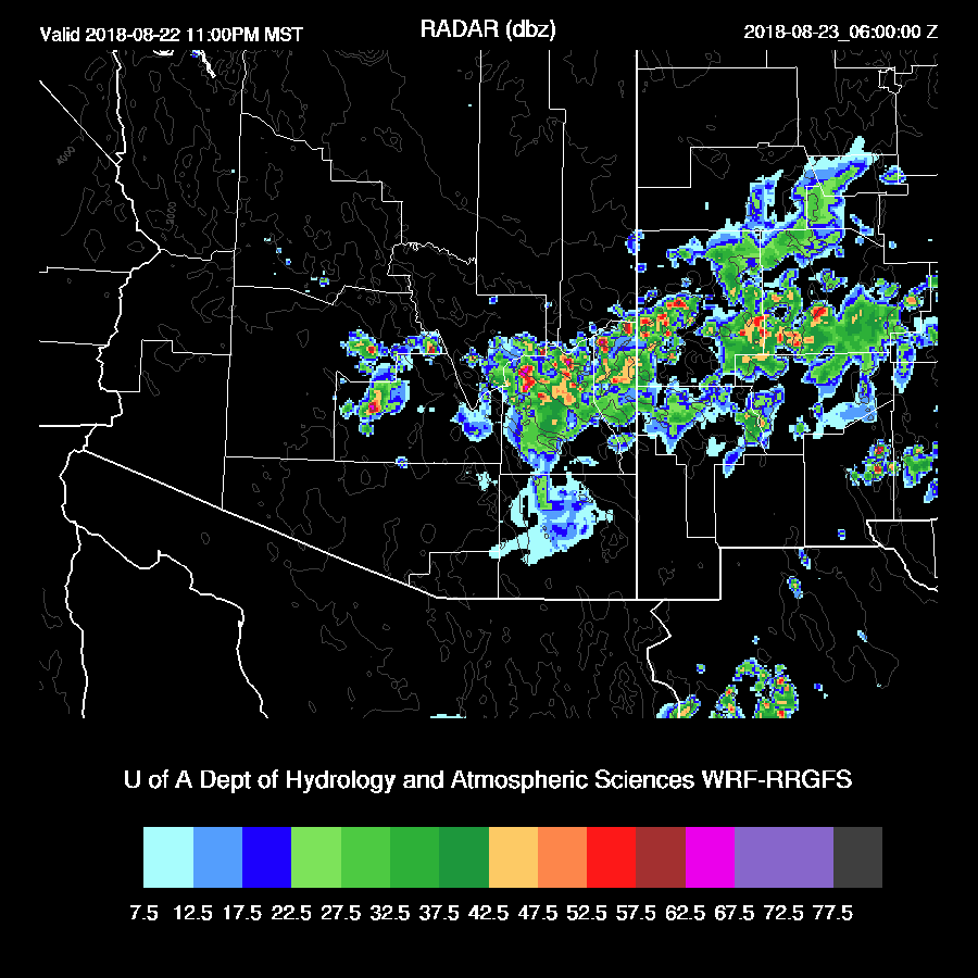
As far SE Arizona was fairly cloudy this morning, storms will get a later start. By early evening, it is very active in SE Arizona with another chance of storms in and around Tucson. Various model runs do have a weak trough moving into south central Arizona this evening and perhaps another moving out of northern Mexico which looks to be responsible for this activity.
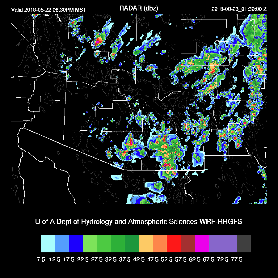
It looks to be an active night as storms as the various runs continue to develop storms over parts of SE and SC Arizona into the late night hours, including the Phoenix area.
CAPE continues to be moderate over south-central Arizona so there is support for late night and early morning activity.
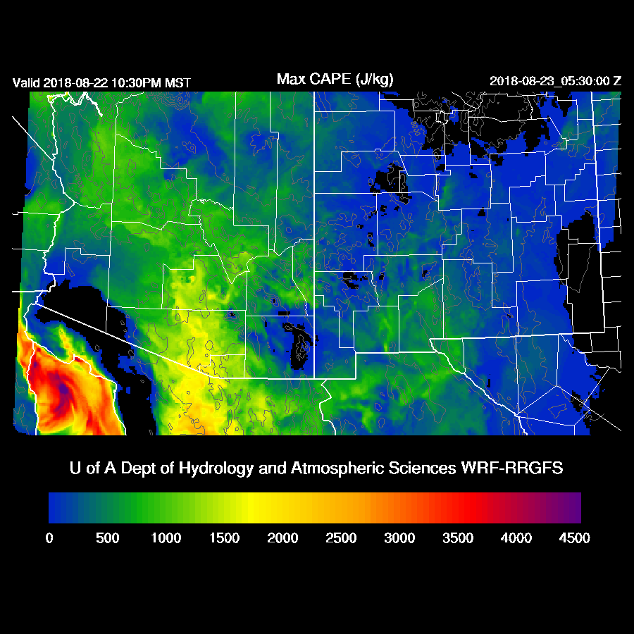
The WRFNAM just became available and it has a large outbreak of showers and storms during the early morning hours. It’s probably overdoing it, but the possibility is certainly there for widespread storms due to the CAPE and the trough.
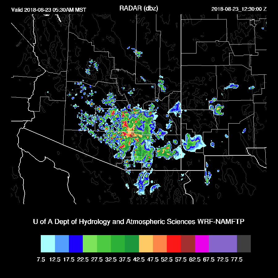
These storms have the potential of producing extreme amounts of precipitation.
Day 2
Day 2 confidence is very low due to the earlier activity thus I’ll just look at the large scale. It’s still quite wet but dry air has worked into the western part of the state.
CAPE is very high over south-central Arizona up to the NW part of the state so there is a potential for a big day if there is decent heating.

Mid-level flow is very light from the west so this is a big negative for storm organization. Most likely, storms will form over mid and high elevations and not move much so there might be some activity for Tucson but probably not for Phoenix.

No comments:
Post a Comment
Note: Only a member of this blog may post a comment.