Previous Forecast
It was very active from central Pima county up through Phoenix and northwest of there as storms developed along the border during the afternoon and then propagated to the NNW.

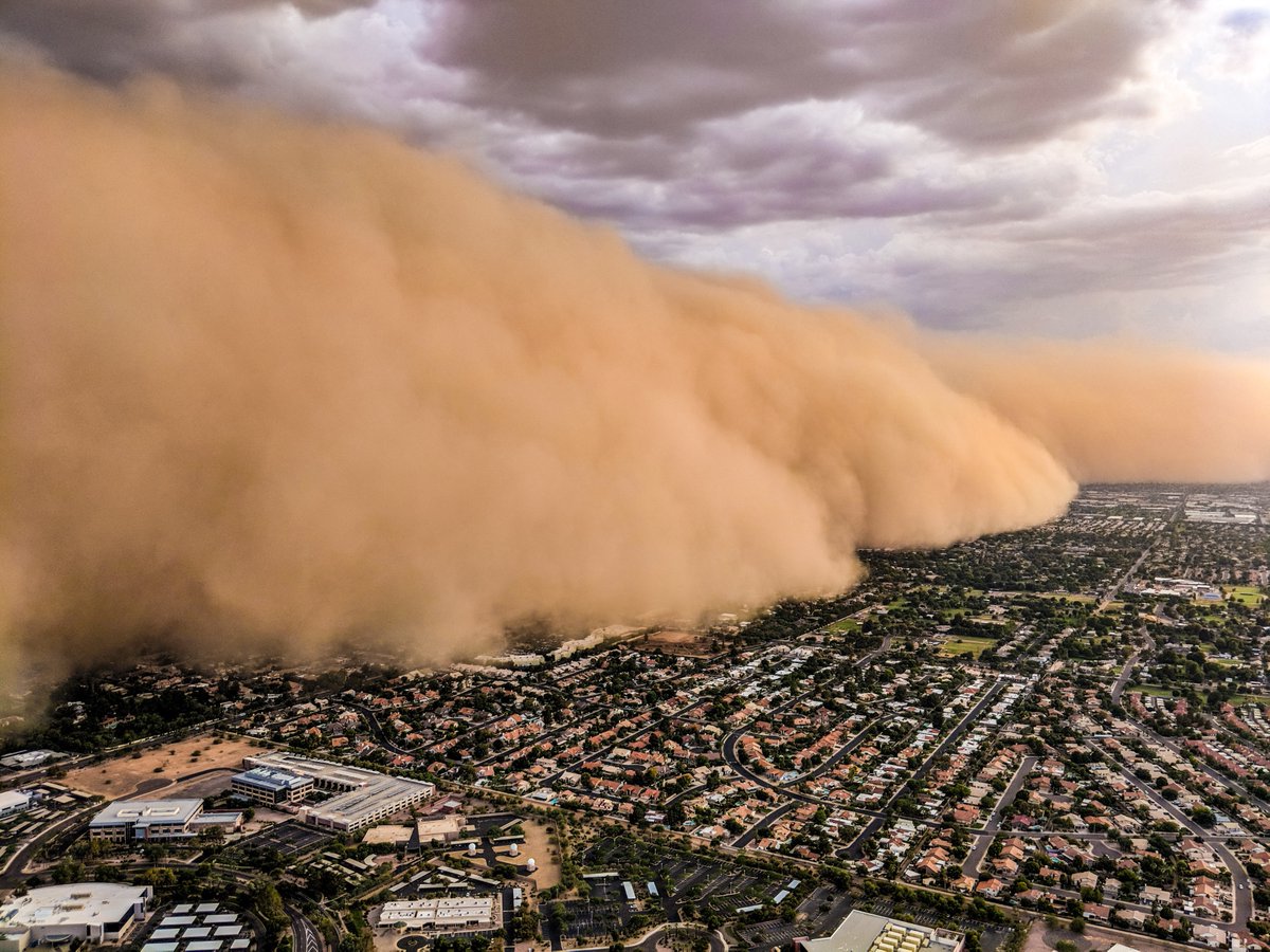
A massive haboob moved into the Phoenix area during the early evening. (Mike Olbinski)
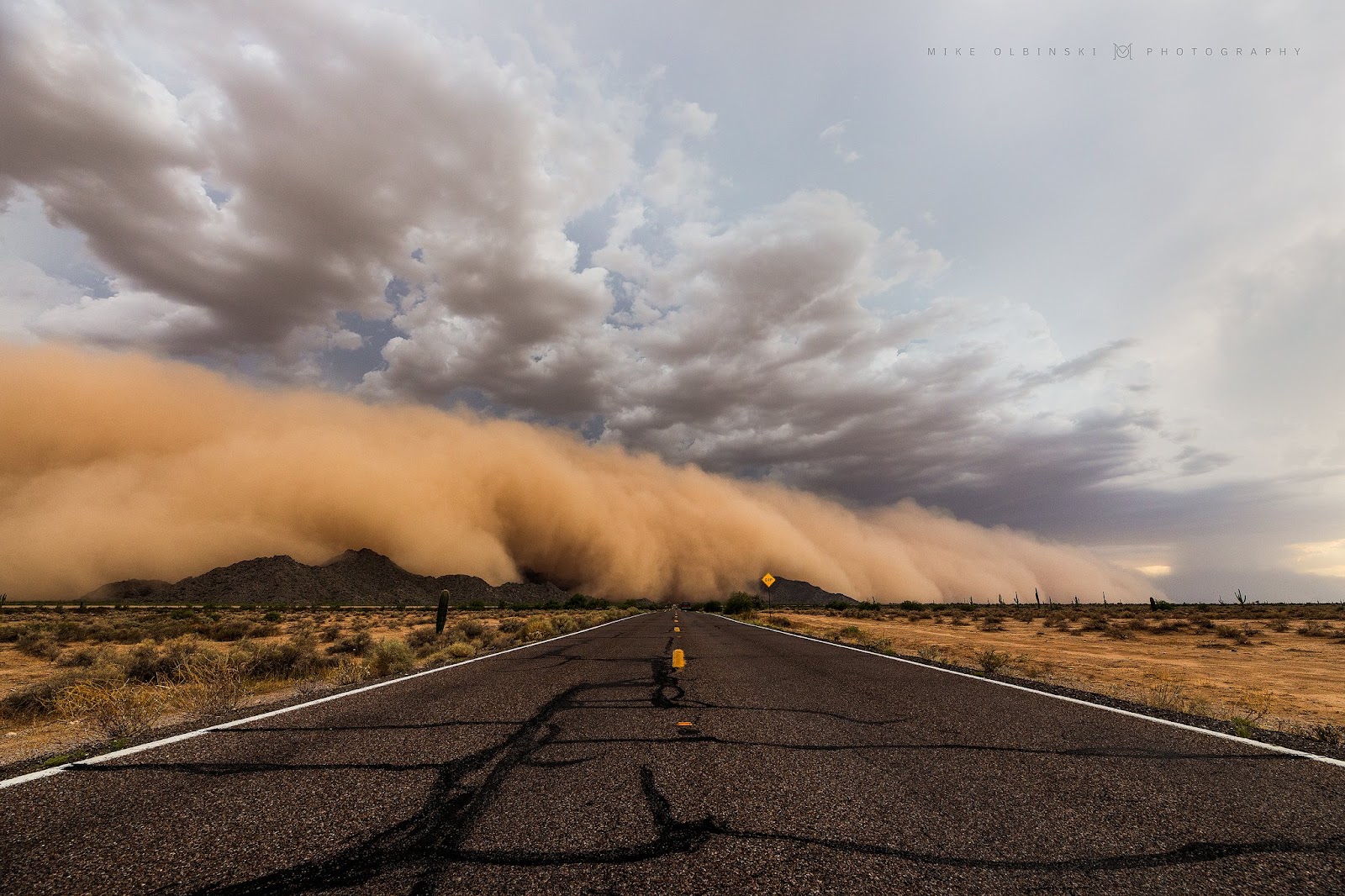
Chopperguy.com
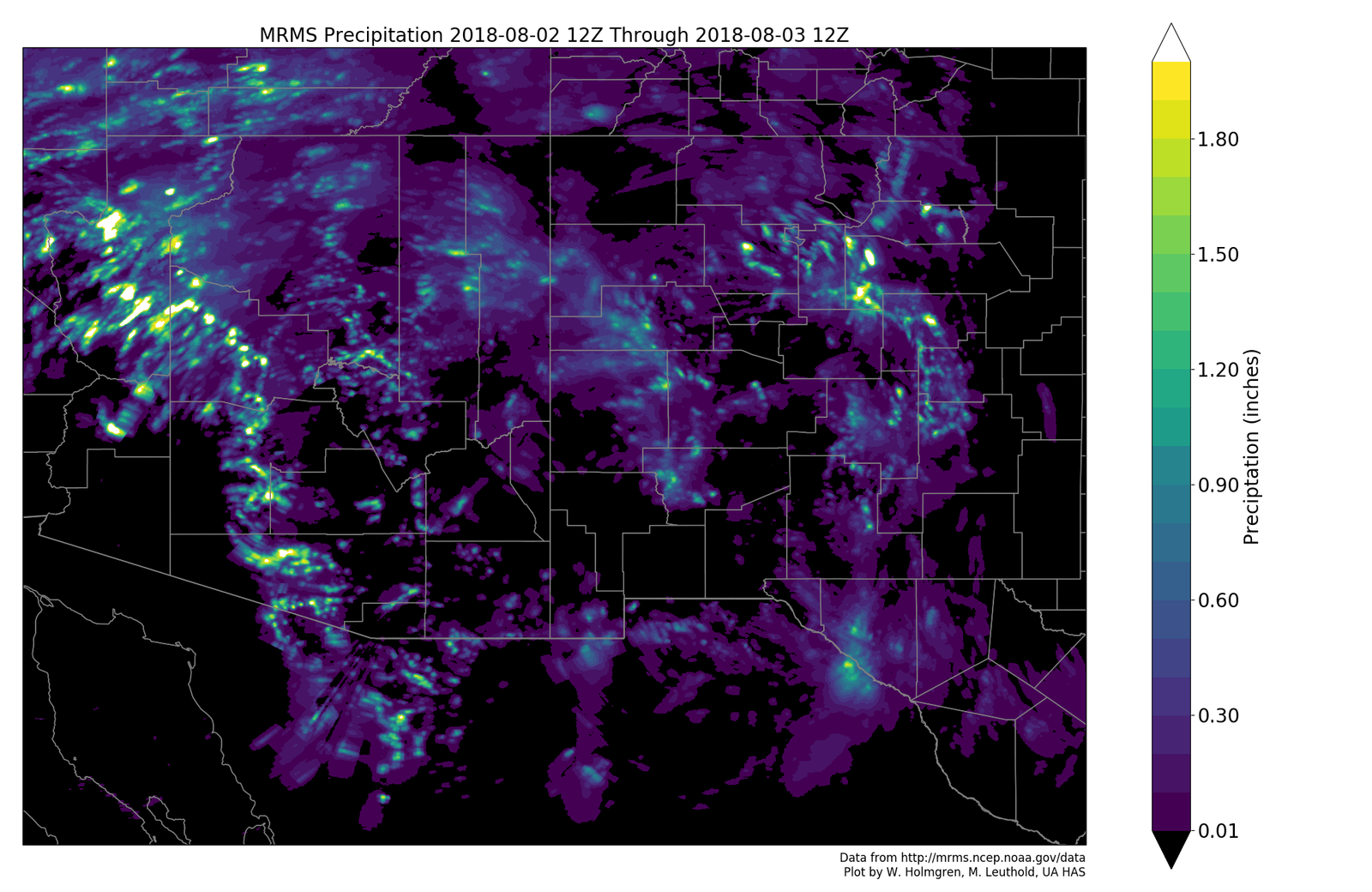
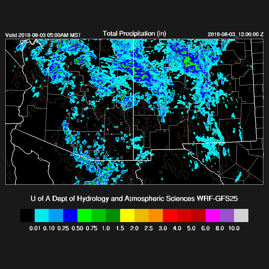
None of the morning runs were quite strong enough with the activity around Phoenix and the 12Z WRFGFS and 15Z WRFRR were the closest. Most of the runs busted around Tucson as no deep convection formed either during the evening or overnight. The best run was the WRFGFS as it had limited Tucson area activity and it had some strong storms in the Phoenix area (but not a lot of precipitation).
The 12Z HRRR was pretty good as it had storms around the Phoenix area during the evening as well as a moderate outflow boundary.

Initializations
The 500mb high center now south of Arizona in far northern Arizona resulting in light westerly flow and warm air with temperatures from -6 to as warm as -4 upstream in California. The state is mostly clear except for some clouds over NW Arizona which are probably associated with the eastward moving shortwave. The RR and NAM have initialized the clouds well.
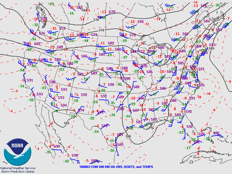
PW initialization errors are also small thus confidence is high for both model runs.
Day 1
In general, PW has trended down over the past 12 hours and that continues into the afternoon. Unfortunately, the PW forecast for today is quite a bit lower than the forecasts created yesterday thus it looks like less activity then was forecast by those runs. No surprise as this has been a common occurrence lately. The difference was 6mm drier at Tucson and 6-9mm around the Phoenix area.

CAPE is lower today too and the lower elevations have only low amounts so not much, if any, activity is expected there. It looks like the best bet is far SE Arizona.
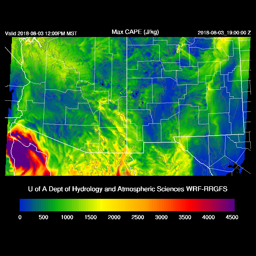
Both runs have scattered storms over only far eastern Arizona. Not much of a transition event as many times troughs in the westerlies enhance the thunderstorms before it dries out.

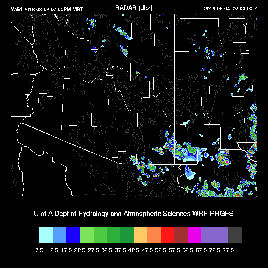
Activity decreases during the evening hours with only a few storms over far SE Arizona.
Day 2
The drying trend continues and only isolated storms are expected only over the high terrain of eastern Arizona. This will be the last discussion until significant activity returns.


No comments:
Post a Comment
Note: Only a member of this blog may post a comment.