Previous Forecast
It was quite active around the Tucson area last evening with the keyword being “around” as only the far south and west side saw any significant precipitation. A microburst hit my neighborhood on the NE side and knocked out the power but there was very little rain. As some of the model runs predicted yesterday, a widespread area of showers and thunderstorms developed during the early morning hours and moved from south to north, mainly east of Phoenix.
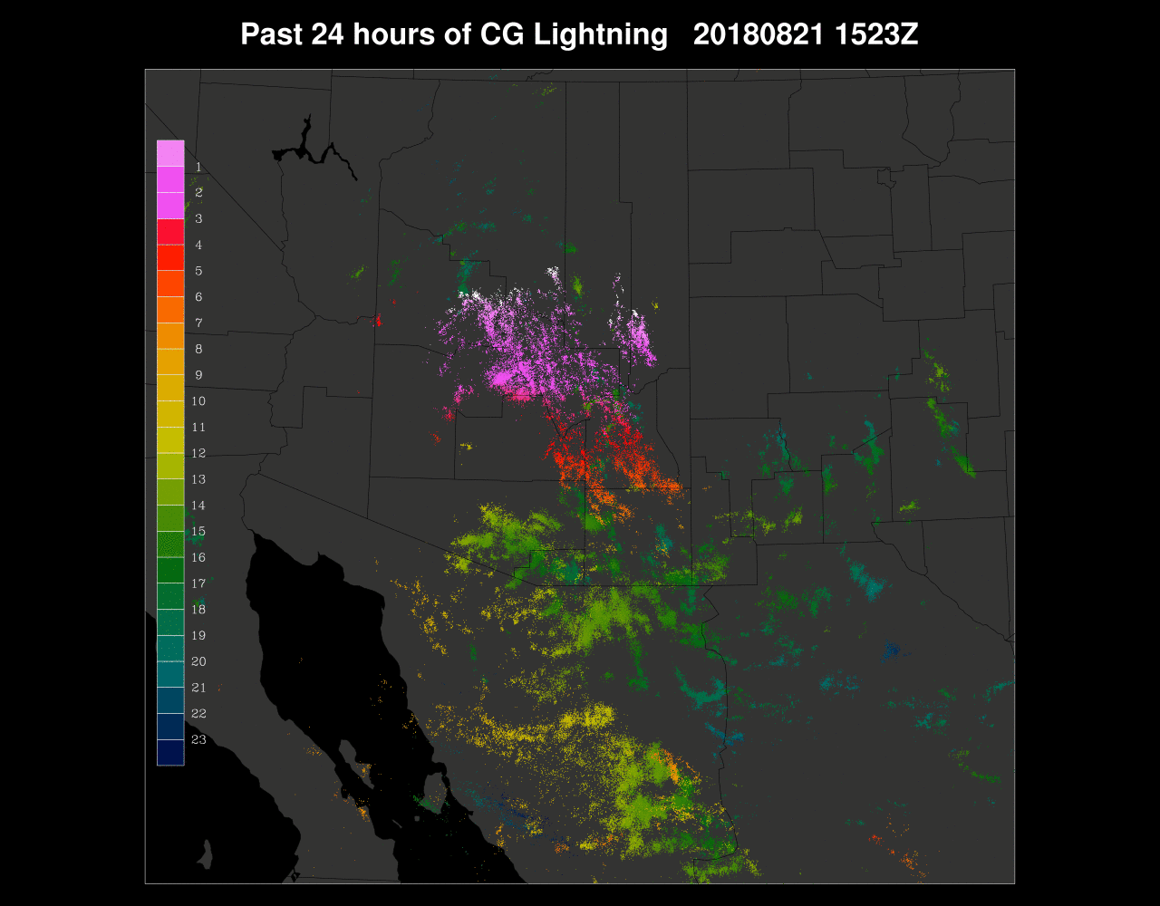
The 12Z WRFRR handled the morning activity the best as it kept it just east of Phoenix. It also was able to predict the big MCS in Mexico fairly well, while other runs missed it.
Initializations
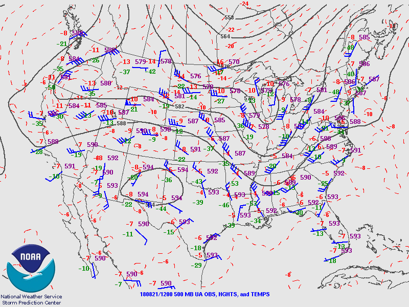
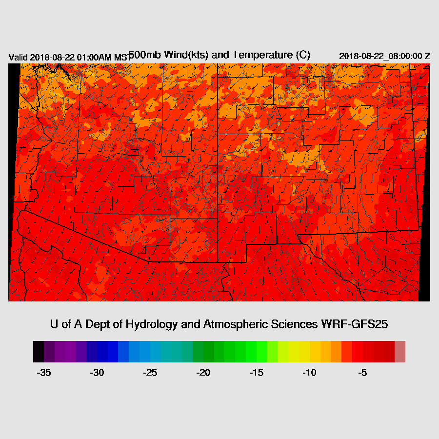
Big trouble as there have been no runs since 0Z as the data feed from NCEP failed. The 12Z WRFRR did have a partial run out to 23Z or so and I did start the 12Z WRFNAM by FTPing the data (very slowly!) from NCEP. The 500mb high center is in a good location over in New Mexico with moderate 20 knot SE to S flow over the state. There is a large MCV moving into far southern Arizona with extensive clouds and a few showers while another area of clouds and storms moves northward around the Flagstaff area so it’s a complex initialization. The 12Z RR initialized the Arizona activity well but only initializes the Sonoran MCV as an open wave and without any associated clouds and showers. The MCV is also too far west, over Puerto Penasco. The 12Z NAM initialized the northern Arizona activity fairly well and does have something that resembles an MCV over the northern Gulf of California. It’s too far west, but better than the RR.
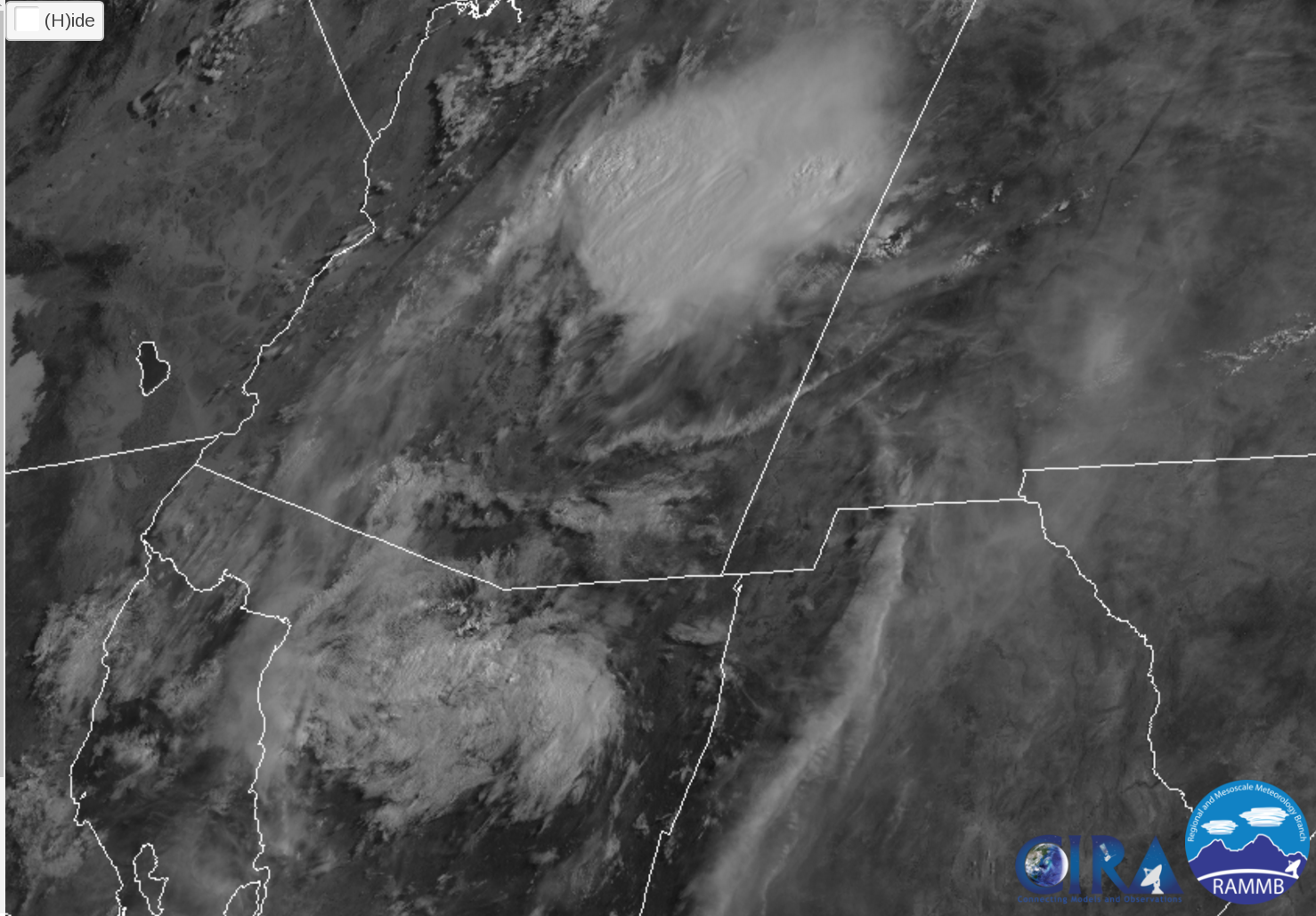
15Z GOES-E
PW was initialized well by the RR but the NAM was too wet over much of NW Mexico and into southern Arizona. As I have some time to kill while waiting for the late-running WRFNAM, I wanted to mention that I heard back from NCEP regarding this problem and they agree that there is a general wet bias and it’s not being corrected as they no longer assimilate GPSPW data. For a short period, their PW data had some large errors which then caused a number of big model busts thus they turned it off. It has not been turned back on because during this time when they weren’t assimilating it, the NAM was “locked down” with no further changes allowed. So that is why there is a bias and it appears it will remain this way.
The MCV and clouds are going to cause big problems today as both morning runs are either missing them or they are too far west. Maybe the WRFNAM will be a bit better but model confidence is low as each has major errors. A quick look at the 0Z runs shows that the 0Z WRFGFS had widespread clouds over southern Arizona this morning but burned them off by the afternoon so maybe it may have some use. As Bob Maddox said this morning in his discussion, “The situation is therefore extremely complicated, and I'll sit back now and watch to see how it evolves.”
Day 1
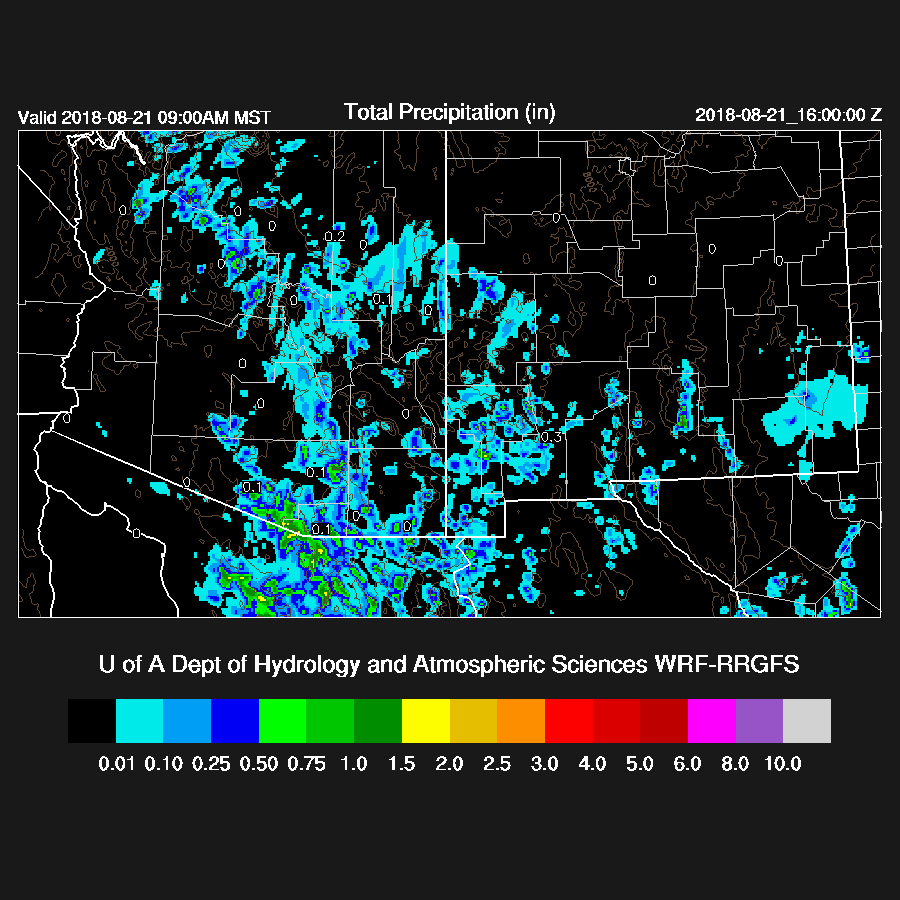
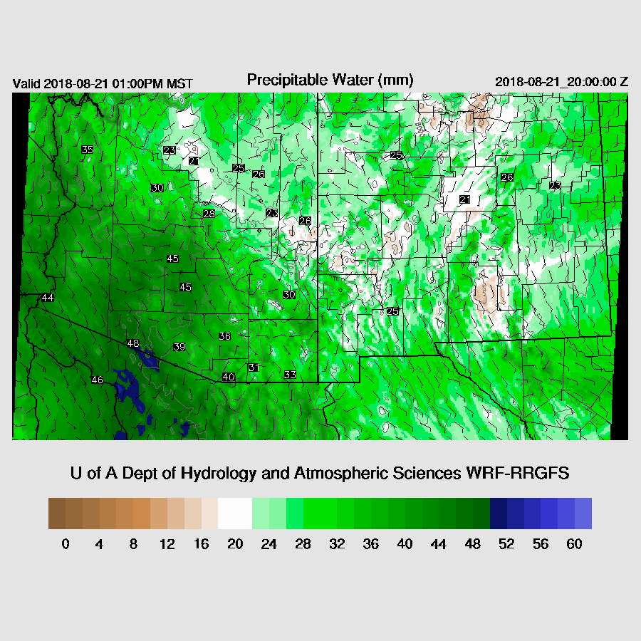
The only good news is that Suominet is more or less fully functional. There are still no sites reporting in SE Arizona or SW NM as they are down for unknown reasons. PW has generally increased over the past 24 hours but is now trending down at sites that had experienced morning convection and ranges from 35mm at Tucson to 46mm at Yuma. PW bounces back around the Phoenix area and is generally very wet during the afternoon. Weak to moderate southerly flow continues up the northern Gulf of California into Arizona while low-level drier SE flow is over NM.
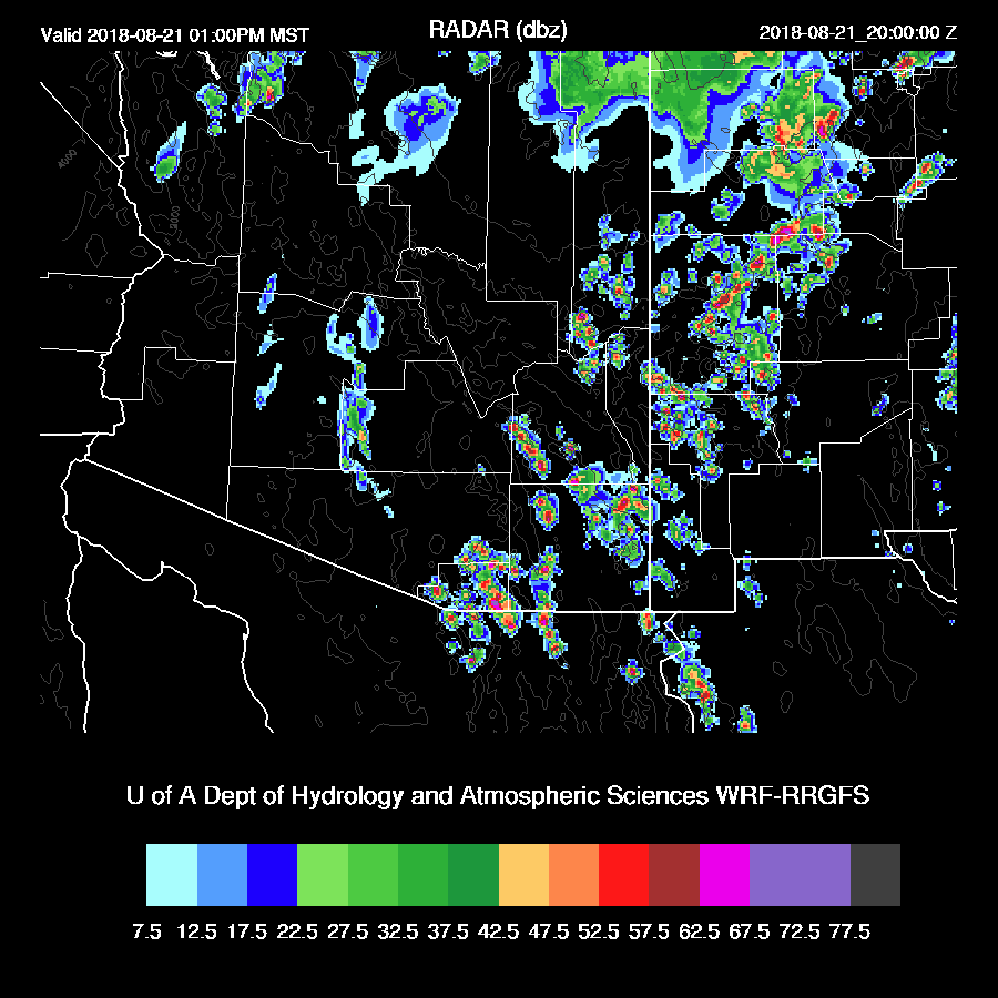
CAPE is mostly low to moderate over much of the state. SE Arizona looks to be the best bet for storms. The MCV appears to be moving directly over Tucson so it should cloud up there pretty soon.

Much of SE Arizona becomes quite active during the early afternoon.
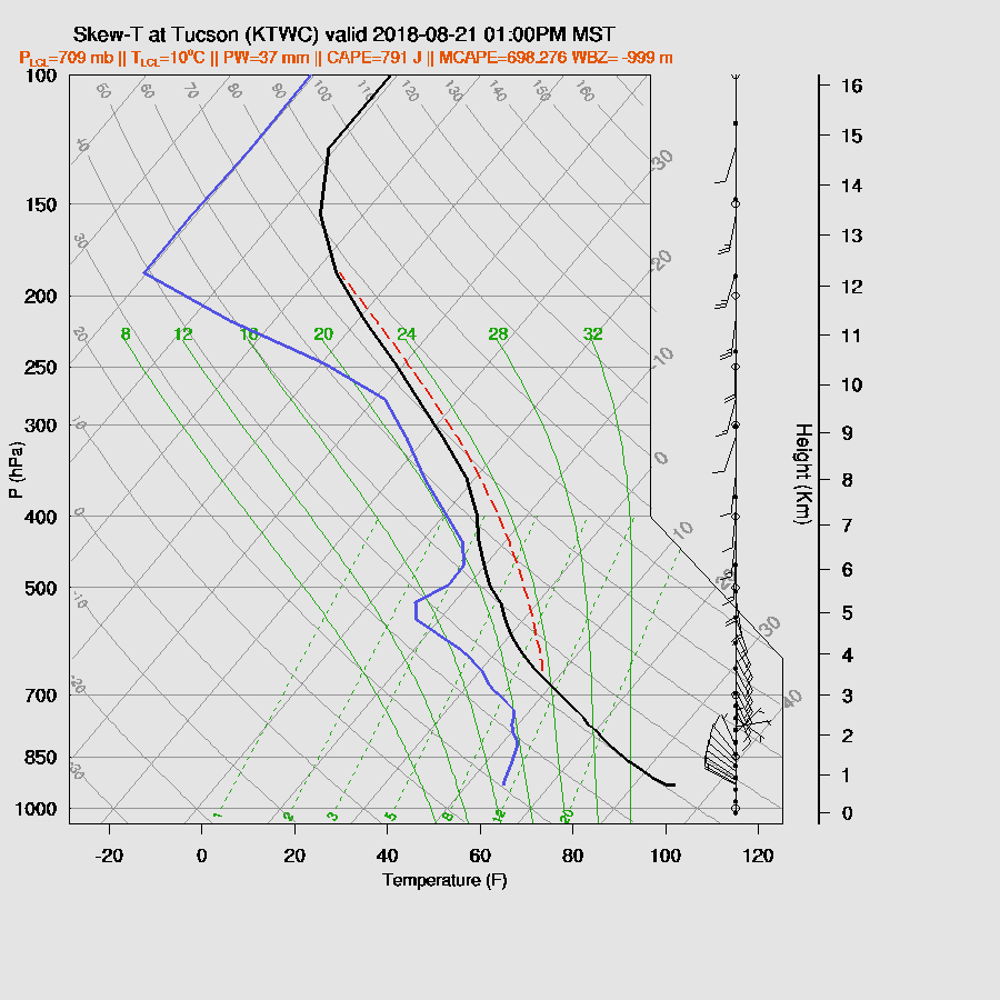
The early afternoon Tucson forecast Skew-T does have a moderate amount of CAPE, some strong SE steering flow, and some heating and mixing. Is this accurate? So far, yes as the clouds from the MCV have not reached Tucson. Maybe there will be enough sun for afternoon deep convection or maybe not.
I’m not going to bother with any specifics as the forecast is too uncertain and there are hardly any model runs to work off of. What is likely to happen are storms forming mainly over the higher terrain of the eastern ⅓ of the state where it’s mainly clear with some strong storms on the periphery of the MCV as it will help organize convection via favorable winds and shear.
Day 2
It is very wet over the state but storms will be dependent on heating so we’ll just have to wait and see what the morning clouds look like.
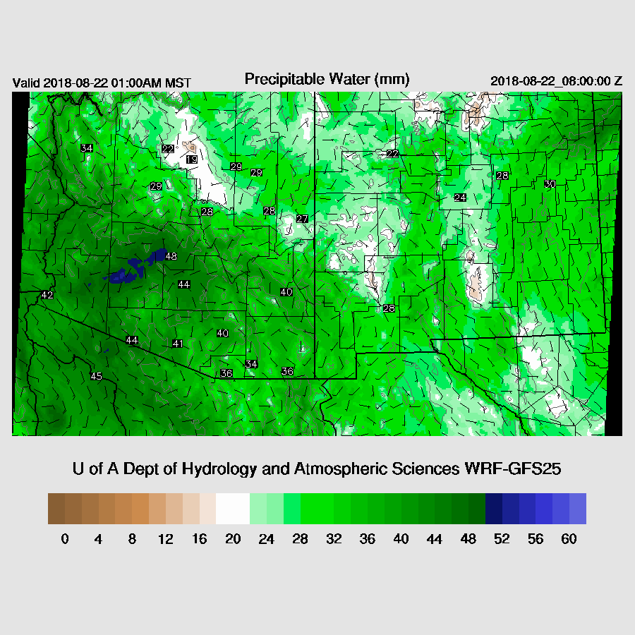
Steering flow is poor as it is light from the southwest. 500mb temperatures are also fairly warm at around -5C.
It looks like the possible active areas are NW Arizona and far southern Arizona.
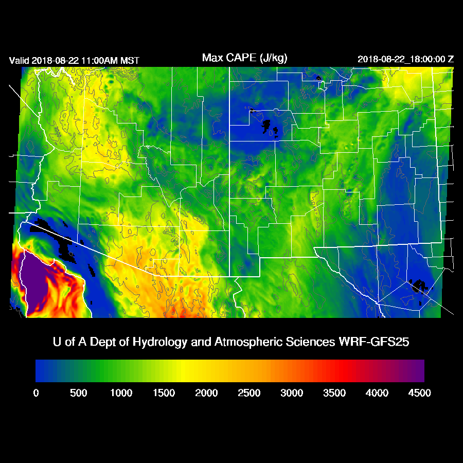
With this weak steering, most storms should remain over the higher terrain. In spite of fairly high CAPE far southern Arizona only sees isolated storms.

No comments:
Post a Comment
Note: Only a member of this blog may post a comment.