Previous Forecast
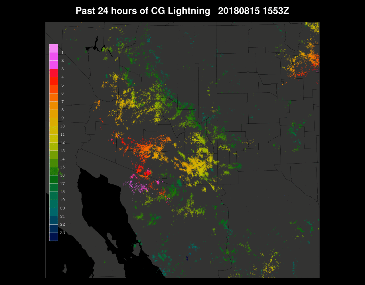
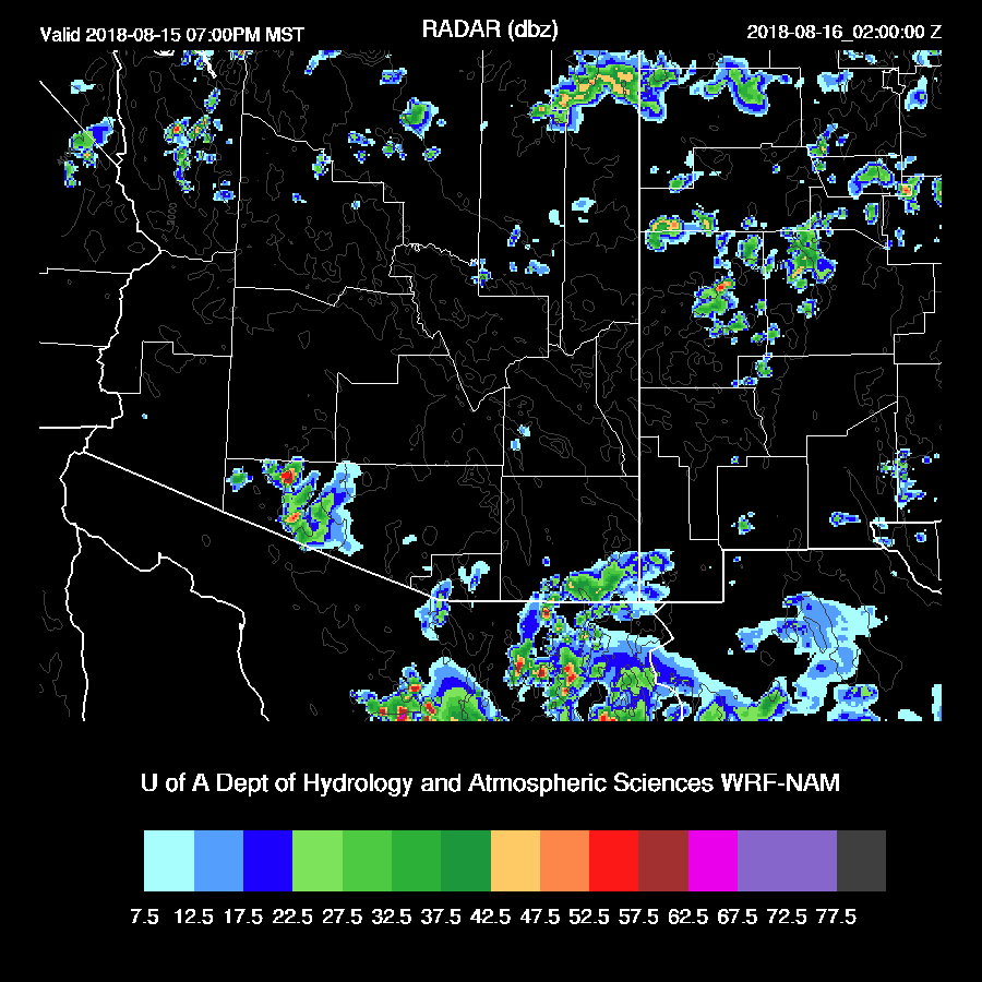
Storms moved off of the high country into parts of the lower elevations of Pima, Pinal, and Maricopa counties last evening with some severe storms on the far NE side of Phoenix and strong storms in the Tucson area. Yavapai county had flash flooding and some severe wind reports.

Cochise county was also very active during the afternoon as seen by the numerous lightning strikes.
The 12Z WRFNAM was quite good as it had strong storms skirt around Phoenix and then moved the Cochise county activity into Tucson and beyond during the evening and early morning hours. The rest of the runs all had some sort of major bust like too much activity for Phoenix. (I’m looking at you, 15Z WRFRR)

Initializations
It is going to be a challenging day for the model runs as widespread clouds along with showers and a few storms are present this morning. It appears there is an IT over far southern Arizona that is responsible. Clouds are thick all the way up to Utah.

Well, this is encouraging as there is a 12Z sounding from Chihuahua. Previously, there was only one a day, at 0Z. It helps define a large but weak IT over NW Mexico with another small one over southwestern Arizona corresponding to the cyclonic circulation seen in the satellite imagery.
The 12Z RR again has issues with its lateral boundary conditions thus will be excluded. In spite of the Chihuahua sounding, the NAM does not have an IT in NW Mexico but does have the weak Arizona IT. Looking closely at the satellite imagery, there appears to be a small MCV just west of Chihuahua which seems responsible for the SW wind so there is probably not an IT in NW Mexico. The NAM and GFS initialize that area with uniform SSE winds and how ironic that the sounding is actually unhelpful as I looked at the Skewt-t and it appeared to have issues. The NAM has thick clouds and showers over central and southwestern Arizona but is too clear over southern Arizona. The GFS is worse as it has mainly thin clouds over much of the state except for the far south. Too bad the RR is bad as it had a pretty good initialization. I’ve identified the problem so future runs will be OK.
Suominet was down yesterday and I did not notice until after writing the discussion. No corrections went into the initializations but it’s fixed today and both the NAM and GFS initialized Arizona too wet by 2-4mm but the correction routine should handle it. Overall, initializations are poor due to the widespread clouds and model confidence is low.
Day 1
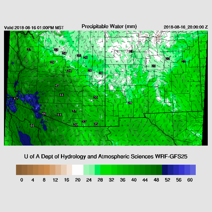
PW has generally increased and ranges from 41-45mm over the lower elevations. Very wet air is down in Sonora as Navojoa is around 60mm. PW remains in that range today but has increased over the higher elevations of NE Arizona. There is little or no flow from the GofC during the day today.

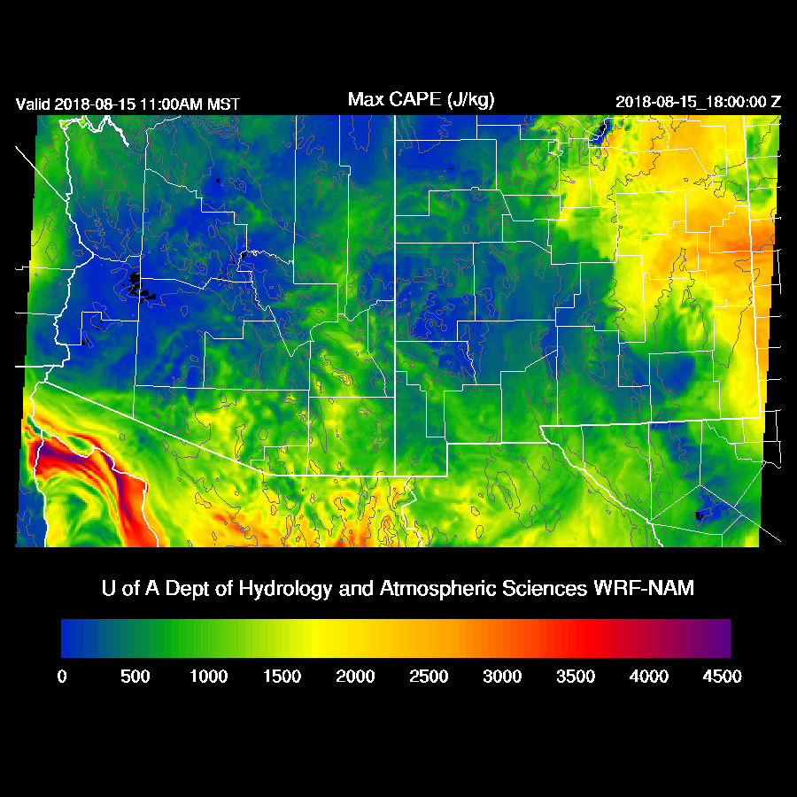
There is quite a difference between the WRFGFS and WRFNAM with respect to the CAPE forecast and I’m going with the lower WRFNAM as Yuma and Phoenix have minimal MLCAPE at 12Z.
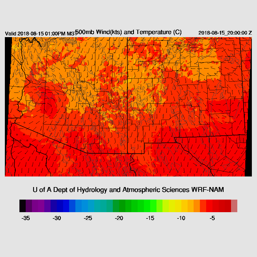
The Arizona IT moves to the NNW during the afternoon and will likely be a factor for thunderstorm development over NW Arizona. The rest of the state is under generally light southerly flow which may be enough to steer some storms, if they form, into the lower elevations.
The model runs aren’t going to be much good, especially over SE Arizona where it’s very cloudy. The WRFNAM develops quite a bit of activity there during the afternoon and at first, I thought it might be too much activity but the IT seems to be forcing morning heavy showers in and around the Tucson area so it might be right for the wrong reason as the WRFNAM gets too much heating. The WRFGFS has much more activity over much of southern Arizona as it had more CAPE and sun thus is most likely wrong.

A few storms continue over southern Arizona into the early evening hours.
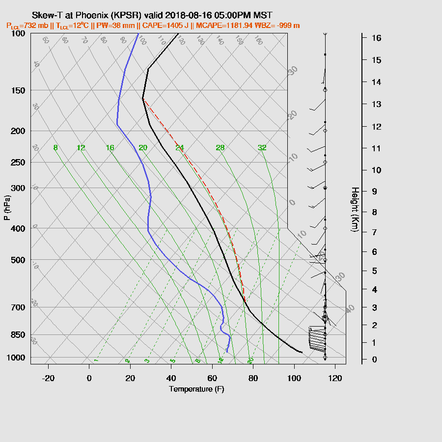
Phoenix is strongly capped and along with a shallow mixed layer and minimal CAPE, no deep convection will form.

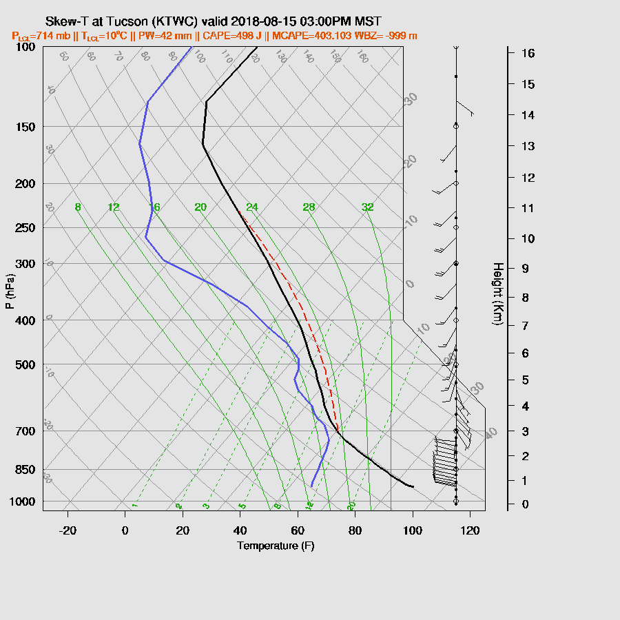
The Tucson vertical profile becomes well mixed by afternoon but I find this unlikely as looking out my window, I see nothing but clouds and showers. CAPE is also unimpressive, thus it’s unlikely for any significant deep convection in Tucson proper. Nearby mountains? Yes, if the clouds break and/or influence from the IT.
Addendum
I was able to fix the WRFRR problem and reran part of it. A quick summary is that the cloud and shower initialization was good and it continues to have morning showers over much of southern Arizona which is quite similar to what is happening now. That area of showers dissipates during the day and by late afternoon, much of the state is quiet and this is the most likely outcome for today.

Day 2
So much for the drying trend that was anticipated yesterday! As mentioned earlier, there is a lot of moisture just south of Arizona in northern Sonora and a surge kicks off overnight and increases PW over much of the state by mid-day. Another forecast rule for the monsoon season to remember: model forecasts are frequently poor beyond 48 hours.
CAPE forecasts are much different between the two runs as the WRFNAM has the stronger surge with more moisture which results in less CAPE. The WRFGFS has very high CAPE over much of the southwestern ½ of the state which may or may not be correct and we will have to wait and see.

It looks unlikely for activity in Phoenix as steering flow is very light and the PBL isn’t mixed very deeply and will need strong outflows to trigger deep convection.
Tucson is similar except the PBL is mixed nearly to the LFC but there is a substantial inversion at the top of the PBL. Steering is also poor so it’s unlikely and storms will be steered into the lower elevations. CAPE is high so any storms that do manage to form will be strong and drop heavy rain as they won’t move much. This is most likely for the higher elevations.

No comments:
Post a Comment
Note: Only a member of this blog may post a comment.