Previous Forecast
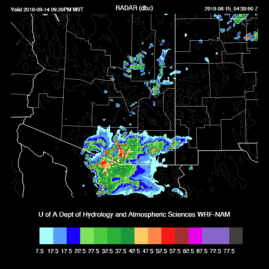
It continues to be a challenging forecast environment and all of the various model runs had some major issues. Strong and severe storms moved into the lower deserts during the late afternoon but mostly moved around Tucson. The far NW and E parts of Phoenix had severe storms during the late afternoon and early evening. Weak storms developed across the southern Phoenix metro late as the second round of Rim storms moved in, but the atmosphere had been stabilized from the earlier activity thus no strong/severe storms developed.

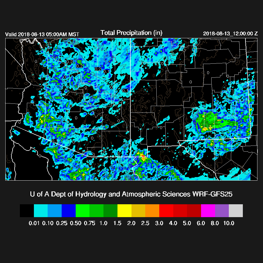
Most runs had only scattered storms during the afternoon and early evening over the state, including the Tucson area, but nothing for Phoenix. The 6Z WRFGFS turned out to be very good as it had the storms continuing across the SW Arizona into the early morning hours but not enough around Tucson. The 12Z WRFGFS was also quite accurate.
Initializations
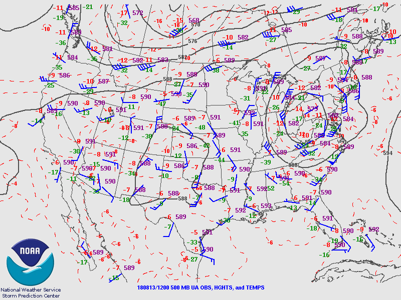
The synoptic pattern continues to be about the same as there is a ridge axis from NV all the way to MN. A cut off low is centered over SE CO and has been responsible for really soaking TX. There may be a small IT over far southern Sonora which may be an extension of the TX low, but nothing else is obvious elsewhere. All the 12Z initializations have the Mexican IT as an extension of the Texas low and all have the major features initialized okay.
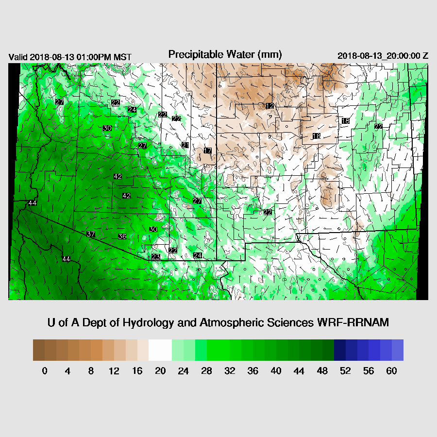
There are no clouds present and all initializations are mostly accurate. PW initializations are generally OK except all initializations are a bit too wet over southern Arizona. Overall, all three have initialized well thus there is no favorite and all should perform fairly well.
Day 1
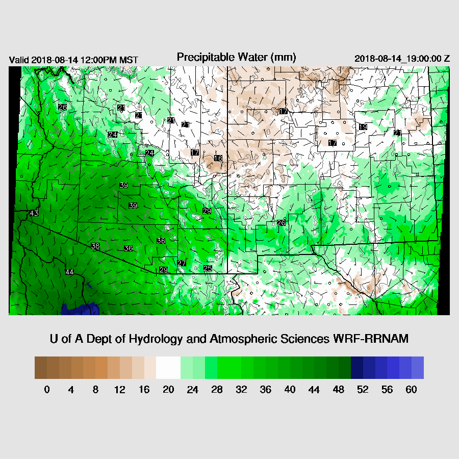
Generally, moisture has remained about the same over the state and is from around 30mm at Tucson to 44mm at Yuma. It continues to be a bit drier to the east of Tucson but it’s hard to say what is going on out there as all of the PW stations are missing there and into SW NM. Weak flow up the GofC continues to import moisture into much of the state today. The Yuma 14Z sounding has quite weak and shallow flow and is not even all that wet as the surface Td is 64C.
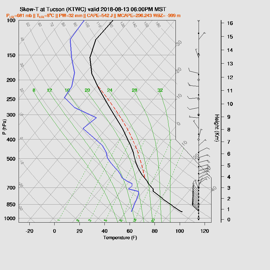
The morning sounding at both Tucson and Phoenix have only minimal MLCAPE but do have around Forecast Surface CAPE of around 1000 J/kg. All runs are very similar in that they have only low to moderate CAPE over much of the state except for around Yavapai and Coconino Counties thus that looks like the active area today.

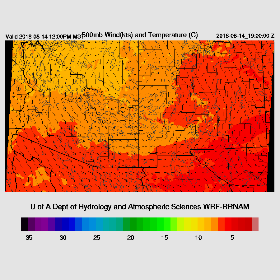
Steering flow is again from a favorable northeasterly direction but weaker at only 10 to 15 knots. Temperatures continue to be fairly cool at around -7 to -9C.

All three runs are quite similar as they develop activity only over Coconino and Yavapai Counties in the area of higher CAPE.

So why so little activity? Both Tucson and Phoenix have significant inversions at the top of the PBL due to the cooling of the lower atmosphere from the previous night’s activity. Phoenix has a moderate amount of CAPE bye early evening so perhaps a storm or two could move in from the N or NE.

A few runs do have some storms over the high terrain of central Pima County tonight and also try do move a few storms towards Phoenix. All die out by later in the evening.

Day 2
Weak flow continues to import moisture into the state and even penetrates into far SW NM thus maybe parts of Cochise county that have been so dry will get some precipitation.
Mid level steering flow becomes more easterly and southesterly as a 500mb high center is located over NE Arizona. This flow is not favorable for steering storms of the high terrain into the Phoenix area but it is quite good for southeastern Arizona.
SE Arizona has high to very high CAPE so it looks like that will be the most active area tomorrow.

Scattered strong storms develop over SE Arizona during the late afternoon while a few develop over the high country.

The Tucson area may or may not get some evening storms. The WRFNAM thinks so but the others do not.
No comments:
Post a Comment
Note: Only a member of this blog may post a comment.