Previous Forecast
There was no deep convection in the vicinity of Phoenix or Tucson yesterday as clouds and light showers kept daytime heating to a minimum. Areas that did see some sun and were under the influence of the IT had some significant rains like around the Lake Havasu area.

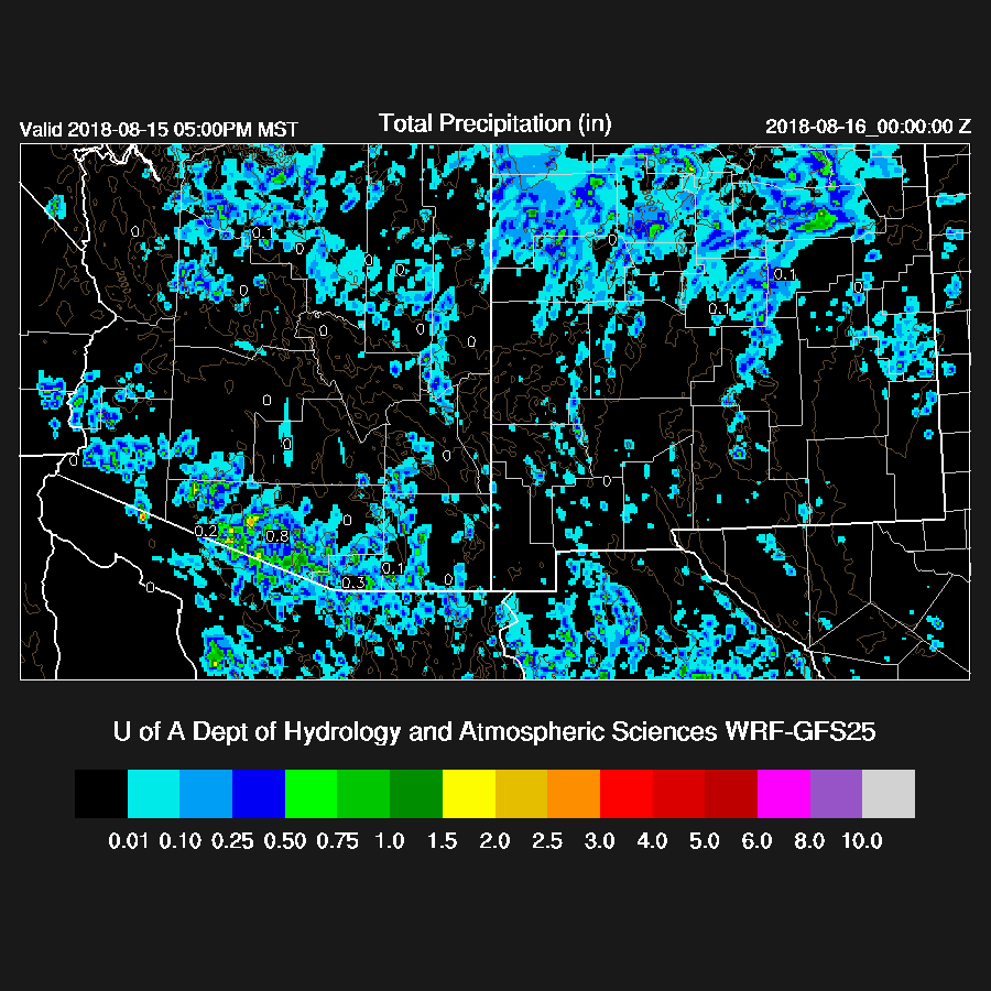
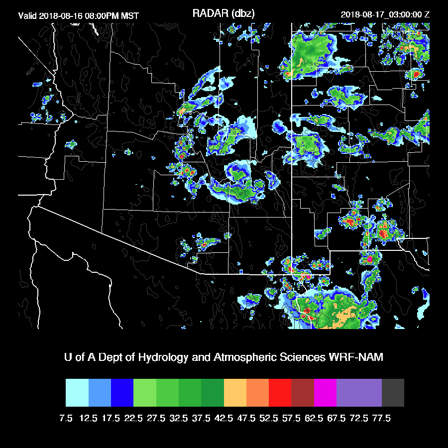
All runs were accurate around the Tucson and Phoenix area but struggled out west as only the 15Z WRFRR had any activity in western Arizona.
Initializations
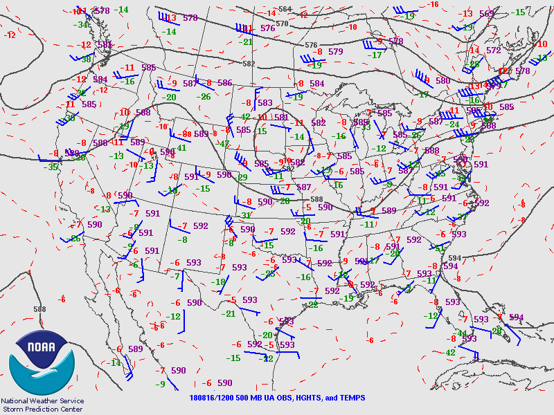
I haven’t mentioned Bob Maddox’s blog this year yet. It’s a great resource and written by a former director of the NSSL who moved to Arizona around 15 years ago and I try to always check it before I begin my discussion. The 500mb map indicates that the IT that has been hanging around Arizona is now just SSE of Vegas. The center of the 500mb anticyclone is not well defined and is somewhere over West Texas. If you squint and run the loop many times, you might see that the area of clouds over south-central Arizona has a little anticyclonic motion. Both the RR and NAM have a weak trough initialized in the area and have the other larger scale features initialized OK.
Clouds are going to be a major issue and the NAM did a poor job with its initialization in Arizona. The RR was better but the WRFRR dissipated clouds too quickly as they are still quite thick as of 16:15Z. Suominet continues to have issues and only a few stations, mostly in Mexico, were available. No data was available for the WRFRR and for what stations made it in in time for the NAM showed minimal errors over the US but a wet bias in NW Mexico. A quick look at the 6Z runs also indicates that they didn’t have enough morning cloud cover(WRFGFS) or the clouds were in the wrong areas (WRFNAM) Overall, confidence is again low and the WRFRR is likely to be the better performing run as it had the best cloud initialization.
Day 1
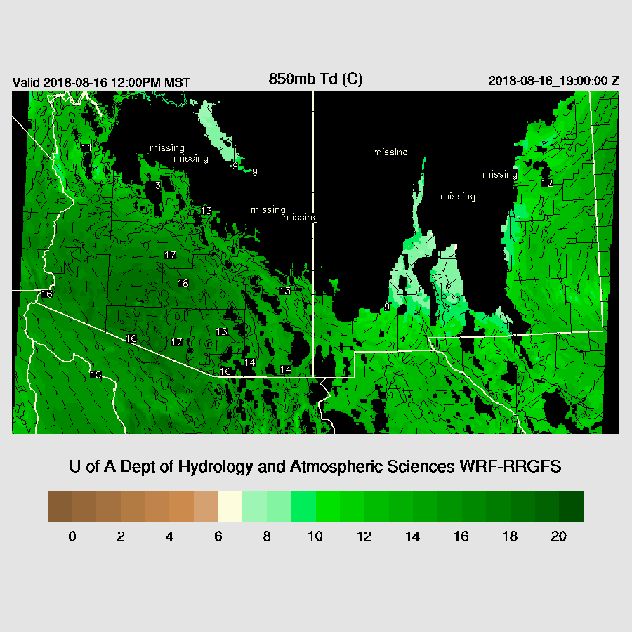
The few Arizona PW stations that are reporting indicate that PW is very high with 53mm at Buckeye and 50mm at Yuma. Morning soundings indicate 46mm at Tucson and 52mm at Phoenix so the forecast for increasing moisture verified well. Weak low level southeasterly to southerly flow continues during the day with 850mb dewpoints of around 15 to 18C which are extremely high.
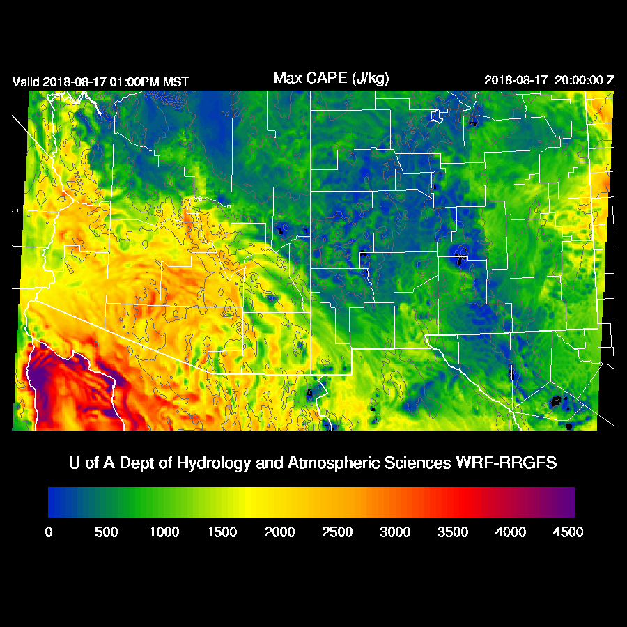
To go along with this very wet air, CAPE is high to very high over the southwestern deserts.

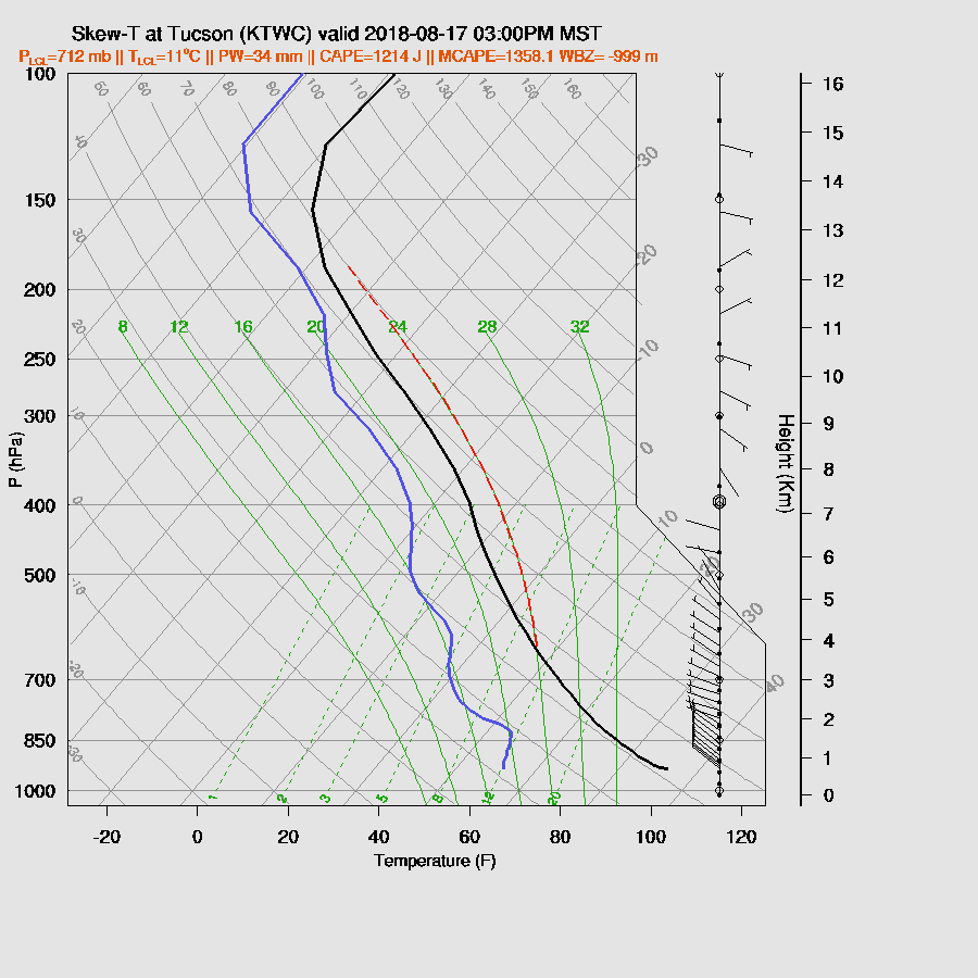
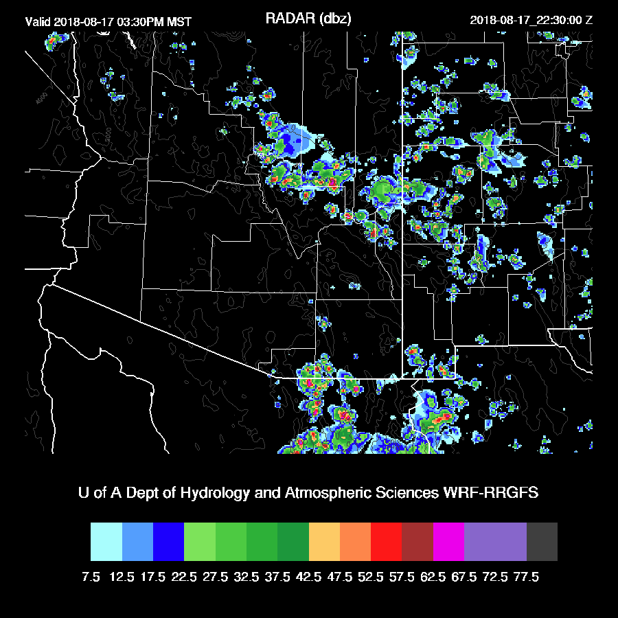
The problem, as always with a big surge, is that the lower troposphere air has cooled which results in a capping inversion at the top of the (shallow) mixed layer. Even with full sun, it’s always difficult to mix the PBL deeply enough at locations in the lower deserts. In Tucson, which receives more sun, (in the model world) the PBL is mixed nearly to saturation by late afternoon but slightly capped. The wind field is mainly light and variable thus storms will not move much and remain mostly over the higher terrain but it’s still possible for a storm or two in the city later today.

It’s pretty much the same story in Phoenix. With this amount of CAPE present, there still is a slight possibility that a storm or two may pop up on an old outflow boundary.

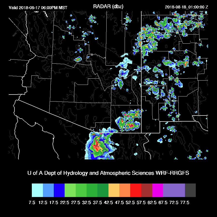
Higher terrain areas that see some sun develop scattered storms during the afternoon. Exactly when and where is hard to say. Lower elevations of western Arizona are also likely to see some afternoon storms and maybe this will be Yuma’s one big precipitation event of the year. It seems they usually get the majority of their monsoon precipitation in one big event.
One or two storms may drift off the nearby mountains around the Tucson area.

While I think it is unlikely, the WRFAM does develop a few showers and storms around the Phoenix this evening. You can never rule out storms when there is this amount of moisture and CAPE present.
Day 2
Moisture decreases somewhat tomorrow but is still more than sufficient for storms.

CAPE is again very high over much of the southern ½ of the state so the potential for big storms is still there.
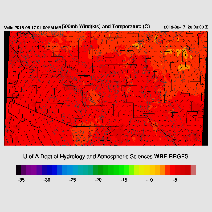
Say goodbye to the favorable mid-level temperatures as the 500mb high is centered over southern Arizona and goodbye to decent steering flow.
A drying trend and subsistence kicks in during the afternoon which results in only a shallow moist layer for both Tucson and Phoenix. It looks like no activity for either area just looking at the model forecast Skew-T plots. What a waste of a good Gulf Surge!
Deep convection is restricted to mainly the higher elevations of eastern Arizona late tomorrow afternoon and evening.
Cochise County may be fairly active tomorrow night. This will likely be the last discussion until the threat of storms returns for Tucson and Phoenix. (Maybe Monday?)
No comments:
Post a Comment
Note: Only a member of this blog may post a comment.