The 15Z WRFRR is now available and it is quite similar to the 12Z WRFNAM and GFS. It produces scattered severe storms for the Tucson area with some hail.

Day 2
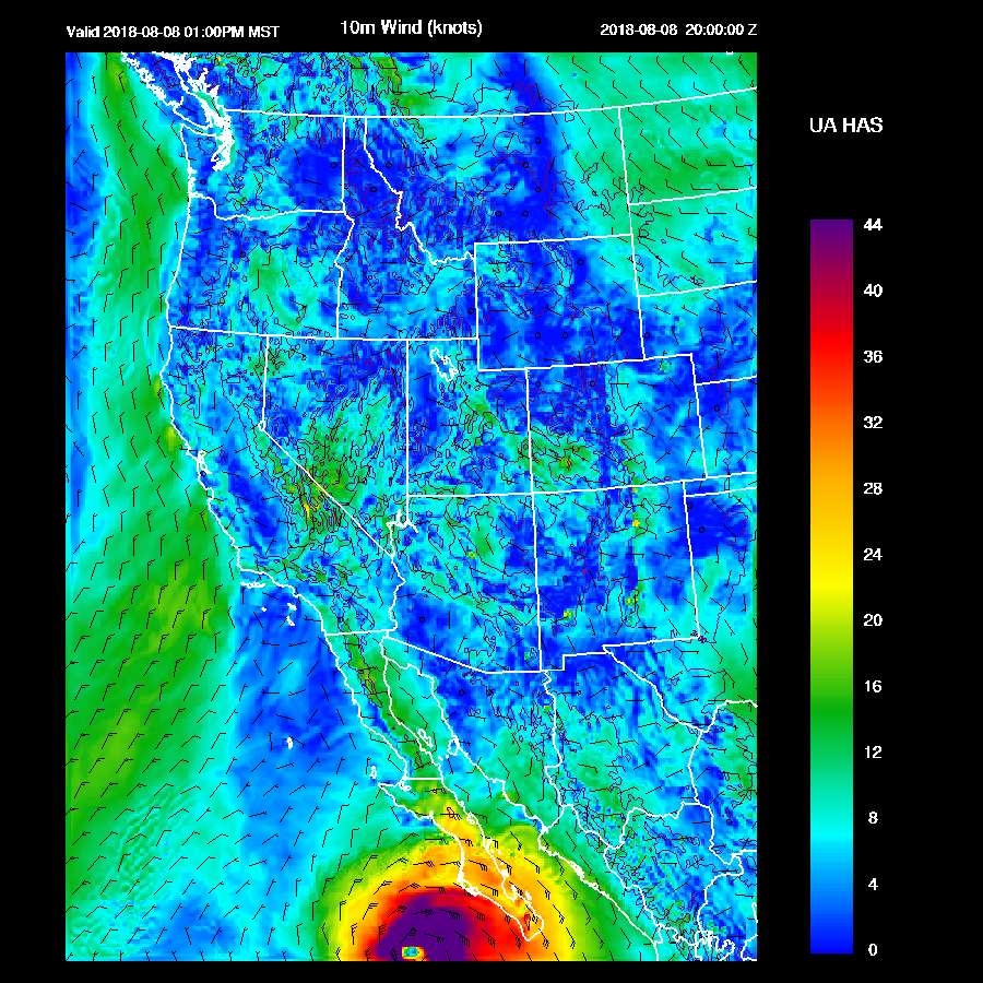
The big story is hurricane John which is forecast to become a major hurricane. It moves to a location just off of southern Baja by mid-day and is in a prime location to trigger a Gulf Surge into Arizona.
The 500mb ridge center shifts to somewhere over southern Utah which results in some mid-level cooling over the state.

What a weird 250mb pattern as there are three anticyclone centers! An upper trough is over northern Arizona along with a weak westerly upper jet over Arizona and NM with quite a bit of divergence in those areas which will result in enhancement of storms.

Moisture increases overnight and into tomorrow with wet air over much of the western and southern parts of the state while areas north of the Rim continue with dry northerly flow.

Combined with the cooling aloft and the increase of moisture, CAPE is high to extremely high over parts of the state. The runs are a bit different with the WRFGFS having less CAPE over much of southwestern Arizona but plenty for SE and along the Rim.

The surge has quite cool air associated with it thus producing a strong inversion and lots of CIN for lower elevations of the state. Even Tucson isn’t mixed very deeply during the afternoon hours.

Areas that will have no problem with CIN, inversions, caps and the like are the high terrain of the White Mountains, Mogollon rim and SE Arizona where strong to severe storms develop during the afternoon hours.

Strong to isolated severe winds are likely with these storms as well as hail. The strong outflow boundaries as well as weak easterly steering flow will help move these storms towards the lower elevations. Will the outflows be strong enough to trigger deep convection when they get there?

It certainly looks likely for another round of strong to severe storms for the Tucson area late tomorrow afternoon or early evening. Every run develops activity there.

Phoenix is a maybe. Some runs mix Phoenix fairly deeply by late afternoon (15Z WRFRR) and have considerable CAPE thus a good outflow or intersecting outflows could trigger deep convection there which would result in some very strong storms. In general, the Day 2 forecast is quite uncertain, especially for Phoenix, as the Day 1 forecast is already quite complex.

The WRFRR and WRFNAM have big storms near the Phoenix area late tomorrow afternoon and evening but nothing in the valley.

No comments:
Post a Comment
Note: Only a member of this blog may post a comment.