Previous Forecast
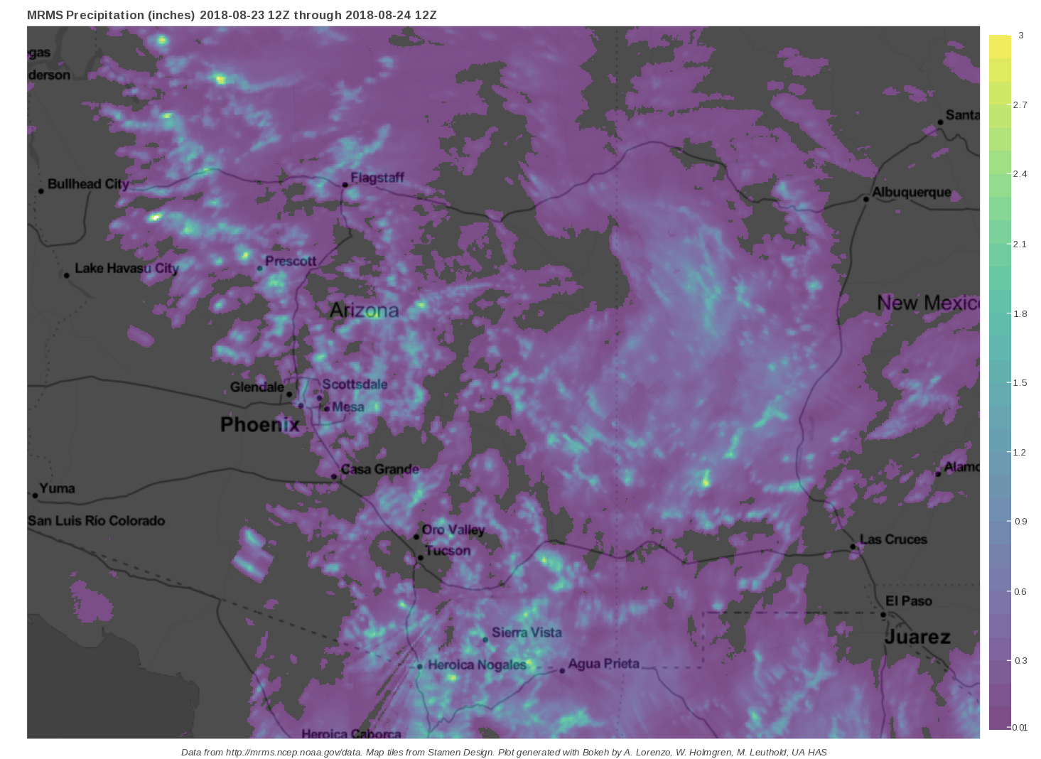
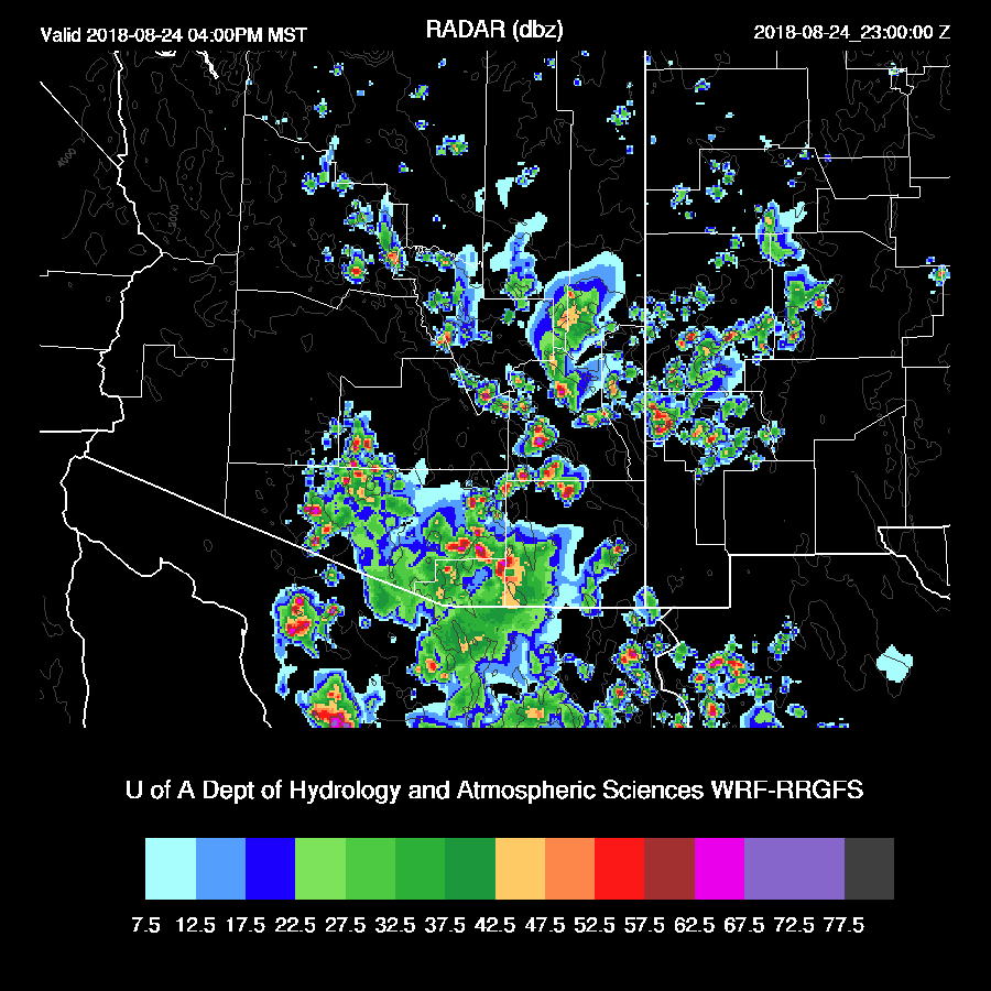
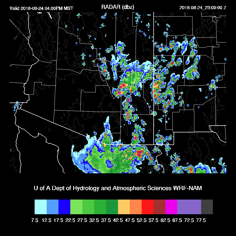
Phoenicians need to stop complaining about how Tucson gets all the storm action! Check out the precipitation map below for a prime example. It seems to me that Phoenix has had significantly more organized convection this year. Storms fired all around SE Arizona by 11am with many locations receiving very heavy rain. Other storms moved south towards the Phoenix area during the late afternoon and generated multiple gust fronts which intersected over the valley resulting in additional development.
The WRFNAM ended up being the best overall but was a bit too late in the day with the very heavy far southern Arizona precipitation. The WRFRR was also pretty good but didn’t have enough activity in the Phoenix area.

Initializations
A large inverted trough is over NW Mexico and SW NM. Multiple smaller scale areas of cyclonic rotation were apparent on morning satellite imagery with one in SW NM and another south of Douglas.
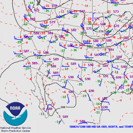
An upper trough is located over NW Mexico and the analysis shows it as an open wave but water vapor imagery clearly shows a closed circulation. There is quite a bit of upper divergence analyzed over Sonora and into SE Arizona which is probably responsible for the widespread clouds. The RR and NAM have the large IT initialized OK but are both missing the NM wave. The GFS does have the NM wave but it’s too far west.
Clouds. There are lots of them over SE Arizona. However, looking out the window indicates that they are slowly burning off so perhaps there will be decent heating after all.

Somewhat surprisingly, the clouds were initialized quite well by all the runs: NAM, RR, and GFS. RR and GFS PW errors were minimal and even the NAM wasn’t as wet as it has been recently. Overall, the initializations look pretty good for such a complex situation and all the runs should perform well today.
Day 1
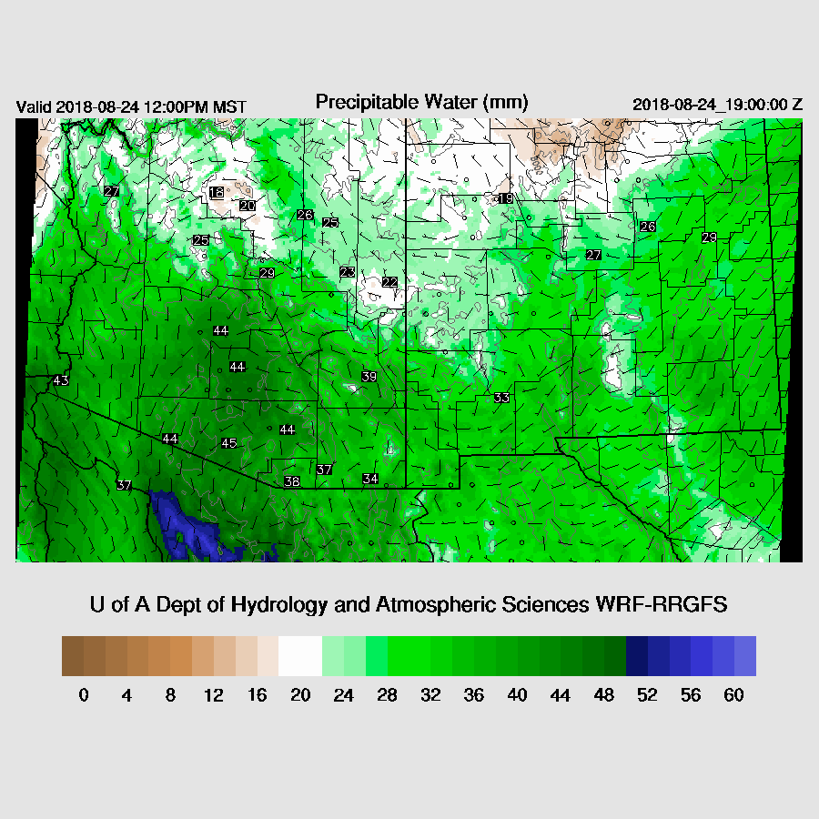
PW has come down somewhat since yesterday and is generally in the low 40mm range over the lower deserts. Tucson is the wettest at 43mm. A shallow surge continues over western Arizona with Yuma reporting 15 knot SE winds with a Td of 74F. The surge continues during the day and increased PW somewhat over central and SE Arizona so storms are again likely to produce very heavy rain.
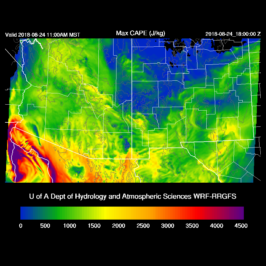
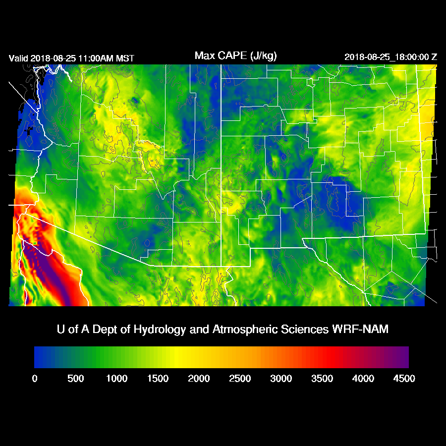
CAPE is moderate to high over much of the state and very high along the border.
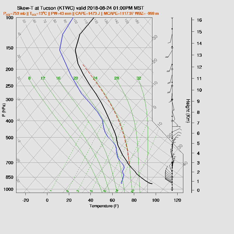
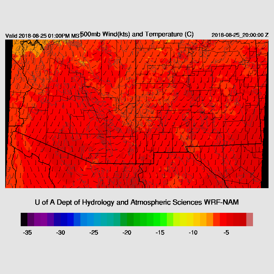
The early afternoon Tucson vertical profile is tropical looking with a nearly saturated profile along with quite high CAPE of around 1400 J/kg (WRFRR). The wind profile is a bit better. Mid-level steering is still quite weak but at least there is some easterly component. Anvils may be an issue if deep convection forms to the SW of Tucson, but other than that, it looks like a very active day in and around Tucson. The other two runs are similar except for less CAPE but still enough to support deep convection.
The Sonoran IT drifts slowly north thus placing parts of SE Arizona in very light NE flow which may be enough to push storms off into the lower elevations. As flow is light, they won’t move too much thus the flash flood risk is high.
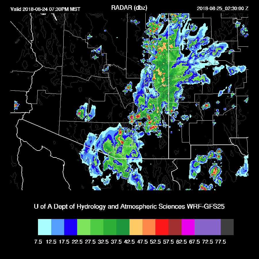
The morning clouds give way to partly sunny conditions which delays the initiation of deep convection until later in the afternoon but once storms get going, they are strong. As would be expected, the model runs do not agree on timing or location very well as the WRFRR has widespread storms over southern Arizona.
The WRFNAM and GFS are mostly active to the east of Tucson. Take your pick as who knows which is right.
Both the WRFNAM and GFS move storms into Tucson during the evening.
Phoenix is mixed deeply by early evening and with moderate CAPE of around 1000 J/kg, some storms in and around the valley are possible. Like yesterday, it’s likely that outflows will be needed to kick off deep convection.

The runs from yesterday were forecasting some strong outflows into the Phoenix area but today they are much weaker. Are they strong enough? Maybe, or maybe not.
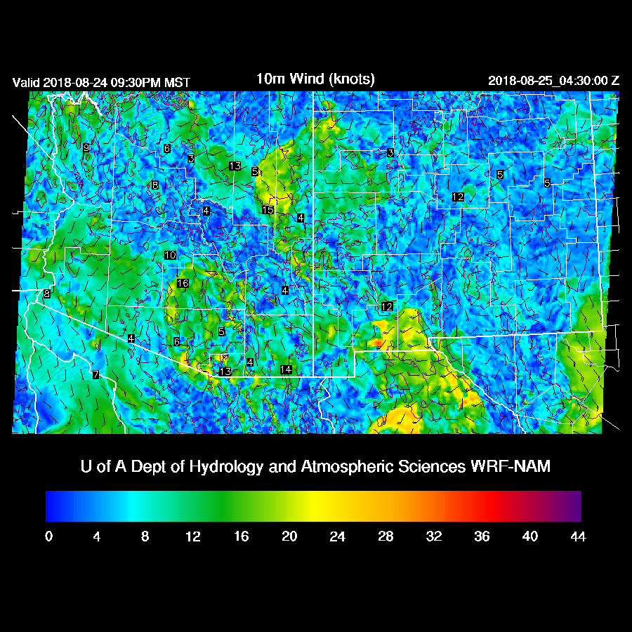
The WRFRR does forecast a few storms for the Phoenix area this evening as it moved a stronger outflow into the valley.

If Phoenix doesn’t see activity during the evening, they may overnight as the IT moves slowly north and is over south central Arizona during the early morning hours.
CAPE remains high enough for early morning activity.

The runs vary on their timing but all have some amount of activity in/near Phoenix during the early morning hours.

Day 2
The trough seems to shear apart leaving the state under mainly light southerly flow so not much good for storm organization.
Moisture and CAPE remain quite high so areas that see some heating will again be quite active. Where and when that will be is difficult to say due to the complexity of the situation today. Tucson should have widespread activity today which results in a worked over with only minimal CAPE in the area.
Not much activity for the lower elevations tomorrow.

No comments:
Post a Comment
Note: Only a member of this blog may post a comment.