Previous Forecast
Little or no activity was present over the lower elevations of the state yesterday but it was quite active around Prescott and Flagstaff and to the west.

All the runs performed well.
Initializations
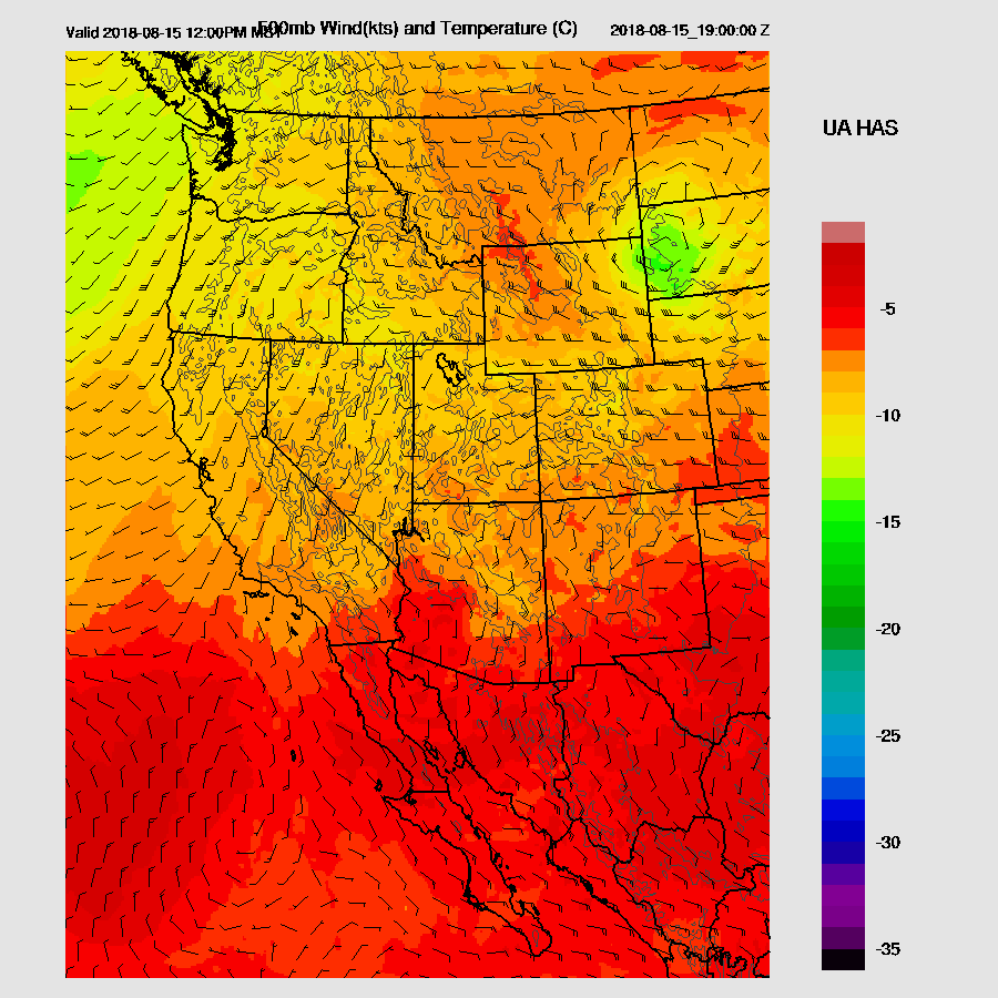
Mid-level flow is now mainly southeasterly over Arizona as the center of the 500mb anticyclone is over the Four Corners. A broad inverted trough is located over northern Mexico and seems to connect up with the tail of a trough that is associated with the Kansas cutoff low. Satellite imagery indicates generally weak cyclonic flow in that region with a couple of MCVs. Both the RR and NAM initialized the large-scale features well. The 12Z WRFRR is going to be suspect today as something went haywire with the LBCs. The 12Z RR only runs out to 18 hours so I use the 6Z NAM to drive the LBCs but something went wrong today and there are all sorts of outer domain artifacts.

It’s mainly clear over much of the state except for some dissipating clouds around and north of Flagstaff. The NAM initialized these well and the 6Z WRFGFS also initialized the clouds well. There is only one 12Z run that is trustworthy, so I’ll be making some use of the 6Z runs. All have only small PW initialization errors but both NAM initializations are a little too wet over eastern Arizona. Overall, all initializations look good, excluding the 12Z RR, and there is no clear favorite. As the general synoptic situation is quite simple, model accuracy should be good today.
Day 1
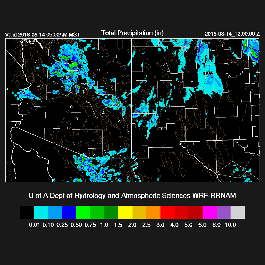
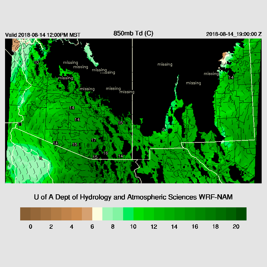
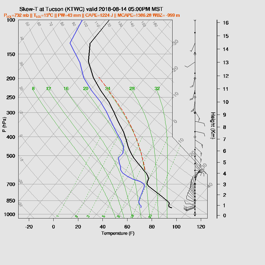
PW has generally increased, mainly over the past few hours, with the biggest jump in SE Arizona as Safford is up to 36mm. Unfortunately, the two Douglas sites are unavailable as well as Deming. Surface dewpoints are up too as Nogales is at 67F. A weak surge continues today and weak is the keyword as it’s very shallow at Yuma. However, it’s deeper to the east as 850mb Td are very wet with SE Arizona as high as 17C.
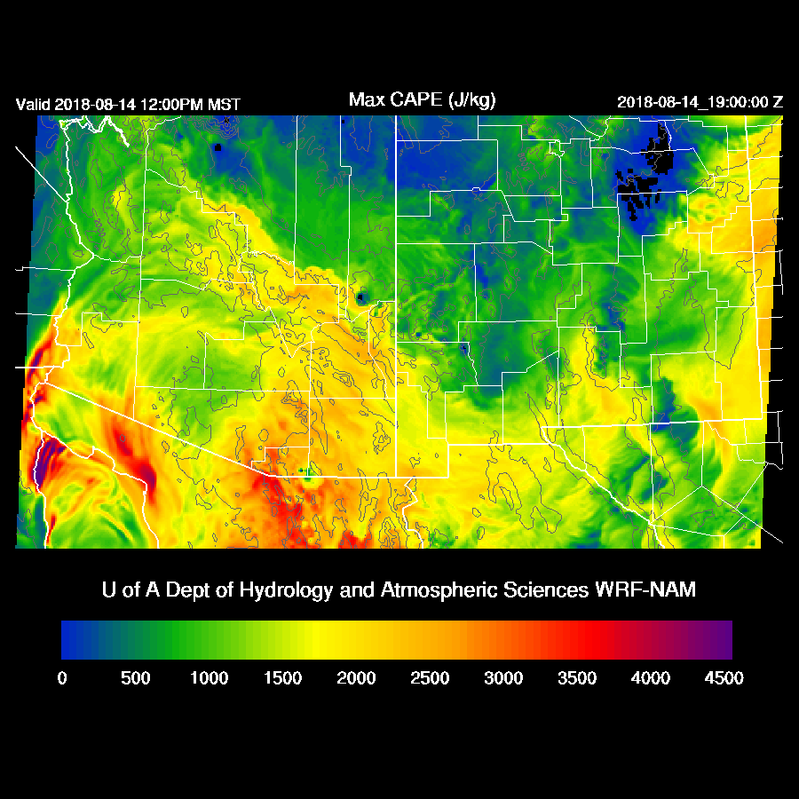
This extremely wet air along with fairly cool mid-level temperatures results in high to very high CAPE over SE Arizona thus this area is likely to be very active today. CAPE is also high over the White Mountains and Rim thus those areas will also be very active as well.
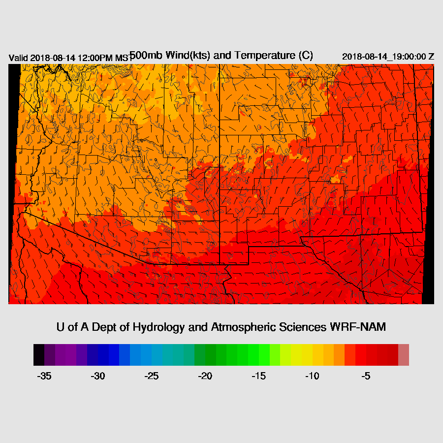
500mb temperatures are starting to creep up over southern Arizona but are still not too warm. Steering flow is favorable for moving storms that form in Cochise/Graham/Greenlee Counties westward towards Pinal and Pima counties. Wind speeds are pretty good at around 15 to 20 knots.
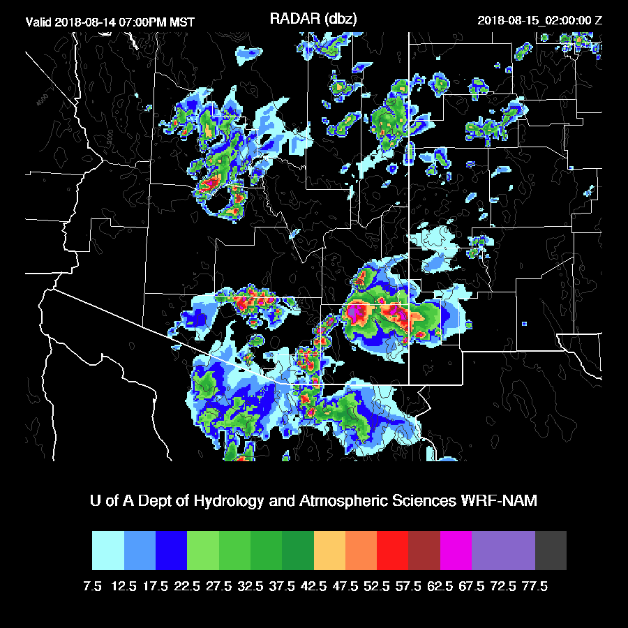
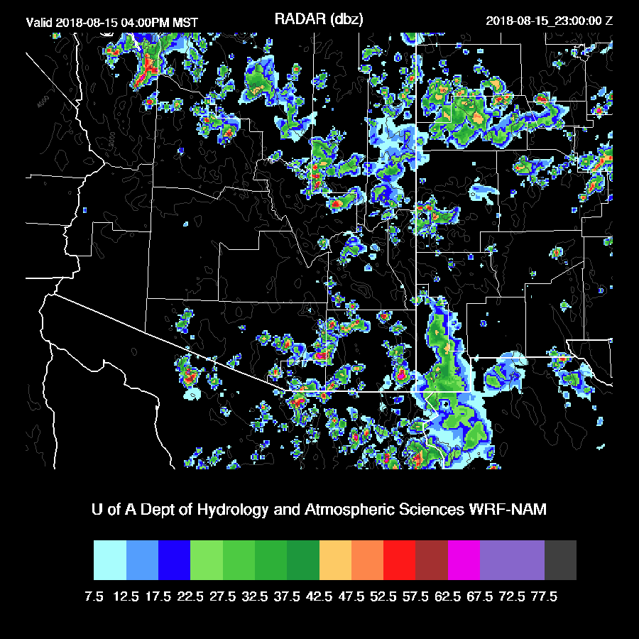
Strong storms develop quickly over the high elevations of the Rim and White Mountains and over the high terrain of SE Arizona with some especially strong to severe storms in Santa Cruz County and then into far SE Pima County. This storm will send a big anvil out over the Tucson area which will suppress convection there during the afternoon. The outflow may also make it to Tucson which will also act as a deterrent.

The impact of the storms to the south can be seen by the low-level cooling due to the outflow boundary plus the clouds from the anvils. CAPE and moisture are high in spite of this cooling but there is a strong inversion at the top of the PBL. Yuck!
The details are different between the runs but the general message is that by early evening, storms begin to move into the lower elevations of Pima, Pinal, and Maricopa
Counties.
Counties.
Phoenix is primed and ready to go as the PBL is mixed quite deeply and there is over 1000 J/kg of CAPE. PW is high so it’s likely some storms will have very heavy rain. Note that the westerlies have returned above 500mb which the first sign of the eventual end of the monsoon.

Tucson recovers somewhat and there is also around 1000 J/kg of CAPE along with a deeply mixed PBL this evening thus all hope is not lost there.

There are big storms roaming around the lower elevations of Pima, Pinal, and Maricopa Counties this evening.

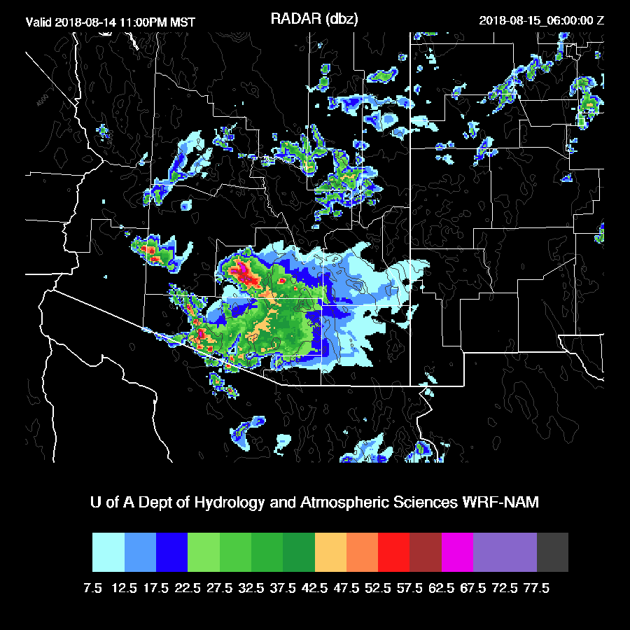
Outflows aren’t quite as strong as they have been recently, but severe winds are likely with some of the strongest storms due to wet microbursts. The 12Z WRFGFS develops strong and a few severe storms over the Phoenix area later this evening as outflows from the SE and NE intersect over eastern Maricopa County.

Both the WRFGFS and WRFNAM generate haboobs but the details are different. The WRFNAM moves one into Phoenix from the SE while the WRFGFS has one move westward from Phoenix during the late night hours.

Day 2
As tonight is likely to be active over many low elevation areas, tomorrow should be mainly a down day for those same areas. Moisture remains very high over much of the state thus storms that do form will produce very heavy rain.

CAPE is forecast to be low to moderate over the lower elevations but moderate to high over the higher terrain.
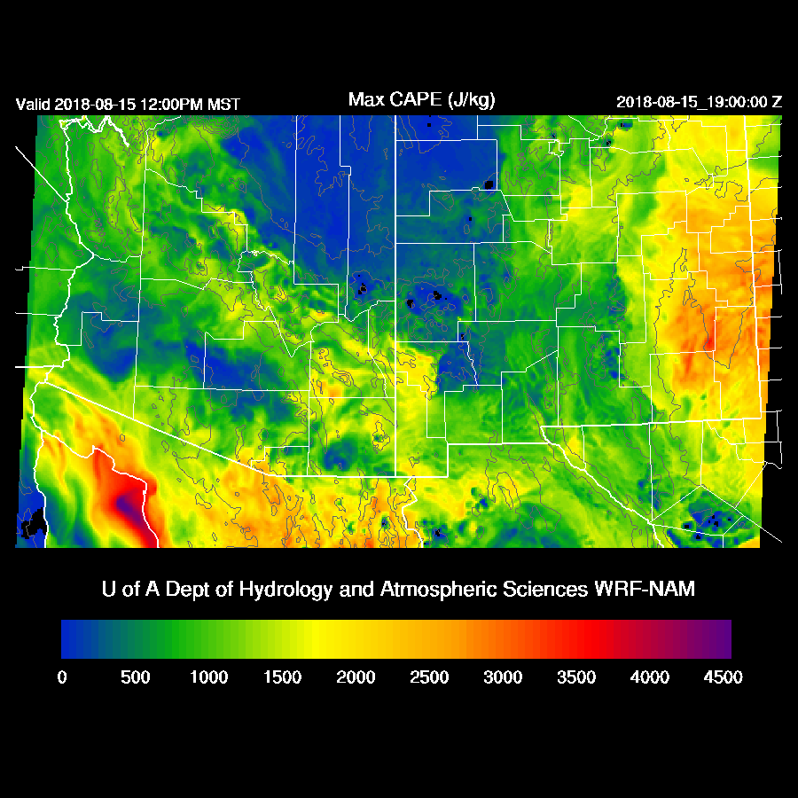
Steering flow becomes mainly southerly as a broad trough moves into the western CONUS. Southerly flow isn’t a great direction for low elevation storms.
The WRFNAM develops storms mainly over the higher terrain during the afternoon with decreasing activity after sunset.
No comments:
Post a Comment
Note: Only a member of this blog may post a comment.