Initializations
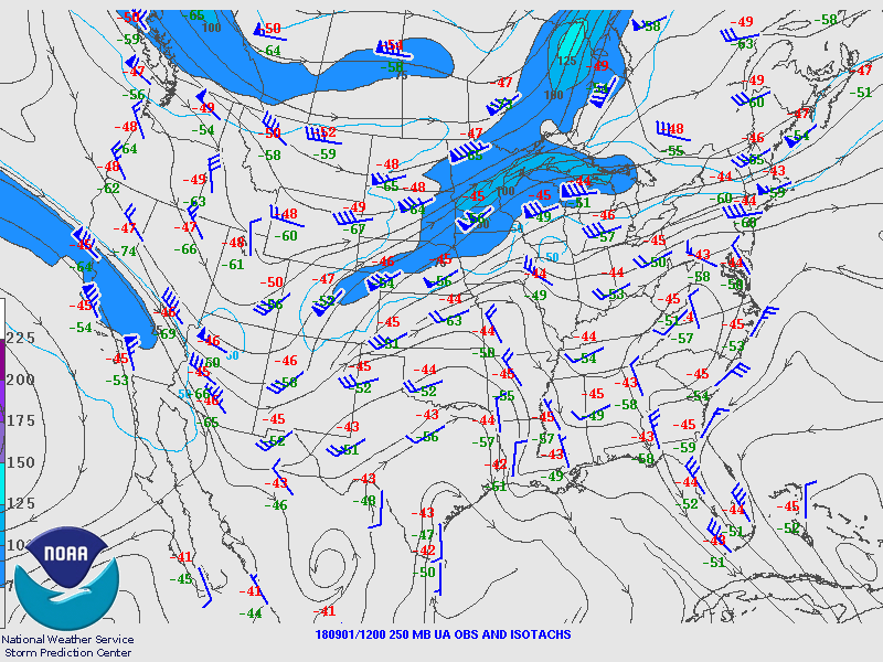
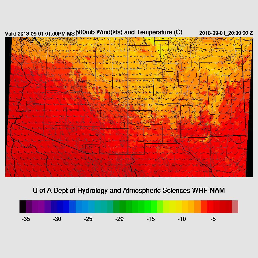
Welcome to transition season! A broad west coast trough is moving into Arizona today with vorticity, a jet streak, and cooler air aloft. However, fairly warm air is still present over far southern Arizona as Tucson’s 500mb temperature is -5C. I see no issues with either the NAM or RR.

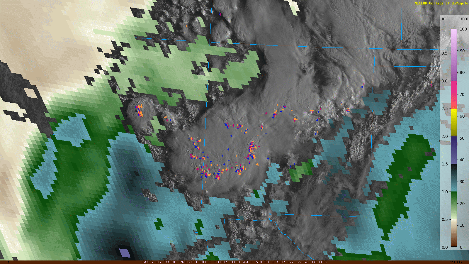
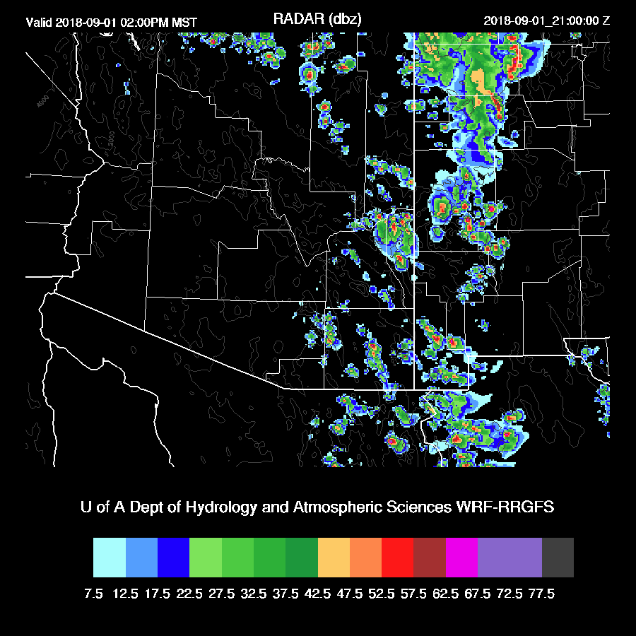
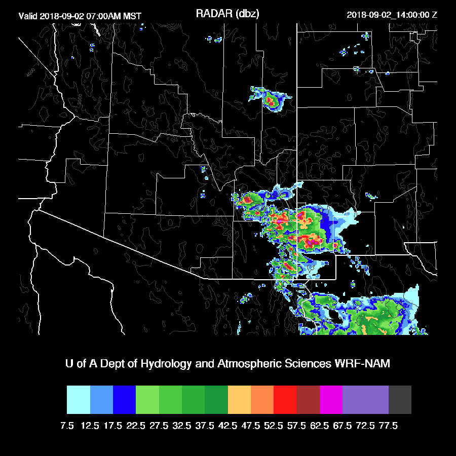
Showers and storms developed during the early morning hours just east and north of Phoenix which was quite similar to some of the runs from yesterday. These storms are moving rapidly NNE into NM and both the 9Z and 12Z RR initialized this area well. The area of clouds over SE Arizona was not initialized very well but as they are scattered so shouldn’t impact heating much. Satellite-derived PW is around 30 to 37mm over SE Arizona which is a little below observed Suominet PW observations. RR and NAM PW initializations were mainly accurate except the NAM was a bit too wet in NW Mexico. Overall, initializations look good and model confidence is high.
Day 1
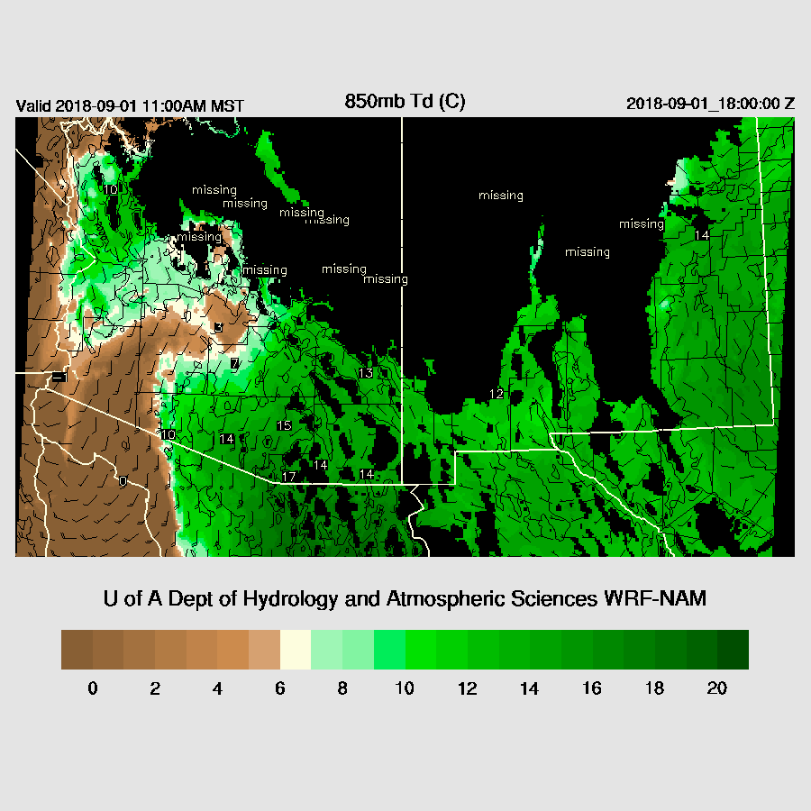
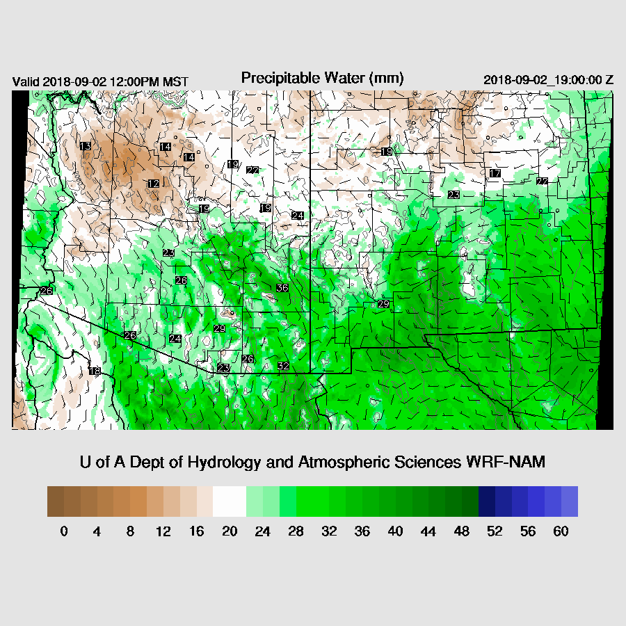
A plume of moisture is advecting into SE Arizona as Both Tucson and Safford PW is now in the 35 to 40mm range while PW is dropping over central and western Arizona. Strong southerly low-level flow (for Arizona) continues to advect very high amounts of moisture into SE Arizona during the day. 850mb dewpoint temperatures are very high from 15 to 17C.
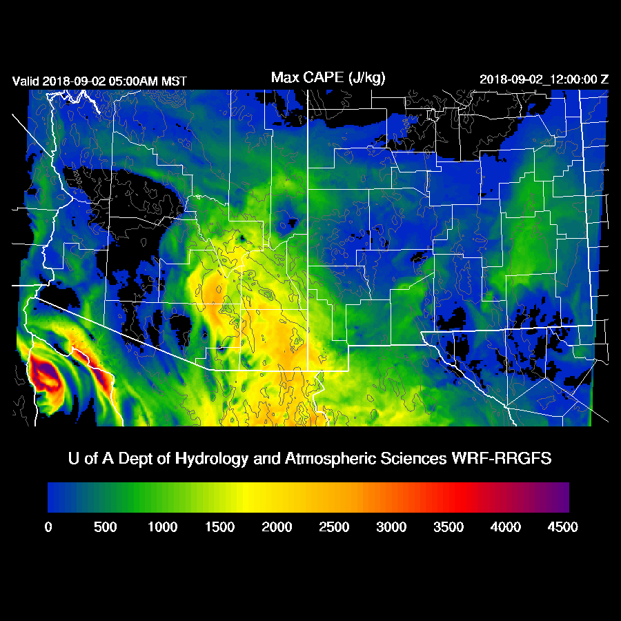
Forecast CAPE is very high by mid-day with some areas along the border approaching 3000 J/kg. Needless to say, the potential is there for severe weather and very heavy rain.

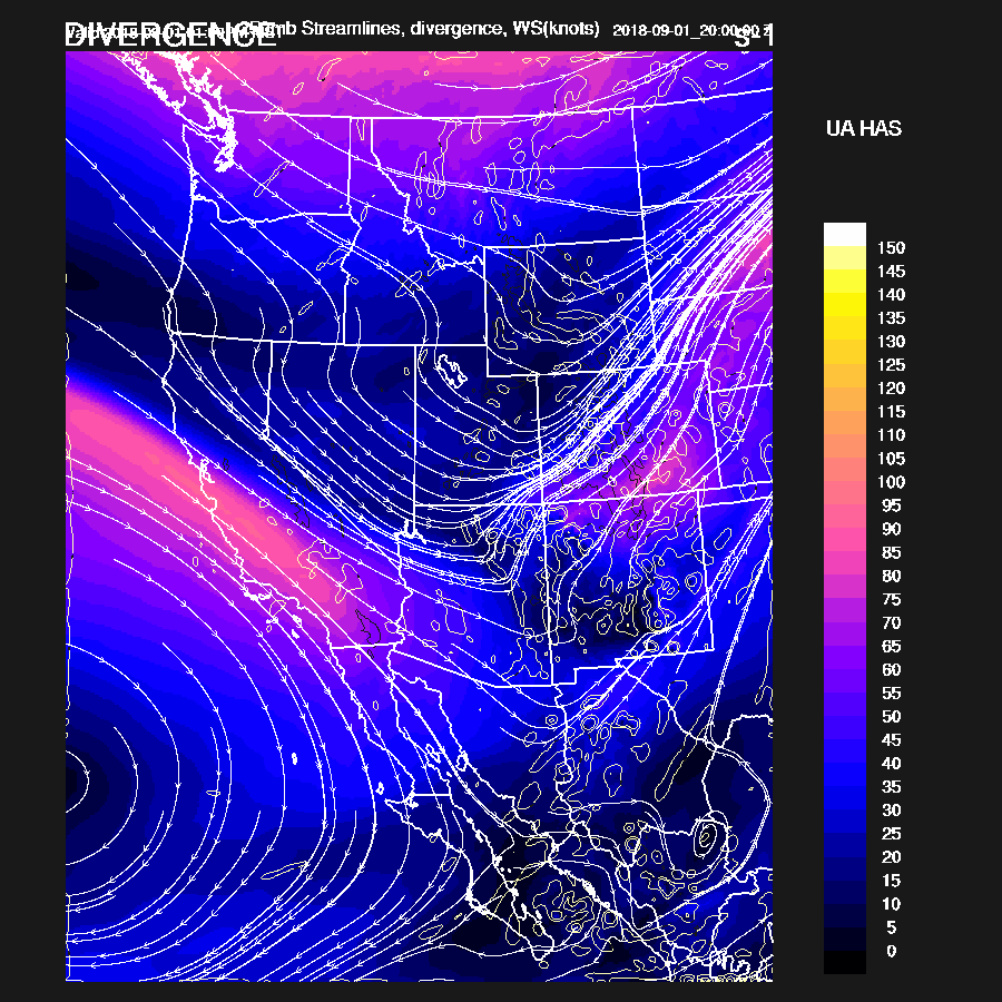
SE Arizona and SW NM are under an area of upper divergence/difluence during the afternoon and evening ahead of the nose of a strong 80-knot upper jet steak over California.
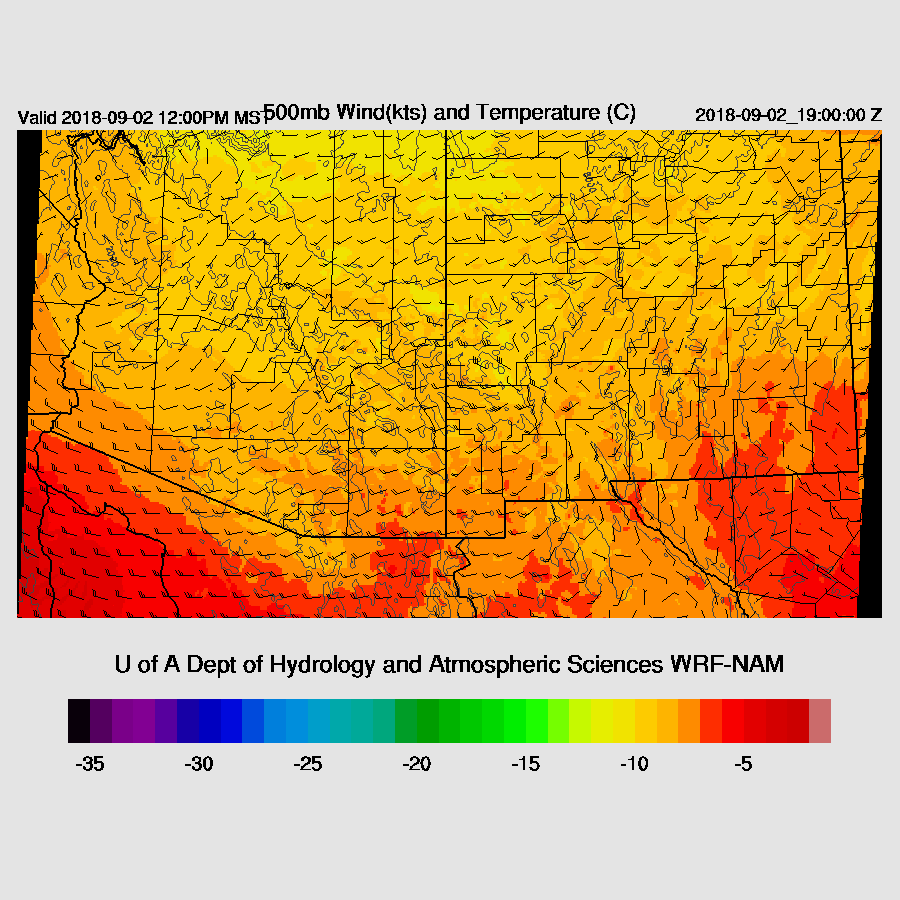
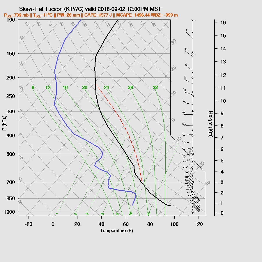
The negative for storms for SE Arizona, at least initially, is the warm air at mid-levels as temperatures are still around -5C today and perhaps a little NVA as the shortwave responsible for the morning activity lifts to the NE over central NM.
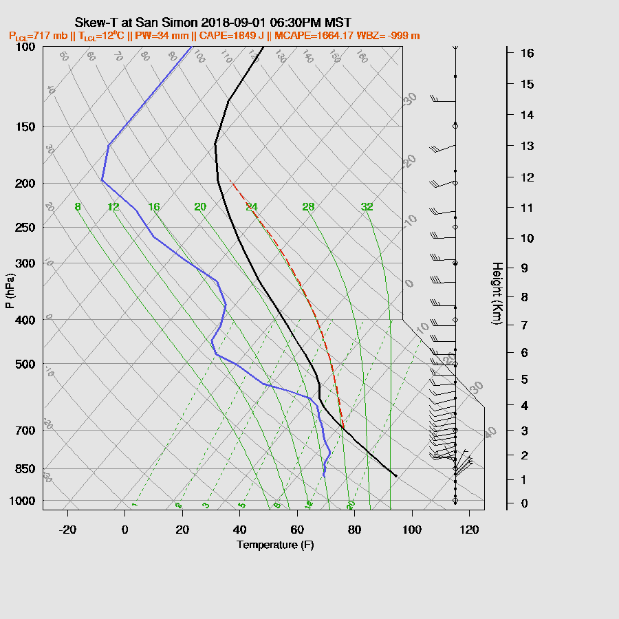
This mid-level warm layer is obvious on the morning Tucson sounding and continues during the day which should keep widespread deep convection limited. The forecast wind profile is excellent for organized severe storms with great directional shear and some speed shear and CAPE is huge at around 2000 J/kg. 
A few storms do get going by mid-day over SE Arizona with maybe one or two in the Tucson area but that inversion below 500mb is keeping widespread deep convection at bay. However, the potential is there for severe weather so some storms may be stronger than the model runs indicate.
That continues to be the story for the afternoon as scattered storms continue over far SE Arizona. They really don’t get going until they move into SW NM where it’s slightly cooler aloft.

CAPE continues to be very impressive over far SE Arizona this evening and the potential for strong to severe storms will continue there.

There is a little cooling of the mid-levels over far SE Arizona which weakens the inversion just below 500mb but the wind field isn’t as impressive as it was earlier because there is very little directional shear but some speed shear remains.
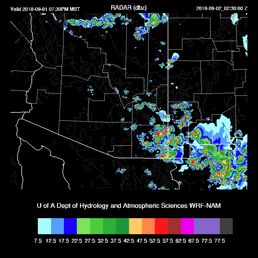
Both the WRFNAM and RR increase coverage and intensity of storms this evening over far SE Arizona. Frequent lightning and some big hail are possible with the storms. Storms continue much of the night in SE AZ into SW NM.

Day 2
The upper trough continues to sink south over Arizona with a secondary shortwave over NV. A jet streak continues over southern CA into southern Arizona with continued divergence/difluence over southern Arizona. This situation will allow training of storms over the same areas thus producing very heavy rain and flash flooding.

Far SE Arizona has a high risk of training echos as moisture and instability continue to feed into the area from the south. 
Morning storms develop over far SE Arizona and into SW NM with the WRFNAM being especially strong.
Storms continue to redevelop in that area throughout the day while large storms develop over the western Rim and White Mountains. Both the WRFRR and NAM are similar so confidence is high.

36-hour rainfall amounts exceed 3 inches in parts of SE Arizona. The runs over the past 12 hours or so have been consistent in this forecast so confidence is high.

The atmosphere dries somewhat by mid-day but strong southerly low-level flow continues which provides southern Arizona with enough moisture for a continued threat of storms.

CAPE also continues to be high over parts of far southern Arizona continuing the threat of deep convection.

The second shortwave drops into western Arizona during the day which brings cooler air at mid-levels which offsets some of the moisture loss.
The Tucson forecast sounding continues to exhibit characteristics favorable for severe organized deep convection as CAPE is high and the vertical wind profile has excellent directional and some speed shear. Again, a weak inversion at 600mb may keep deep convection isolated.
Scattered strong storms continue over SE Arizona into the late afternoon and early evening.

No comments:
Post a Comment
Note: Only a member of this blog may post a comment.