Previous Forecast
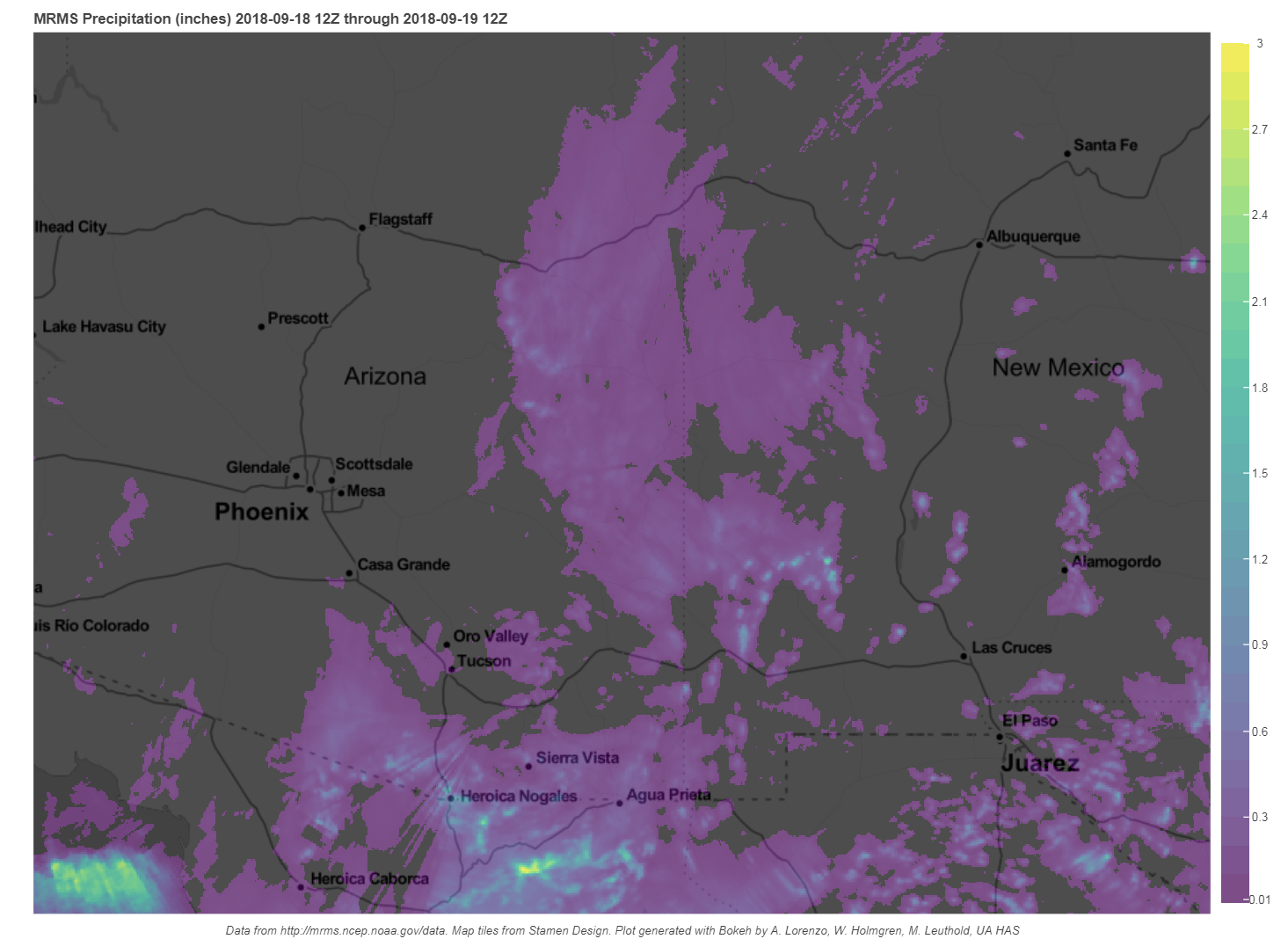
Strong storms formed in the Nogales area much as was forecast by the various 12z runs. Mostly light precipitation continued into the evening over parts of far SE Arizona.

Initializations
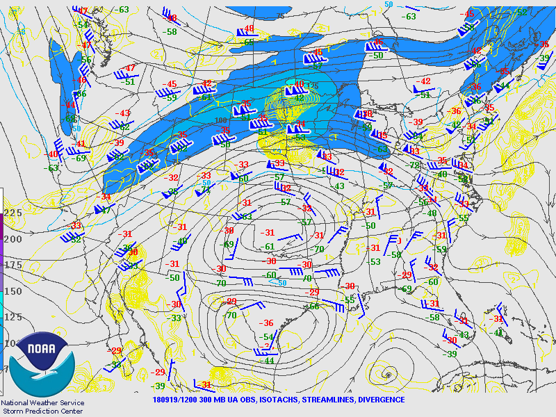
The upper-air pattern is much like yesterday with a west coast trough and an anticyclone over the central part of the CONUS. Of great interest is the weak upper trough over northern Baja which is taking its sweet time ejecting to the north. WV imagery indicates there is no longer a closed circulation and looks like an open wave as depicted by the 300mb plot below. It should eject over southern Arizona today. The various 12Z initializations appear to have the major features initialized well.
A large area of deep convection extends from the lower Gulf of California all the way to Sonora and was initialized fairly well by the RR and NAM. Much of the southern GofC activity is associated with newly minted TD 19-E which is located near Loreto BCS. The RR had the TD initialized quite well and the NAM wasn’t too bad either.

There are widespread clouds over much of the state with the overcast being quite thick in many places. Fortunately, both the RR and NAM have initialized clouds pretty well. The RR PW initialization was very good. Even the NAM was pretty good except it was about 5mm too wet in NW Mexico. Overall, for such a complex situation, both initializations look good and model confidence is high.
Day 1
Arizona is back in the soup again as PW over the low deserts ranges from 42-47mm and is even higher to the south at Sonora sites report over 50mm. Moist advection continues to increase PW during the morning hours as a Gulf Surge continues.
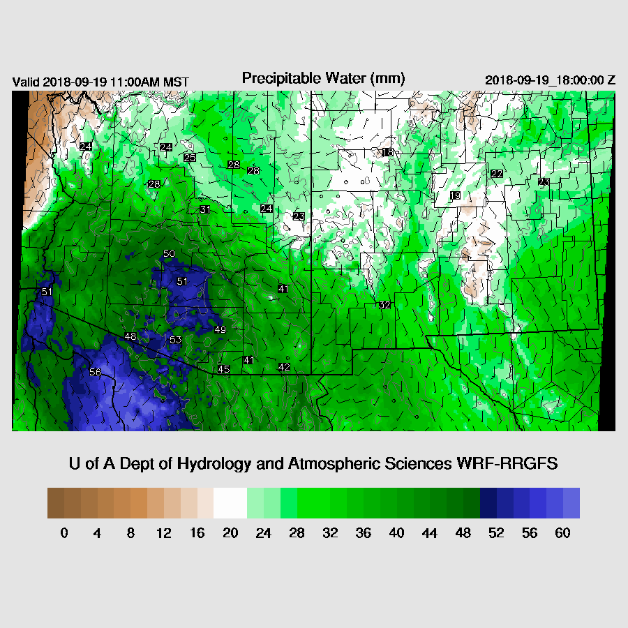
The wettest air is over SE Arizona during the day thus this is the area of greatest potential for very heavy rain and flash flooding.
The late morning forecast vertical profile for Tucson is nearly saturated all the way to the tropopause and contains around 1000 J/kg of CAPE. This profile supports extremely heavy rain. Not much lift is needed to develop deep convection and as of this writing, storms are already developing over southern Arizona. As Bob Maddox pointed out, the wind profile is also good as there is decent directional sheer. Mid-level steering is also good as it is southeasterly at 15 knots. Mesoscale lift will be provided by the ejecting shortwave and longwave troughs.

So far this morning, the WRF-RR has the best forecast of the showers and storms around the Tucson area. This area continues to expand and intensify as the morning goes on.
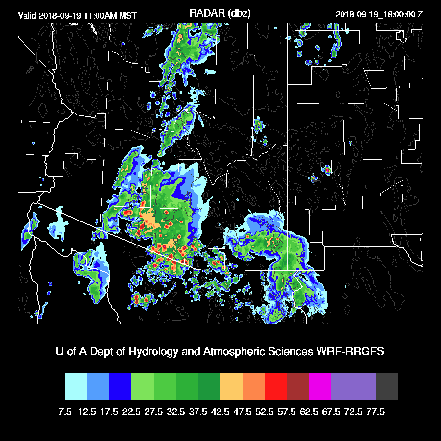
The question isn’t “if”, but “when” and “where” as all the runs over the past 18 hours have very heavy precipitation for parts of SE Arizona. Both the WRF-GFS (which is now available) and WRF-NAM (below) hold off the heaviest precipitation until the afternoon. As there is already quite a bit of activity, they are probably too slow.

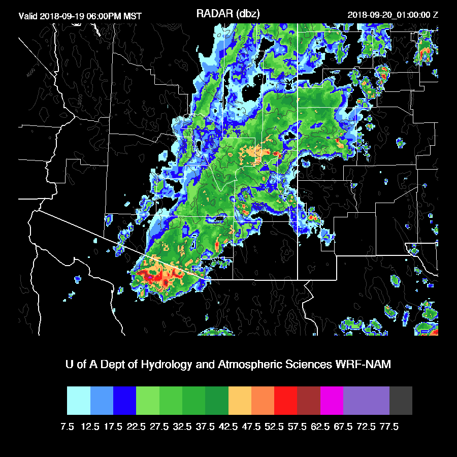
The morning activity didn’t dampen the WRF-RR’s afternoon storms at all. Many strong echos are present over SE Arizona during the afternoon.

Extremely wet air continues to feed into SE Arizona on 20 knots of southerly flow which enhances the heavy rain and flash flooding risk considerably and contributes to the redevelopment of storms.

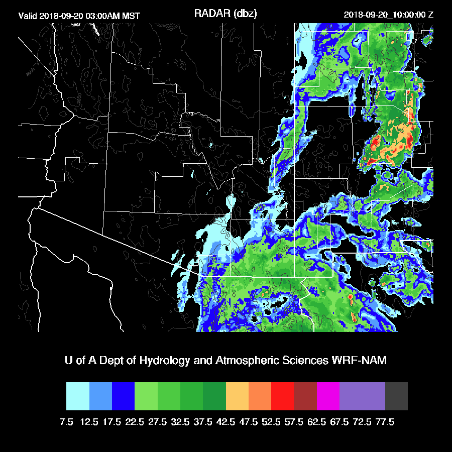
Precipitation rates generally decrease into the evening over SE Arizona but areas of heavy precipitation continue.
This is likely to be a major flash flooding event for many areas of SE Arizona as depicted by the rainfall totally from the various 12Z runs. There are minor difference between 12Z runs but in general, they are quite consistent with a band of 2-4” precipitation from eastern Pima up to the NE. Some isolated amounts of 4-6” are possible.

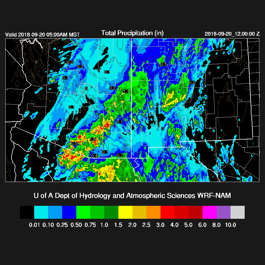
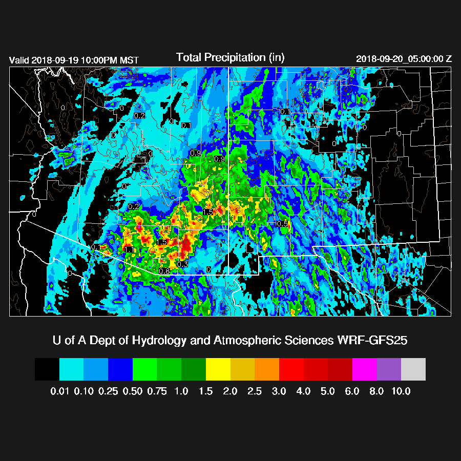
The tropical depression moves NE into Sonora this evening and towards far SE Arizona and SW NM overnight.

This results in another round of precipitation over far SE Arizona during the early morning hours. All model runs are nearly identical so confidence is high for the track. Rainfall amounts look to be around .5 to 1.5” from the TD.
I’ll post results from the 15Z WRF-RR on Twitter later.
No comments:
Post a Comment
Note: Only a member of this blog may post a comment.