Previous Forecast
It certainly has been a busy couple of days. Yesterday’s activity was centered over SC Arizona along with a few severe storms east of Phoenix.

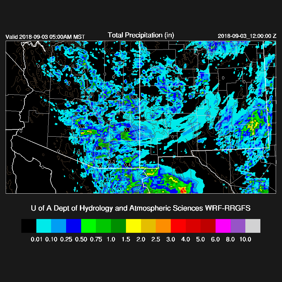
All the runs had the right idea but were off with the details. The 12 and 15Z WRFRR looked the best as they developed widespread activity over the Tucson area during the afternoon and then redeveloped storms during the late evening. They were a little slow with the second batch though.
Initializations
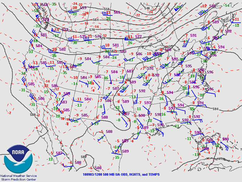
It’s a complicated pattern as a broad trough continues over the SW with a shortwave over eastern Arizona up towards the 4 corners and another weaker over southern NV.
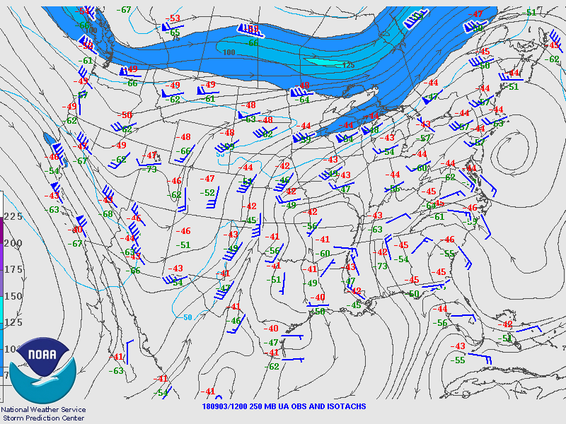
259mb still has a jet streak over California with the exit region over Arizona.
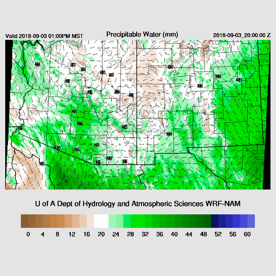
Most of the state is clear except for the far eastern parts where some cloud and showers continue but these are moving eastward into NM will be no factor. The models initialized clear skies, correctly, across the state. PW was initialized well and overall, both the NAM and RR look good. Note that most of the day 2 forecast was using only a single 12Z run as I have somewhere I need to be this morning and couldn't wait so day 2 confidence is low.
Day 1
After 2 days of widespread activity, the atmosphere is quite worked over and both Tucson and Phoenix have almost no CAPE. PW has slowly decrease too and is only in the 25-30mm range over the lower deserts. All of this is much different from the forecast yesterday where moisture continued and CAPE was high.
CAPE is low to moderate over much of the state and looks to be insufficient for much activity over the lower deserts.

It doesn't get much better during the day and by late afternoon Tucson only has around 300 J/kg. Note that the surface based CAPE is too high which happens sometimes. The wind profile has a bit of directional shear but not as much as the past few days. Just looking at the model Skewt-T, I’d say this will be a down day for the deserts.
Phoenix looks no better.

It looks like only the higher elevations will see any activity today.

Day 2
Moisture is forecast to increase over southern Arizona tomorrow so it should be a more active day.

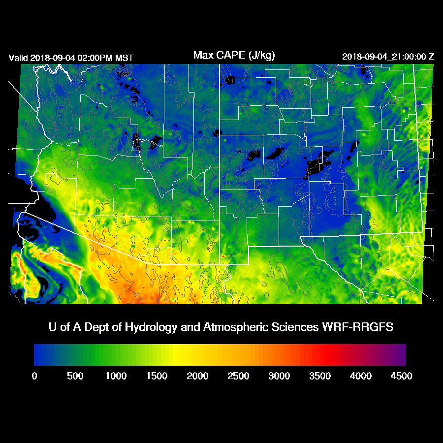
Along with the returning moisture, CAPE increase over far southern Arizona so it looks like that area will have the most activity.
The SW trough is still hanging around and is cut off from the main branch but is not quite a cutoff low with a closed circulation but it sure is acting like it. The center is located around Vegas and has much of Arizona in westerly flow along with fairly coo air at the mid-levels.

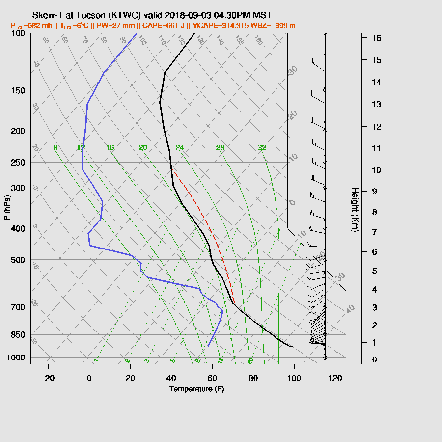
The Tucson forecast Skew-T looks much improved as CAPE is around 1000 to 1200 J/kg along with a deeply mixed PBL. The wind profile does have some directional shear favorable for some storm organization. So, Tucson could see storm activity tomorrow.

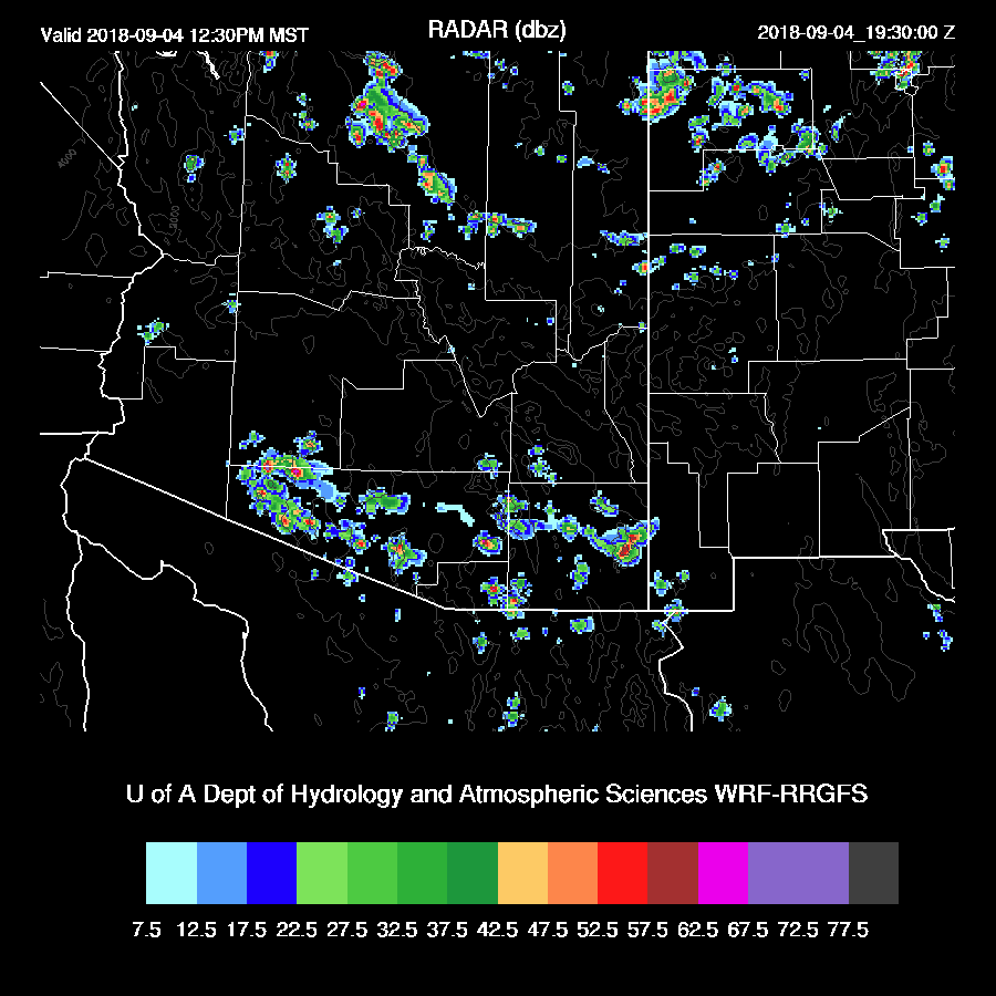
Scattered storms form over southern Arizona during the early afternoon.
It is possible that in or around Phoenix could see some activity later tomorrow afternoon or evening as CAPE is around 1200 J/kg and the PBL is mixed deeply. However, there is an inversion on top of the PBL that is going to need some lift to break which looks unlikely as no storm activity is forecast for the higher elevations around Phoenix.


No comments:
Post a Comment
Note: Only a member of this blog may post a comment.