Initializations
The 500mb high is located over far NW Texas while a weak trough is along the Pacific coast. A well defined mid/upper inverted trough is located over central Baja and multiple areas of disturbed weather are present in the eastern Pacific so it’s quite a complex situation. Both the NAM and RR have the Baja low initialized a few hundred km too far to the south and this error results in initialized clouds and showers were too far to the south. Both initializations have a low-level cyclonic circulation the SW of the southern tip of Baja which does verify with morning low-level cloud motions from satellite.
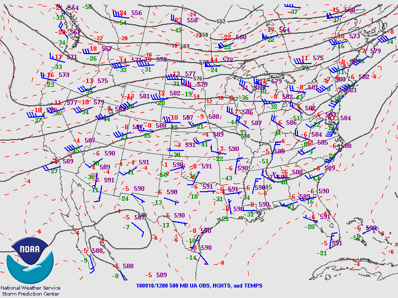


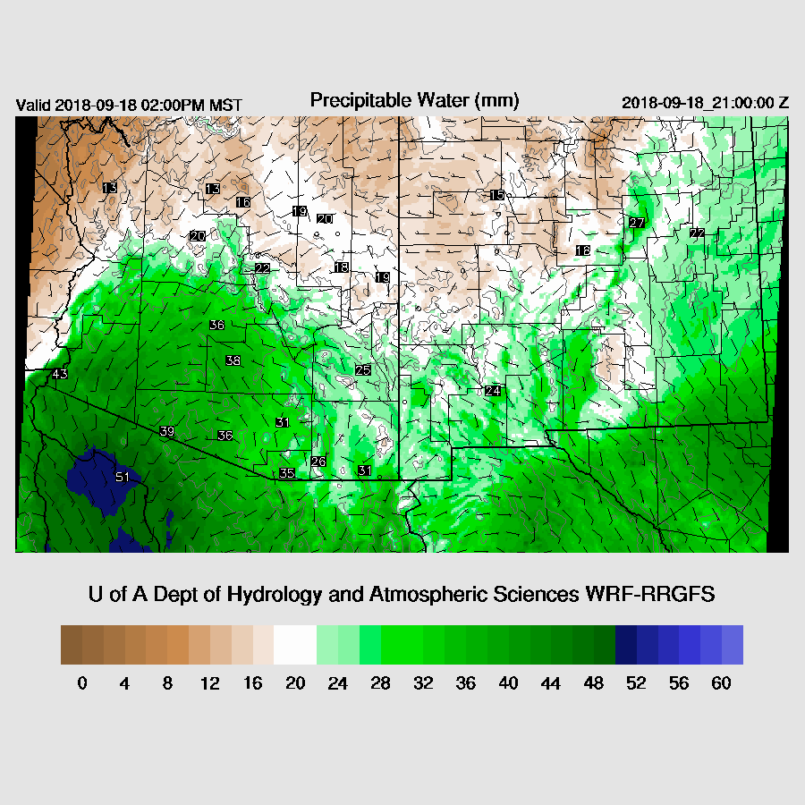
As seen above, very wet air is moving northward with the yellow areas having greater than 2.0” of PW. NAM PW initialization wasn’t too bad as most errors were +/- 3mm and the RR was good with mainly minimal errors. As mentioned above, clouds were initialized too far south plus the coverage was too low too. Model confidence for Day 1 is OK but with the big error in the position of the upper low, Day 2 for Arizona is low.
Day 1
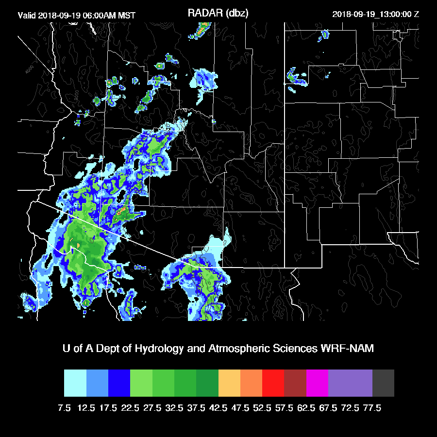
PW has increased over southern Arizona the past 12 hours and is now around 30-34mm. A shallow surge is underway at Yuma with dew-points around 75F. Moist advection continues during the day which continues to increase PW over much of southern Arizona.
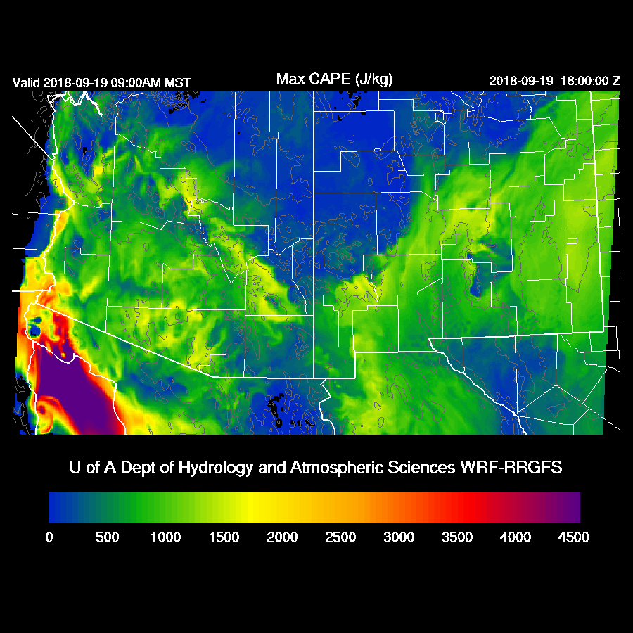
In spite of this moisture increase, CAPE remains too low to support any deep convection except for near the border. CAPE is very high over far SW Arizona but the atmosphere is strongly capped so deep convection is unlikely there.

Both the Tucson and Phoenix afternoon vertical profiles look similar as there is limited CAPE, a warm layer at 400mb, and a shallow mixed layer with a weak inversion on top.

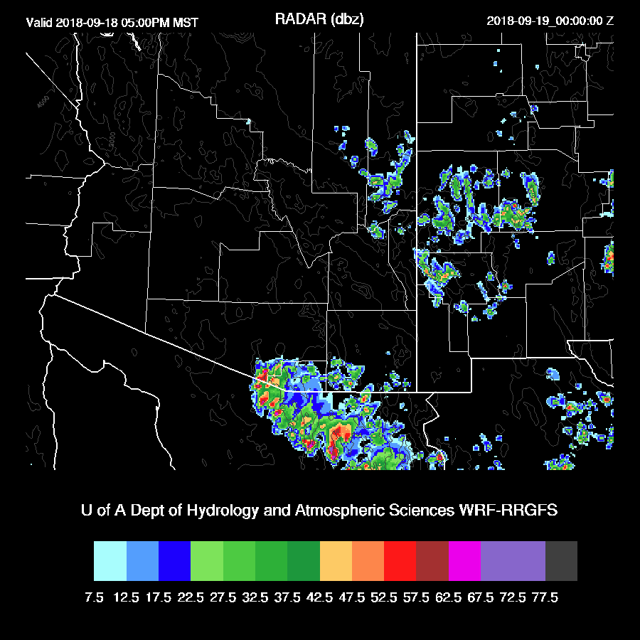
Both runs develop activity over far SC Arizona and into northern Sonora later this afternoon. The WRFRR has stronger and more widespread storms and I can’t say which is more accurate.
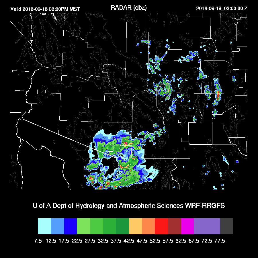
The WRFRR continues showers and a few storms into the evening hours.
Day 2
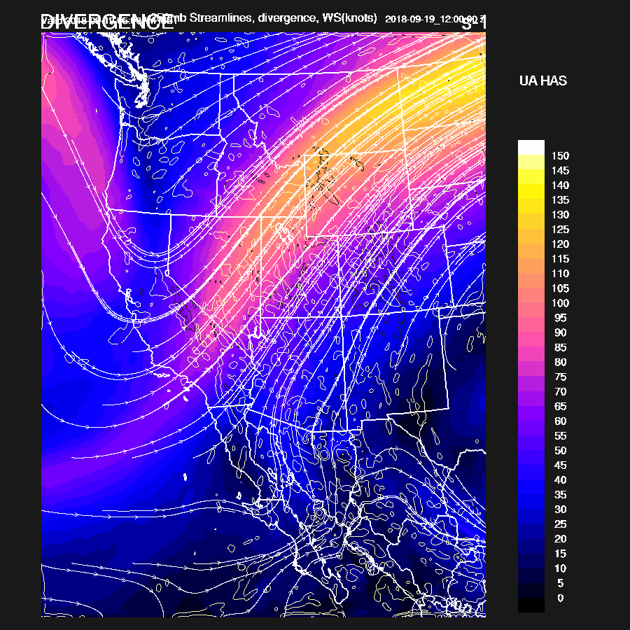
By 12Z, the broad west coast trough deepens while the upper low over Baja begins to eject towards Arizona. The big unknown is where exactly it will go as the initialized position may be off. A strong jet is located on the east side of the trough with Arizona being near the right rear entrance region. The 250mb plot shows considerable divergence over the state from both the large-scale trough and the shortwave ejecting out of NW Mexico.
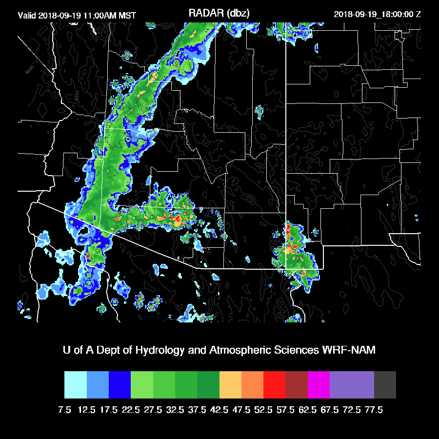
Combined with the increase in moisture, light showers develop over much of the western ½ of the state during the early morning hours.
Very wet tropical air is over the state by morning as the surge continues. There is a lot of uncertainty as the WRFNAM has more moisture but less CAPE tomorrow morning.

This results in widespread showers with some thunderstorms during the late morning hours.

In spite of less CAPE, the WRFNAM also develops scattered showers and storms during the late morning over southern Arizona. One big problem will be that the morning clouds and showers are likely to reduce heating and result in only limited afternoon activity for some locations.
The WRFRR continues to have around 1000 to 1500 J/kg of CAPE over much of the state during the afternoon hours which results in widespread strong storms.

The WRFNAM forecast looks very similar with regards to coverage but with lower CAPE, strong storms are not as widespread and no strong storms over central Arizona where widespread clouds and showers are present much of the day.

The WRFNAM decreases activity into the evening hours but the WRFRR redevelops strong storms over southern Arizona.

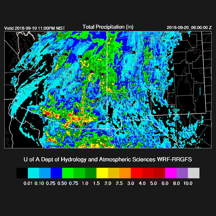
This results in some locations receiving extremely heavy rain with amounts over 3 inches. WRFRR 30 hour total precipitation.
WRFNAM 30 hour total precipitation

The WRFGFS is now far enough along that I can talk about it. In general, it’s more like the WRFNAM as it only has mainly light precipitation in many areas of central Arizona but does develop stronger storms during the late afternoon for areas of eastern Arizona.

No comments:
Post a Comment
Note: Only a member of this blog may post a comment.