Previous Forecast
This blog entry serves as a post-mortem for yesterday’s heavy rain event. Widespread moderate precipitation developed over much of SE Arizona with some areas of extreme rainfall. One area southern Maricopa and western Pinal were RADAR estimates were near 4”. Other areas were south of Tucson with some gauge reading of 4 inches in Green Valley. RADAR estimated precipitation with the product below was not very good for that area due to beam blockage as it had only 1.5 inches.
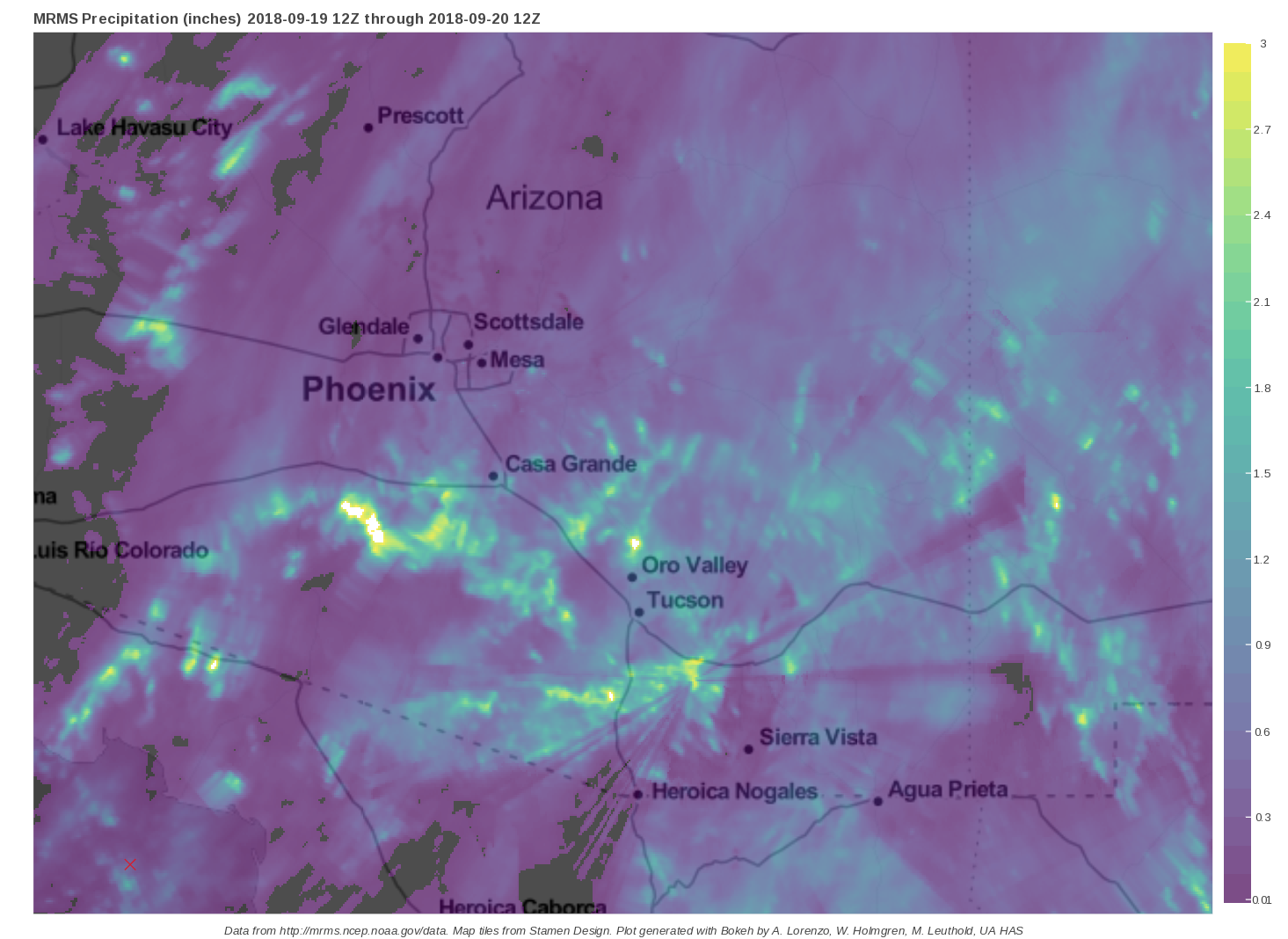
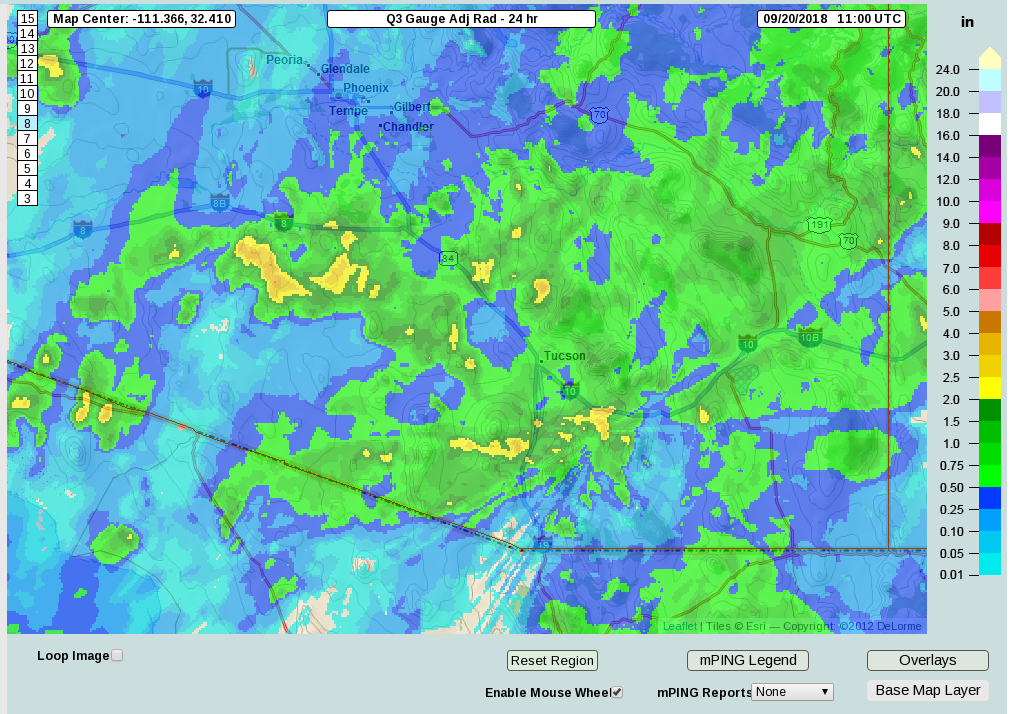
The MRMS Q3 Gauge Corrected RADAR product was a bit better as it had 2.5-3 inches in the area but was still not enough. I wonder how much much precipitation really fell to the SW of Green Valley? Estimates were not much better out in eastern Arizona as Rainlog sites in Safford reported 2-3 inches while the various RADAR derived precipitation products were around 1/2 that.
The WRF forecasts from the 18 at 12Z varied in their accuracy quite a bit with the WRF-RR being fairly good as it had areas of very heavy precipitation over southern Arizona. It was a bit too far south with south central Arizona but had the right idea of developing storms there during the early afternoon. The WRF-GFS was fairly good too but didn’t have enough accumulation. The WRF-NAM didn’t have nearly enough precipitation.
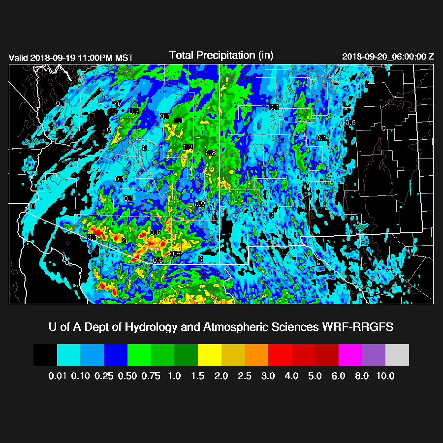
The model runs from the 19th were fairly consistent with their forecast of a heavy rain band across SE Arizona. Some of the details were wrong as the WRF-RR had too much precipitation and it was too far north as well as having the south-central Arizona activity too far south.
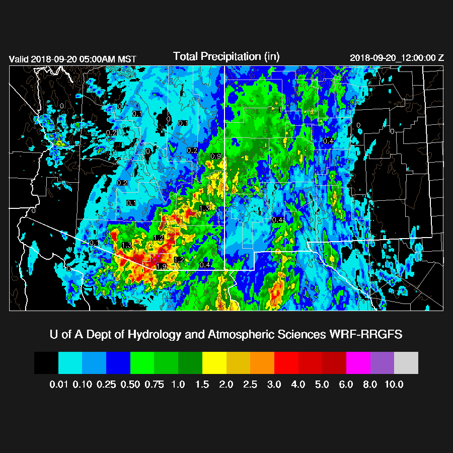
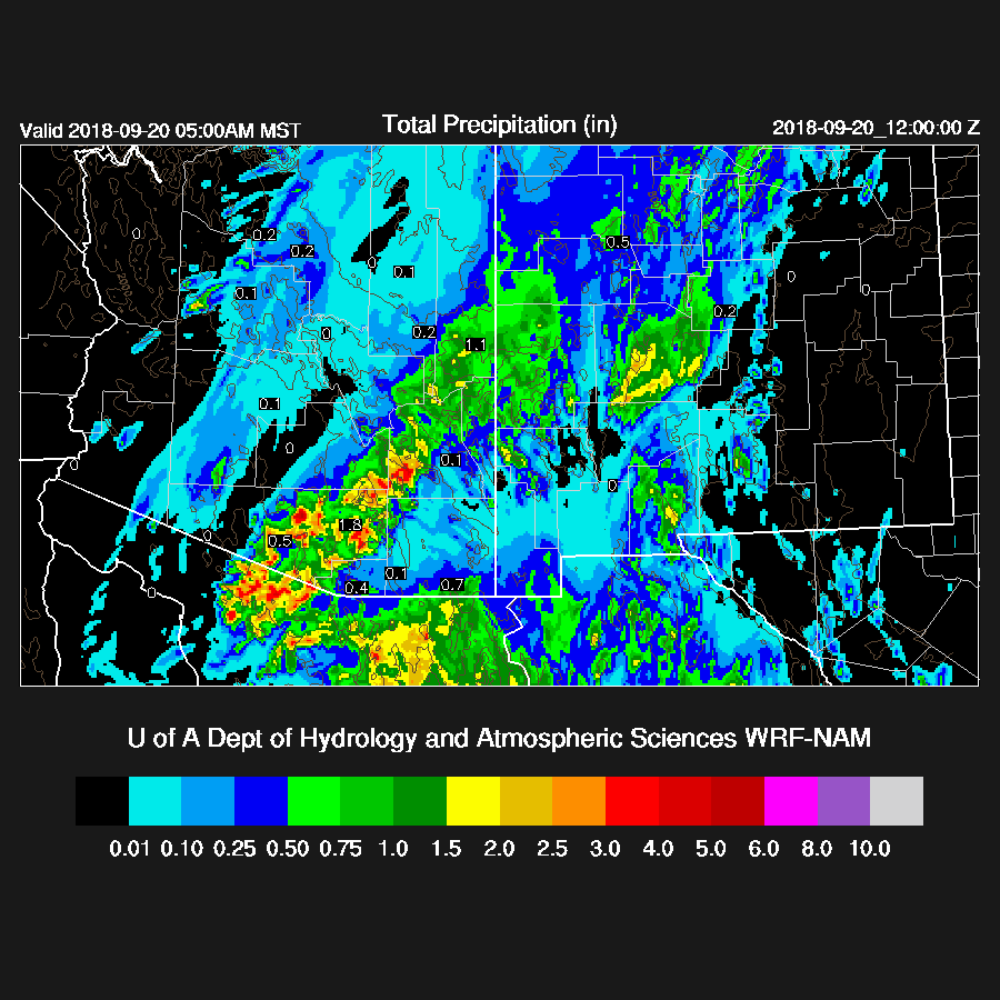
The WRF-NAM accumulations were better and the band was mostly in the correct location. It didn’t develop the early afternoon south-central Arizona activity quite far enough but I can’t complain as the weather situation was complex.
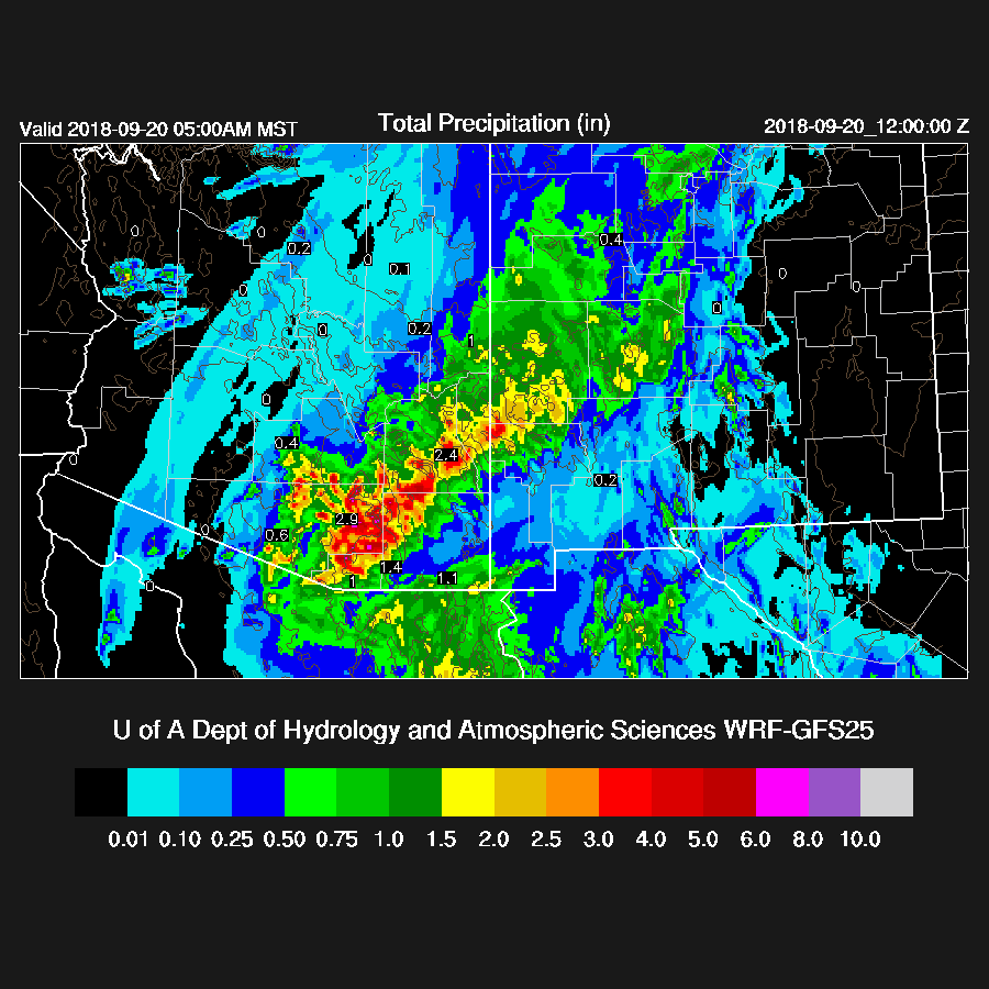
The WRF-GFS was also pretty good but might of had a bit too much accumulation around the Tucson area. It did well in eastern Arizona with locations and accumulations. Overall, I was pleased with the model performance especially the Day 1 forecasts.

As a side note, the 12Z WRF-GFS ran with both the ACM2 (winter) and BouLac (monsoon season) PBL schemes and I thought it would be interesting to see the differences. The ACM2 WRF-GFS produced too much rain and was a bit too far to the east with the heaviest precipitation.
No comments:
Post a Comment
Note: Only a member of this blog may post a comment.