Previous Forecast(Aug 29)
Storms were scattered across southern Arizona as well as Tucson. There were multiple severe, warned storms within the Tucson valley. WRF runs were generally pretty good. The WRFGFS underpredicted precipitation amounts, though.
Discussion
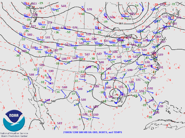
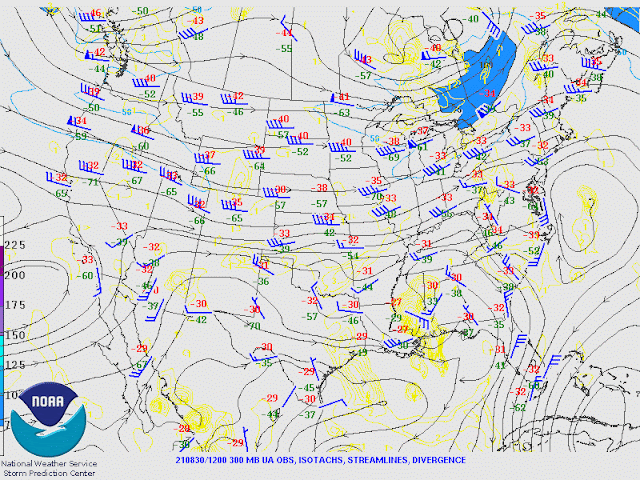
It turns out the GFS track for Nora was the most accurate as it moved it more to the east, keeping it over land, which resulted in rapid weakening. This morning, nothing is left of the circulation, and it was declared dead. Satellite imagery indicates a broad area of weak cyclonic motion over much of NW Mexico. The 500mb ridge axis is located from California into west Texas, resulting in a southeasterly steering flow. Temperatures are fairly cool, at about -7 to -8C. There is a cut-off low at the upper levels off the southern California coast, providing SSW flow and perhaps some upper divergence over the state.
The morning soundings aren't very interesting as CAPE is minimal. The mid-levels are saturated, resulting in widespread clouds over the state.
Initializations
All have the remnants of Nora initialized over Sinaloa, which looks accurate using satellite imagery. Widespread clouds are cover all of NW Mexico and parts of Arizona. The GFS and RR did a good job initializing them. Suominet is down this morning, so no PW checks can be done. Even though the situation is complex, the GFS and RR did well with the initial conditions.
Day 1
A weak gulf surge is underway in southwestern Arizona as dewpoints are in the mid to up 70's. It's not possible to tell how deep it is without Suominet or sounding data. The surge continues into the afternoon, resulting in a slow increase in moisture. Moderate easterly flow is present over eastern Arizona, advecting slightly drier air into that area. Again, there is a low-level convergence line north and south of a line through eastern Pima County. As mentioned before, sometimes this can act as an initiation point and also enhance deep convection.
850mb Td gives a better idea of what is going on as it shows that the surge is quite shallow over southwestern Arizona as it's quite dry and has light and variable winds. The more favorable dew points are over south-central Arizona, while southeastern Arizona is in unfavorable easterly downslope conditions. I'd say the outlined area is the most favorable for deep convection later today.
CAPE is low to moderate over much of the state, so storms could form just about anywhere over the higher terrain.
Storms develop from around Tucson to the west by later in the afternoon. The Rim/White Mountains also become quite active, as well as NW Arizona, where CAPE is more favorable.
CAPE is marginal at Tucson with only 4-600 J/kg but sufficient to support a few storms in the valley. A few could have strong winds as the PBL is mixed quite deep, resulting in an inverted V profile.

Storms continue to expand and move to the NW toward Phoenix during the evening.
All recent runs have some activity in or at least close to the Phoenix valley tonight.
Scattered showers and storms continue for western Arizona into the early morning hours.
Day 2
Moisture from Nora enters the state during the morning hours, and by early afternoon, PW will increase to over 50mm for far southwestern Arizona.
Despite the increased moisture, CAPE still isn't very high, except for far SW Arizona.
What a strange-looking Skew-T, as there is a very warm layer at 300mb, resulting in a significant inversion. The CAPE calculations are struggling, and eyeballing it, there is some CAPE present below this inversion. Not a lot, but enough to support storms. The wind profile looks good with some low-level shear and southeasterly steering flow of 15 to 20 knots.
Phoenix also has this warm layer, but CAPE looks to be calculated correctly, at around 900 J/kg. While not great, it should be enough. The wind profile also looks good, but there is a significant cap on the top of the mixed layer.
There is very little consistency between runs regarding storms, so confidence is low for tomorrow. Some runs are quite cloudy, resulting in less activity, but the storms could be very strong where it's clear.
Storms continue into the evening hours over much of central Arizona.
As one would expect, precipitation amounts for some locations will be high, over 3" for some areas. 48 hour QPF.


No comments:
Post a Comment
Note: Only a member of this blog may post a comment.