Previous Forecast
It was mostly a down day for the lower elevations, except for a couple of small cells that moved through Tucson during the late afternoon/early evening, which managed to produce more than 1.5" of rain near the AF base. Scattered, very heavy rain fell from about Flagstaff and north.
The WRFRR had the best forecast as it kept most precipitation over the higher elevations. The WRFNAM came in second as did well around Tucson and up north. Too much around Phoenix, though.
Discussion
The end is near! (at least for now) A strong trough moves over the western CONUS resulting in broad southwesterly flow over Arizona and a transition-type day.
A mid to upper-level shortwave trough is moving into western Arizona, which may provide upper divergence over the state, resulting in better organization of storms and perhaps some training echos.
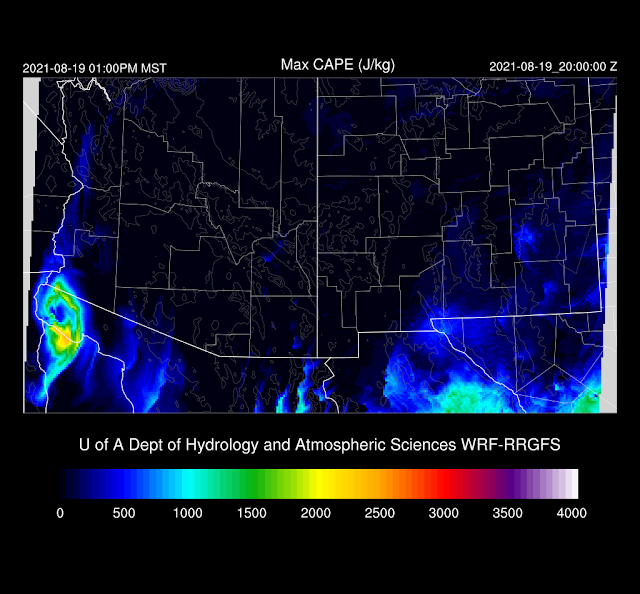
Both Tucson and Phoenix have a large amount of MLCAPE and a high PW of 46 and 50mm. Since 12Z, it has dried out some, as Tucson is down to 41mm and Phoenix is around 43mm. There is some directional and speed shear present, which will help to organize storms. With dry air advection underway, it will be challenging to get deep convection to form over the lower deserts, but not impossible, as the LFC is quite low at around 800mb. So, a mixed bag.
Initializations
It will be a challenge as there are widespread clouds, along with increasing thunderstorms to the NE of Phoenix. The 6Z WRFNAM and GFS are doing well so far, as they have the clouds well forecast and the scattered storms. The 9Z WRFRR has too much activity and too many clouds. The 12Z RR was better, but the WRFRR developed storms to the SW of Phoenix within the first few hours, which didn't occur. The 12Z NAM was OK, but the clouds were a bit too thick over northern Arizona. PW initializations had minimal errors except for the 6Z NAM. I'm a little surprised that the RR is struggling this much. The 9Z might be OK for Tucson and Phoenix later, as the main error was the too widespread convection to the NE of Phoenix. Otherwise, I have no clear favorite.
The morning showers and storms continue to expand and move to the NE and are scattered about northcentral and northeast Arizona this afternoon. Flagstaff appears to get nailed again.


No comments:
Post a Comment
Note: Only a member of this blog may post a comment.