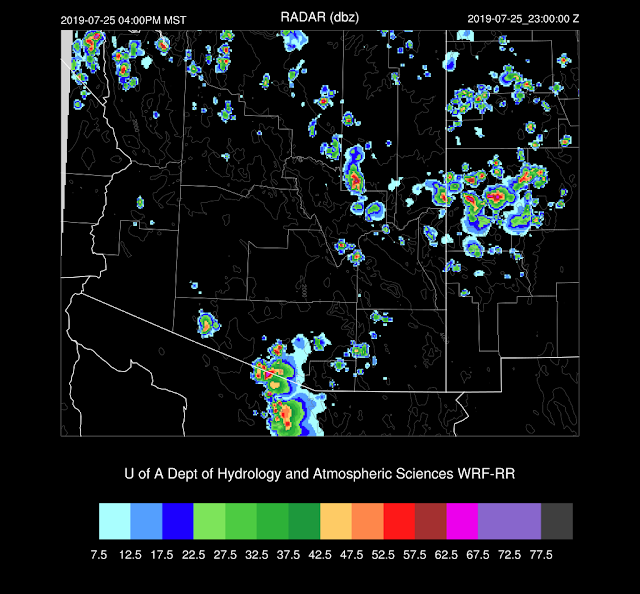
The model runs were all over the place. The 12Z WRFRR was generally too dry, and the other extreme was the WRFNAM which was way too wet. The 15Z WRFRR was pretty good as well as the WRFGFS as they limited precipitation to the higher terrain. All that changed after midnight as showers and storms developed over central Arizona in what appeared to be in response to the large MCS over Sonora. The 0Z runs did pick up on the overnight activity, but a few hours lead time isn't beneficial.
0Z WRFGFS
Initializations
It is a complicated situation due to thick clouds over western Arizona along with ongoing showers and storms. The MCV from the Sonoran MCS is located over the northern Gulf of California. The NAM had the worst cloud, but the best MCV initialization. The GFS and RR did a reasonably good job with the clouds.
There is a problem with the Flagstaff sounding 500mb height, but the wind seems OK and indicates that there is a weak IT/MCV over western Arizona. This feature was initialized well.
PW was initialized well except for the NAM. The initializations and resulting forecasts have been inaccurate so many times that I'm considering reducing the number of times it runs each day. I'd replace some runs with the WRFRR by using the GFS for lateral boundary conditions. The WRFGFS and WRFRR are the favored model runs today.
Day 1
Moisture has increased over southwestern Arizona due to the outflows from the active MCS in Sonora, resulting in PW around 50mm today. Low-level southeasterly flow is advecting drier air into eastern Arizona.
This dry air advection has reduced CAPE over eastern Arizona, but it's probably enough for some activity over the higher terrain. Southcentral Arizona up to around Flagstaff has CAPE in the 1500 J/kg range so if those areas can receive some heating resulting in some deep convection, storms could be strong with heavy rain.
The problem is the PBL has been cooled significantly due to the morning activity and the advection of cooler and wetter air from the south. The afternoon Phoenix Skew-T indicates a shallow mixed layer as well as an inversion.
Tucson looks a little more favorable, but low-level winds are advecting in drier air resulting in lower PW. These downsloping drying situations are unfavorable for deep convection in the lower elevations.
The WRFRR runs have very little activity over most of the state today.
The WRFGFS is a bit more active but keeps any significant weather out of the low elevations.
Both runs do increase activity this evening over Pima and/or Pinal Counties Perhaps a good night for lightning photography?
The 15Z WRFRR reverses the low-level winds, which results in the wind profile becomes more favorable plus PW increases slightly due to moisture advection reversing. We'll have to wait and see if this actually happens.
Day 2
Moist air continues over much of central and western Arizona while drier easterlies are present over the far east.
Once again, favorable CAPE is present over much of central Arizona. Is there going to be enough heating to mix deeply and break through the stable layer at the top of the PBL?
The PBL isn't mixed very deeply at Phoenix, but there is plenty of CAPE and an OK shear profile. Mid-level steering is pretty weak though. I'd say probably not too much activity for the lower elevations.
That appears to be the case through the afternoon as only scattered storms are present over only the higher elevations. Storms decrease into the evening hours. All runs have the same general idea.


No comments:
Post a Comment
Note: Only a member of this blog may post a comment.