Previous Forecast
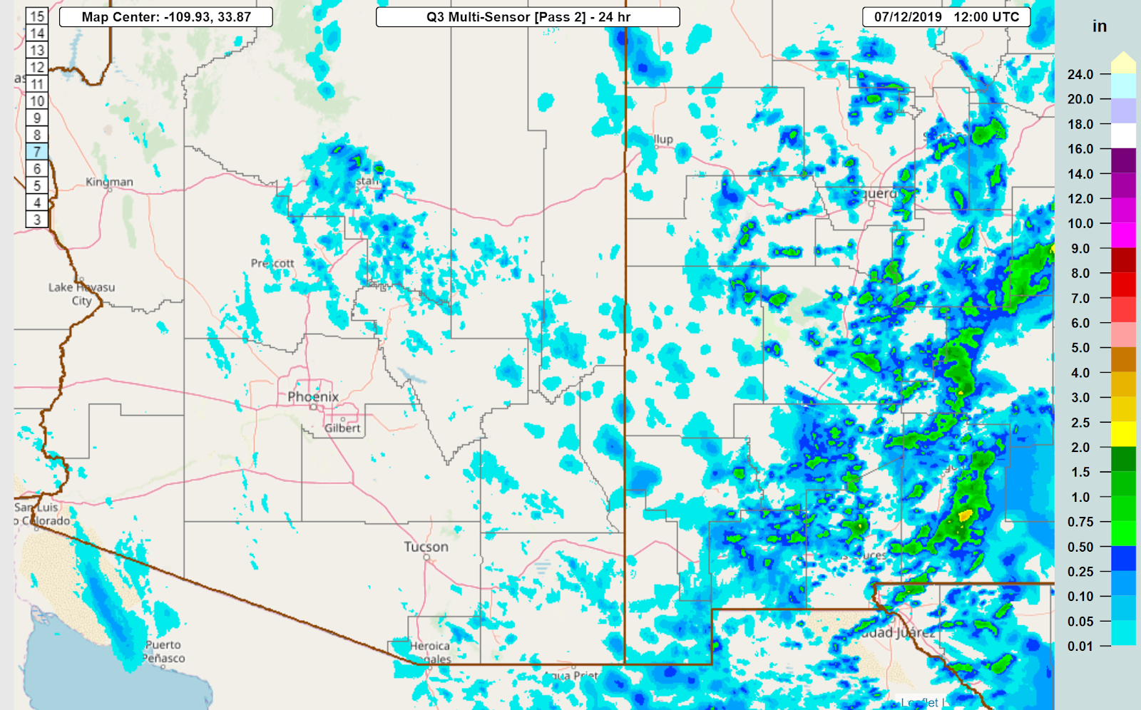
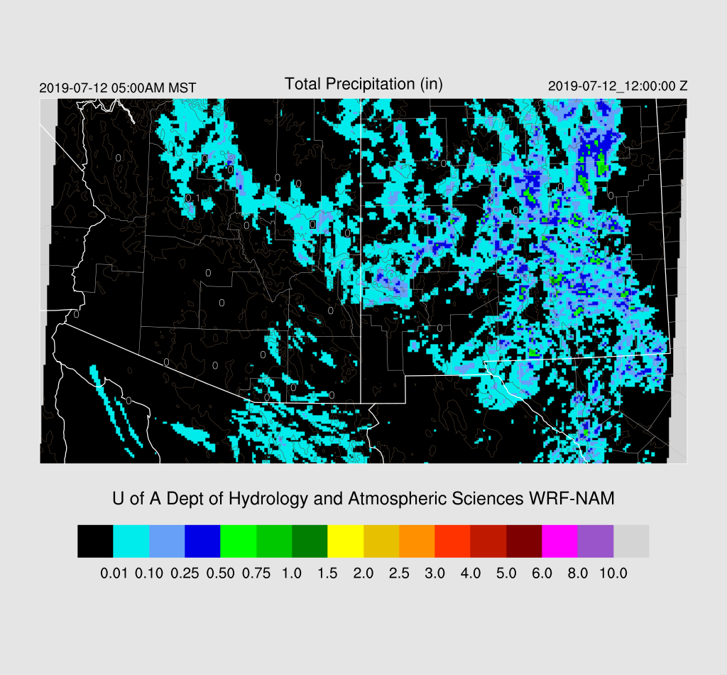
Not much activity in Arizona except for a few storms up around Flagstaff. NM was quite active, and in general, the WRF performed well except not enough activity in SW NM.
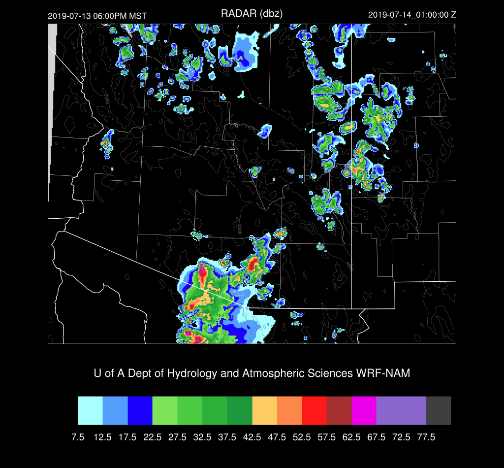
Initializations
The 500mb pattern is about the same as yesterday with a ridge centered over the Four Corners. A weak IT was noted in the upper data over north-central Mexico and another over southeastern California. Satellite imagery shows another cyclonic circulation (MCV?) moving into far SE Arizona. The larger troughs are initialized well, and both the NAM and GFS have a weak IT in the general area of the MCV. It is quite cloudy over the state due to a combination of the CA IT plus the weak MCV. Satellite trends indicate clouds are dissipating over SE Arizona, but they are hanging on over central and western Arizona. There are even a few showers in NW Arizona. The 12Z RR has the clouds and showers in western AZ but is missing clouds elsewhere. The 12Z NAM is better as it has some clouds over SE Arizona and the 12Z GFS has also initialized clouds well. PW initialization errors are minimal. The NAM and GFS appear to have the best initialization.
Day 1
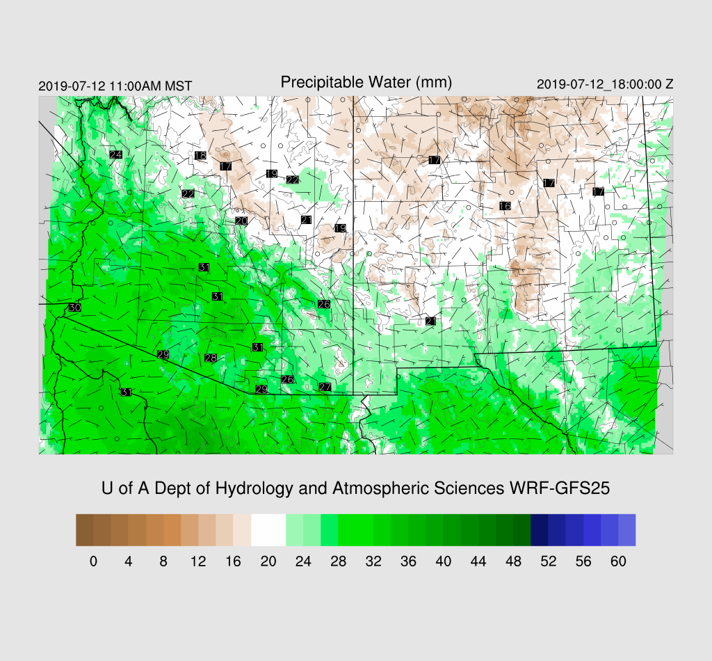
Moisture has continued to increase as wetter air moved in from NM overnight. Surface dew-points have increased into the upper 40’s and low 50’s and PW is around 25-30mm. Moisture is forecast to slowly increase throughout the morning, which I do not really see in the GPSIPW as of 16Z.
850mb Td has increased in eastern Arizona but is still below 10C so the situation for storms is better compared to yesterday, it’s still not great.

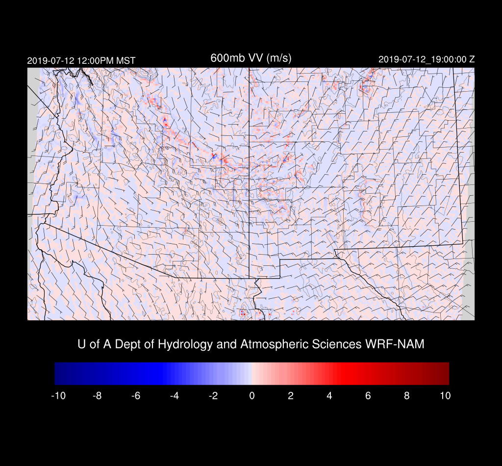
Low to moderate CAPE is present over eastern Arizona and along the Mogollon Rim and the White Mountains thus I’d expect to see some fairly strong storms especially over the high terrain.

Steering flow is mainly southeasterly at 5-15 knots. Note the IT over Nogales which may increase chances for storms over southern Arizona today.
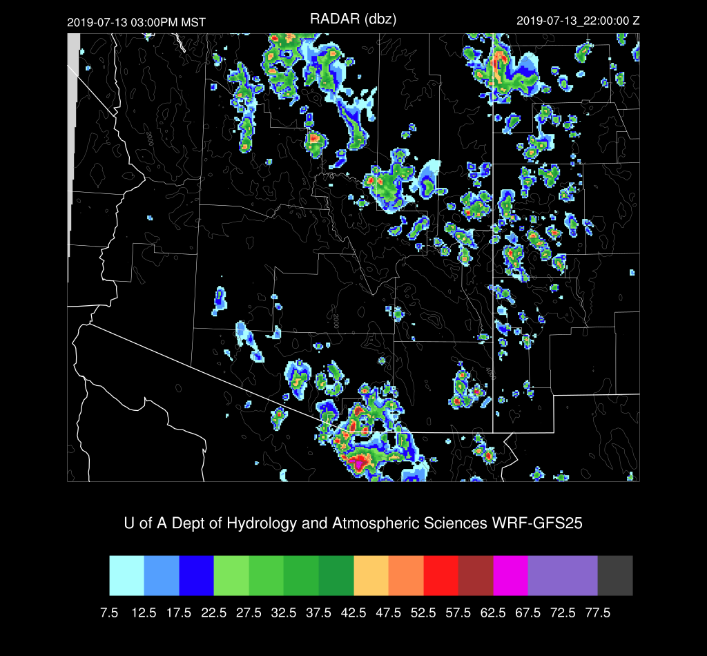
Scattered storms are underway by afternoon over the higher terrain. The WRFRR has more activity over SE Arizona. It is the odd man out as the other two runs don’t have too much activity at this time. It will be interesting to see what the 15Z WRFRR has to say later this morning especially as last year it was usually the best performing run.

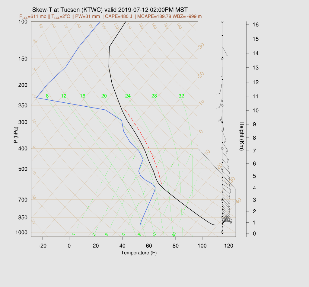
The Tucson forecast Skew-T plot displays a deep mixed layer and good SE steering winds. However, CAPE is pretty low from 200-400 J/kg but looks to be enough to support some storms.
By late afternoon, both the WRFGFS and NAM have only isolated storms over SE Arizona. Elsewhere, storms develop to the NE of Phoenix. This is the area of interest yesterday as some runs predicted strong thunderstorm outflows for the Phoenix area.

All three of the runs have outflows of varying intensity moving into the Phoenix area this evening. Haboob producing, probably not, but some blowing dust is likely.
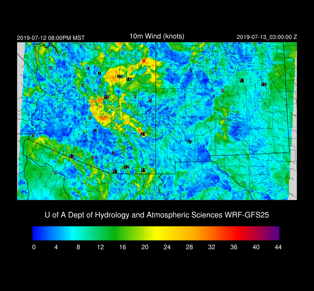
A few weak storms may pop up on the edge of the outflow boundary near the Phoenix area.

Day 2
A gulf surge gets underway by tomorrow in increases PW into much of the state. There is a tropical system quite far south of Baja which moves NW and may be partially responsible. Weak low-level easterly flow brings drier air into far eastern Arizona.

CAPE is again generally low over much of the state but enough to support higher elevation storms.
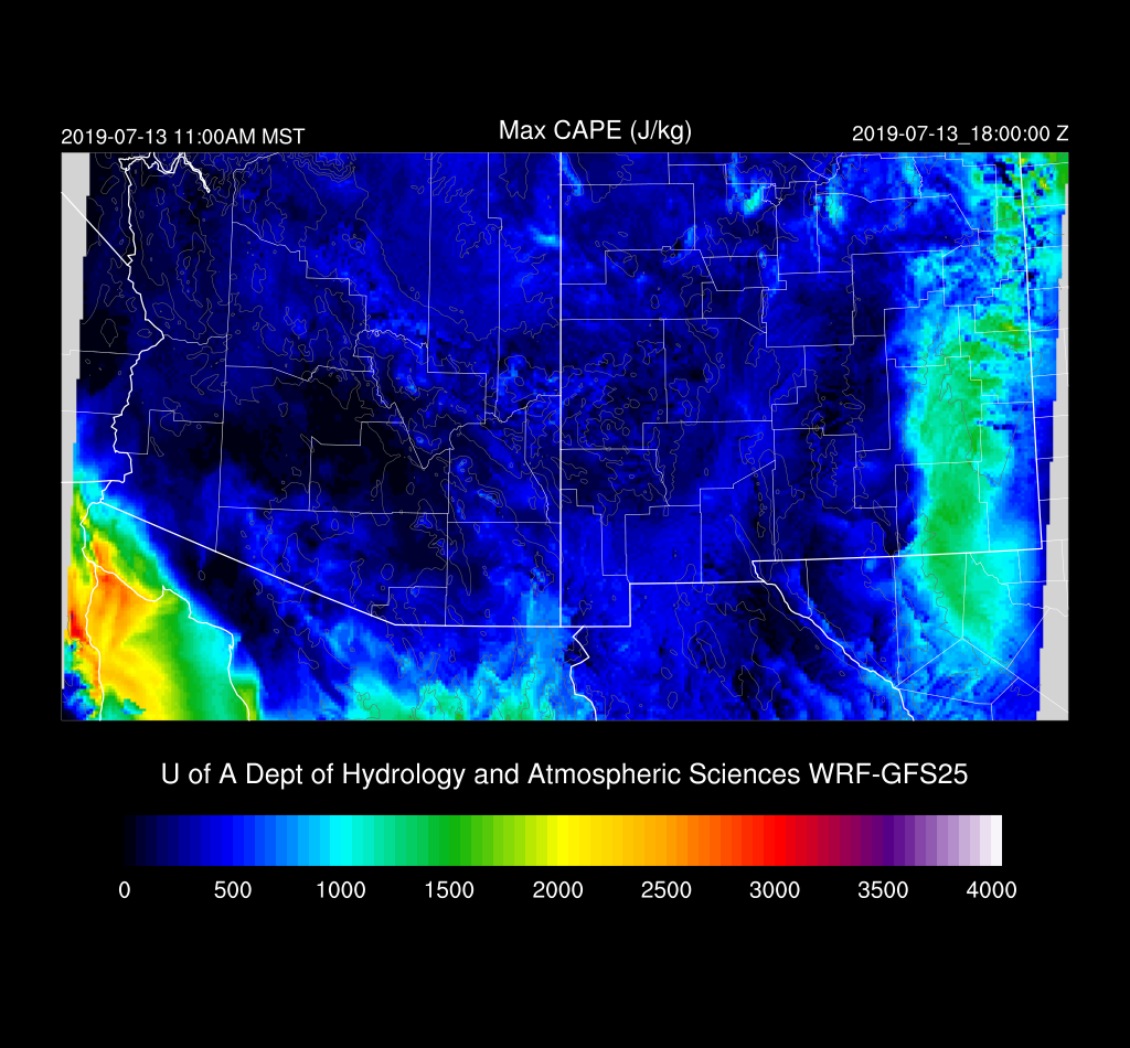
Again, just enough CAPE to support mainly higher elevation storms. Steering flow is good for moving what storms form, but it’s doubtful that they’ll make it into the lower elevations.

Once again, the Rim/White Mountains will see scattered storms. The only significant area of deep convection looks to be over far southern Arizona where an area of strong storms form as CAPE is higher there.
Will there be strong storms as far north as Tucson? Maybe.

No comments:
Post a Comment
Note: Only a member of this blog may post a comment.