Previous Forecast
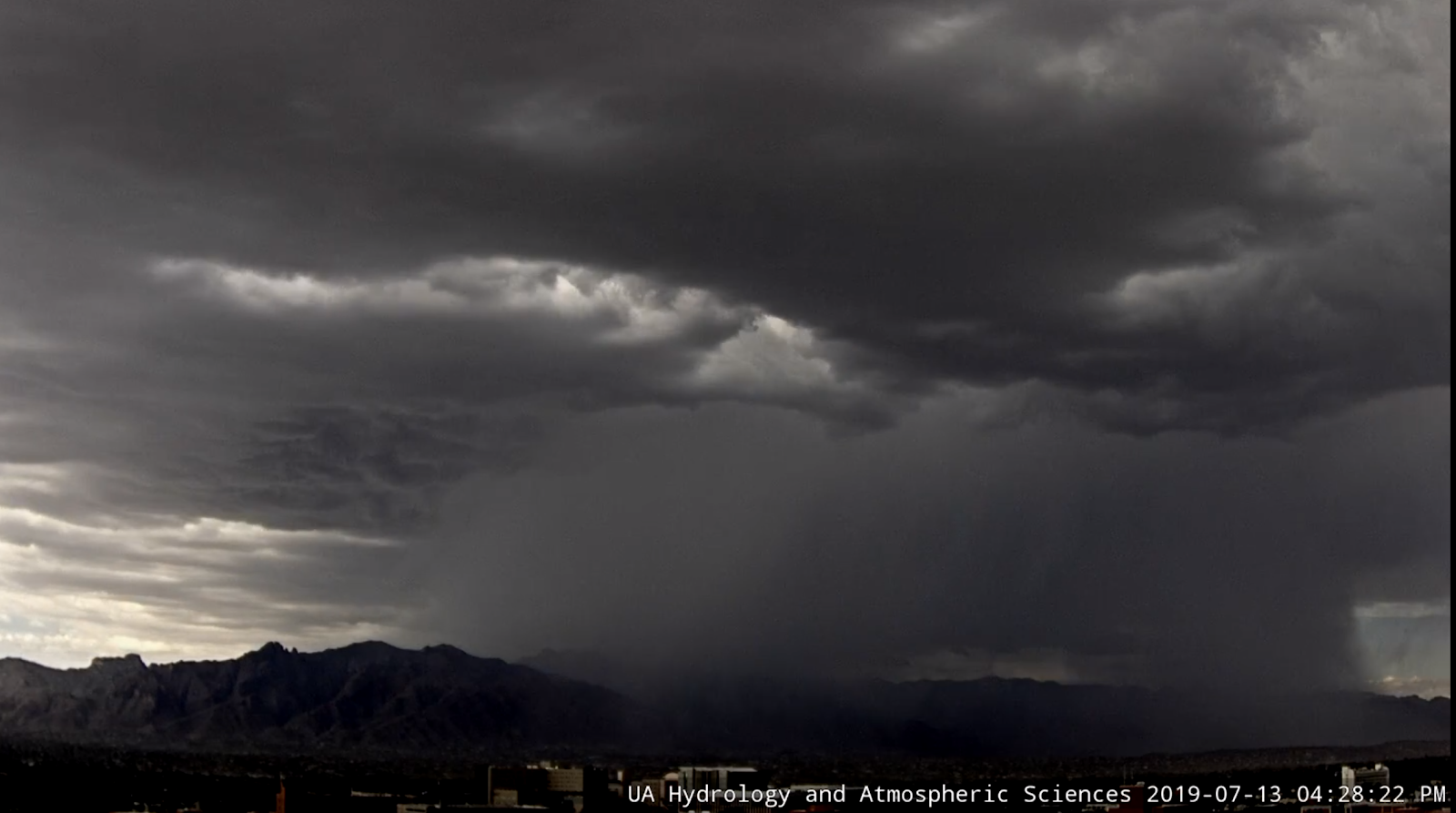
While some of the details were wrong, some of the runs verified fairly well (WRFRR and WRFNAM). Strong storms formed across eastern Pima and Santa Cruz counties during the afternoon and drifted west-northwestward. Many of the runs moved the storms into central Pima county which did not happen. The west side of Tucson had a very strong storm with a flash flood warning issued. The forecast was for a strong outflow to come in from the SW, but it appeared that storms were triggered by a strong northeasterly outflow from earlier activity over Mt Lemmon. The new cloud camera animation is here. It’s the first exciting animation of the year.


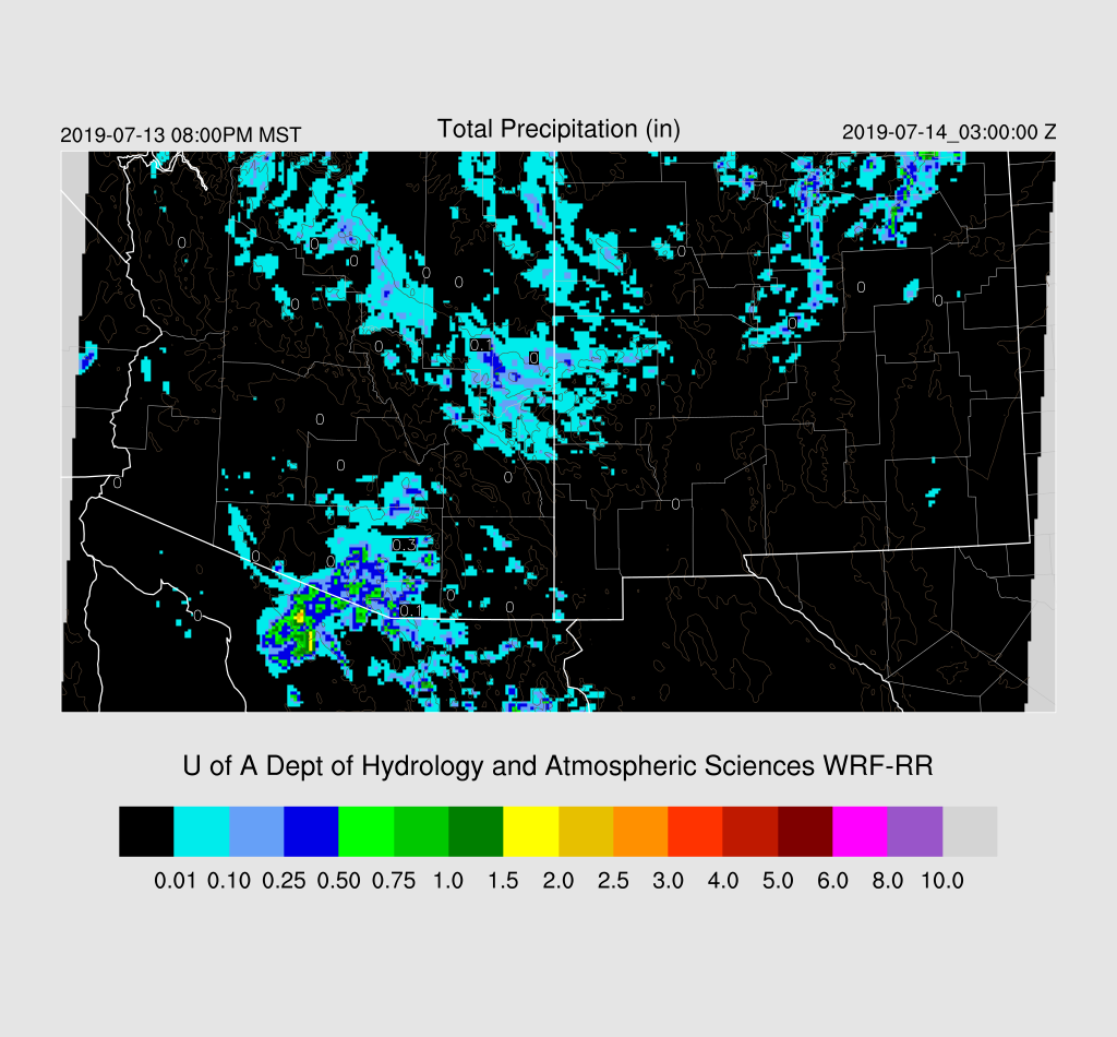
The 15Z WRFRR was best but had the strongest storms a little too far to the west. Most runs missed the evening activity east of Phoenix. The 15Z WRFRR had some, but not enough.
Initializations
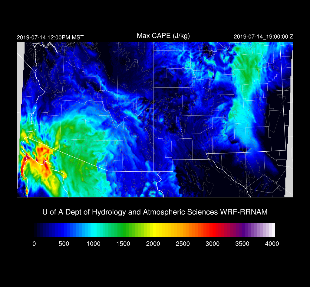
Yesterday’s runs didn’t look very promising for today, but when I looked at the 12Z data, there was a bit more CAPE at both Tucson and Phoenix than I expected. The Phoenix MUCAPE calculation was too high, but there was over 300 J/kg of MLCAPE thus just based on the soundings, there could be some activity in and/or near Tucson and probably Phoenix too.

The 500mb plot shows that the center of the anticyclone has moved a bit to the east as another trough moves into the NW CONUS. Again, a full complement of NW Mexico upper-air data. ¡Viva México! The analysis indicates a weak IT over Arizona, which may or may not exist as it doesn’t seem to be present in the wind field.

There is a significant MCV over NW Sonora with widespread clouds into SW Arizona. The rest of the state is mostly clear. Neither the 12Z RR or NAM initialized the cloud or MCV very well while the GFS had more cloud but no real circulation. The MCV is moving away from eastern and central Arizona so this error should be no factor.
The NAM had a large scale wet bias of 3-5mm over much of the SW CONUS and into NW Mexico. There were no substantial errors so the correction routine should be able to fix much of the bias. The GFS was also too wet by 3-5mm over southern Arizona into northern Sonora. Based on all of this, I’d say the WRFRR would be the favored run(s) today.
Day 1
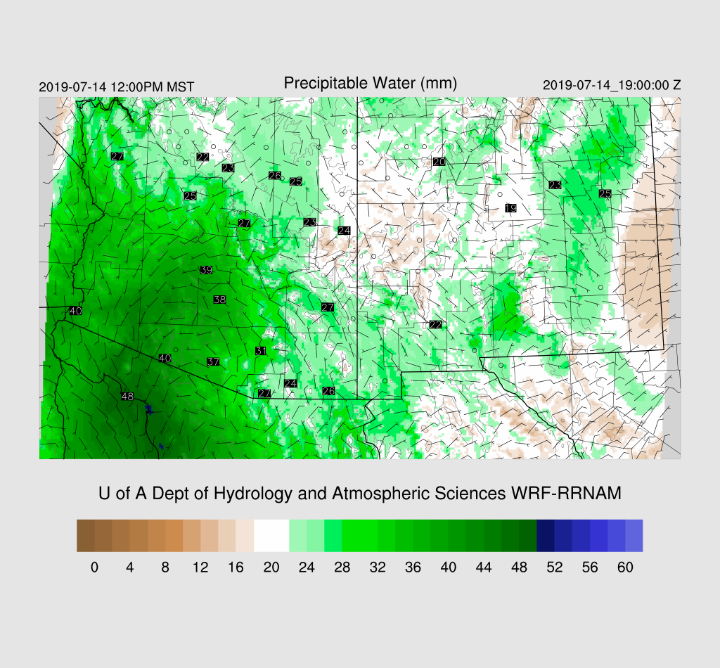
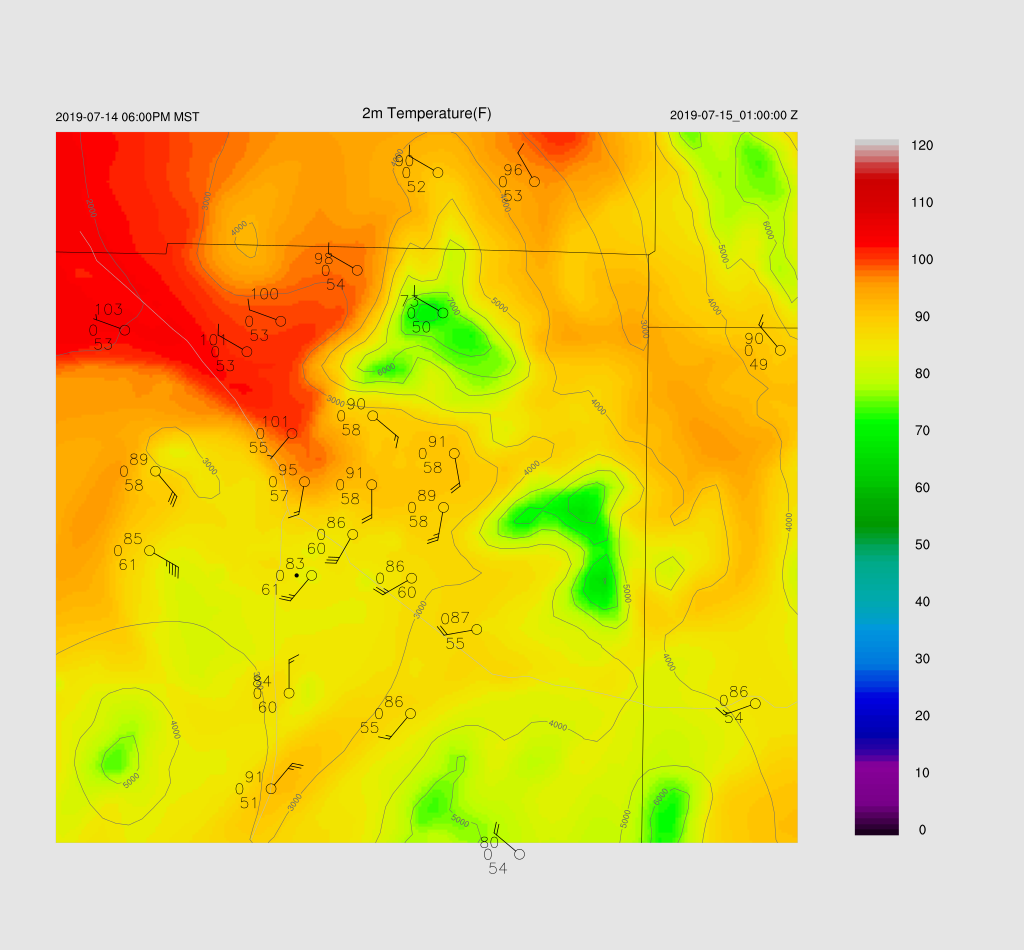
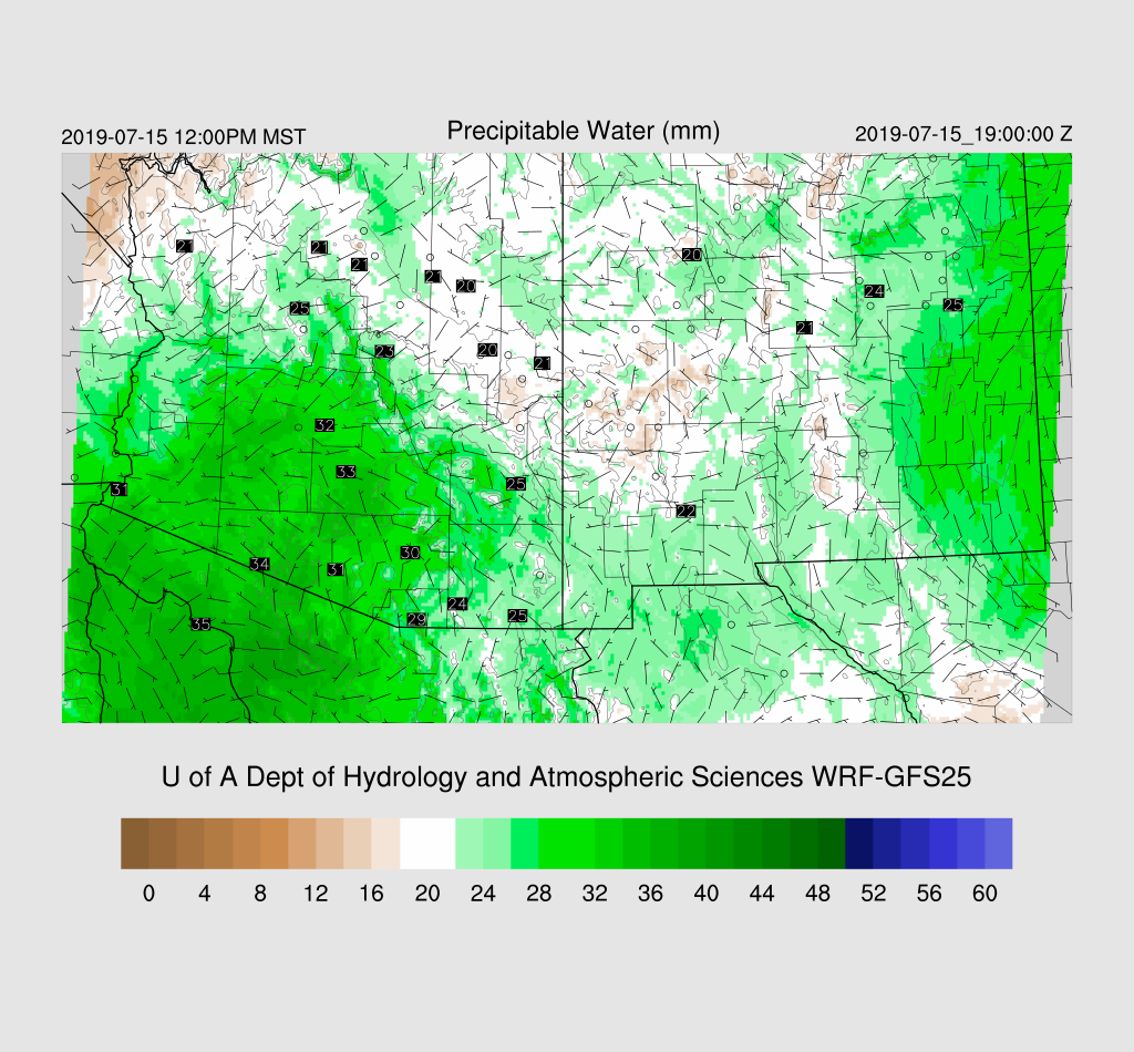
It is certainly wet at the surface as dew-point temperatures are mainly in the 60’s in the lower deserts. PW is moderate with around 30-40mm with the highest being out in SW Arizona where a weak surge continues. Yesterday’s forecast was for it to weaken today but the morning runs have it continuing. It turned out to be quite strong as moisture has made its way over much of the state by mid-day. Far eastern Arizona is still under light easterly flow which is advecting in drier air from NM.
The surge is relatively deep as it’s seen at 850mb. Also, it’s now quite wet at 850 as dew-point temperatures range from 10 to 15C by mid-day. So far, it’s looking like it might be more active today than I thought it was going to be.

Both the WRFRR and WRFGFS have moderate CAPE over much of southern Arizona today. In some ways, it’s looking much like a repeat of yesterday for southern Arizona.
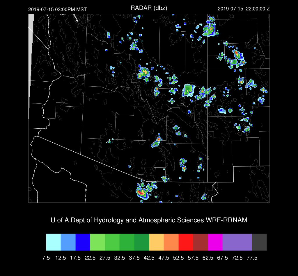
Activity is underway during the afternoon in the usual locations. Like yesterday, storms form over the higher terrain of eastern Pima and Santa Cruz counties.

There is quite a bit of CAPE in the Tucson area this afternoon as well as a good wind field with low-level NW flow and light SE steering flow. The problem is that there is a weak inversion at the top of the PBL thus some sort of convergence/lift will be needed to get deep convection going over the lower elevations of SE Arizona.

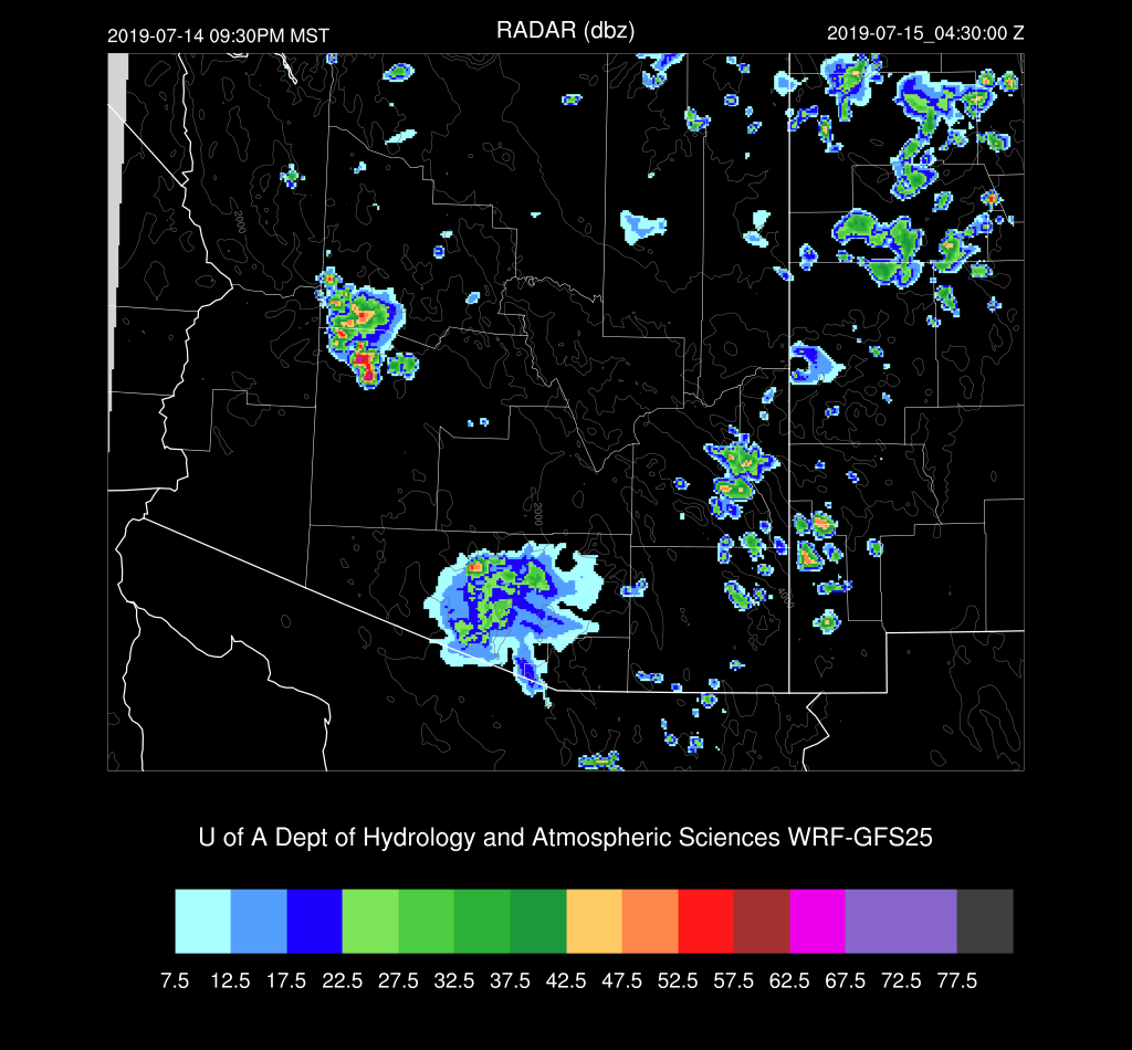
Both the WRFRR and WRFGFS become quite active over mainly central and eastern Pima county late this afternoon and into the evening. The main difference is timing as the WRFRR delays most activity until the evening while the WRFGFS is late in the afternoon.

It looks to be another active evening for the Tucson area.
WRFGFS
WRFNAM

Outflows move into Pinal County during the evening, but they don’t appear to be strong.

The WRFGFS is of interest for parts of Maricopa county as it develops some evening activity when the outflow boundary moves through. Phoenix has some CAPE to work with plus the PBL is mixed deeply. Steering is light and variable so storms will have to form in place and won’t go far once underway.

A few storms may pop up west of Phoenix later this evening. It’s not a high probability event as only the WRFGFS develops storms.
This just in from the 15Z WRFRR….It has quite a bit of activity in eastern and central Pima County this evening as well with some storms being very strong to severe.
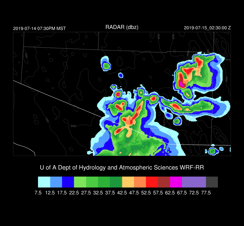
The 15Z WRFRR produces a much strong outflow boundary that moves into Pinal County later this evening.

Day 2
The surge weakens and PW decreases, but it’s likely that the higher terrain will see afternoon showers and storms again.
CAPE is mainly low over much of the state thus a less active day.

Only isolated activity is expected, even for the high elevations.
No comments:
Post a Comment
Note: Only a member of this blog may post a comment.