Previous Forecast
Model forecasts were all pretty good, and the forecast of outflows into the Phoenix area did occur but were weak. Also, some weak showers/storms formed in Maricopa and Pinal counties which was also forecasted. Below is an image from NSSL’s newest version of MRMS web site which Ken Howard kindly sent me. This is the Q3 Multi-Sensor product which as you can see, has coverage into Mexico.


Initializations
The morning 500mb map is again similar to the past few days as the 500mb anticyclone continues to be centered near the Four Corners, thus placing Arizona in favorable southeasterly flow. A broad, but weak inverted trough, is over north-central Mexico, The 12Z runs have a weak trough over the central Gulf of California which I can’t find any evidence of in any data. There a weak MCV and associated clouds and some showers over west-central Sonora which is moving WNW. Debris clouds from the overnight Mexican MCS are over south-central Arizona. The NAM is missing these clouds while the other two have some, but not enough, thus the WRFNAM will likely be too active. It all depends on how fast the clouds move out and/or dissipate.

Both the NAM and GFS are generally 2-3 mm too wet over much of Arizona while the RR has only minimal PW errors. Overall, I think the WRFRR will most likely be the better run and the WRFGFS is OK too as it had the best coverage of clouds.
Day 1
As was being predicted yesterday, a gulf surge is now underway as winds at Yuma are southeasterly at 20 knots and the Td is 68. It’s shallow as PW has risen only slightly. The surge is an outflow surge from the NW Mexico MCS. Moisture has also increased over far southern AZ as PW has increased to nearly 35mm at Amado and Organ Pipe. The surge continues during the day today which continues to advect moisture into south-central Arizona. Also, low-level dry air is moving to the west from NM which is setting up a low-level convergence zone along the Pima-Cochise County line. Note the plume of highest PW curls around into eastern Pima county.
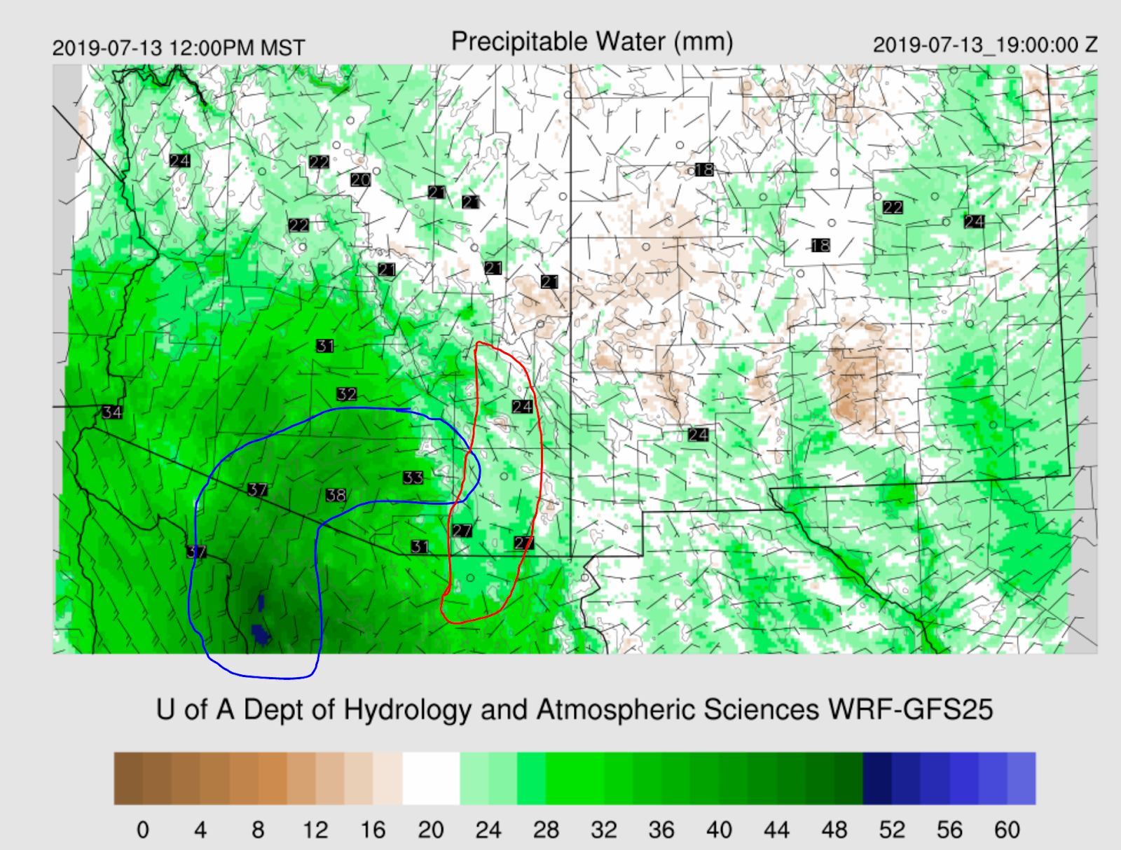
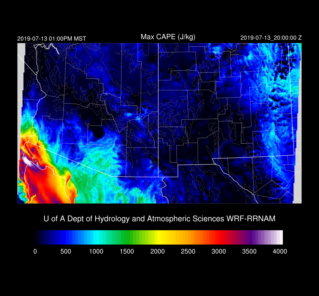
This plume is also seen on the Max CAPE plot with some areas approaching 1500 J/kg. Those areas in Santa Cruz and central/eastern Pima county is going to be the hot spot for convection this afternoon.
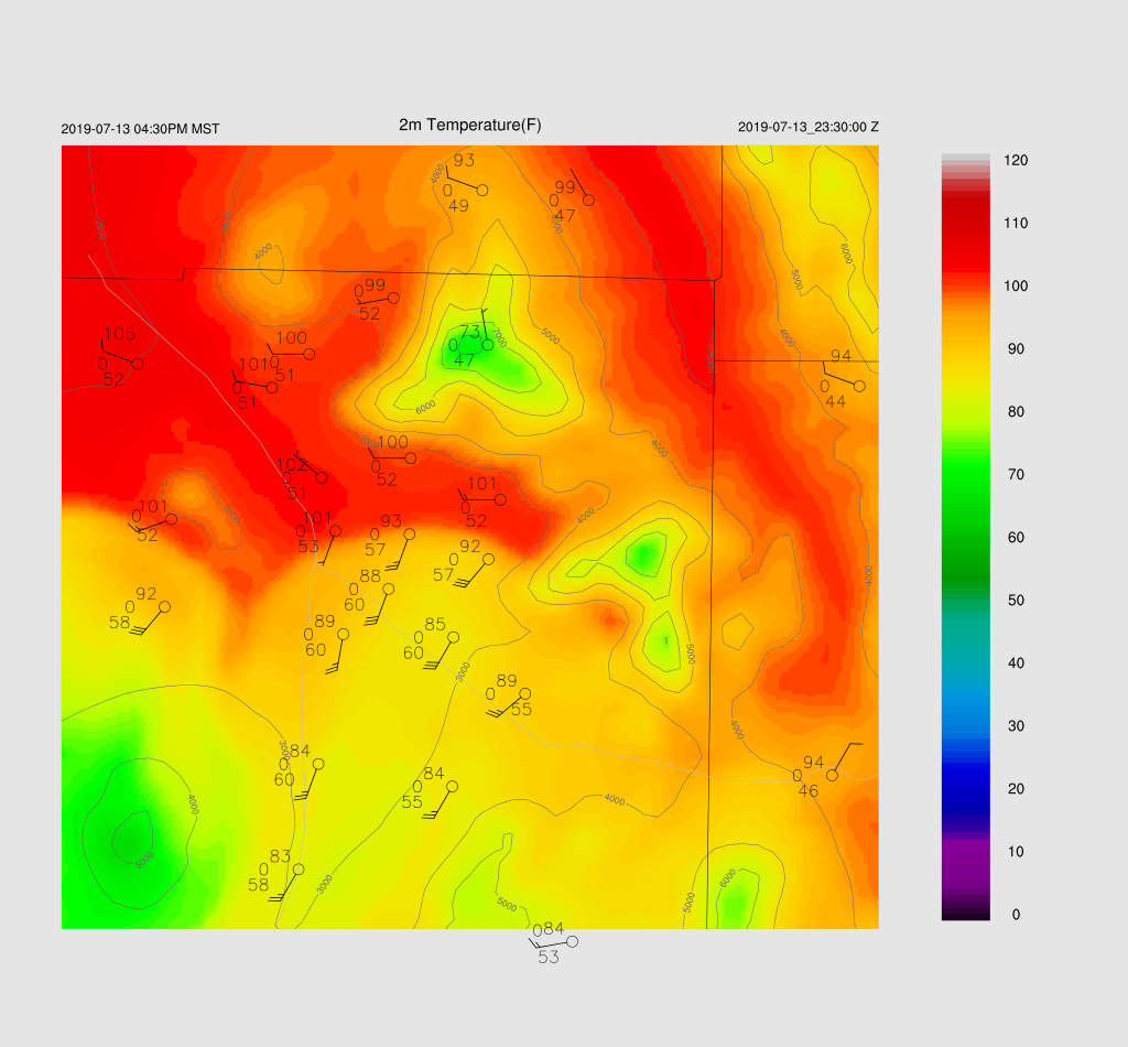
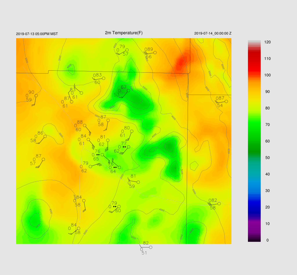
The three 12Z runs don’t agree at all for this afternoon. The most active is the WRFNAM as it incorrectly has full heating today. The middle of the road is the WRFRR which is probably still too active due to too much morning heating. It develops very strong storms right along the border. (checking forecast 2m temperatures at 18Z, I see that the WRFRR is pretty close to observed)

The WRFGFS has hardly any activity. Looking closely at the PW forecast, I see that the WRFGFS is 5mm too dry at Amado and 3mm at Tucson. While I think the WRFGFS is not going to be active enough, I can’t entirely discount it. (as of 18Z, it is also too cool over Santa Cruz county)
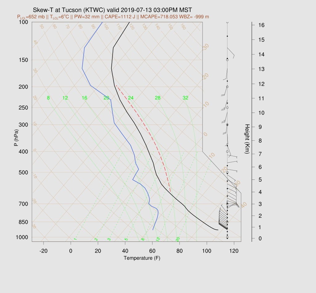
Tucson has quite a bit of CAPE (WRFRR) this afternoon with surface-based CAPE above 1000 J/kg. I did more or less fix that calculation by moving the location of the “surface” out of the super adiabatic layer for the CAPE calculation. The wind profile is good with both low-level moist NW flow plus good easterly steering. However, note the weak cap on top of the fairly shallow (for AZ) mixed layer. Tucson will need a strong outflow to trigger deep convection.
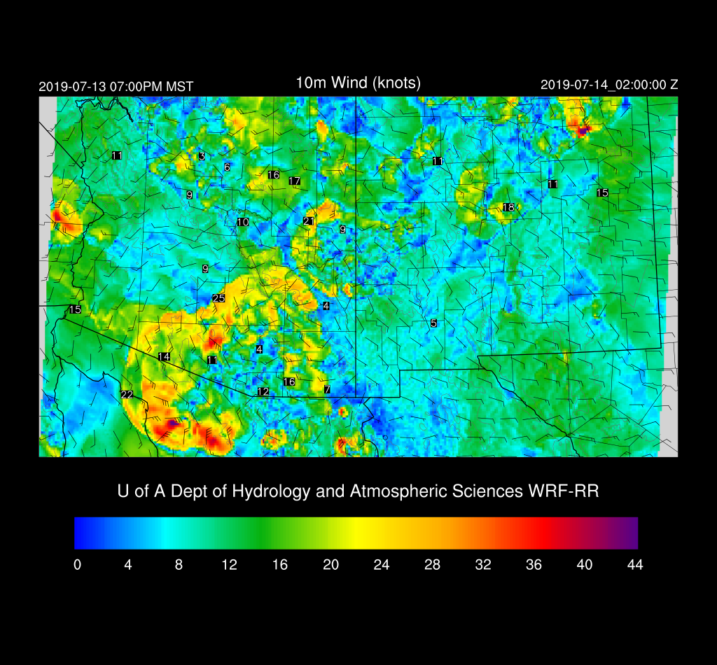
Both the WRFNAM and RR move a strong outflow into the Tucson area by late afternoon.
A few storms do pop up around Tucson during the early evening hours but nothing widespread. The main area of deep convection moves into Mexico.
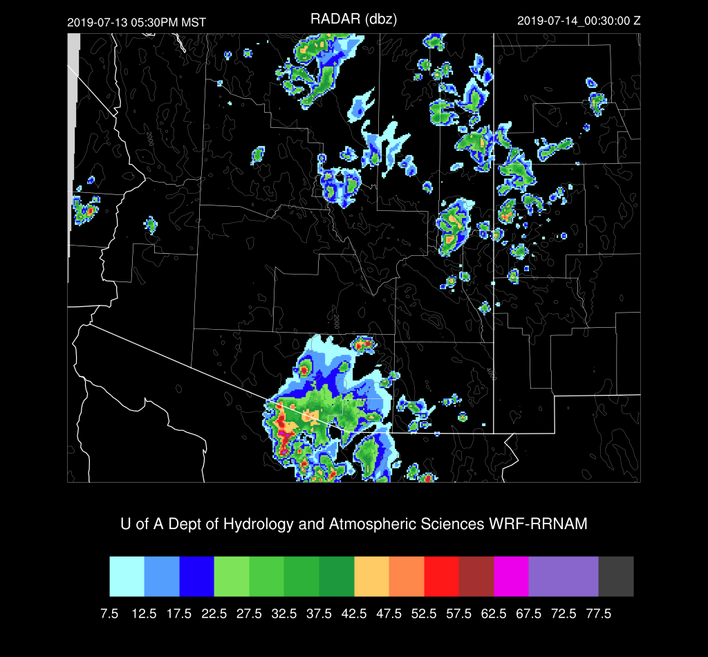
The chances for a significant outflow and resulting dust storm of Pinal and Maricopa Counties is low as only the WRFNAM has this result.

I’ve been waiting for the delayed 15Z WRFRR, and it’s very interesting. It has a bit more clouds than the other runs but still not enough, but heating is close to observed at 18Z. It develops very strong storms on the outflow boundary as it moves through Tucson.

This run moves the weakening outflows into Pinal county during the evening and should be strong enough for some blowing dust.
Day 2
Moisture increases over much of central and western Arizona, but the surge weakens.

CAPE increases as well with moderate to high CAPE over south-central and southwestern Arizona.

The Phoenix forecast vertical profile forecast has only a shallow layer of moisture as well as a weak inversion. It’s likely much of the moisture mixes out during the day and CAPE decreases.

The Tucson forecast has a moderate amount of CAPE, good winds, but the PBL mixed very deeply.
Most afternoon activity stays over the higher terrain near the border and over the Rim/White Mountains.

The WRFGFS does develop a few storms in southeastern Arizona during the evening hours, but I wouldn’t bet money on it.

No comments:
Post a Comment
Note: Only a member of this blog may post a comment.