General Discussion
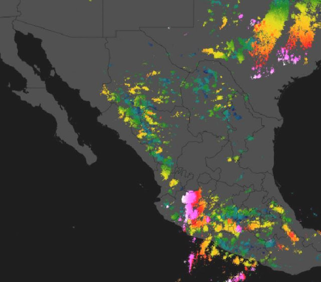
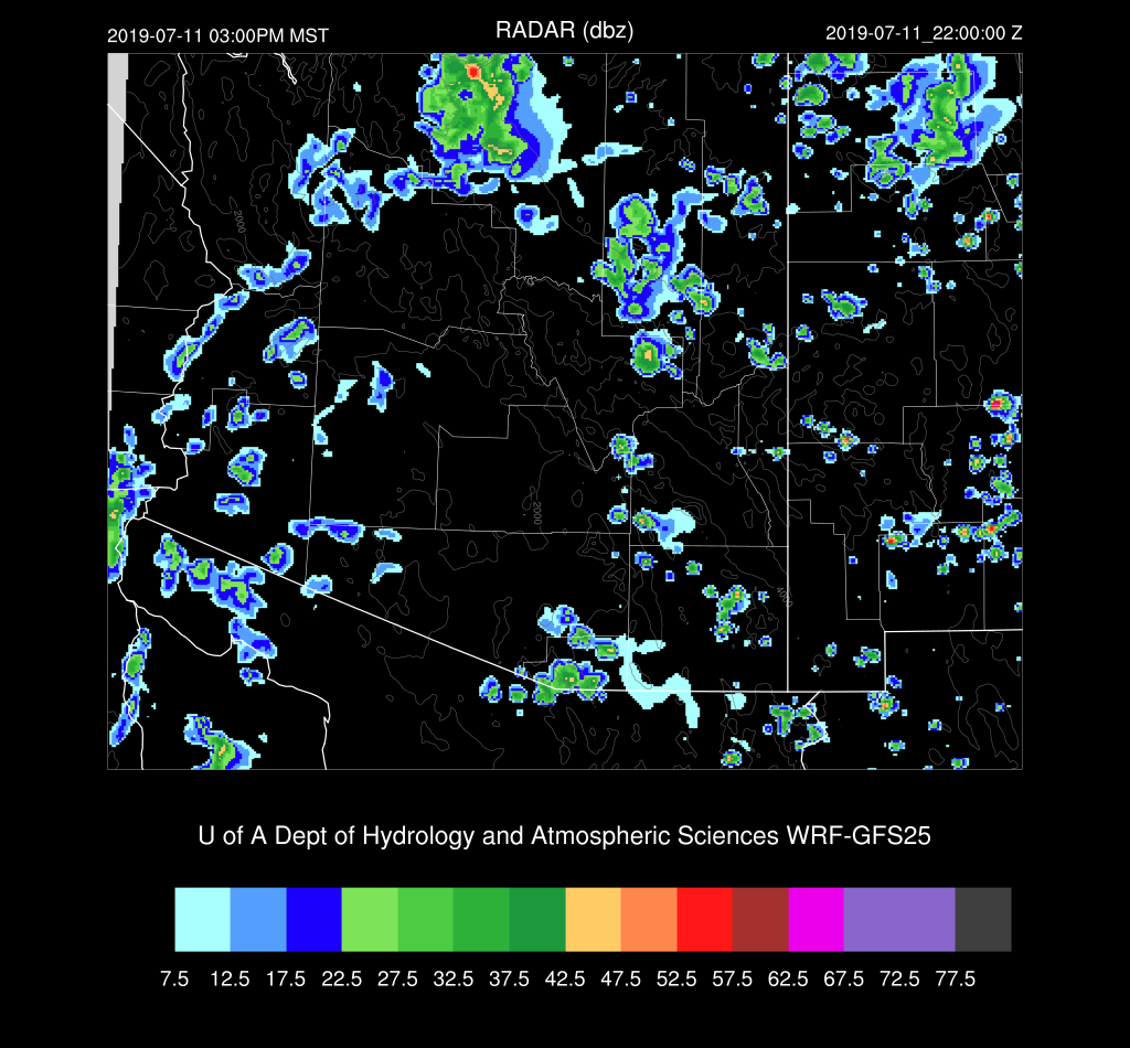
These forecasts discussions sure have been few and far between so far as the monsoon continues to sputter. It’s just not us as far NW Mexico hasn’t had much activity either, and the outflow from Mesoscale Convective Systems there play an important role by increasing the moisture in Arizona through either direct outflows or northern Gulf of California outflow induced surges. What storms there have been in NW Mexico have been restricted to far southern Sonora at best and not well organized and stuck over the higher terrain as depicted below in the past 24 hours lightning plot. So, to me, it looks like it’s still going to be some time before the monsoon cranks up.
Model Initializations
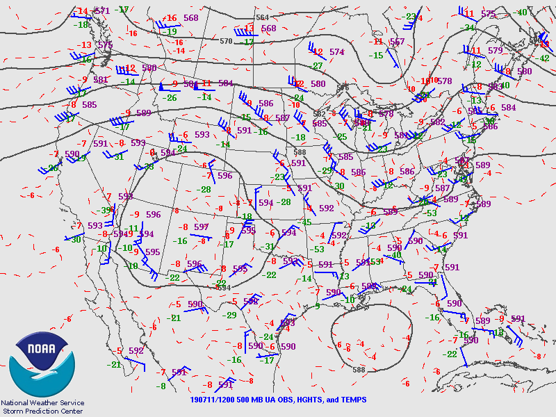
The 500mb plot from 12Z sure looks like a classic monsoon pattern with the anticyclone located near the Four Corners, it sure isn’t turning out that way. One issue is the strong subsidence around the nearly 6000m high center. There was a substantial area seen over eastern NM in the “low-level WV” GOES channel. No significant inverted troughs were evident in either the 500mb plot or satellite imagery. An area of clouds is present over western Arizona and south into Mexico which may be the result of a weak trough. Model initializations have a weak inverted trough over southern Baja which may or may not be there. Empalme SON sounding data was missing this morning.
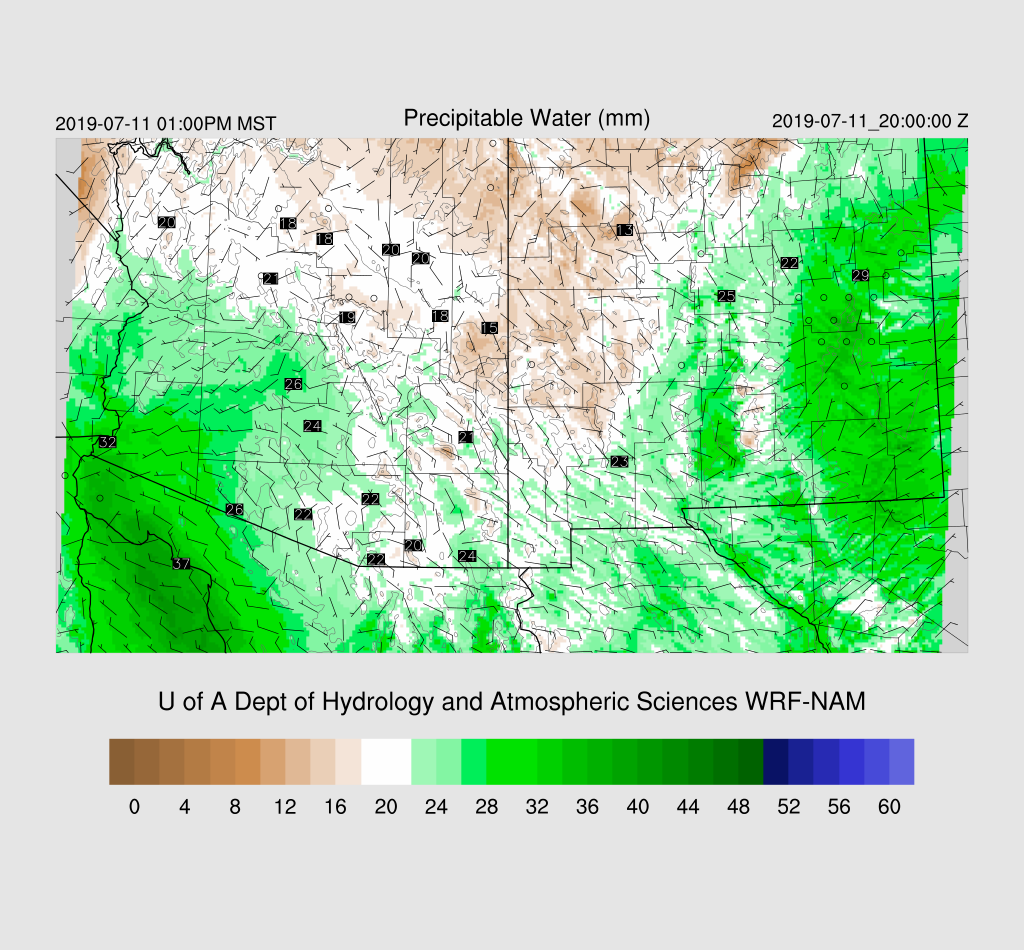
All three (RR, NAM, and GFS) had only minimal PW initialization errors this morning. The RR did not have enough clouds initialized in western AZ while the GFS and NAM were very good. Maybe the 15Z RR will be better. In any case, that error should not matter as no activity is expected for that area. Generally, all initializations are good, and model confidence is high.
Day 1
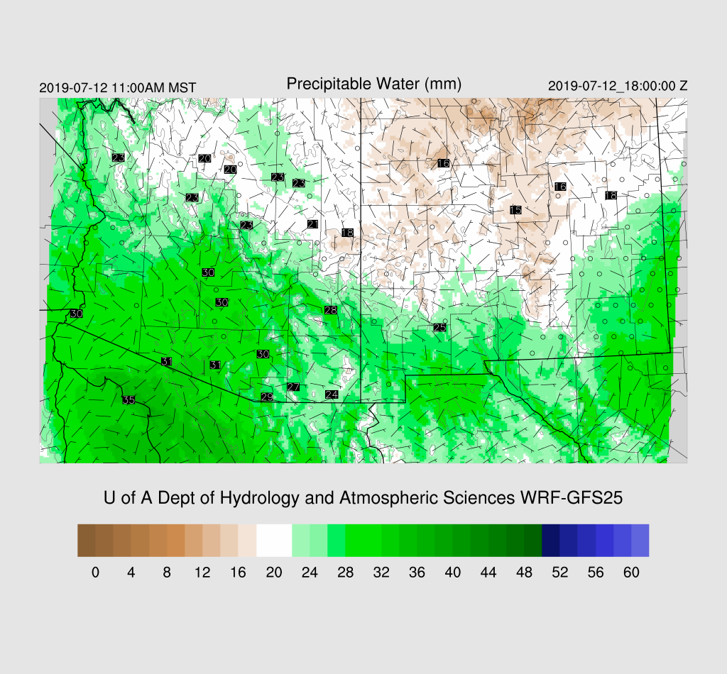
Moderately wet air is present over western Arizona by mid-day while much of eastern Arizona and western NM are quite dry as that area of subsidence in NM moves to the west. However, quite wet air is moving into central NM and is likely to be a factor for Arizona tomorrow.
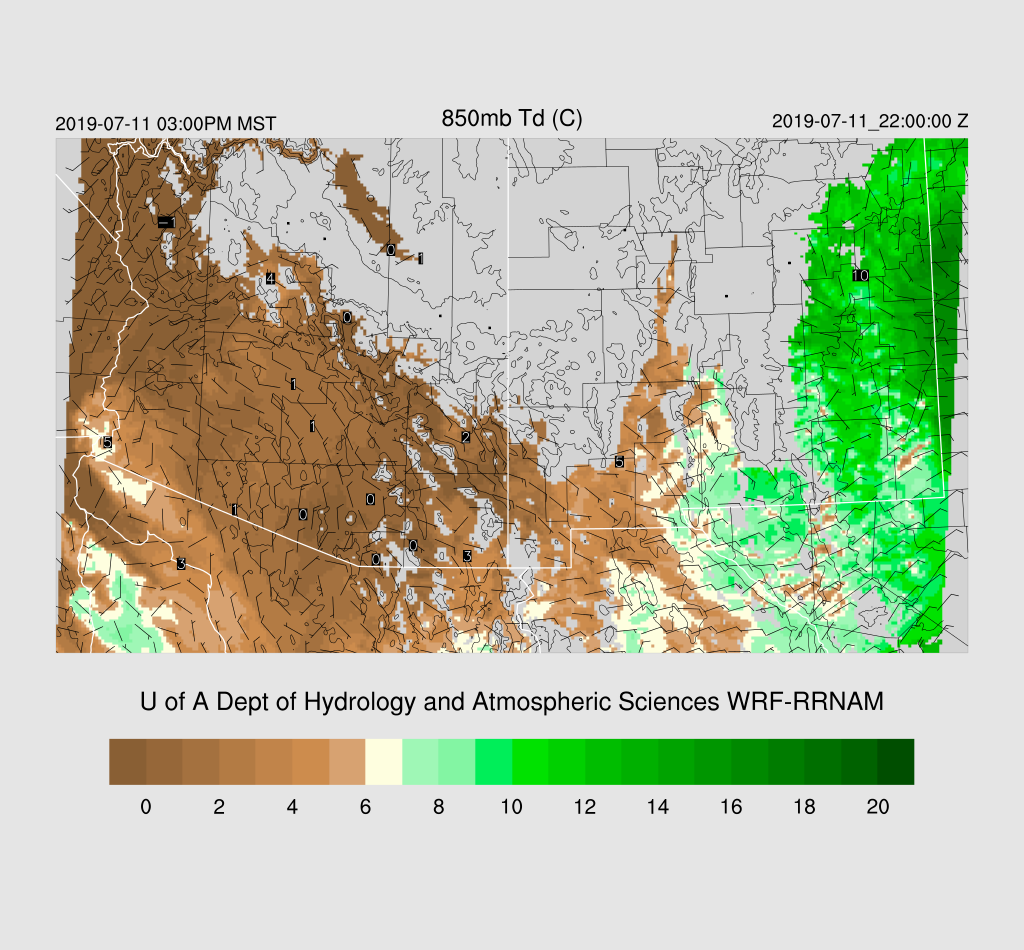
Way too dry at 850mb to support any significant lower elevation activity today or into this evening.
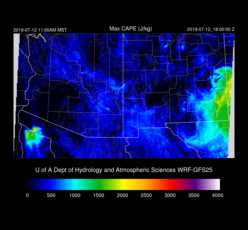
There is a bit of CAPE in the WRFGFS and WRFNAM over far eastern Arizona and along the Rim this afternoon which will support some showers and weak storms which will result in some gusty winds but not much/any rain.
Tucson may see some gusty outflow winds from nearby higher elevation storms this evening.
Day 2
The area of moisture in NM moves into SE Arizona while weak moisture advection continues into western and central Arizona.
Enough CAPE is present to support scattered showers and storms over much of eastern Arizona and along the Rim/White Mountains during the afternoon and evening.
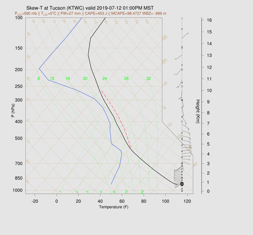
The forecast Skew-T plot for Tucson indicates there is a little CAPE present and might enough to support a few lower elevation storms. Please be aware that the Skewt-T CAPE calculation and positive area have been especially wrong this year after transitioning to 43 sigma layers and I’m looking at the problem, again. The Max CAPE is OK but can’t be used to plot the positive area. Steering flow is suitable for moving storms off the higher terrain.
Storm coverage and intensity are on the upswing, and by afternoon, scattered storms are underway over the higher terrain. The WRFRR is in the middle of the road of the three runs.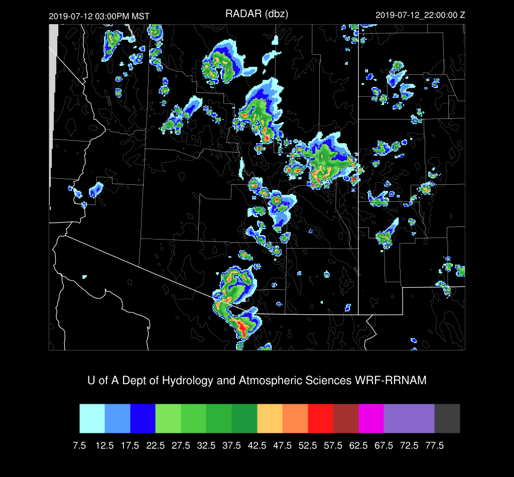
The WRFGFS is more active over far southern Arizona, but it still looks like the stronger activity stays out of Tucson.

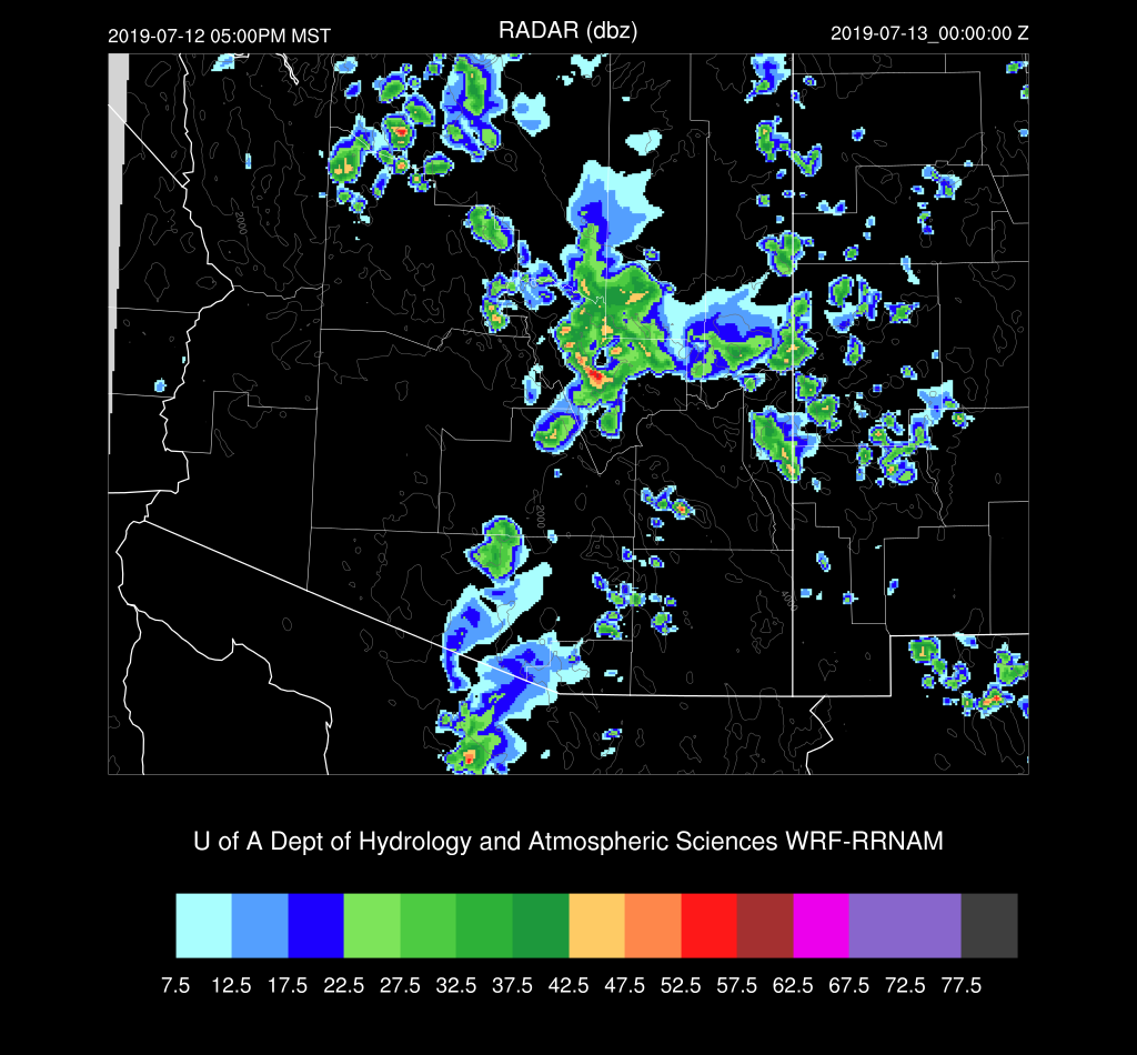
By late in the afternoon, a few storms do move towards the Phoenix area, and you know what this means!
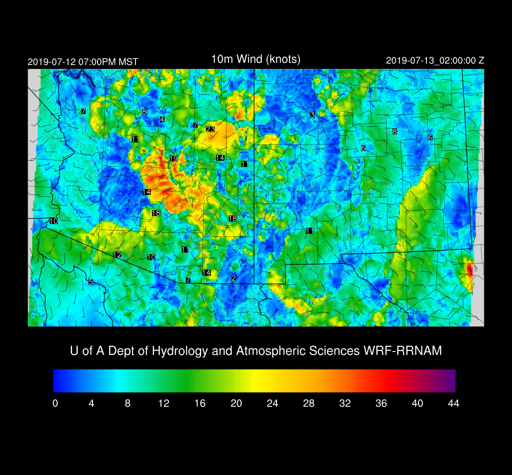
Haboob! It’s not especially strong nor does it move that far into the western deserts, but at least it’s something.
No comments:
Post a Comment
Note: Only a member of this blog may post a comment.