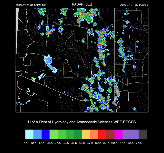
It was a widespread light to moderate precipitation event for Arizona yesterday with some isolated areas receiving substantial rain. About the only place that didn't see much rain was Tucson. It was suppressed much of the day due to the proximity of the MCV and later, anvils and cooling outflows. Just now (16Z), it's finally raining here on campus.
The 12Z runs didn't have enough precipitation, especially around the Phoenix area. The 15Z WRFRR turned out to be OK but didn't have quite enough activity over southwestern Arizona and too much for parts of SE Arizona, including Tucson. It was a difficult day due to the uncertainty due to the MCV and the lack of its initialization.
Initializations
Model confidence isn't going to be any better today, that is for sure. Morning clouds and scattered showers and storms are over most of the state except for the far eastern portions forced by some sort of cyclonic circulation. I think it is an MCV, but I don't think it's the same one from yesterday.
The IT is over western Arizona and down towards the northern Gulf of California, which is resulting in moderate mid-level southerly to southeasterly winds over the state.
The NAM and RR have initialized the MCV well, but the GFS has it too far north in Yavapai County. None of the 12Z initializations has the clouds and showers initialized correctly. The RR is least bad, but it's missing all of the Tucson activity. I'm afraid that the 12Z runs aren't going to be of much use today, except for far eastern Arizona where their initializations were best. Maybe the 15Z RR will be better? I'll include it later in this discussion.
Day 1
The airmass over Arizona is extremely moist with PW values from 45 to 50mm over the low elevations. High PW continues into the afternoon.
Moderate to high CAPE is present over much of southcentral and southeastern Arizona. It looks likely for strong storms with very heavy rain for areas that receive decent solar heating.
The WRFRR seems to have the right idea as it develops scattered storms by early afternoon over eastern Arizona.
It is a nice looking vertical profile at Tucson with some shear and good steering flow along with plenty of moisture and CAPE. The PBL doesn't need to be mixed too deeply for deep convection, but that is going to be difficult as it's been cooled even more so than shown here. Tucson is going to need some sunshine plus some outflows, and that is likely to not be sufficient. Also, anvil shading may be a problem if convection forms first over the high terrain to the south.
Activity continues into the late afternoon over parts of southeastern Arizona. Some of these storms are very strong and will produce very heavy rain.
Moderate mid-level flow pushes the storms along, so only a few spots have over 2 inches.
The 15Z WRFRR is now available, and it does have a bit better cloud initialization. It looks similar to the 12Z run as it develops some strong storms over SE Arizona mainly over higher elevations. It looks like anvil shading from the south does occur over Tucson resulting in suppressed convection. Most SE Arizona activity is over by this evening, and it seems like another goose egg for Tucson.
Some drying takes place, but it's still plenty moist thus storms that do form are likely to produce very heavy rain.
A broad trough in the westerlies moves to the east which places most of the state in southerly flow. 500mb temperatures are a bit lower; thus, conditions may be a bit more favorable for deep convection.
CAPE continues to be quite good as some areas are around 1500 J/kg.
The bad news is that convection is typically suppressed on the backside of an ejecting IT and that seems to be the case tomorrow. The model skew-t diagrams from Phoenix and Tucson both indicate only shallow afternoon PBLs and mid-level drying due to subsidence.
Only far eastern Arizona sees much activity tomorrow afternoon.


No comments:
Post a Comment
Note: Only a member of this blog may post a comment.