Previous Forecast
Not much to say about yesterday as there wasn’t much activity. The WRFGFS and WRFRR did the best job, at least in NM and AZ.
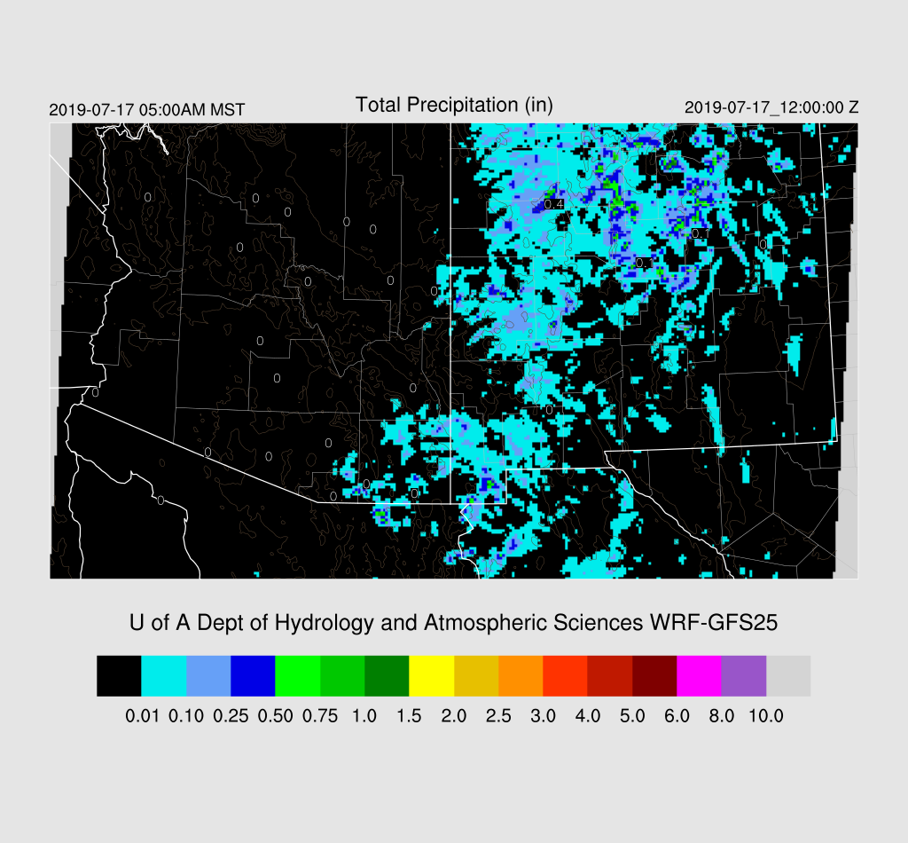
A large and long-lasting MCS developed overnight in Sinaloa and then moved/developed into Sonora. I looked at how the outer domain did as these features can really impact our next day weather due to clouds and moisture surges. The WRFGFS (below) was not very good as it had only scattered deep convection.
The WRFNAM was a bit better, but the best was the WRFRR. Still, it looks like even the WRFRR didn’t have enough activity and some time in the future I’m going to look at either increasing the outer domain resolution or another high res domain over NW Mexico to see if it helps improve the day 2 forecast for Arizona.
Initializations
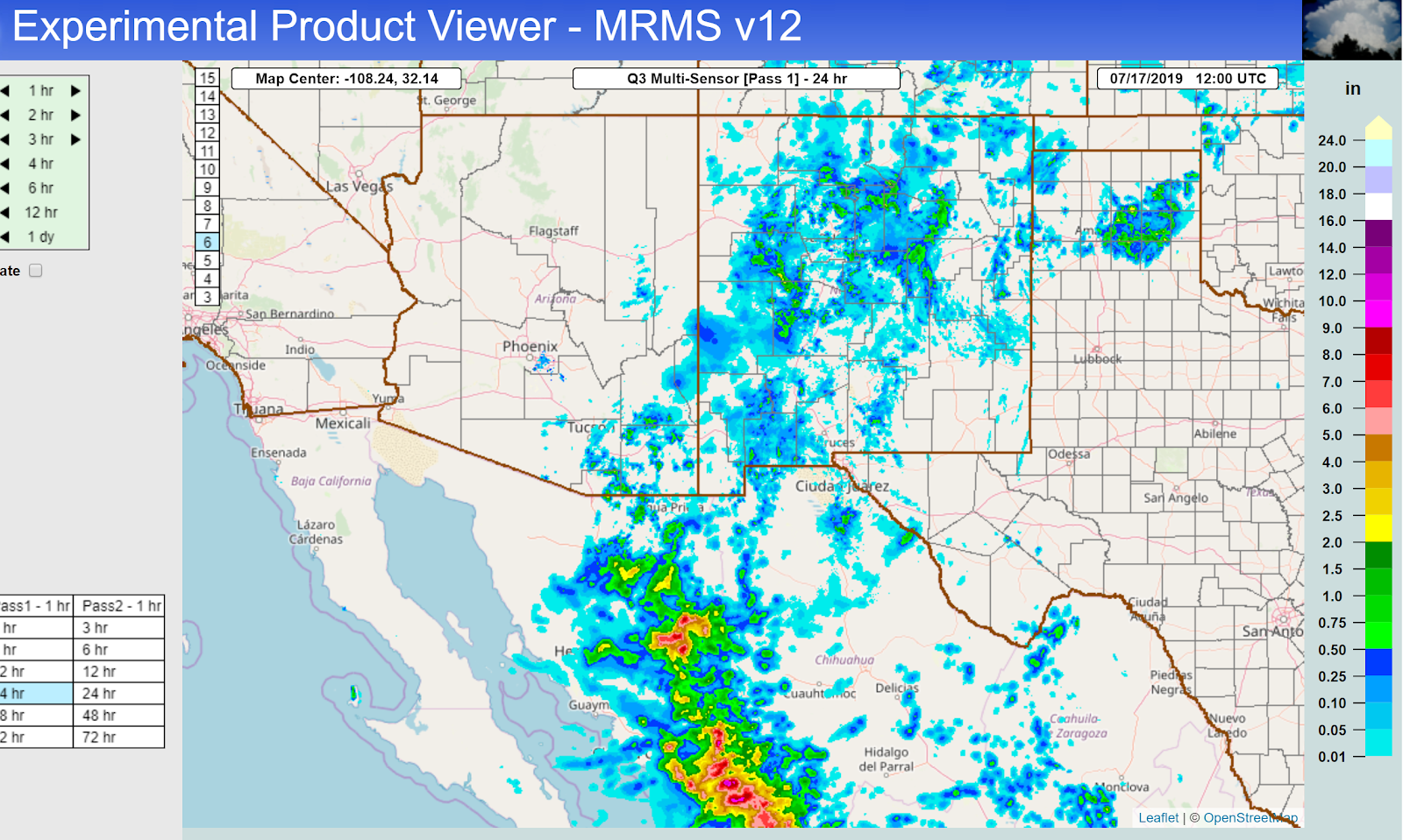
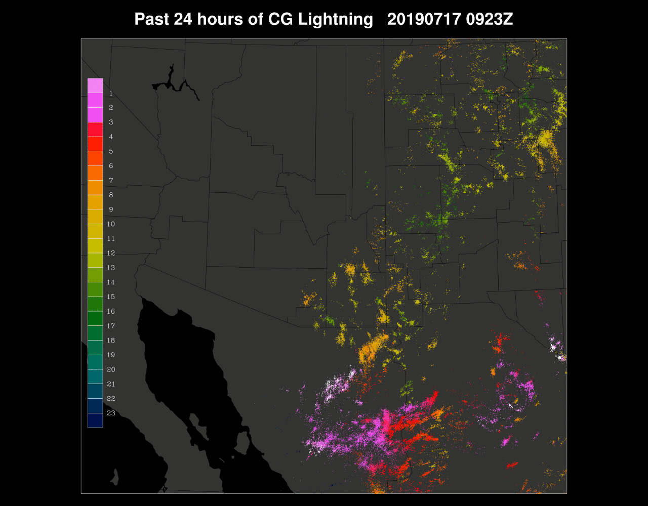
The big MCS (best of the year so far) has left behind a large area over southern Arizona and even a few showers/storms developed in central Pima County this morning. Most of the clouds are thick cirrus, and they continue to dissipate; thus, heating may not be reduced that much. A large MCV is spinning roughly over Hermosillo as well as another MCV or IT over the south-central Gulf of California. It’s a complicated mess!

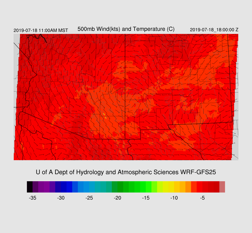
The 500mb map has a weak trough along the west coast that has turned mid-level winds to the SW. The big issue is the possibly anomalous 35-knot wind at Empalme which was probably from being in the vicinity of one of the MCV’s and storms.
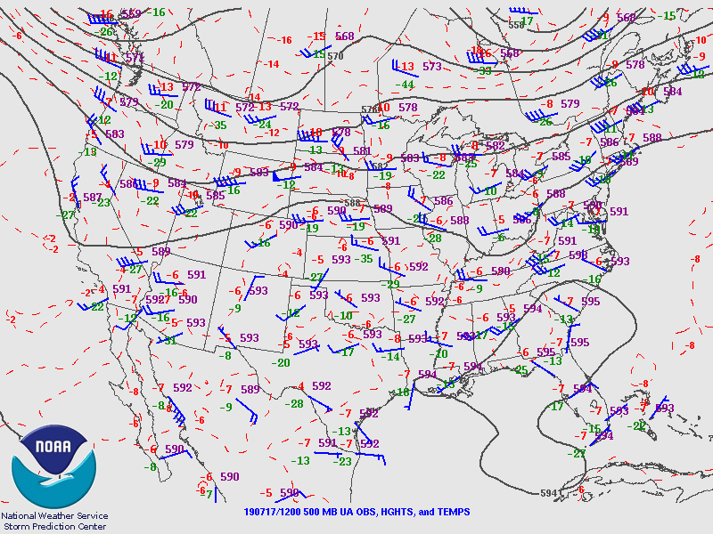
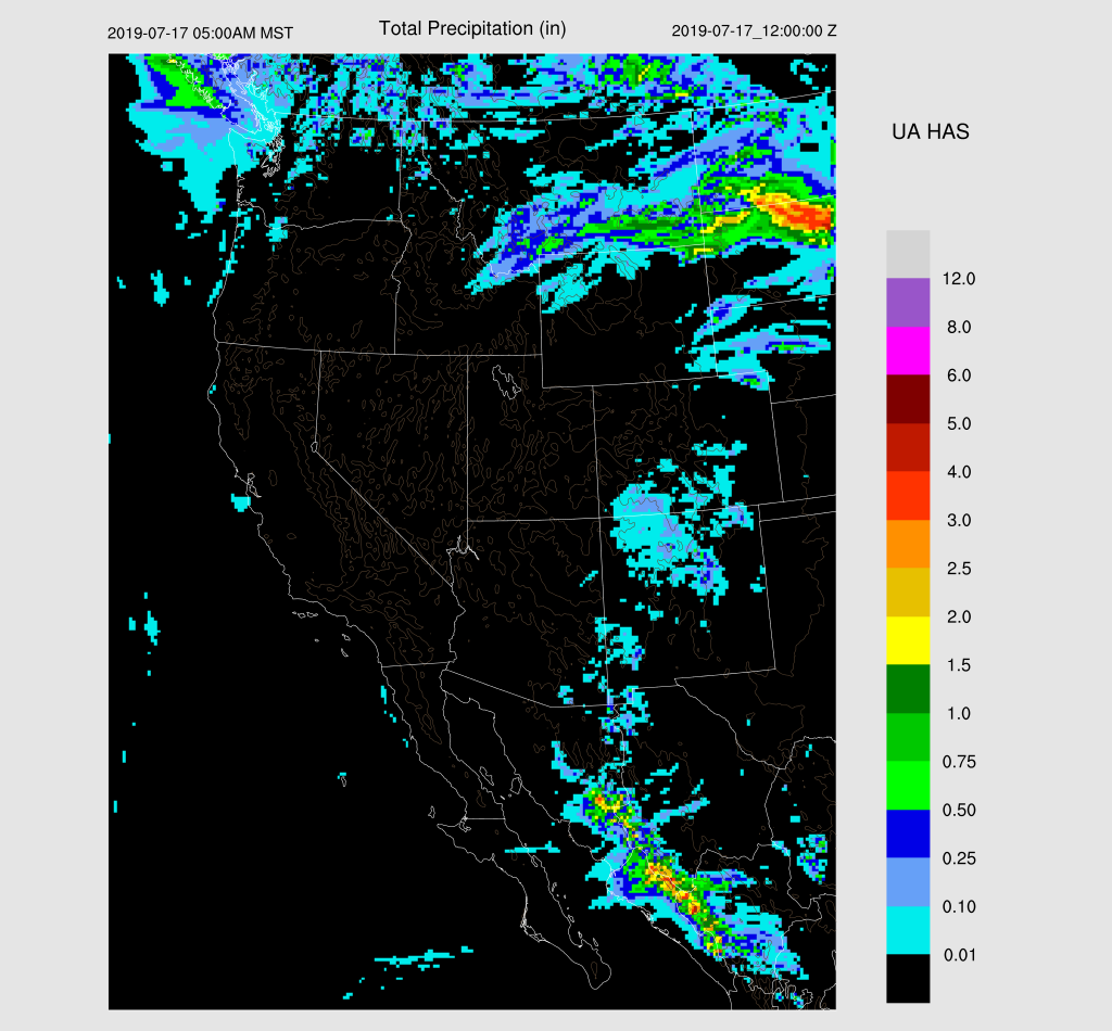
12Z RR clouds were not initialized well as there was not nearly enough coverage. The NAM cloud initialization was actually quite good as was the GFS. The 12Z RR really struggled with the dual circulations as the northern one was very weak while the southern one had 20-35 knot winds, thanks to the nearby sounding data. The NAM was better as the northern one was stronger and the southern one weaker, but still too strong, IMO. The GFS was similar to the NAM. WRFNAM below.

Another problem is that the PW initialization in NW Mexico was very poor. The NAM was too wet by 12mm in Sonora. Part of this might be localized drier air post convection, but all of this makes the confidence in the WRFRR and WRFNAM quite low. The GFS errors were much smaller and were actually not bad. We’ll see later this morning if the 15Z RR improves, but at this point, the WRFGFS should be the best performing run.
Day 1
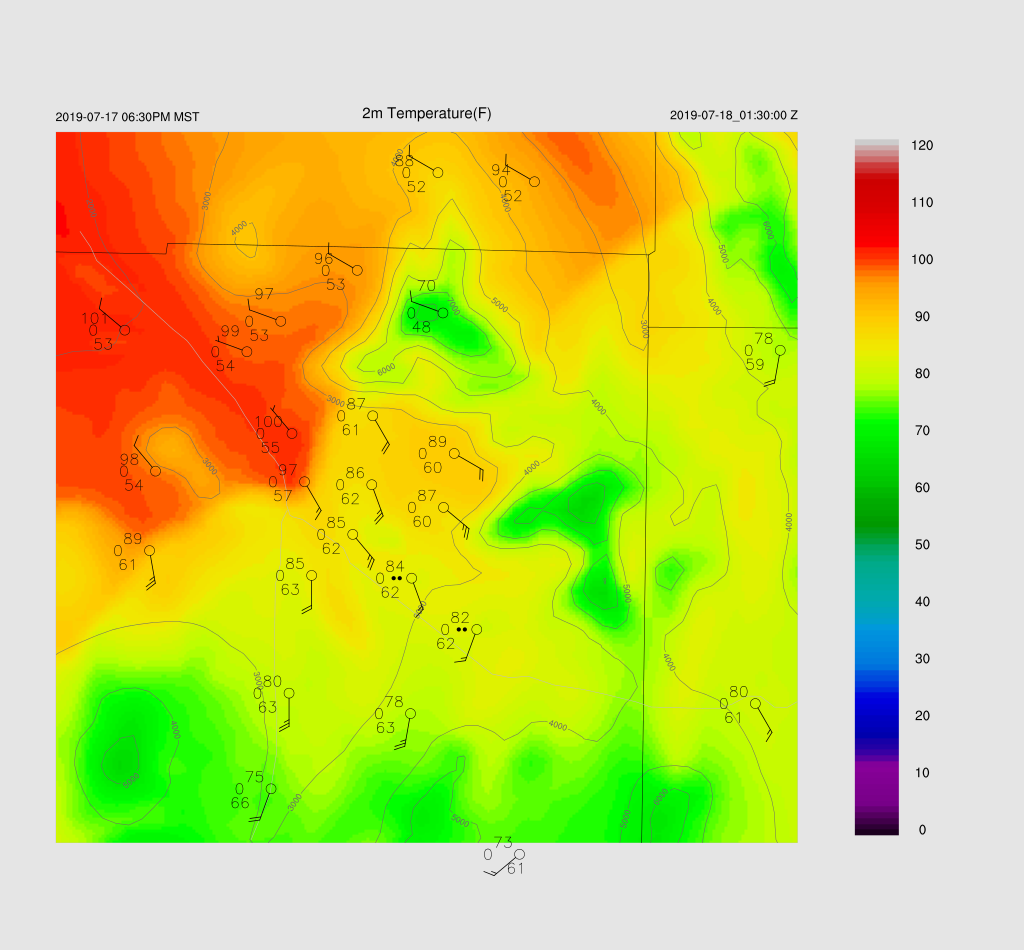
The surge is underway with strong southerly winds and blowing sand at Yuma. Dew-points are in the low 70’s there. PW has increased over southern Arizona and is in the upper 30mm range. The strong surge continues today and wet air continues to advect into the state. 850mb dew-points increase into the 10-14C range; thus, there is a threat of heavier rain compared to the recent storms, assuming storms develop.

CAPE is quite high over southeastern Arizona and out in western Arizona. The question of the day is if there is going to be enough heating to overcome the cooling in the PBL? Just from previous experience, I’d say no for most lower elevation areas.
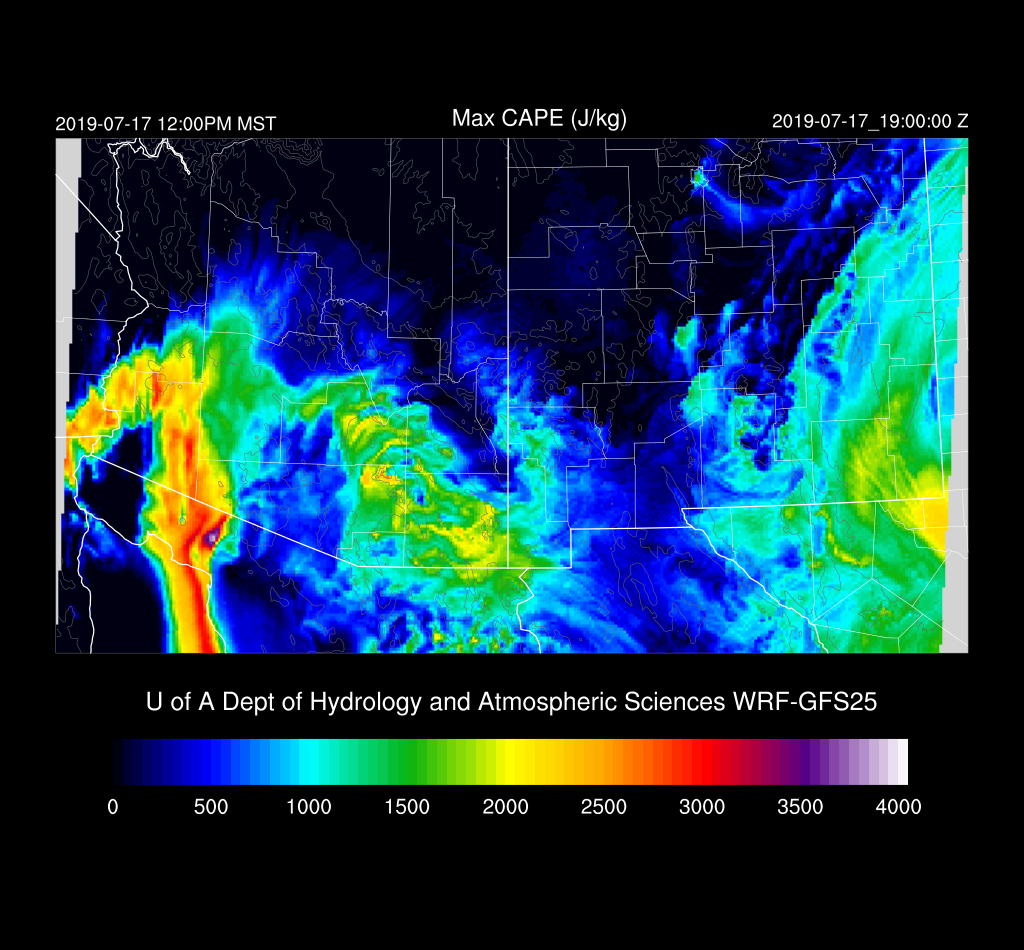
The cooling in the PBL can really be seen at Phoenix where it almost looks like a mid-west style cap.

The situation in Tucson isn’t as bad as the inversion seems pretty weak so there may be some activity around later this afternoon or evening assuming decent heating. I looked at 16Z observed vs. forecast and in general, the 3 models are 3 degrees or so too warm in southeastern Arizona. There is plenty of CAPE and moisture, so any storms that form could produce very heavy rain and along with very light steering, storms won’t move all that much. As steering is weak, it’s going to be challenging to get storms to move into the lower elevations of SE Arizona and will have to develop on outflow boundaries instead.

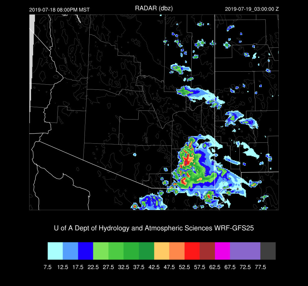
All runs have strong storms underway by mid to late afternoon in Santa Cruz and Cochise Counties.
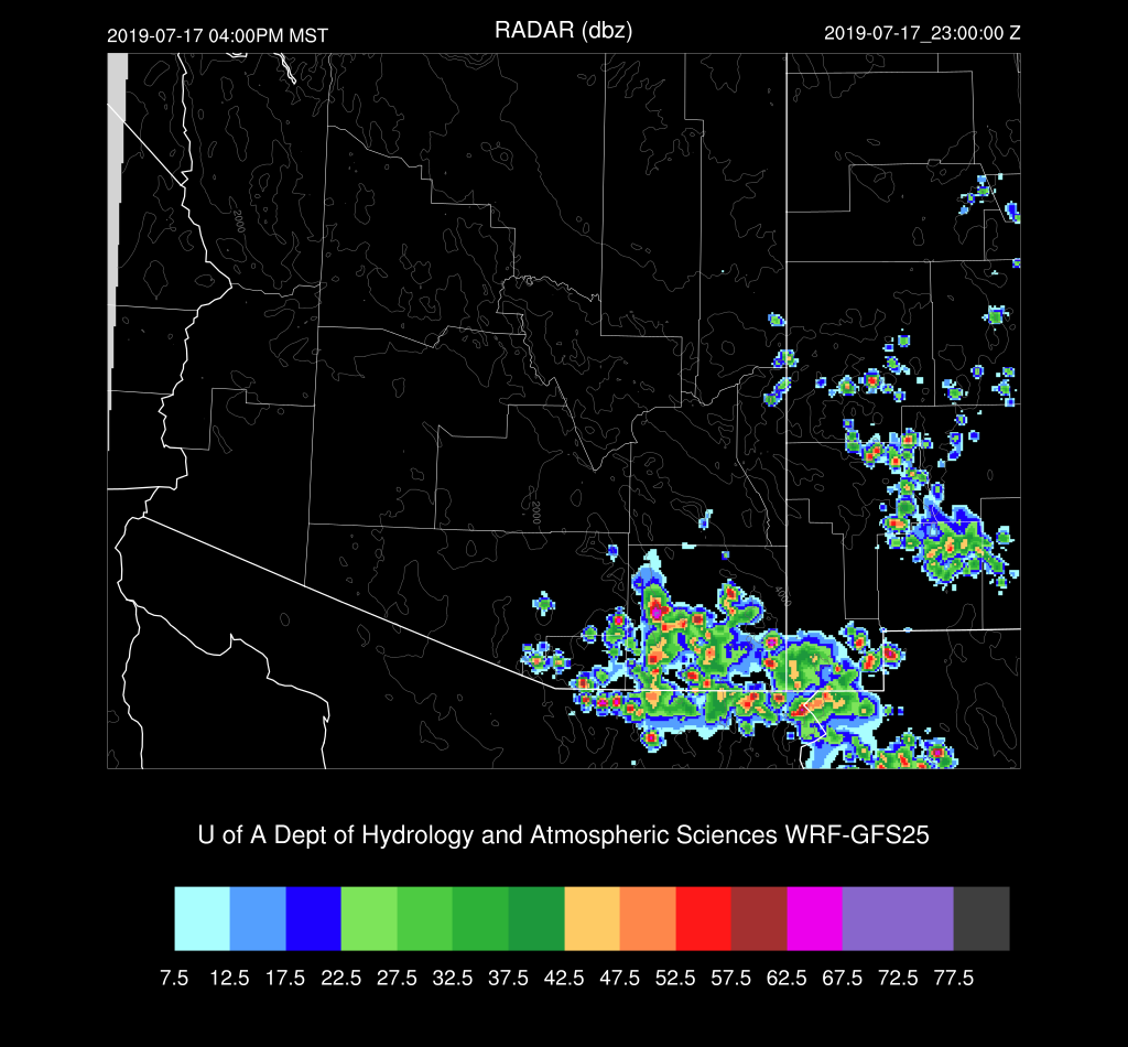
Storms generally move to the west due to some week easterly steering and strong storms move into eastern Pima county during the early evening.
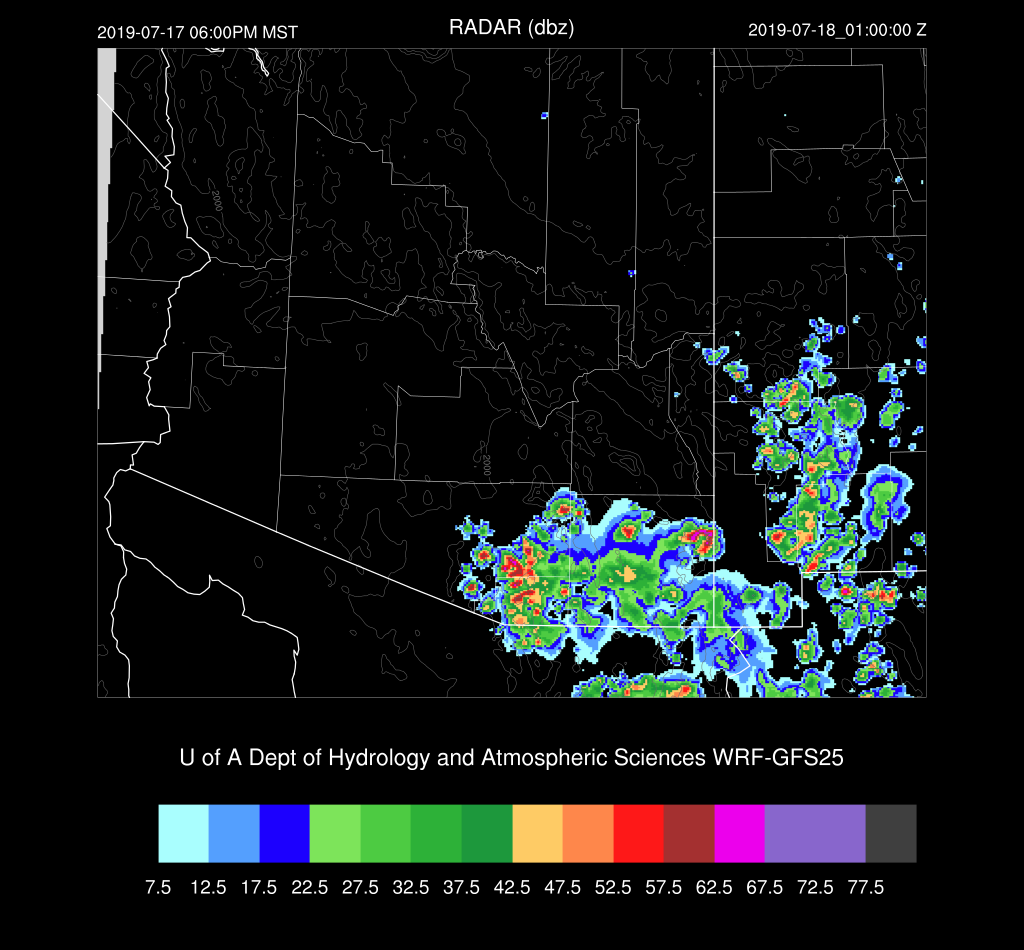
It’s really a tough call for Tucson. Thunderstorm outflows move into the valley early this evening and some runs do develop a few storms.
A storm or two may pop up over central Pima into southern Pinal Counties later in the evening and perhaps generate some blowing dust in Pinal County. Far SE Arizona and SW NM stay active.

Day 2
The wettest air of the monsoon season (which isn’t saying much so far) is present over southern Arizona as the gulf surge continues. Again, the problem for storm formation will be the cooled PBL and warm air aloft.

CAPE is quite high over much of eastern and southeastern Arizona; thus those will be the most active areas.

A mid-level anticyclone center is over eastern Arizona thus putting southern Arizona in light southeasterly steering flow which isn’t too bad.
There isn’t much activity until late in the afternoon. Storms form mainly in the high CAPE areas and elevated terrain.

Storms move to the west and into Cochise county and threaten eastern Pima but dissipate before moving into the Tucson area. All of the runs have a similar solution; thus, confidence is reasonably high, considering this is a Day 2 forecast.
No comments:
Post a Comment
Note: Only a member of this blog may post a comment.