Model Initialization
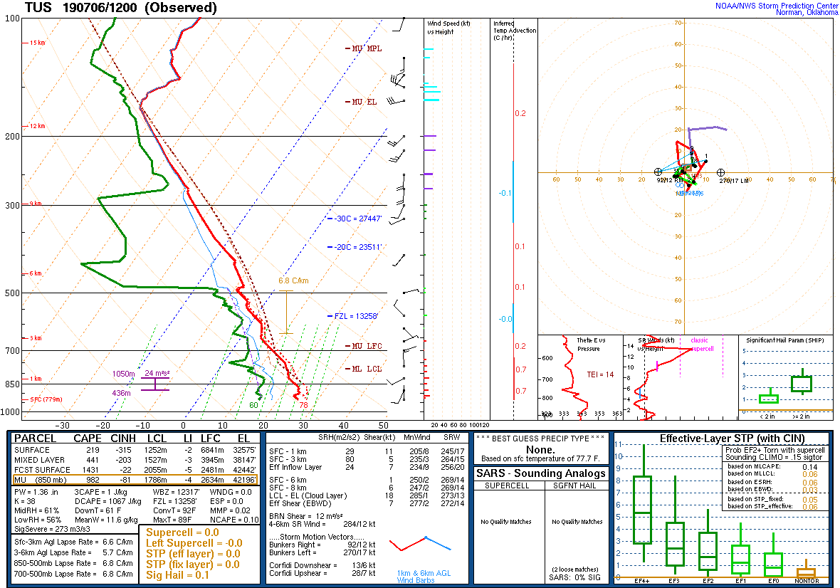
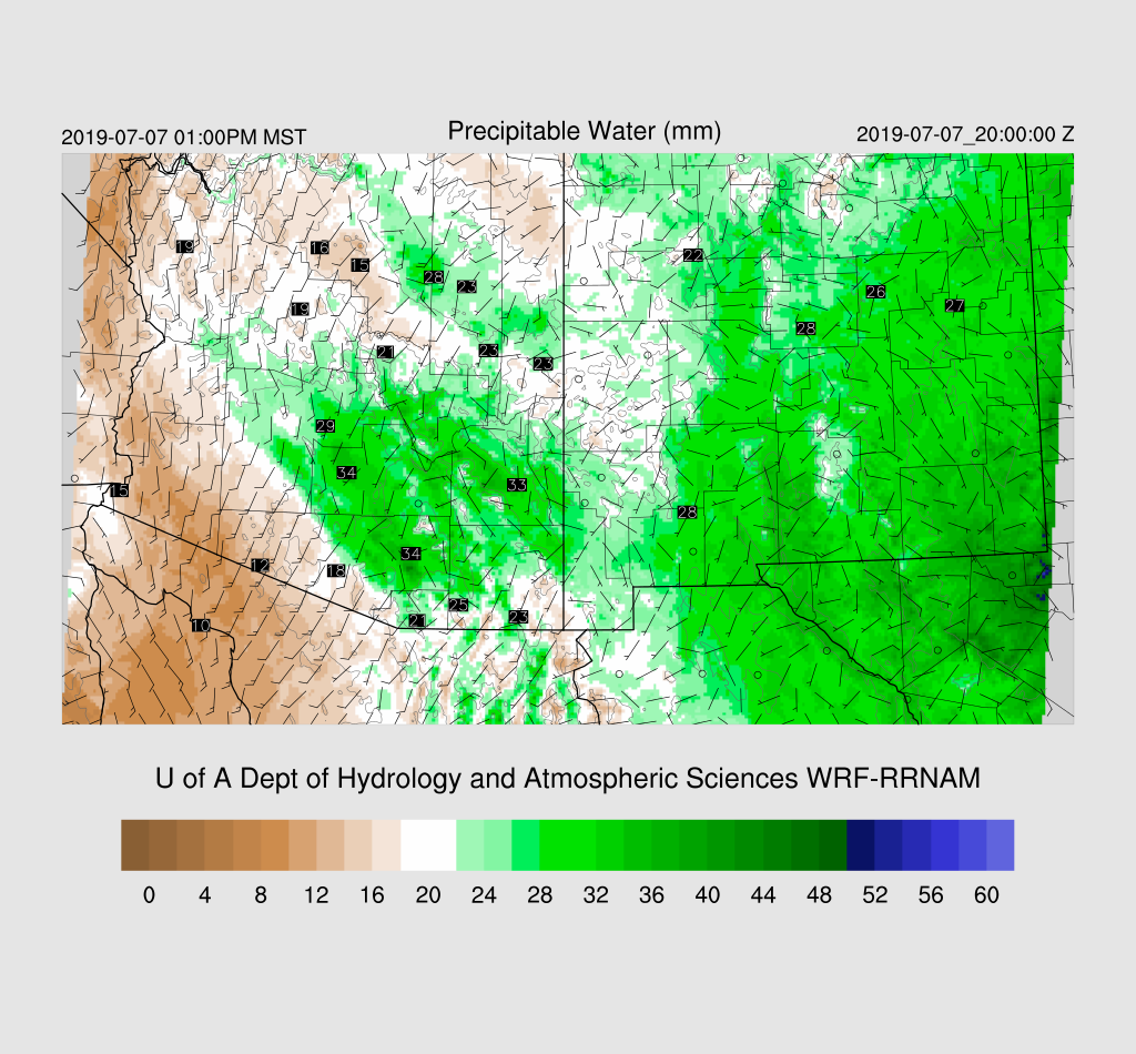
There has been a significant push of moisture into the Tucson area and west of there as a strong outflow boundary moved through last evening. GPSIPW has increased to 32-34mm across SE Arizona and the 12Z morning sounding from Tucson reported 34 mm plus 441 J/kg of mixed layer CAPE. This is the first decent situation for the Tucson area.
The 12Z RR and 6Z GFS had only minimal IPW errors while the NAM was a bit worse as it was a bit too dry from SE Arizona into New Mexico but it’s wasn’t too bad. The 6z WRFGFS run at 12Z didn’t have enough moisture in the lowest 100mb part of the atmosphere.
Morning clouds are present over parts of SE Arizona with thick clouds over east-central and into NM. All the initializations do a good job and have clouds depicted well. Of special interest is the obvious cyclonic circulation just south of Nogales. It looks like an MCV but could just as well be a larger inverted trough. In any case, the 12Z initializations both have this feature while the 6Z WRFGFS does not. I’m thinking this feature is going to play an important role in organizing storms for SE Arizona later today. The 500mb plot shows that there is a general cyclonic circulation over NW Mexico so maybe it’s actually a weak IT. Another notable feature on the 500mb plot is the return of the sounding from Empalme Mexico! Great news!

Overall, the 12Z initializations look good and confidence in them is high.
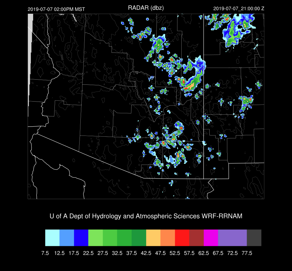
Day 1
First thing I did this morning was to walk outside and I immediately thought it felt like it was going to be an active day. Who needs fancy models and weather maps to forecast the weather! Well, I better check them to be sure. As mentioned earlier, the situation looks favorable as moisture/CAPE is present as well as a weak IT just to the south. By late morning, the IT moves over the Tucson area which results in decent SE steering flow.
Moisture levels remain about the same into early afternoon and 850mb Td is around 10C which is my minimum requirement for storms.
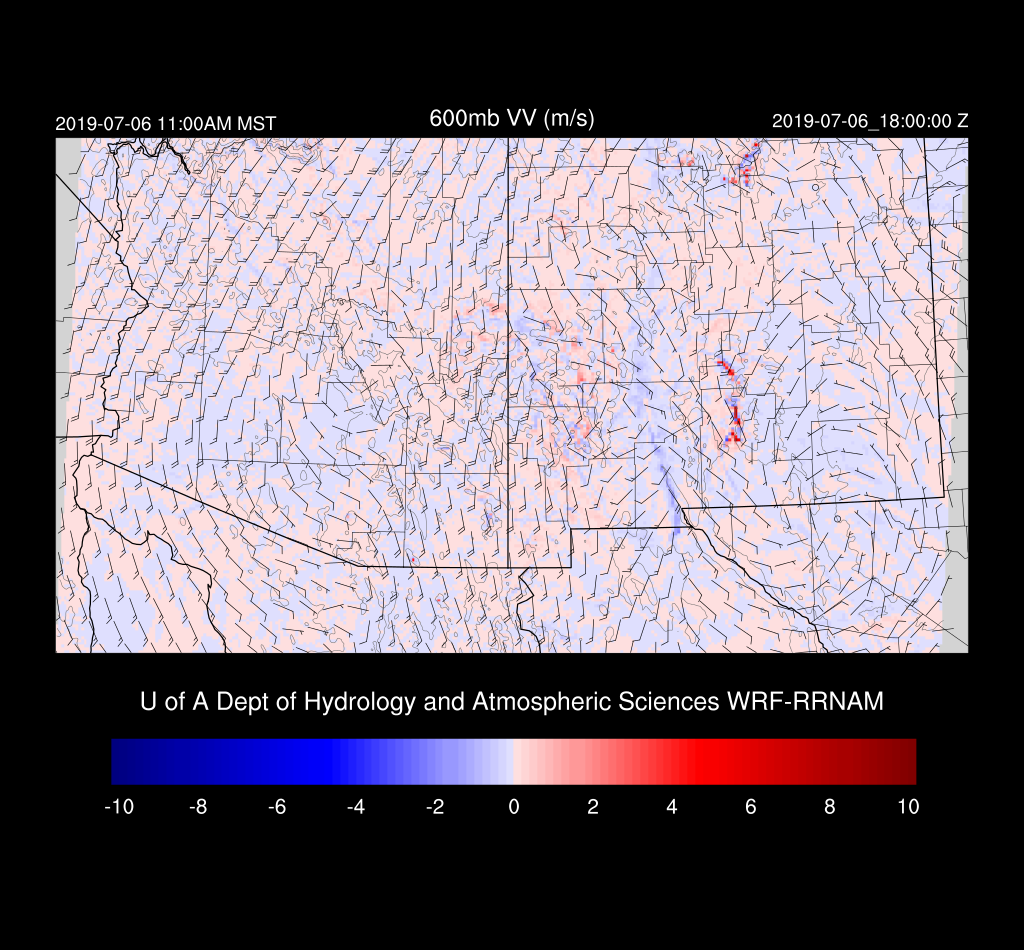
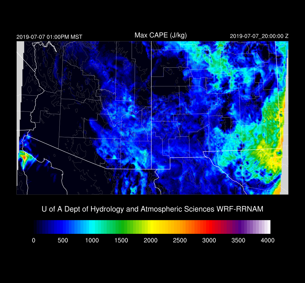
 Both the WRFNAM and WRFGFS have areas of low to moderate CAPE over SE Arizona and specifically, over Tucson. It should be enough to support storms.
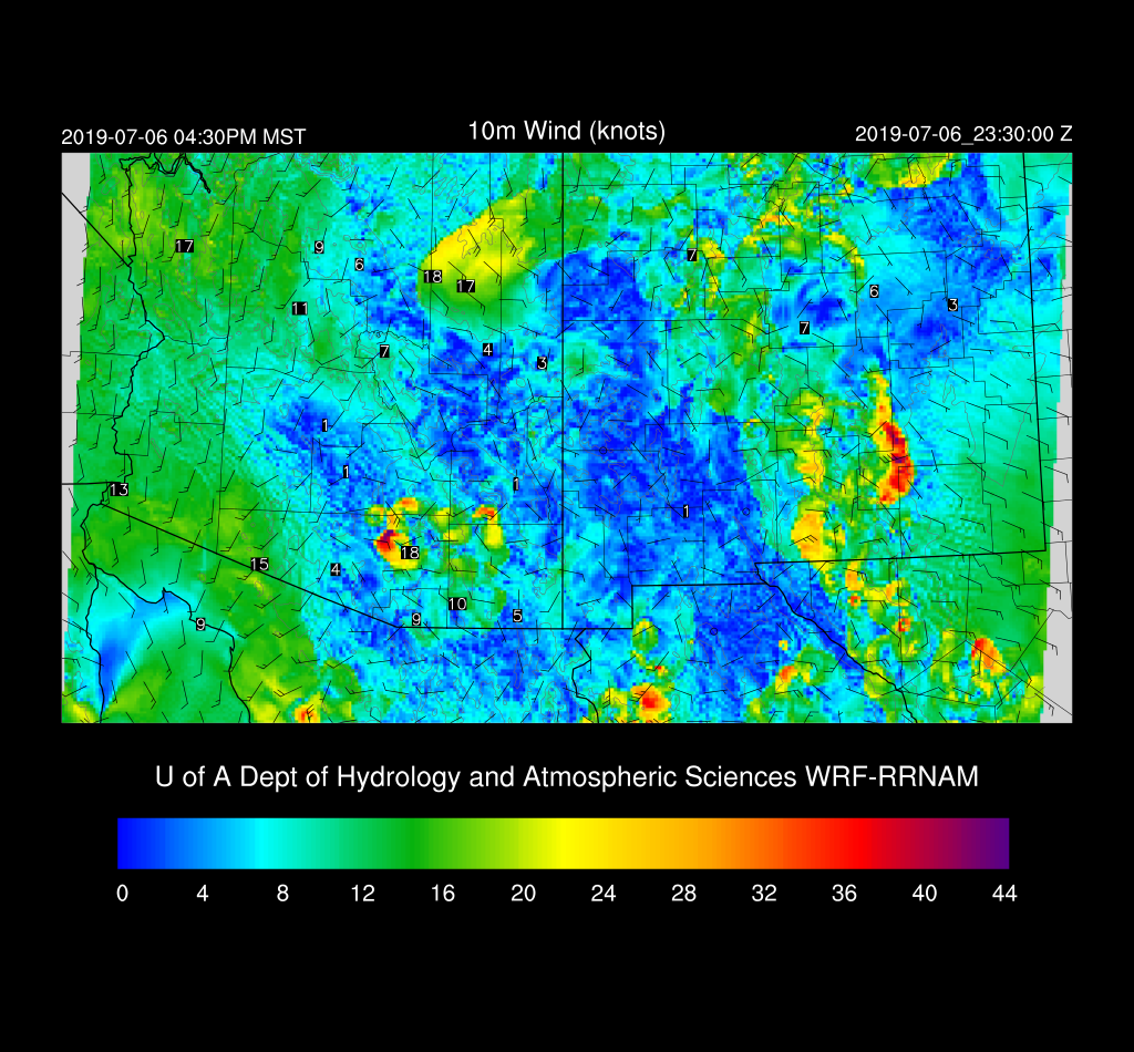
The WRFRR forecast vertical profile looks favorable for storms this afternoon as the PBL becomes deeply mixed with a moderate amount of CAPE, good mid-level steering flow, and some low-level NW flow. A pronounced inverted V profile is present thus storms are likely to have very strong winds.

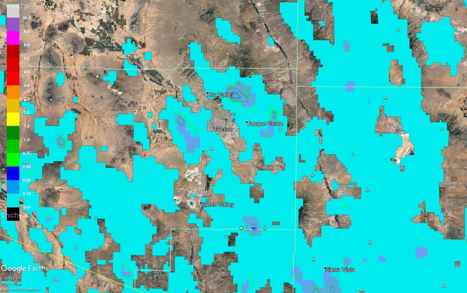
Does all this mean we actually get activity in Tucson? The WRFRR thinks so as it develops storms over the higher terrain to the SE and these move into the Tucson valley during the late afternoon.
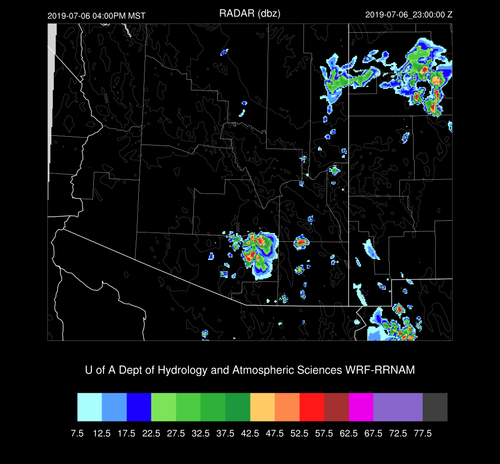
However, the WRFNAM does what is more typical which is to developed storms over the higher terrain east and west of the valley and not actually move them into Tucson. So, it looks likely that a strong outflow will move into the Tucson valley with maybe a few storms.

Not much rain is expected out of these storms for the low elevations but some could produce very strong to marginal severe winds. The ensemble max shows the possibility of up to an inch for the Catalina mountains.
Scattered storms continue into the evening hours over SE Arizona.

Day 2
Well, that didn’t last long. By early afternoon strong dry air advection is underway over SW Arizona. Will the wet air stick around long enough for afternoon storms to form? Maybe.
Enough CAPE is present over SE Arizona to support some storm activity.
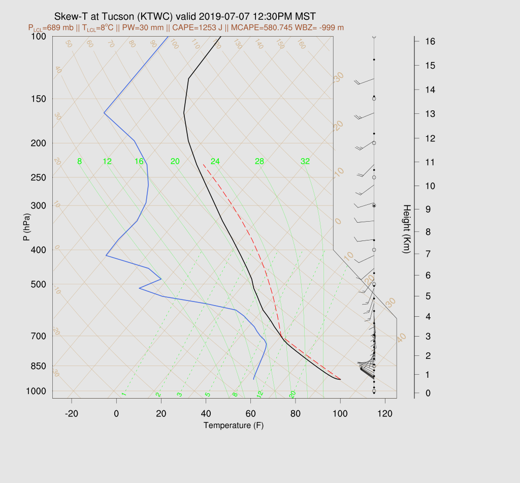
In fact, the Skew-T for Tucson looks pretty good as surface based CAPE is over 1000 J/kg and the other CAPE calculation is almost 600 J/kg.
Both 12Z runs develop scattered storms during the early afternoon hours over the higher terrain of SE and SC Arizona but rapidly decrease in the Tucson area as the dry air moves in. It looks like that’s it for a few days.
No comments:
Post a Comment
Note: Only a member of this blog may post a comment.