Previous Forecast
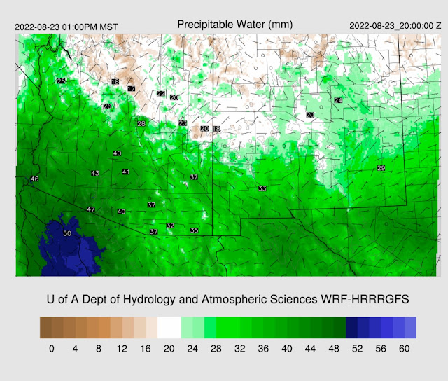
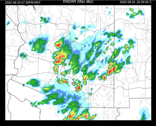
The below plots are from 21-22 Aug. Several strong/severe lines of storms moved north to south over much of western Arizona. While the runs missed the heavies precipitation near Prescott, they mainly had the right idea.

Discussion
The 500mb pattern is optimal for steering high elevation storms from northern and eastern Arizona into the lower deserts. Another positive is that 500mb temperatures have lowered to -6 to -7C, with cooler -9C air upstream in Ut and CO. A weak trough is over eastern NM.
It is difficult to decipher what is going on at 300mb. However, the WV imagery indicates a cyclonic circulation is off the coast of northern Baja, which may result in some upper divergence/difluence over southern Arizona.
PW continues to decrease, and it's below 40mm at Tucson, with the trend being down, but there is still more than enough. MLCAPE isn't that great, as it's only 475 J/kg, but it should improve as the day goes on due to good heating. An inversion at 800mb will need to be removed before deep convection can go. The vertical wind profile is OK as there are about 10 knots of ENE flow and upper winds are pretty strong, at 40 knots from the southwest.
Phoenix looks better as MLCAPE is 1100 J/kg, the steering flow is northeasterly at 10 to 15, and the upper flow is in the opposite direction of the steering. Like Tucson, there is a bit of an inversion at 750mb.
Initializations
Clouds, or the lack of them, were initialized well. One issue is the location of the upper-level trough, as the initialization has quite a sharp trough over western Arizona and nothing obvious west of there. WV imagery shows a weak trough over Puerto Penasco and another circulation west. Other than that, everything looks well initialized, including CAPE.
Day 1
A weak, shallow surge continues for SW Arizona while the easterly downslope flow is underway for eastern Arizona.
This slight drying results in only low CAPE for much of southeastern Arizona. The rest of the southern 1/2 of the state has moderate to high CAPE.
Some big storms get going over the higher terrain of the Rim and the higher terrain SW of Flagstaff, as well as in the high CAPE areas of central/western Pima County.
The forecast calls for a very impressive CAPE at Phoenix by late afternoon. A moderately strong cap is at the top of the fairly shallow mixed layer, so it may take strong outflow or outflow interactions to get storms to pop. There isn't any shear in the low levels, but mid and upper winds are favorable.
CAPE is "meh" at Tucson, and the steering flow is only about 5 to 10 knots. Check out the 50 knots at 250mb! Anvils from the activity over central and western Pima County will likely move over the valley later in the afternoon. suppose the 250mb forecast location of the trough is correct. In that case, it lifts out over SE Arizona later this afternoon, resulting in unfavorable convergence over southern Arizona but favorable divergence over northern Arizona.
There is no real consistency in what happens in either Tucson or Phoenix. Some runs have activity, while others run storms around Tucson and Phoenix, as we've seen quite a few times this season. As CAPE is so high in Phoenix, I'm inclined to go with the more active Phoenix runs. Tucson, who knows?
15Z WRFHRRR is much less active for Tucson and Phoenix.
All runs agree on moving strong/severe storms into southwestern Arizona again. They certainly have seen a lot of activity over the past week.
Day 2
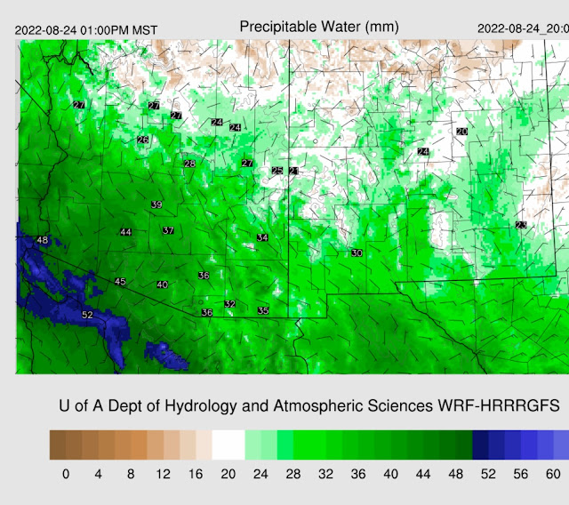
A weak surge continues for southwestern Arizona, keeping PW relatively high there. Easterly flow continues over much of southeastern Arizona, keeping activity limited there.
Combined with the easterly downslope flow and the considerable activity from the previous day, CAPE is mainly low over most of the eastern 1/3 of the state but probably sufficient for mountain storms. It's still moderate for parts of western Arizona. Like today, some runs have some storm activity for Tucson/Phoenix, and some do not.


No comments:
Post a Comment
Note: Only a member of this blog may post a comment.