Previous Forecast
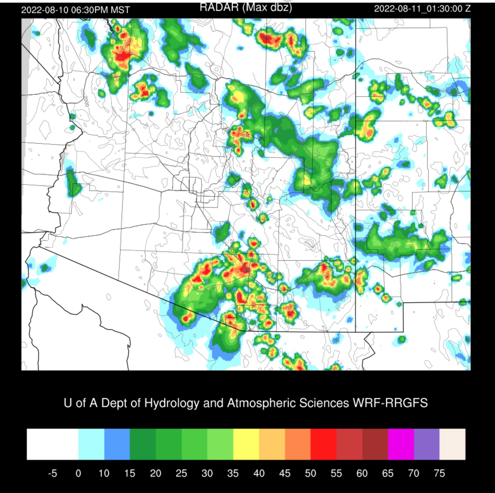
It was an active day in Cochise County and in NW Arizona. A few storms managed to get going near the mountains in the Tucson area.

I have no idea why the GFS went so far off the rails. The other runs were pretty good, except they didn't have enough activity in Cochise County, which is strange as that is where the best CAPE was forecast.

Discussion
Another surge is underway as Yuma has winds from the SE at 10 knots and a Td of 77F! The moisture has made its way to Phoenix as the PW is 50mm there again. CAPE has finally improved and is almost 700 J/kg. There is a shallow cool layer near the surface, but that should mix out with heating. A more serious inversion at the top of the old mixed layer will require outflow boundary interactions to break. Steering flow is favorable for moving storms off the high terrain to the east, but anvil-level winds remain problematic.

Tucson is worked over with little CAPE and will take good heating to overcome. It is clear now, and as the past few days have shown, a little heating can go a long way, as long as you live near the higher terrain. Anvil level winds are slightly better as they are northeasterly while steering is southeasterly.

The upper-level IT I've discussed has moved close enough to affect southern Arizona. It's evident in the WV imagery and the synoptic map and will provide some upper influence and divergence. The map already shows Arizona is under significant divergence.

The 500mb anticyclone has strengthened to our NE and continues to provide good mid-level steering. Temperatures continue to be OK at -6C.

Initializations
It is another challenging morning as an MCV, and clouds are spinning between Tucson and Phoenix. Another is east of Puerto Penasco, and a third, much larger (IT?), is located east of Hermosillo. As usual, the 6Z runs do not have nearly enough clouds. 9Z RR and 12Z RR were the best, as the 12Z HRRR also didn't have enough coverage, but it was better than 6Z. They all initialized the IT/MCV in Mexico but couldn't resolve the Arizona IT very well. It was more of an open wave. The 9 and 12Z RR are initialized well enough for such a complex situation.

Day 1
Acapulco's airmass has returned to Arizona. PW continues to be above 50mm from Phoenix to the GofC. The problem, as it is typically when a surge occurs, is the cooling of the lowest part of the troposphere and the resulting cap. Eastern Arizona is influenced by weak and relatively drier air advection from NM.


Storms certainly take their sweet time initiating today. By late afternoon, most runs finally have a bit of action over the mid and high elevations.


No comments:
Post a Comment
Note: Only a member of this blog may post a comment.