Previous Day
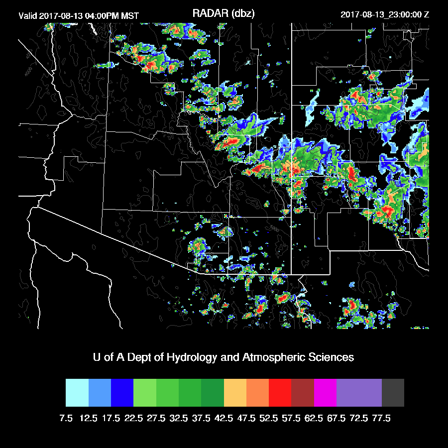
It was quite an active day across the state with afternoon activity in SE and N and NW Arizona. Activity moved slowly south towards the Phoenix area during the early evening and sent out multiple outflows into the Phoenix area which were then able to trigger widespread strong storms. Tucson also experienced evening storms.
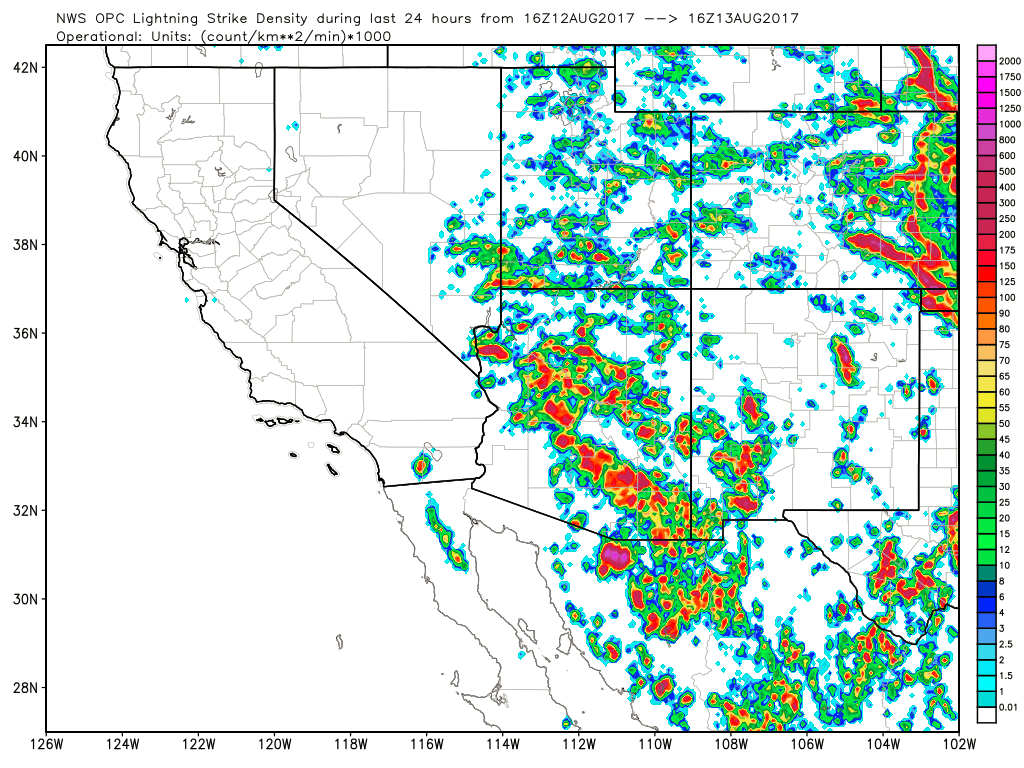
In general, the WRF runs were not very good/terrible especially with regards to forecasting the overnight storms in Phoenix and Tucson. The WRFRR, which I relied on for most of the forecast was especially poor as it did not develop any activity in/around Phoenix. Its big problem was the lack of strong storms over NW and NC Arizona as these storms eventually moved towards Phoenix and ejected strong outflows to get the party started there. The WRFGFS had the best forecast as it did have strong storms move near Phoenix and eject outflows which did develop a few storms but not nearly enough.

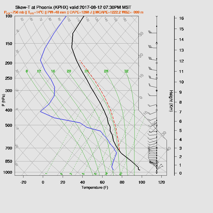
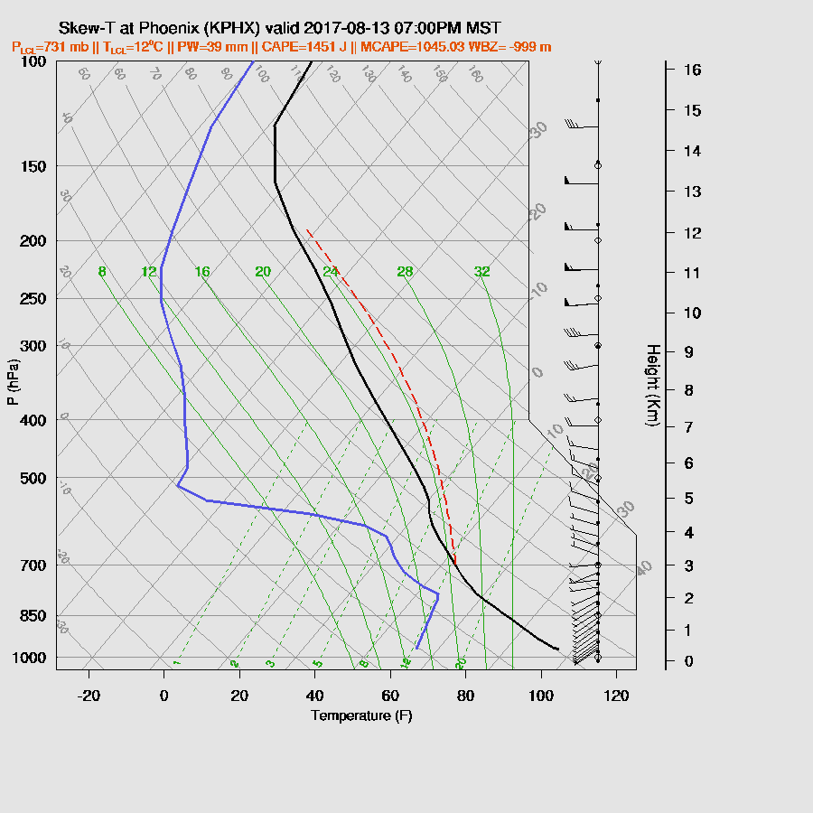
The 3Z Phoenix observed sounding had an impressive 1600 MLCAPE so no wonder there was deep convection around. I would of though the forecast CAPE of 1200 J/kg would've been enough to trigger convection as the outflows moved through. It just goes to show you how difficult convection forecasting can be when the outcome can be so dependent on what happens elsewhere earlier in the day and having just a small error in CAPE can result in such a large difference in deep convection. Plus, having to sort through all the various WRF solutions. There was no hope for WRF in Tucson as the early morning activity was triggered by the outflows from Phoenix (via Bob Maddox) and how often does that happen!?
It turns out that Tucson was primed for the early morning activity as forecast CAPE was around 1000 J/kg. I made the mistake of looking only at the various model runs of RADAR reflectivity when I should've paid more attention to the instability/CAPE/Skew-T forecasts especially in this transition period when these nocturnal events are not uncommon. Another indicator was the previous night’s activity as sometimes you get repeat performances and I even thought about that but didn’t look closer.

Initializations
Enough with the navel gazing and on to today. The first thing I thought when I saw the 12Z 500mb map I thought I was looking at September as looks like fall as a moderate westerly flow is in place over much of the country as there is a split in the jet stream due to a block over central Canada. Arizona is in weak westerly flow with slightly cooler air as temperatures are around -6 to -7 which is cooler than the forecast was for today and a weak trough is located over southern Arizona which helps explain the overnight activity. The NAM and GFS have this feature while the RR does not.

Much of the state is clear except for far east-central Arizona and far NW Arizona where some deep convection is ongoing. All initializations have the east-central AZ clouds initialized more or less in the right location. The GFS IPW initialization was too dry over much of the SW US while the RR and NAM had only minimal errors. All three runs are a couple of degrees too warm at 17Z thus they may develop deep convection too early. Overall, the initializations are OK as the weather situation is fairly simple and there is no clear favorite run.
Day 1
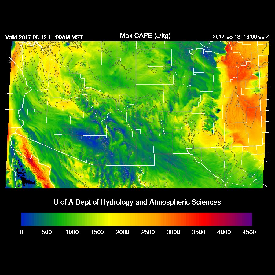
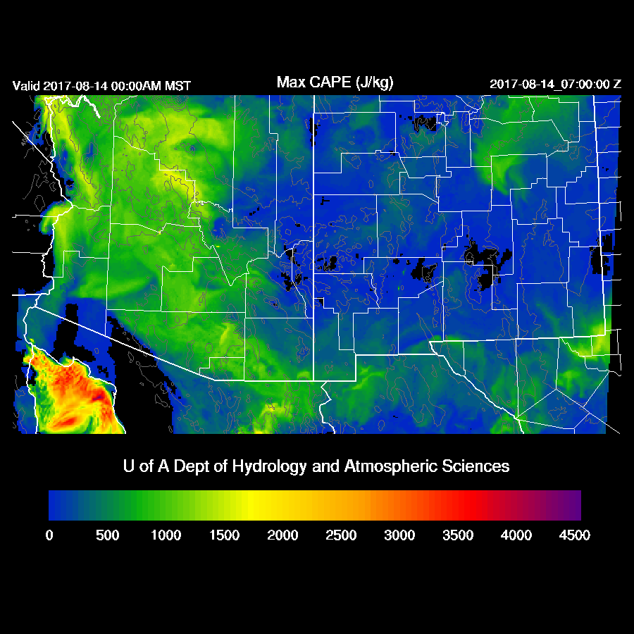
Most of southern and central Arizona have dried out slightly in the wake of the overnight activity. Combine that with an active day and overnight, deep convection is going to struggle to develop today in spite of heating and sufficient moisture due to a weak surge.

The runs all agree that the NW part of the state will have moderate to high CAPE while most other areas are low to moderate thus it looks like northern and northwestern Arizona will once again be active today and into tonight.
Much of northern Arizona also has 20-knot westerly mid level flow thus storms there should again exhibit some organization. Central and southern Arizona have mainly light westerly flow as the weak trough moves into NM.

Northern Arizona is also under an upper jet with areas of upper divergence helping to organize storms there today. Eastern Arizona also has some divergence.

Saying all that about northern Arizona, the various WRF runs aren’t that active as dry air from the NW moves in during the afternoon which results in less activity than yesterday. Still, some strong storms are underway this afternoon and perhaps WRF is not active enough especially as storms are already underway over far NW Arizona.
The morning runs disagree about how much afternoon moisture is present at Tucson. Current IPW trends show it to be still drying over SE Arizona thus the WRFNAM seems to be the most accurate. By afternoon, it has some CAPE present in spite of only 36mm. Winds are mostly unidirectional and fairly light so it looks like storms around on the mountains with only a few weak storms possible in the lower elevations.

A moderate amount of CAPE is forecast for the Phoenix area this evening sufficient to support some storms if there are outflows that move into the lower elevations.
Some runs do have a few storms around the Phoenix area this evening but nothing strong.

I’m going to take my own advice and look at overnight CAPE and it does remain moderate over both Tucson and Phoenix thus there is a risk of overnight activity.
Day 2
Looks like the end is near as there is quite a bit of drying tomorrow as the surge weakens and low-level SW flow is in place over western and northern Arizona.
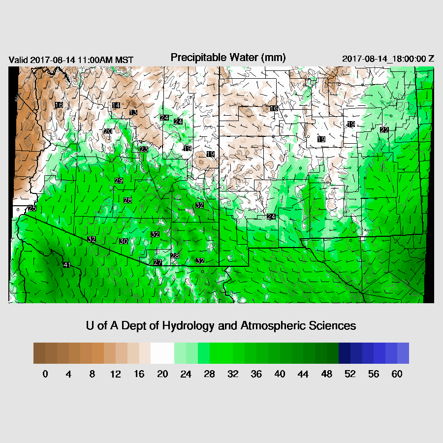
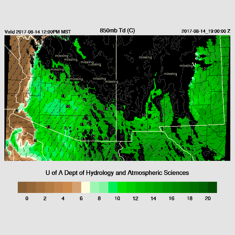
Eastern Arizona holds onto enough moisture to support some activity as 850mb dew-points remain above 10C.
Mainly weak activity is expected there during the afternoon and dry elsewhere in the state.

No comments:
Post a Comment
Note: Only a member of this blog may post a comment.