Previous Day
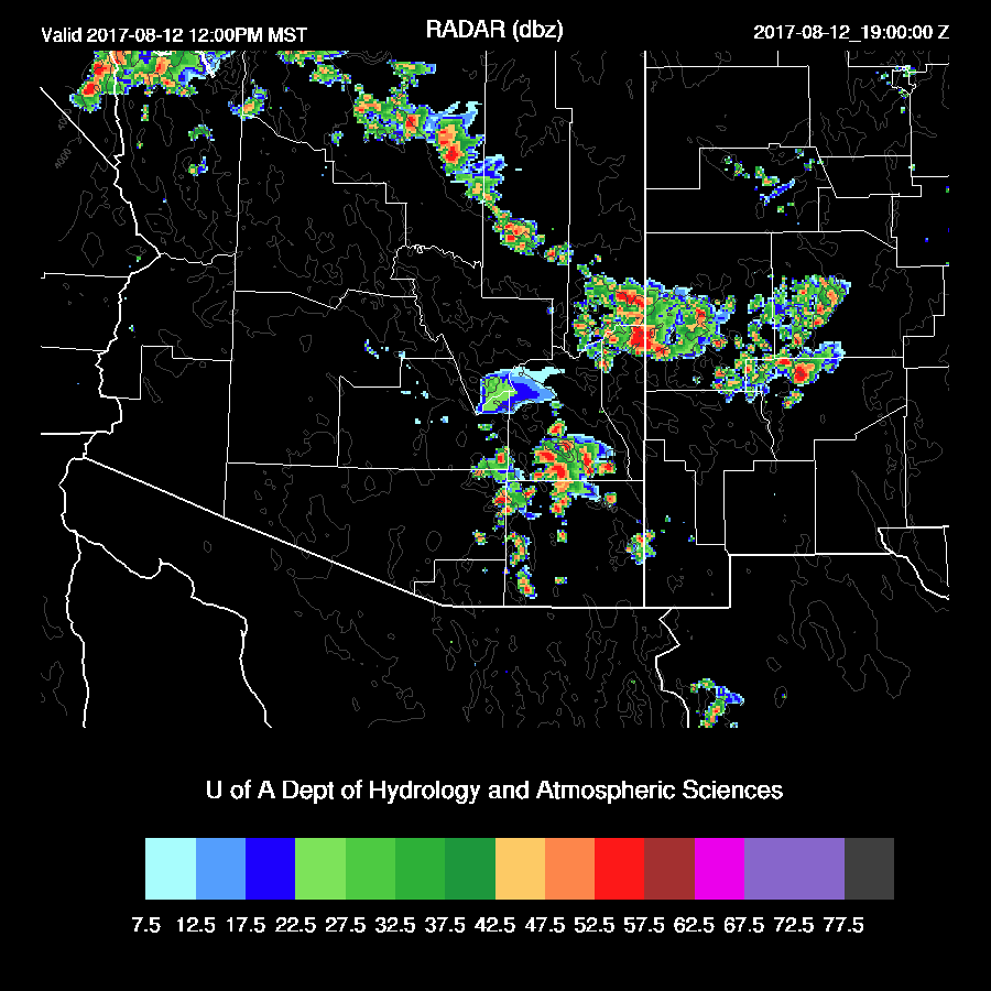
Low elevation locations were devoid of activity yesterday and the various WRF runs predicted this. However, scattered storms developed around the Phoenix area this morning.

The WRFRR did forecast a few showers and weak storms around as it had around 700 J/kg of CAPE and a deeply mixed elevated layer. A small short wave trough probably passed through in the westerlies and triggered the deep convection. Will Holmgren did point this out but I thought it was unlikely as only a single run was forecasting this event.


Initializations
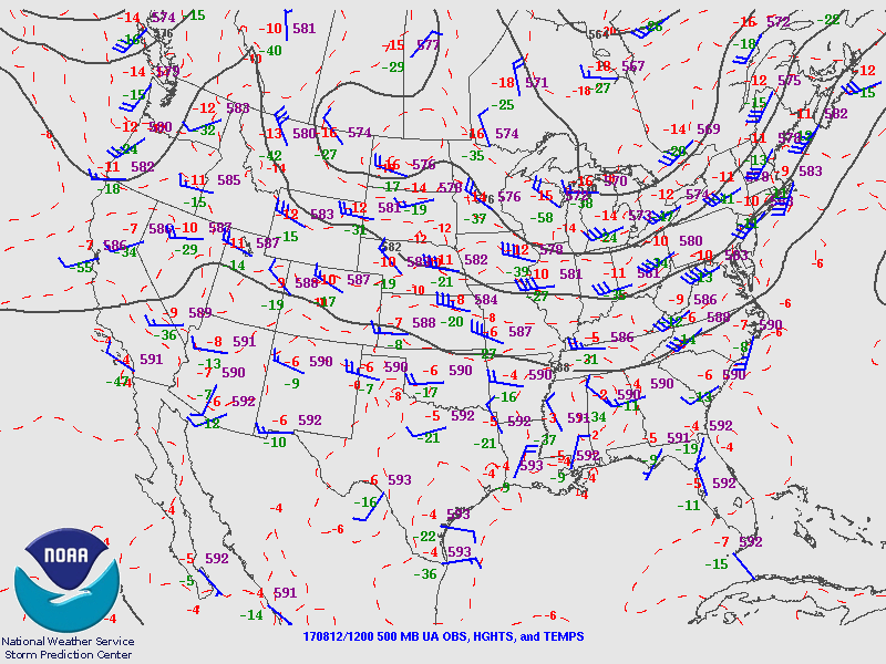
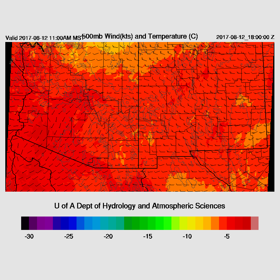
The western US 500mb ridge continues to slowly break down while the main high center continues over in Texas. Unfortunately, this continues the unfavorable SW mid level flow over Arizona. There is a large MCV over far southern Sonora while the tropical depression has weakened and is located SW of Cabo San Lucas.
The three initializations have the general pattern initialized well. However, neither the NAM or GFS had the morning activity around Phoenix while the RR was able to initialize the clouds and showers quite well. This area of storms, showers, clouds, and associated cool air may cause big problems for the WRFGFS and WRFNAM runs.
Day 1
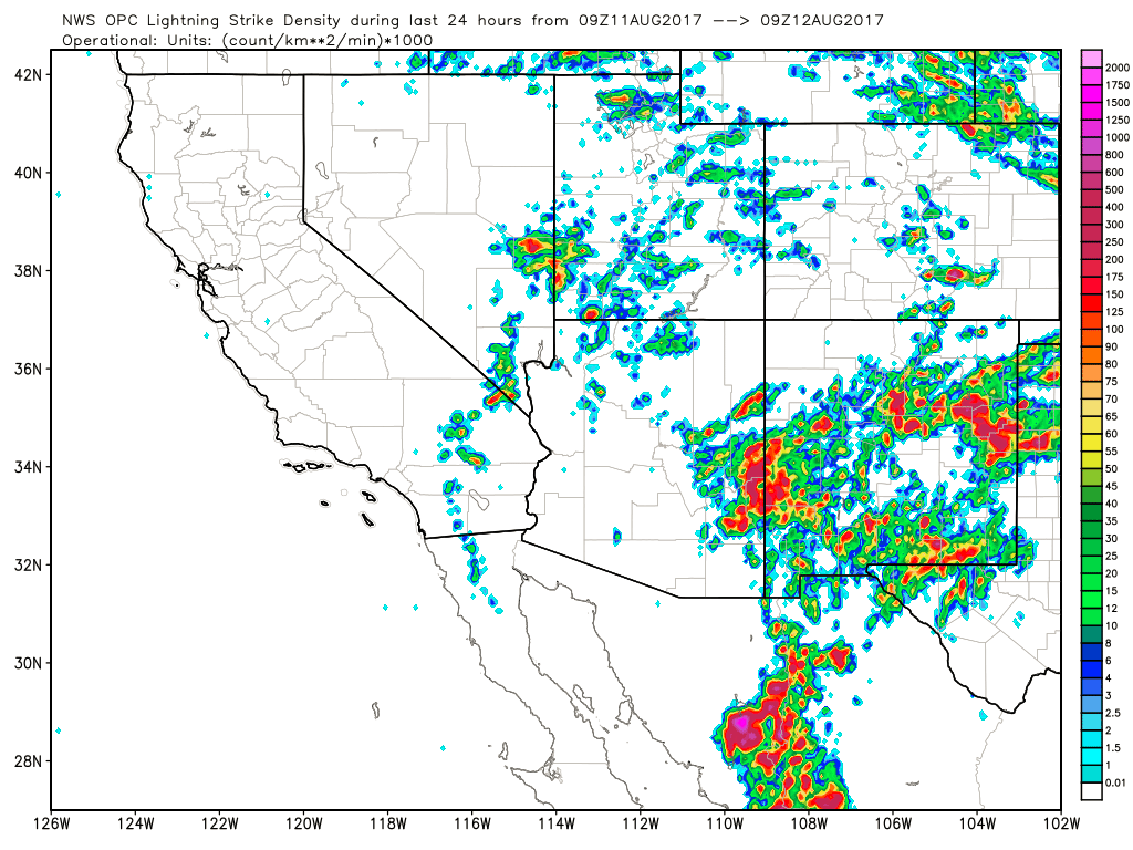
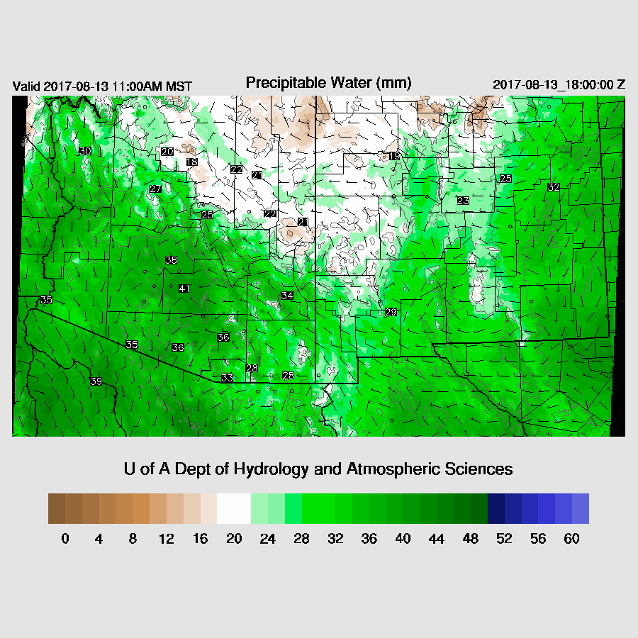
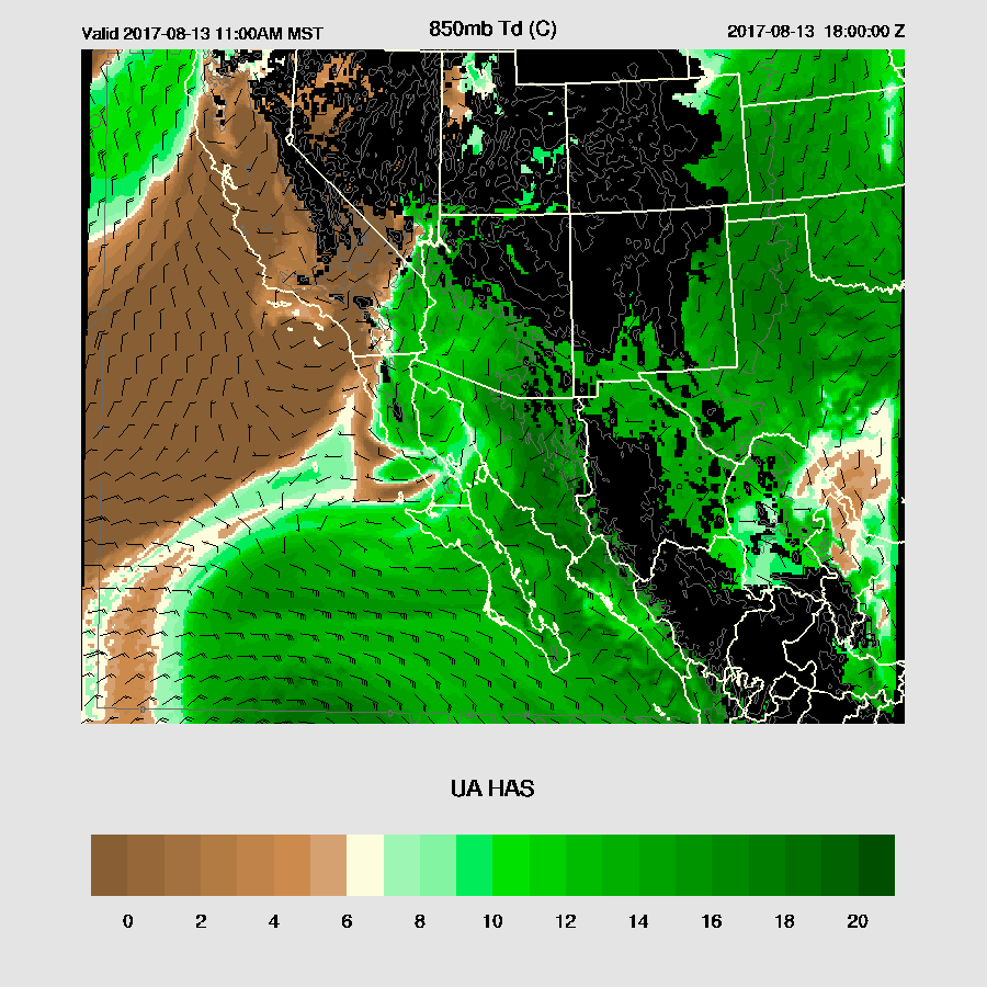
The surge that was forecast is underway as Yuma has SSE winds 23G30mph. However, not much moisture is associated with the surge in western Arizona as IPW has increased only slightly over the past 12 hours while Phoenix and Tucson have had a noticeable increase. The surge is forecast to continue during the day today with moderate to high moisture over much of the state.

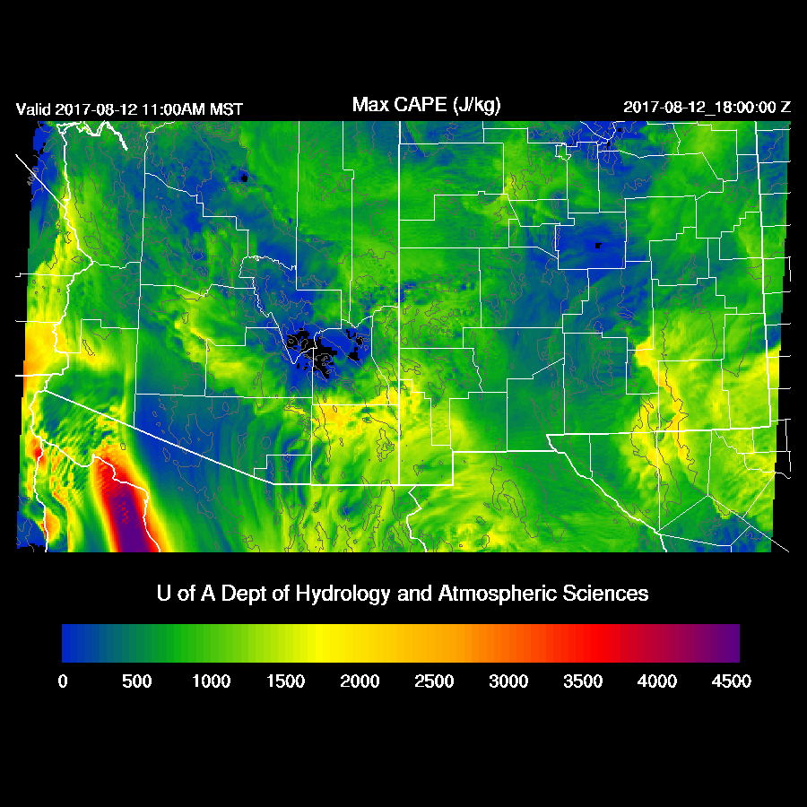
CAPE is forecast to be moderate over most areas of the state except lower in the wake of the ongoing morning activity.
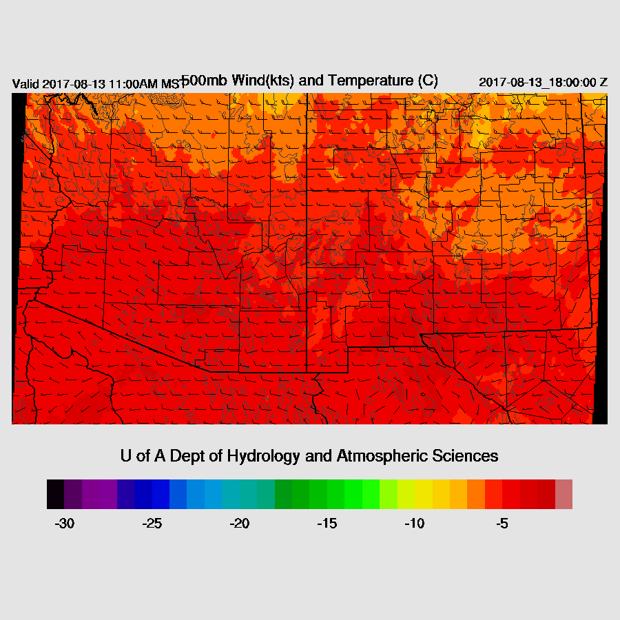
Nasty looking 500mb map as mid level winds are light southwesterly and temperatures are around -4 to -5C.
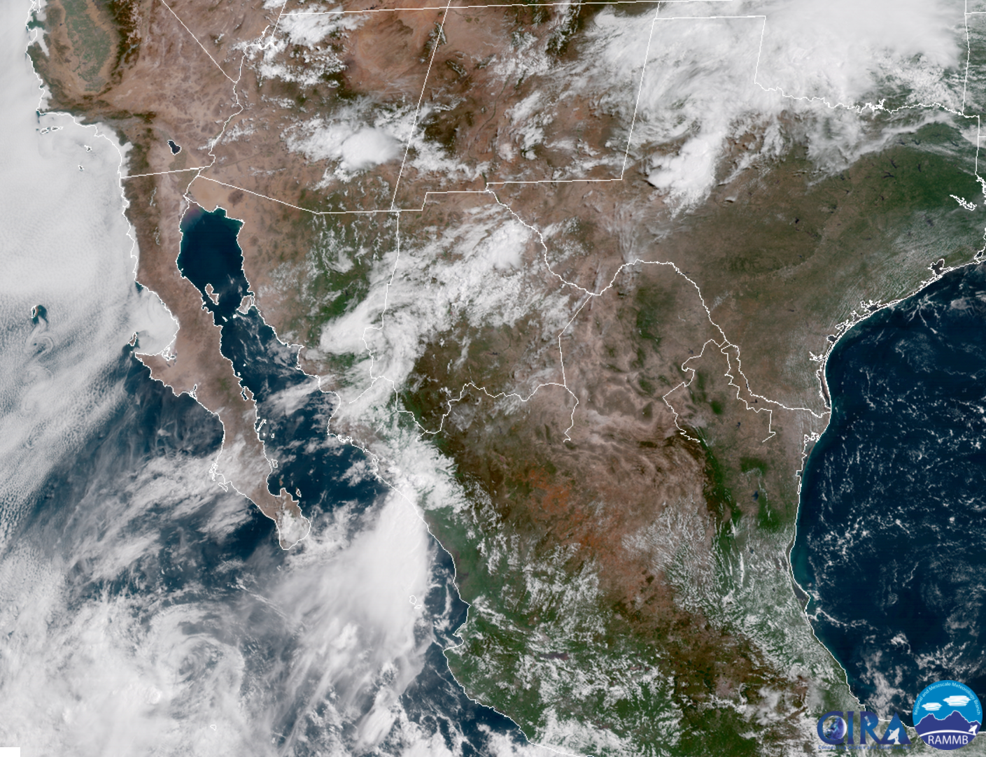
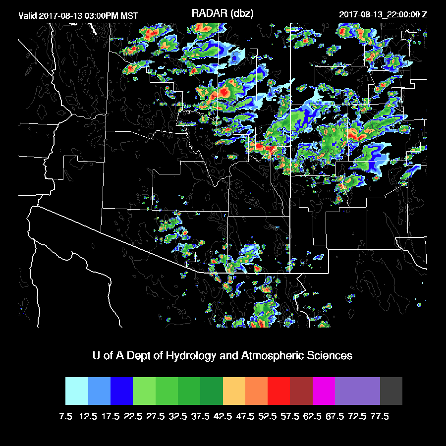
While the WRFNAM and WRFGFS too little/no morning activity, the WRFRR, by 18Z, has too much as current satellite/RADAR data shows the activity is dissipating. I’m afraid none of the morning runs are going to be very good today.

The WRFRR is quite close to observed 2m temperatures so far. The 6Z run developed morning convection but it was too south so those may end up being the best two runs.

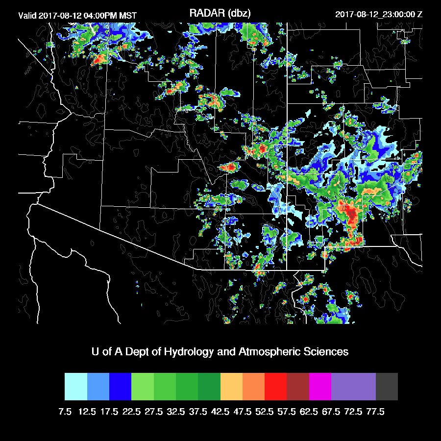
The late afternoon Tucson vertical profile does have a moderate amount of CAPE at around 1000 J/kg and the BL is mixed well as SE AZ will get decent insolation. The bad is the multiple mid level inversions and mostly unidirectional southwesterly winds. It looks like deep convection is most likely over the mountains with maybe a few drifting into the lower elevations around Tucson.

Phoenix recovers somewhat by late afternoon which looks possible as it’s clearing there now. CAPE is high but as usual, there is an inversion/cap that will need to be broken and it looks quite significant so it’s going to take a strong outflow or multiple converging outflows.

I”ve been taking my time this morning as I’m waiting for the 15Z WRFRR to run and it has now finished and it looks like it has a good handle on the dying activity north of Tucson. By early afternoon, it has strong storms developing over far SE Arizona and up in NW Arizona stretching SE down the Rim to NM.
Storms move rapidly into SW NM while isolated storms continue over higher terrain and maybe a few weak storms in Tucson.
Activity decreases this evening.
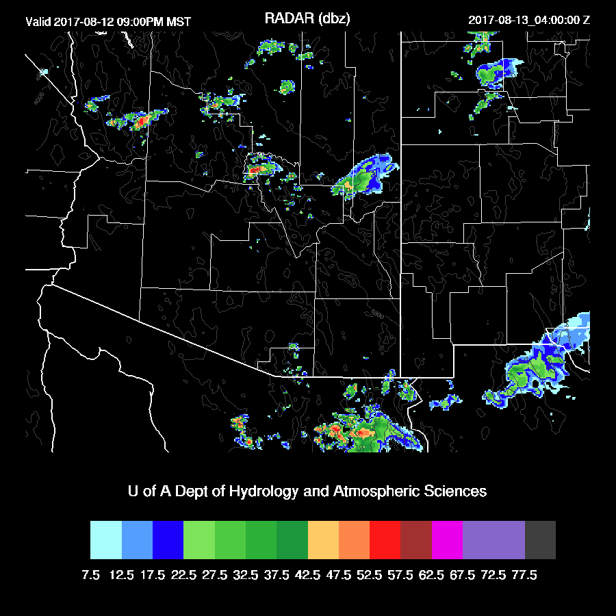
The above sequence is what I think is most likely. However, the WRFNAM and WRFGFS are more active around central Arizona and Phoenix tonight and with the amount of CAPE around Phoenix, there could be some activity.

Day 2
Moisture decreases for most areas of the state in spite of a weak surge continuing. Some dry air is forecast to wrap around a low-level cyclonic circulation over the far northern GofC. I don’t know if this feature actually exists but it looks like eastern Arizona and NW Arizona will stay plenty wet.
The same old story at 500mb with weak westerlies and very warm air thus it looks like another day with scattered high elevation storms.
CAPE is forecast to be very high over NW Arizona and high over SE Arizona. With some decent winds in NW Arizona, there could be some storm organization.

Some WRF runs are forecasting scattered strong storms over northern Arizona with maybe some organization. Only weak activity over southern Arizona. (hint hint chasers)
No comments:
Post a Comment
Note: Only a member of this blog may post a comment.