Previous Forecast
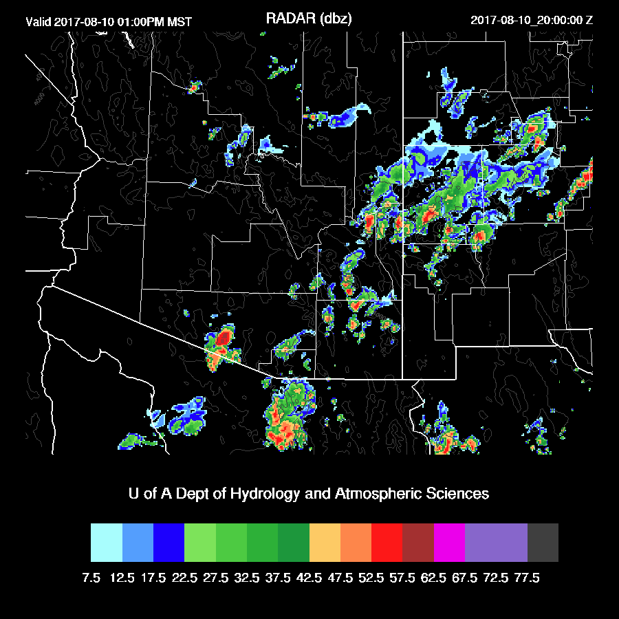
Storms formed over Santa Cruz and Cochise counties yesterday afternoon with a severe storm in the Nogales area. A very impressive MCS pounded southern Sonora last night and was probably responsible for triggering overnight weak storms across southern Arizona. The WRFNAM and WRFGFS (below) performed well while the WRFRR missed the Sonora MCS and did not have enough activity around southern AZ.


Initializations
The morning 500mb map indicates a split flow over western CONUS with a cut off low stuck under the ridge axis which stretches north into BC. Another high is located from Texas into NM which results in SE mid level flow over southern Arizona. Mid level temperatures have also cooled slightly and are now around -6C. Satellite imagery indicates a large MCV has been left behind, west of Hermosillo, by the overnight MCS. My thinking is this is actually a larger scale IT now reinforced by the MCV. Both the NAM and RR have this feature initialized well in spite of a continued lack of any 12Z upper air data in northern Mexico.

The morning showers and weak storms have dissipated but widespread clouds are present over the southeastern ⅓ of the state. The 12z WRFRRx and WRFGFS have clouds initialized very well. The WRFNAM is OK except for not enough clouds over far SE Arizona which has resulted in too much heating as 16Z temperatures are up to 6F too warm. The WRFNAM initialized NW Mexico too wet again while the others have only minimal errors. The WRFRR initialized the best followed by the WRFGFS. In spite of the complex nature, I think the two should perform well today.
Day 1
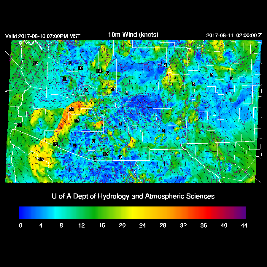
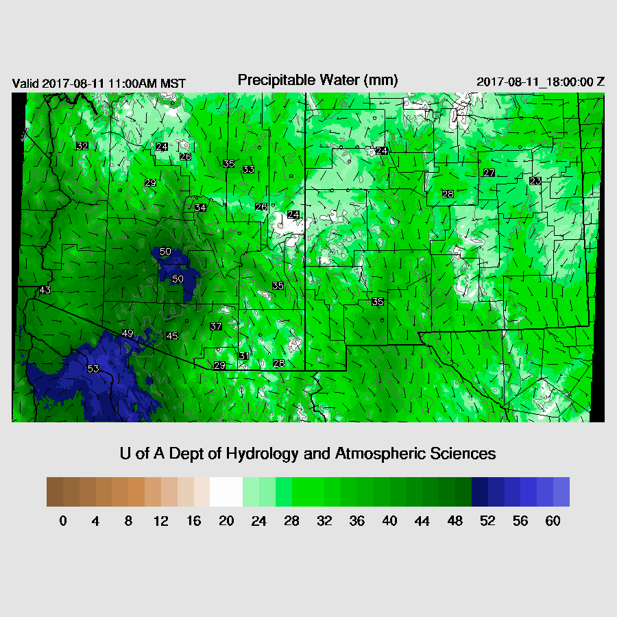
A strong outflow surge is underway with surface dew points as high as 78F at Blythe. IPW has increased too as SW Arizona has >45mm and this surge is forecast to continue during the day. There is some disagreement over far SE Arizona as the WRFNAM has drier air advecting into that region while the WRFRR (below) keeps the low-level SE flow restricted to SW NM. The WRFGFS does have a bit stronger low-level easterly flow and sets up a weak low-level convergence zone over far eastern Pima County today. 
CAPE is moderate to high over parts of the southern ½ of the state. Note that it’s pretty low around the Tucson area as the MLCAPE from the 12Z sounding was nearly zero. Hopefully, some of this higher CAPE air will move into the Tucson area later. The 12Z sounding from Phoenix also had very little MLCAPE too.

Mid level steering winds are good over SE Arizona due to the northward moving MCV. 500mb temperatures are also fairly cool at around -6 to -7C.

By early afternoon, a few storms develop over the higher terrain of SE Arizona.
CAPE and moisture increase in Tucson this afternoon as over 1000 J/kg and greater than 40mm of IPW is forecast, more than enough for storms. Additionally, the vertical wind profile is also very good with some low-level shear, mid level 20 knot SE flow and upper winds from the SW to keep anvils from shading storms as long as significant storms do not form to the SW of Tucson.

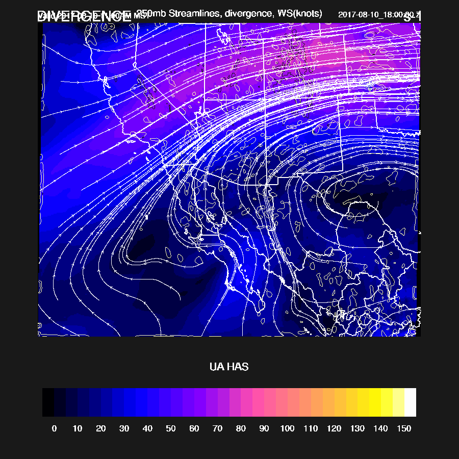
Speaking of 250mb, there is a fair amount of divergence ahead of the upper trough that is over Sonora which will help storm organization so it’s looking like a very active day for parts of southern Arizona.
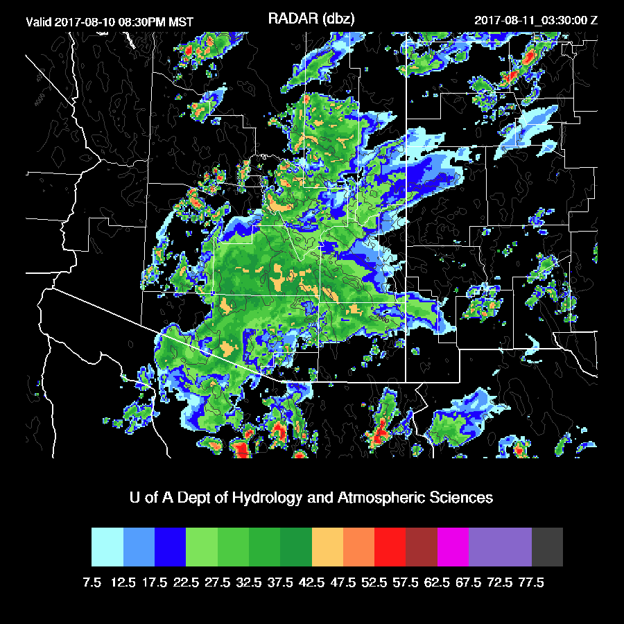
Big storms are scattered across Pima County sometime this afternoon with some likely being severe. Timing is quite uncertain as the WRFRR (below) develops storms later while the WRFGFS has storms developing a couple of hours earlier. I like the later solution as the WRFRR seems to have the best forecast of heating.
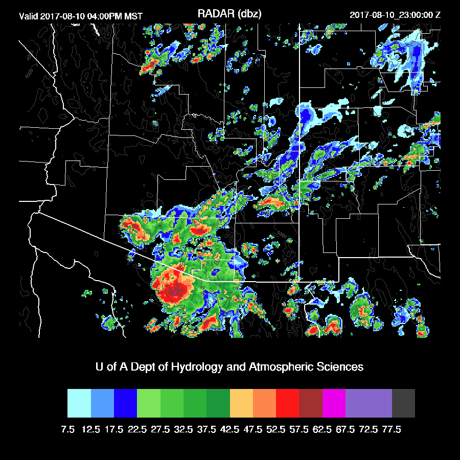
The WRFRRx (below) forecasts strong/severe storms move northward into Pinal County by early evening while the WRFGFS has storms over western Pima and into SW Maricopa Counties. It’s hard to say which is more likely.
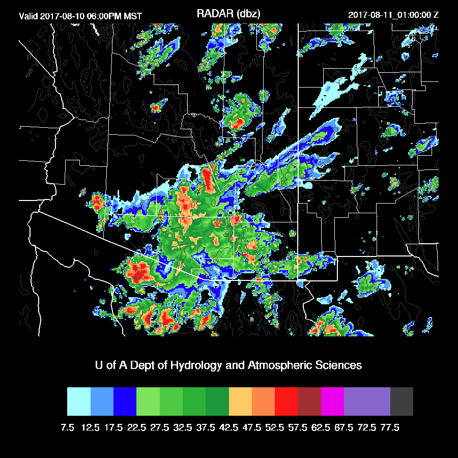
As is typical for the first day of a surge event, the lower troposphere has cooled and moistened. The WRFRR forecasts a shallow BL with a hint of an inversion, so outflows could trigger storms if there is enough CAPE. Unfortunately, the forecast is for only marginal CAPE of around 400 J/kg. There is a fairly deep inverted V profile so it’s likely a strong outflow will move into the Phoenix area accompanied by a big dust storm/haboob.

That is what both the WRFRRx (below) and WRFGFS forecast for early this evening.
The WRFGFS is a bit farther to the west and has very strong/severe winds along I-8 during the later afternoon.

Only a few weak storms are able to in/around the Phoenix area in the wake of the strong outflow. (WRFRRx)
The WRFGFS is more active especially over Yavapai county and out in western Arizona. It also has more activity around the Phoenix area too.

Day 2
The large MCV/IT moves northward over the state and is located somewhere north of Phoenix. Mid level temperatures and winds become southwesterly behind the trough thus the situation is less favorable for activity tomorrow in spite of moderate to high moisture.

Only isolated activity is expected over far eastern/northern Arizona tomorrow afternoon and evening.

No comments:
Post a Comment
Note: Only a member of this blog may post a comment.