Previous Day
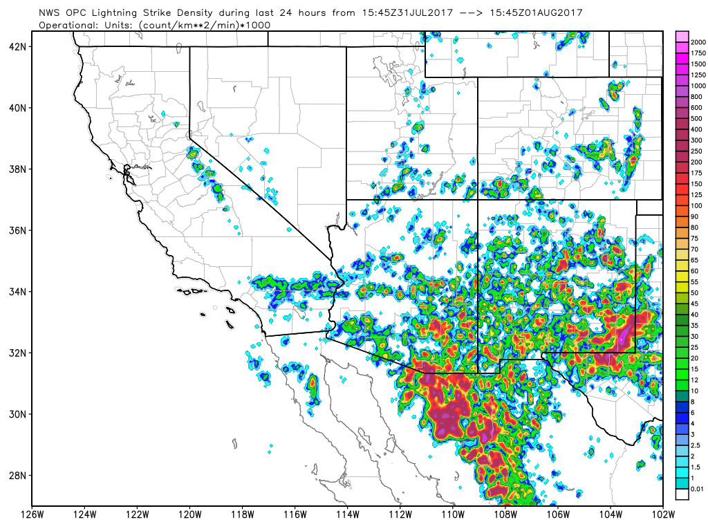
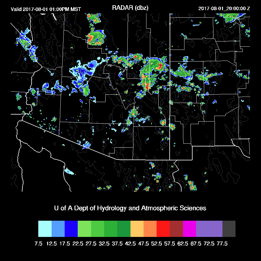
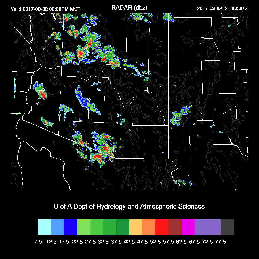
Most storm activity was over SE Arizona with some strong storms mainly over the mid and high elevations. Lightning flash rates were very high with some of the storms.

The WRFRRx (below) kept storm out of both Tucson and Phoenix and had the late afternoon and early evening activity over SE Arizona and was overall the best run. The WRFGFS and WRFNAM did a bit better with evening activity but were too active around the Tucson area, especially the WRFGFS. The weak downward vertical velocities under the anvils kept a lid on deep convection plus there was not as much CAPE as was forecast by the WRFGFS.
Initializations
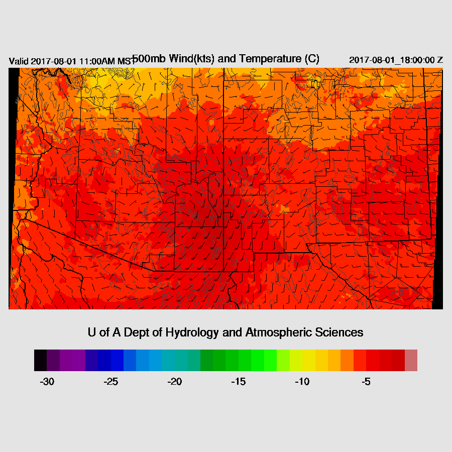
The story for today is the large MCV and all the associated clouds, showers, and some thunderstorm (which was forecast by the WRFNAM and WRFGFS) located just south of Cochise County as seen on morning satellite imagery. A high center is located over Nevada and as Bob Maddox pointed out, there is cold air advection on the east side of the high over CO and NM. Even Phoenix is a bit cooler with a -7 at 500mb.

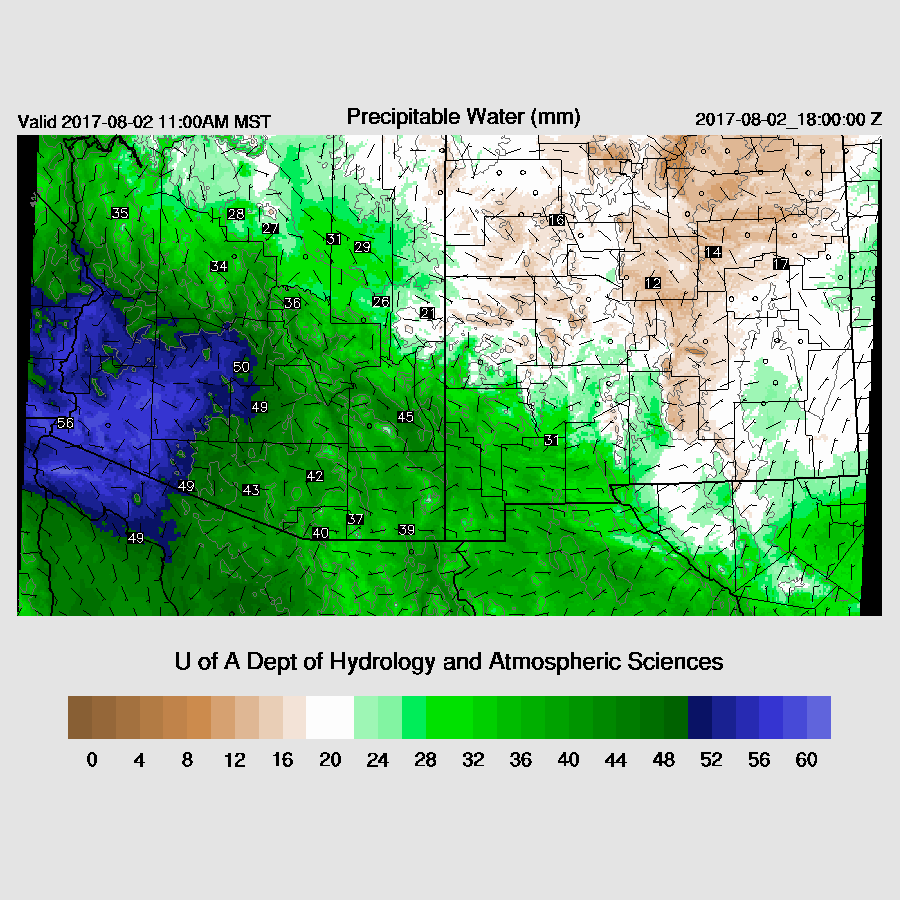
All the initializations are having issues with the MCV as the GFS and NAM have it as an open wave while the RRx has a closed circulation. However, the RRx has it too far to the NW over Santa Cruz County. The WRFRRx has mostly good cloud coverage but the location of the ongoing precipitation is too far north. The WRFGFS and WRFNAM don’t have any clouds or showers in southwestern Arizona but are OK elsewhere. NAM PW is again 3-4mm too high in NW Mexico and into parts of the SW US. The RRx and GFS have only minor IPW errors. Overall, there are major problems with all the initializations and forecast confidence is low.
Day 1
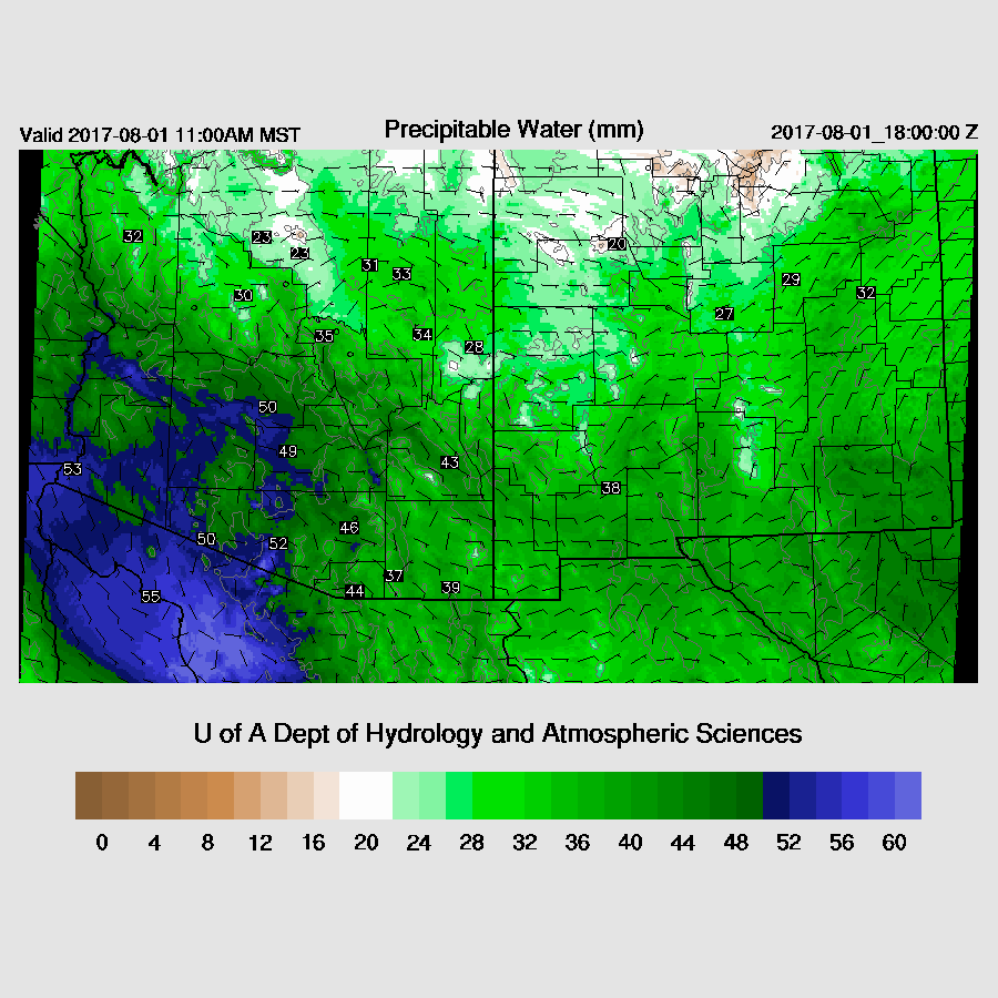
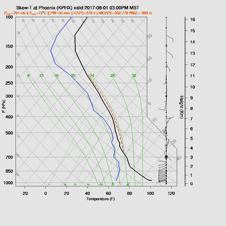
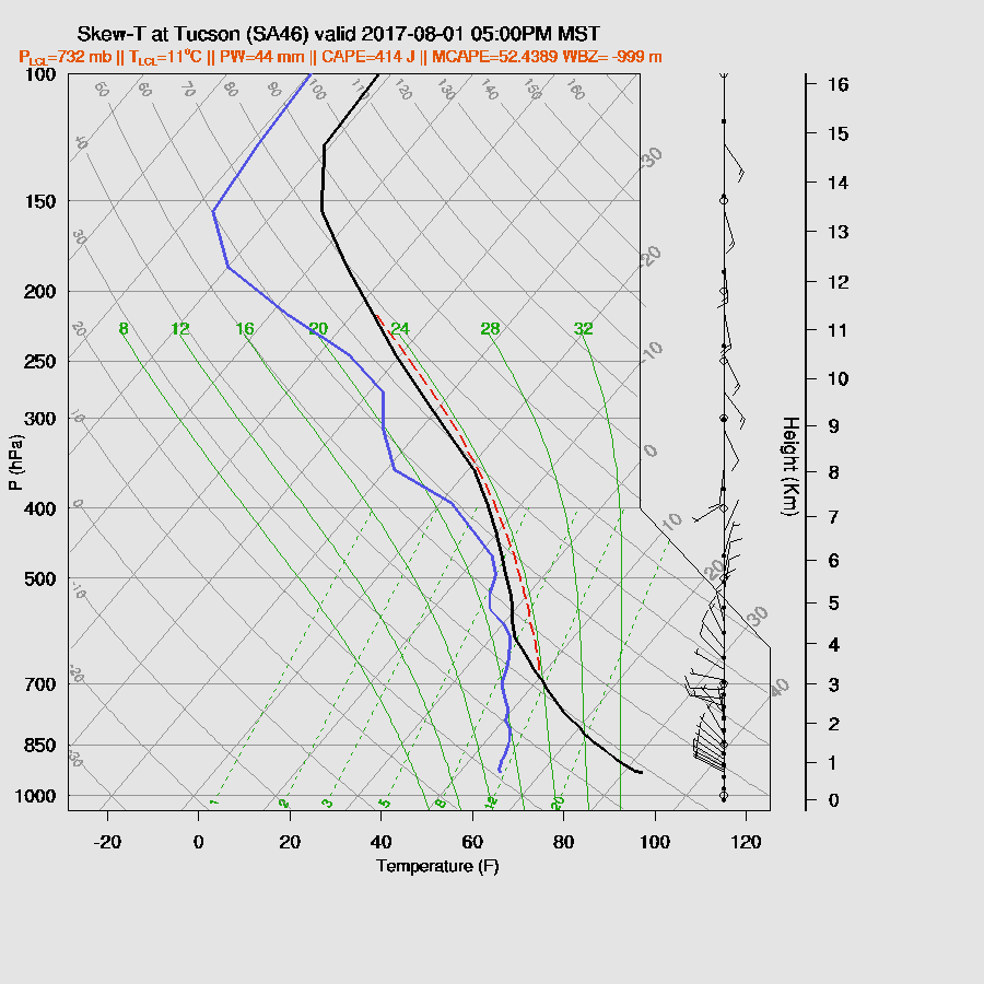
Well, this is a first as the WRFRRx is a few degrees too cool in Phoenix and Tucson. The other two runs are close to observed. Thus I think the model runs have a good handle on the clouds and heating, or the lack of, so far. Very wet air continues over most of the state except over the far SE and north where it is close to normal. Yesterday, the slightly drier air resulted in higher cloud bases and somewhat less precipitation thus lightning was finally more visible and chasers were able to get some good lightning shots.
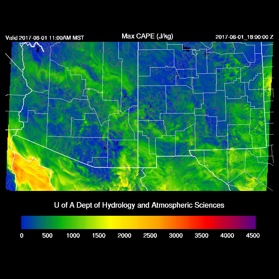
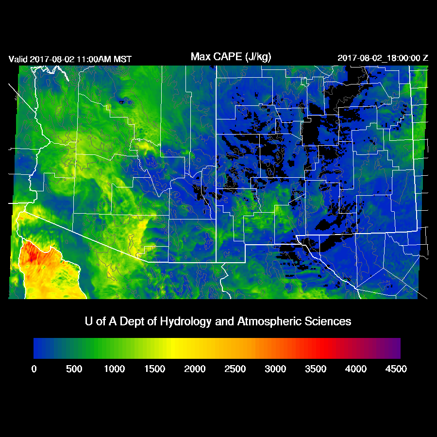
There was very little CAPE at 12Z at either Tucson or Phoenix so just based on that, little or no activity is expected in the lower deserts. Looking at the midday forecast, the situation doesn’t change much. There is low to moderate CAPE over the higher terrain mainly in far SE Arizona and the Rim/White Mountains so with some sun, deep convection should form later today. Satellite imagery does indicate some clearing in those areas.
The cooler mid-level air doesn’t make it down into south or central Arizona and all the runs are struggling with the MCV. The WRFRRx (below) has it too far to the north and maybe even too strong. Most areas of Arizona have poor mid-level steering flow thus organized storms are unlikely.
Current activity is clearly moving to the west faster than what the WRFRRx has at 500mb. The WRFGFS (below) has a better forecast of winds at 500mb and later in the day, has 10-15 knot easterly steering flow. This may help steer any storms towards the Phoenix area assuming any form upstream.

A few storms are underway over the Rim and the White Mountains by early afternoon.
The forecast past this point is uncertain as all the runs have issues that make me question their accuracy. There is a chance of activity over far eastern Phoenix as a few storms may drift off of the higher terrain to the east. It all depends on how much heating the area gets today. 
The WRFGFS and WRFNAM are forecasting quite a bit of CAPE for Phoenix later this afternoon which is likely too high due to all the clouds and showers around now. The vertical profile will probably look more like the WRFRRx (below) with limited CAPE and a fairly shallow mixed layer. The light and variable mid level winds are probably wrong as the flow is likely to be 10-20 knots thus the possibility of a few storms moving in. Again, any forecast for this area is highly uncertain today.
Some runs develop strong storms over parts of SE Arizona later in the afternoon and into the evening and I can believe this as there is some surface heating as the clouds have decreased.

The Tucson area also is likely to have limited heating and minimal CAPE thus little or no activity over the lower elevations is expected.
There may be some early morning activity associated with the old MCV over SE Arizona. The WRFRRx (below) has the location of the low a bit too far to the NE.

Day 2
As the Day 1 forecast is so uncertain, this make the confidence in the Day 2 forecasts also low. The runs agree that western Arizona is to remain very wet but the WRFGFS (below) and WRFNAM significantly decrease moisture over NM and put SE Arizona in downsloping low level easterlies which are unfavorable for storm development. 
The 12Z WRFRRx kept NM wet but a quick look at the 15Z WRFRRx (below) shows that it’s now inline with the other runs.
Mid-level flow remains light and the cooler air in northern NM doesn’t make it’s way to the SW.

A fair amount of clouds are forecast to be present over southern Arizona tomorrow thus lack of heating will again be a problem.

Little or no CAPE is present over the eastern part of the state thus less activity there.
Activity is expected over the higher terrain east of the backdoor pseudo dryline wherever it may be as that is uncertain. If it is farther west like the WRFNAM, it looks like the below.
If it’s farther east, it looks more like the below. Let’s hope for this one.

No comments:
Post a Comment
Note: Only a member of this blog may post a comment.