Previous Forecast
Clouds and morning showers shut down storms over central Arizona. It was active from around (but not in!) Tucson and out to the west and along the CO River. I neglected to look at 250mb flow and what do you know, a big anvil moved across the city from the south at around lunchtime shutting down deep convection over Tucson proper.
The WRFGFS and the 15Z WRFRRx were OK. They had issues but had the right forecasts for most areas.

Initializations
The 500mb ridge has moved slightly to the NW with some very high heights over the NW CONUS. Arizona continues to have weak mid level flow with a weak IT moving NW south of Vegas. A little cooler air is present at 500mb as temperatures are -6 to -7.

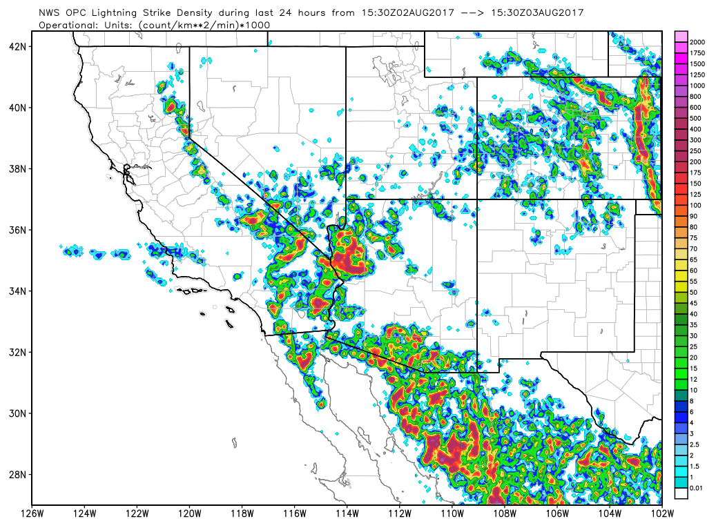
Satellite imagery shows showers and storms associated with the Vegas IT and clouds are also present over much of central Arizona while the rest of the state is mostly clear. A large MCV (or small IT?) is located in western Chihuahua and seems to be mainly stationary and there may be another weak MCV near Nogales. I don’t know what is wrong with GOES-W but it looks like a drunk walking down the street as morning imagery is shifting back and forth by 50 to 100km.
500mb initializations look good as they even have the Chihuahua IT/MCV. The WRFRRx has initialized clouds well while the WRFNAM and WRFGFS don’t have quite enough but are still pretty good. The NAM IPW initialization in NW Mexico is bad with large errors at multiple stations along the coast. The GFS and RRx have only minimal IPW errors. Overall, the WRFRRx and WRFGFS have initialized the best. The WRFNAM might be OK in Arizona for Day 1. As the weather situation is fairly simple this morning, model confidence is higher than it has been recently.
Day 1
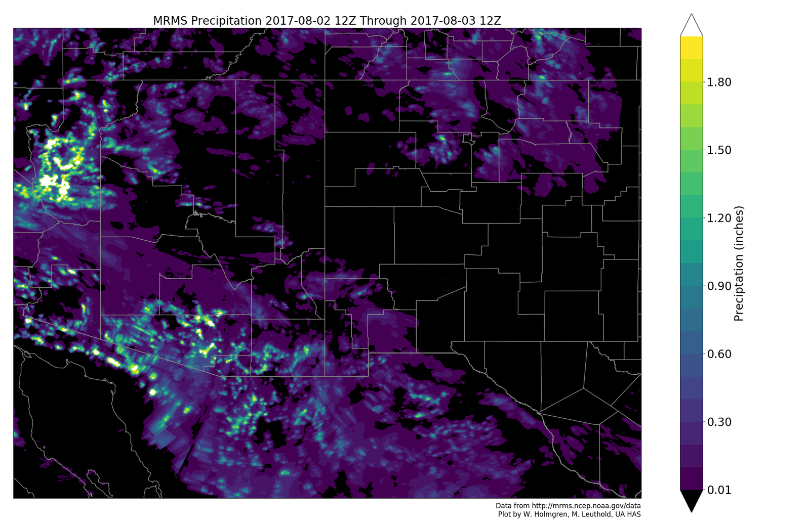
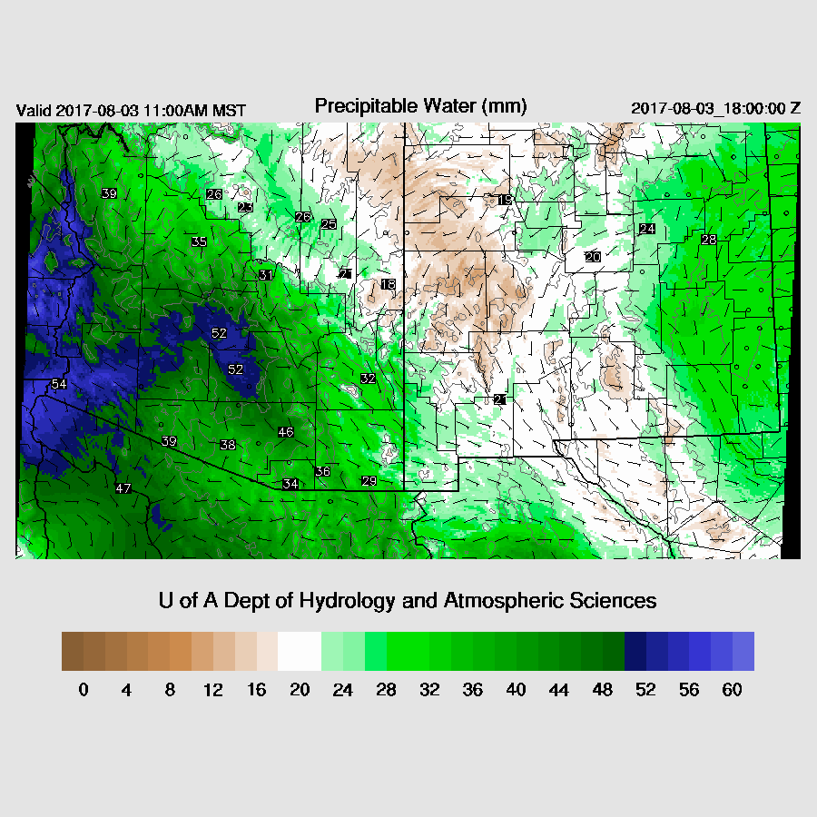
The run of very high IPW continues today as it is very wet air is over western and central Arizona. Drier air is advecting into much of eastern Arizona with Tucson right on this boundary again.
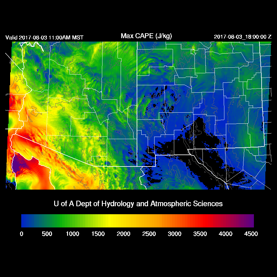
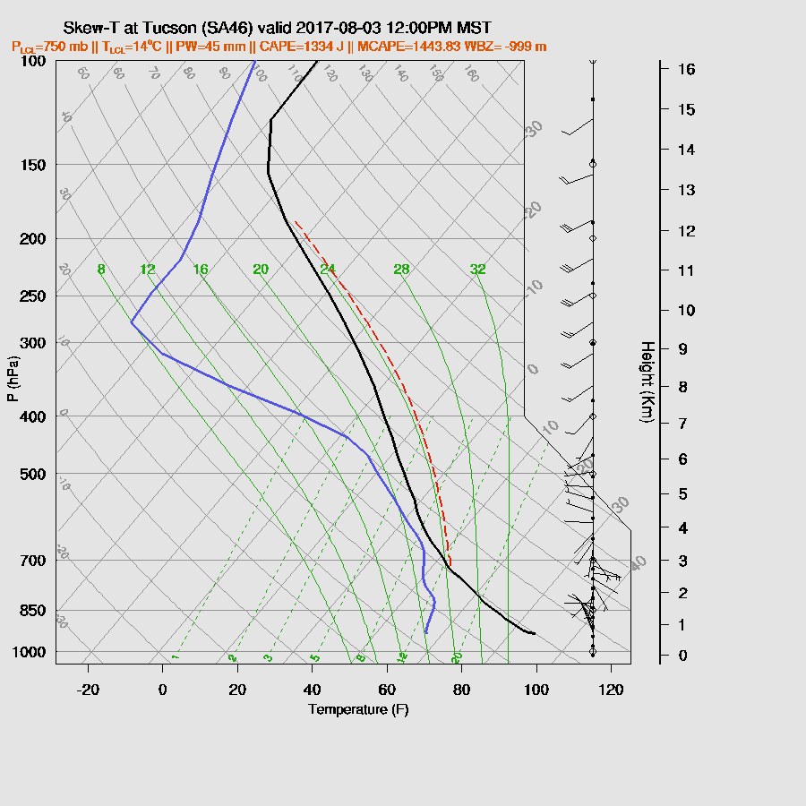
CAPE goes from almost 0 over far eastern Arizona to extreme over western Arizona which may be too much as the 14Z Yuma sounding has only 950 MLCAPE with a forecast surface CAPE of 1600 J/kg. Both the Tucson and Phoenix 12Z soundings indicate quite a bit of CAPE with Tucson having almost 1400 MLCAPE. The problem, like yesterday, is that storms develop quickly around the nearby mountains early and may blow anvils across the valley. As Bob Maddox said, upper winds are WSW so perhaps that will be less of a problem today.
A rather impressive looking vertical profile at Tucson by midday as CAPE is high at around 1400 J/kg. The BL isn’t mixed very deeply but the LFC is low at 750mb so it doesn't have far to go. Winds are poor with 0 steering flow so storms that form won’t move much and valley storms will have to form on outflow boundaries. Anvils are likely to blow over the valley at some point from convection over the higher terrain to the southwest. Hopefully, deep convection gets going in Tucson before that happens.
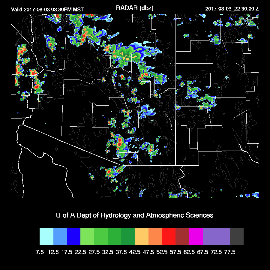
Deep convection develops over the higher terrain just south of Tucson during the early afternoon. Other strong storms are underway from Flagstaff and to the west of there. The 12Z WRFRRx went off the rails quickly this morning as it developed a large area of strong convection over central Arizona thus it will be ignored and that most of the forecast is based on the 12Z WRFGFS. Maybe the 15Z WRFRRx will be better.

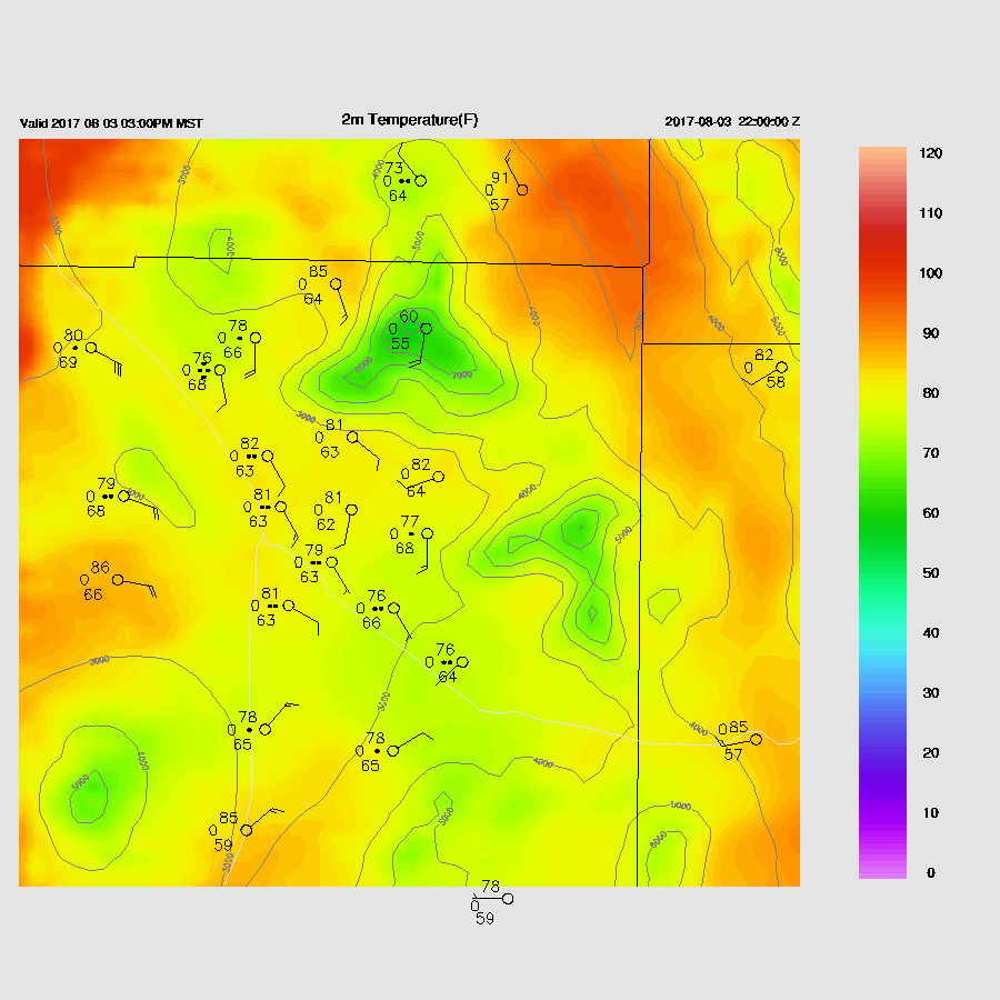
The WRFGFS seems to think most of Tucson is going to see storms and precipitation this afternoon.
The WRFNAM (below) forecast is considerably different and similar to the situation yesterday as storms develop to the SW of Tucson and an anvil comes over and shuts down deep convection. Another problem is that the low-level easterly flow begins to dry Tucson out during the afternoon hours which results in only scattered storms around Tucson.
The CAPE forecast is considerably different between the model runs as the WRFGFS(below) has a lot of CAPE for Phoenix by late afternoon and a well mixed BL. Winds are unfavorable as they are mainly weak and unidirectional. The WRFNAM has less CAPE of only around 800 J/kg which may be sufficient to support some deep convection if there is outflow convergence. 
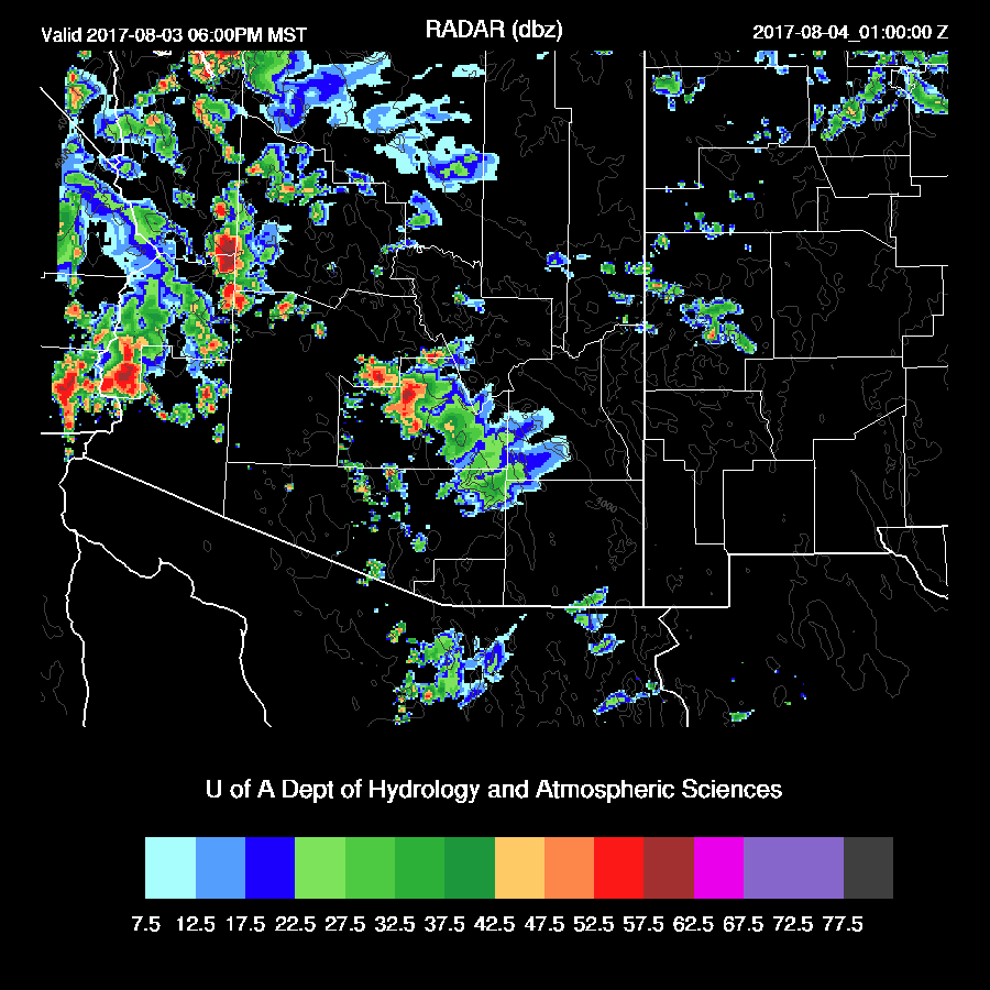
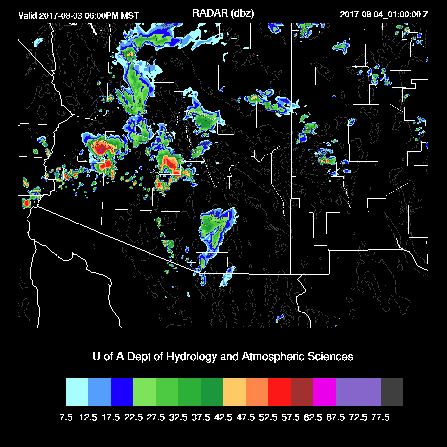
The WRFGFS and NAM do have a similar forecast as they have storms moving through Pinal County by early evening and strong/severe storms out to the west.
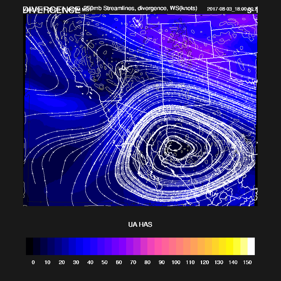
The western Arizona storms are being supported by good difluence and divergence at 250mb due to the upper trough that was over southern Arizona yesterday.
Both runs are forecasting converging outflow boundaries around the Phoenix area early this evening which is likely to trigger deep convection. It is certainly not a typical direction for outflows to move into Phoenix (from the west) but we’ll take it!

Both model runs have storms in and around Phoenix. The WRFGFS(below) has the strongest storms and some of these may be severe.
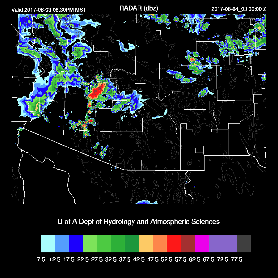
A quick look at the 15Z WRFRRx has a similar forecast as strong/severe storms are over parts of northern ½ of Maricopa County this evening.
Day 2
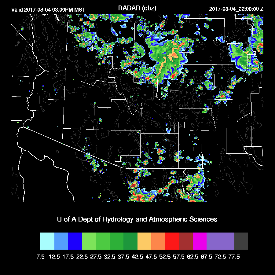
Less activity over the lower deserts as considerable drying take place there. Plenty of moisture continues over northern Arizona where afternoon storms will develop. This is likely to be the last discussion until significant activity returns to the lower elevations.

No comments:
Post a Comment
Note: Only a member of this blog may post a comment.