Initializations
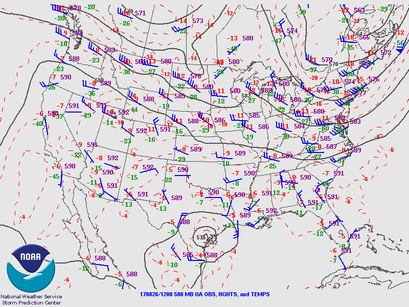
The 500mb map indicates a broad high center over NV and all the way over to OK. Southern Arizona has light easterly winds with quite cool temperatures, around -8C. There may be a weak inverted trough over western Arizona with some associated clouds. The rest of the SW US is clear.
The model initializations all look good mainly because the morning synoptic setup is simple. Model confidence is high.
Day 1
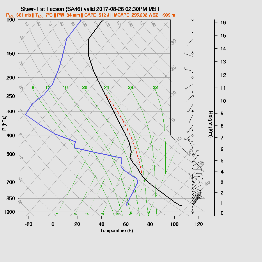
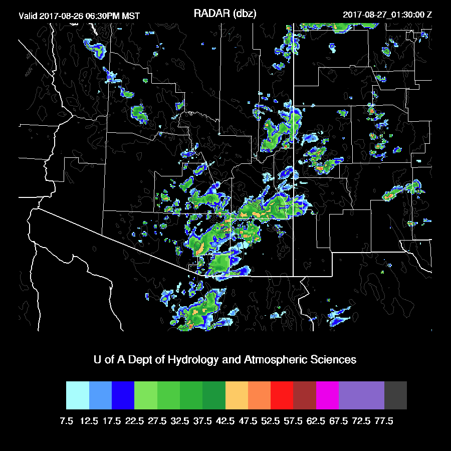
Moisture has slowly increased over SE Arizona over the past day or so and is now in the mid 30mm range at Tucson. Wet air continues over southern Arizona this afternoon with a bit of moisture trickling up from northern Mexico and from SW NM.

Moderate CAPE is in place over SE Arizona today which will support widespread storms in that area.

Tucson is right on the edge of the unstable air. The morning sounding data indicated only a slight amount of CAPE. By afternoon, even when using the wetter WRFNAM, only 300-500 J/kg are present. Too bad as the wind profile is quite good with northeasterly mid-level winds and upper SW winds. The PBL is mixed deeply thus storms that form to the east of Tucson are likely to have very strong winds. A few outflows are likely to make their way into Tucson and may trigger a few weak storms.
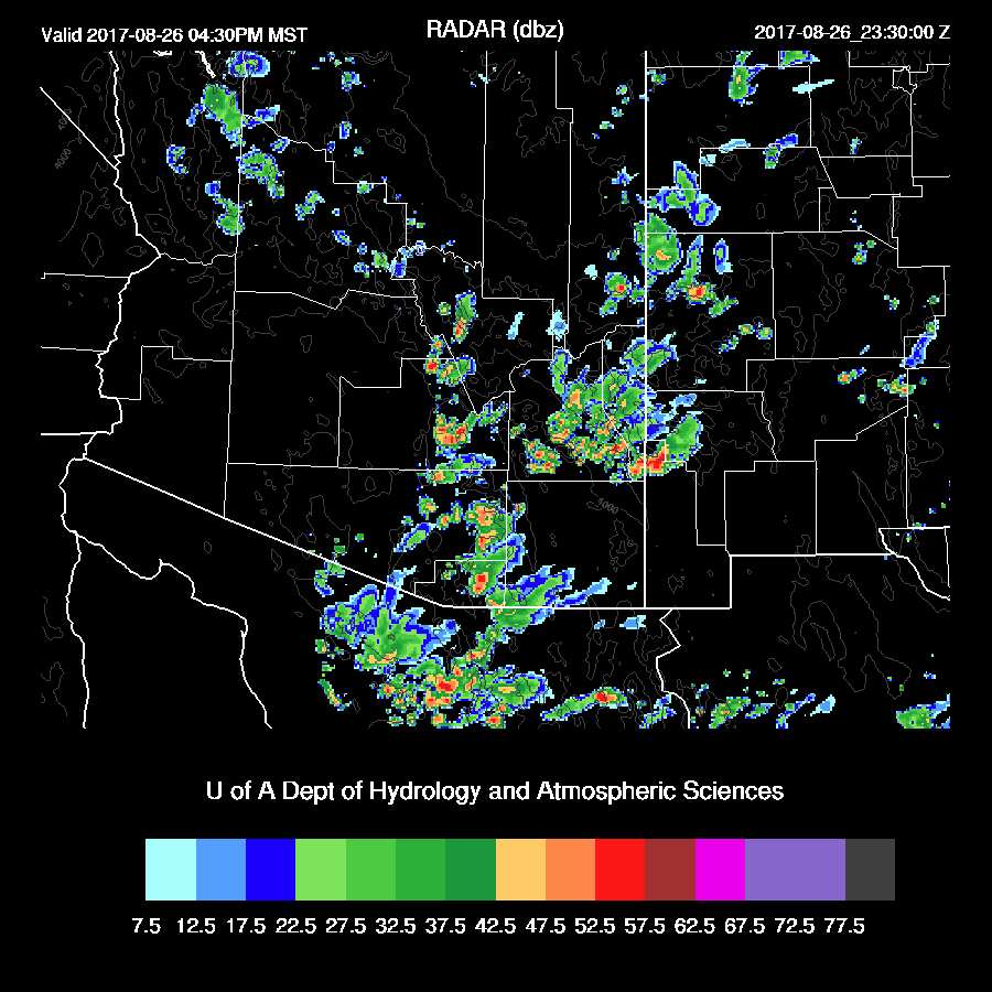
Scattered storms develop over higher terrain in SE Arizona during the afternoon.

Storms continue over SE Arizona during the evening. (WRFRRx)

There is some disagreement how far the low-level SE flow penetrates into SE Arizona. The WRFGFS has it the farthest west which then sets up a low-level convergence zone around Tucson.

The WRFGFS also has more CAPE with around 700 J/kg. This is enough to support some storms in and around Tucson this afternoon.
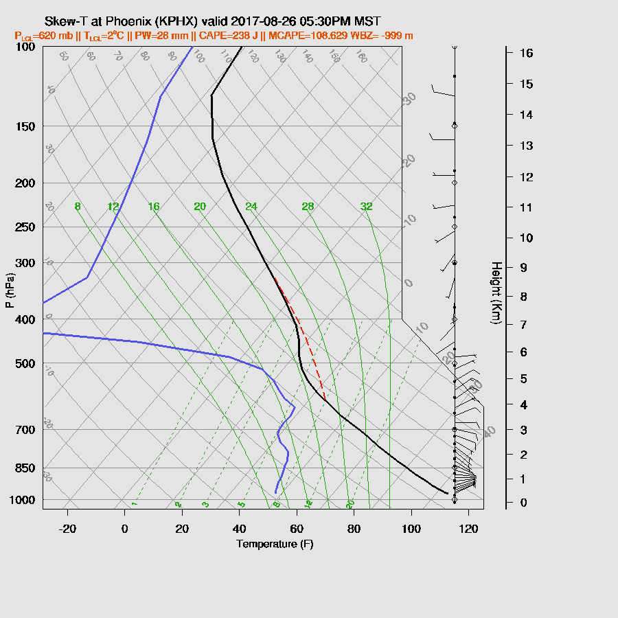
Both the WRFNAM and WRFGFS have quite strong outflows moving through SE Arizona and into eastern Pinal and Maricopa late this afternoon.

There is very little CAPE forecast for Phoenix this evening so it’s unlikely that any storms form as the outflow moves through.
SE Arizona storms dissipate this evening.
Day 2
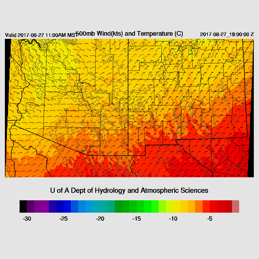
Mid-level steering is excellent over SE Arizona as it’s from the NE at about 10-20 knots. This will steer whatever high elevation storms that form over east central Arizona towards the lower elevations. Mid-level temperatures are again forecast to be fairly cool at around -9 to -6C.
Model runs are all over the place with regards to moisture. Low-level E flow out of NM dries out SE Arizona in the WRFNAM while SE flow out of NM increases moisture in the WRFRRx! Needless to say, the two runs are completely different as the WRFNAM has no activity in SE Arizona while the WRFRRx (below) has scattered storms there during the late afternoon and evening. The WRFGFS is not available out to Day 2 as this is being written.

Just a comment on the idea that moisture from Harvey will somehow make it over here. That looks impossible as strong low-level dry NE flow is present over all of northern Mexico by the 28th which pushes monsoon moisture to the west.

No comments:
Post a Comment
Note: Only a member of this blog may post a comment.