Previous Forecast
Rain, rain, and more rain. Except for Phoenix and most of Tucson.


Impressive 72-hour QPE.

Discussion
See yesterday's.
Initializations
There isn't much to write as the computer cluster got stuck, and no model runs were main until I could log in this morning. I could not log in earlier as my power was out starting late afternoon yesterday. Widespread clouds and scattered showers, and storms continue this morning. A large IT is located over Arizona, with a few MCVs embedded. I restarted the 6Z GFS, and the 12Z runs are available. Once again, the WRFRR went wild with deep convection shortly after it began, so it's out. The GFS and HRRR did have reasonable initializations of cloud and two MCVs, one in SE Arizona and another northwest of Phoenix, so they should be OK.

Day 1
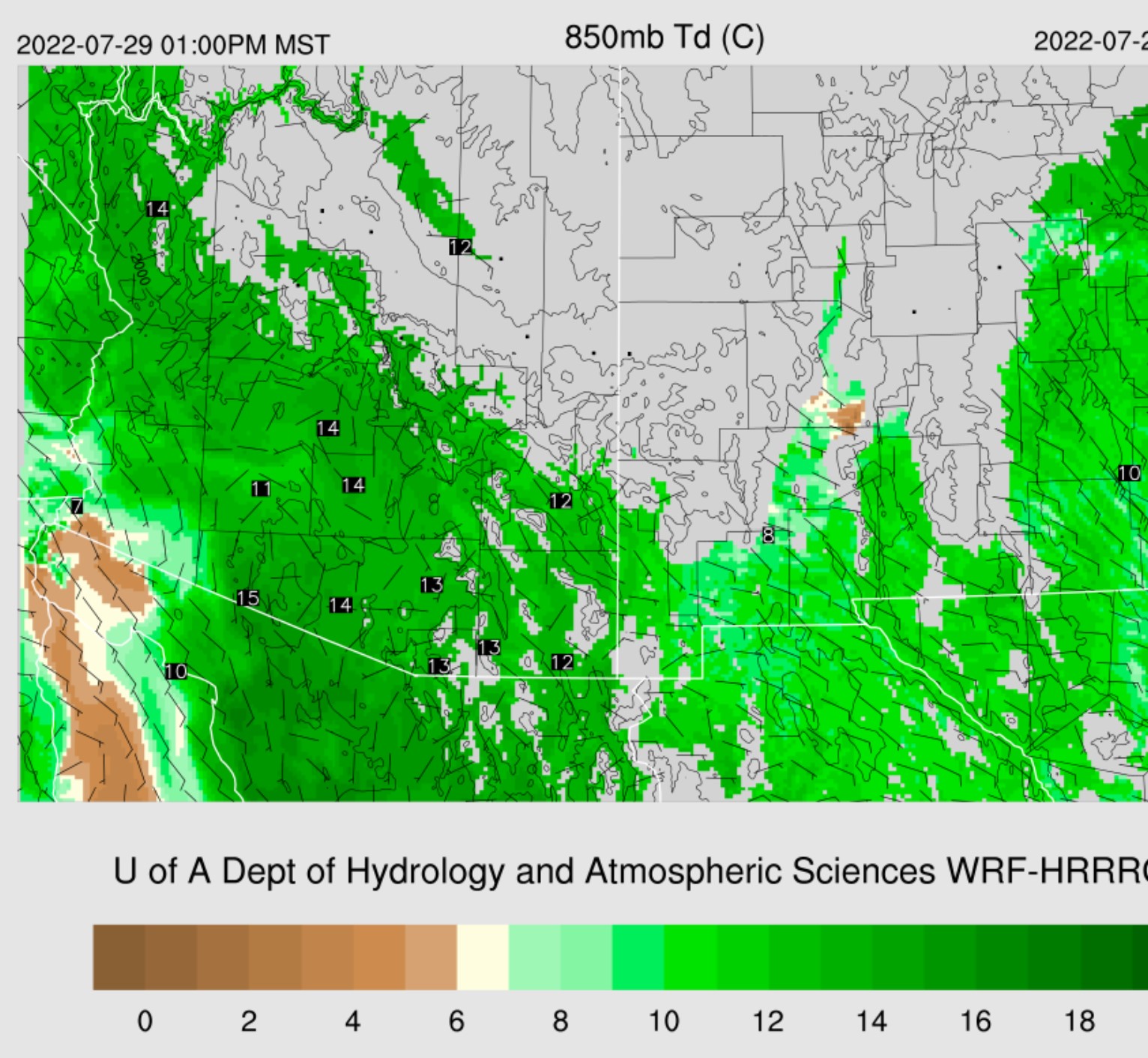
Yesterday's slight drying forecast did not occur, and PW is still above 50mm over the lower deserts as a weak Surge continues. 850mb dewpoints are still very high at 12-15C.

The 850mb low continues slowly moving west, and the Gulf of California is no longer under its southerly flow. In fact, drier air is moving into the northern Gulf, at least at 850mb.

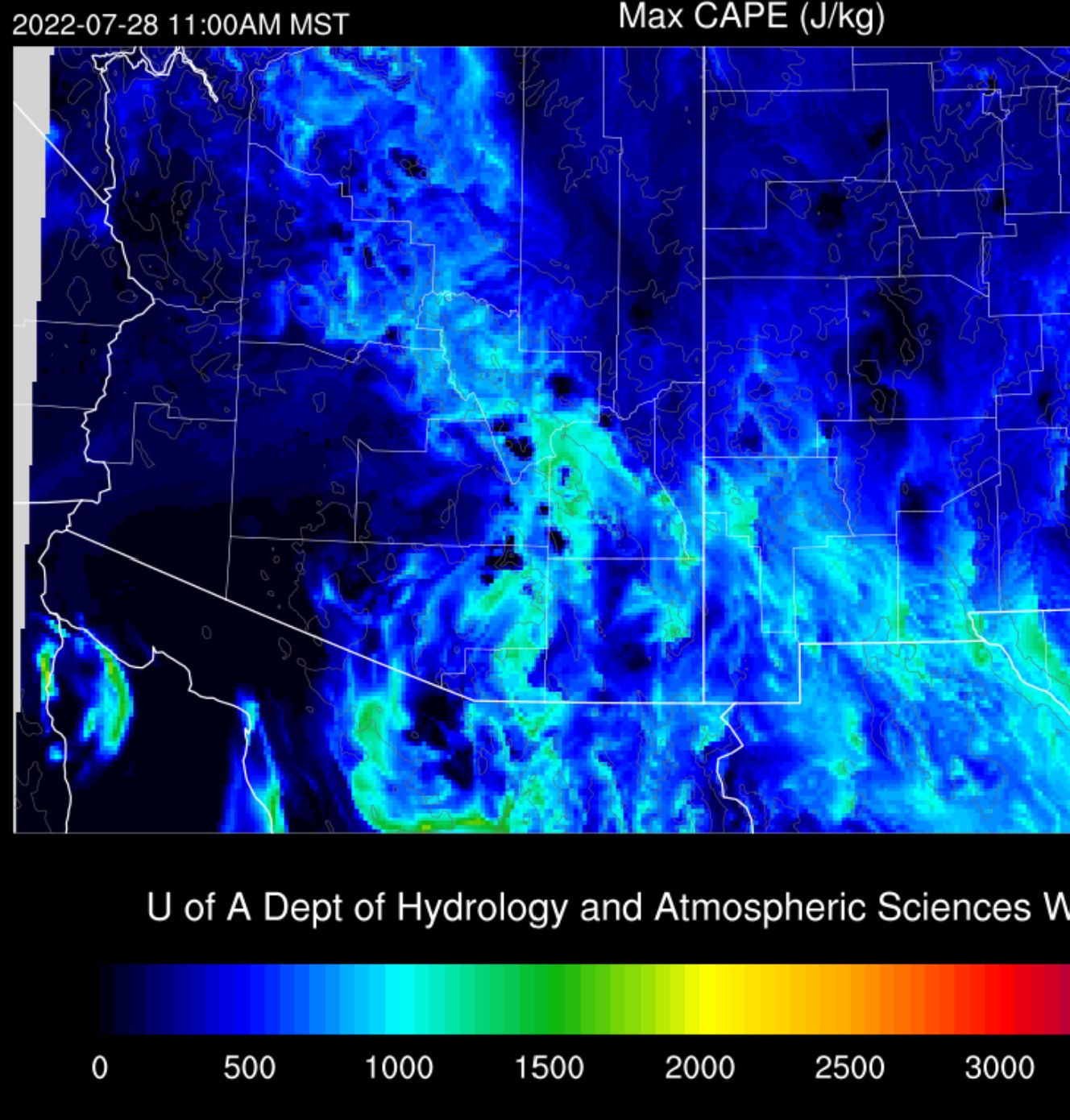
CAPE is generally below 1200 J/kg but more than sufficient for storms over the mid and high elevations. Like yesterday, it will depend on the location of the various MCVs and how much the clouds part for heating.
The WRFHRRR and GFS fire up storms early and are active just after noon. It's not really possible to say where and when, as it, all depends on heating, and WRF can't forecast at this fine scale.

Tucson's Skew-T forecast plot still has the potential for strong storms and heavy rain as CAPE is around 1000 J/kg and PW is a very moist 45mm. The negatives are still poor steering and upper winds potentially blowing anvils out from activity over higher terrain to the NE. I had a question about why there is so little lightning activity. Our airmass is tropical and not much different from Acapulco, resulting in skinny CAPE profiles, weak upward velocities, and minimal charge separation. In addition, the cloud microphysics is mainly warm rain, with less graupel, ice, and mixed phase.

The story for Phoenix also remains unchanged. CAPE is marginal, steering flow very light, a weak cap on top of the mixed layer, and stronger upper-level winds advecting anvils over the valley. PW remains very high at 50mm, so in the unlikely event anything develops, rain accumulation could be extreme.

The four-panel plots are missing. The WRFHRRR keeps most/all activity away from Tucson and Phoenix. Elsewhere, amounts could exceed 3" at some locations.

Day Ahead
Very moist air remains over central and eastern Arizona. There is one slight change as low-level easterly flow increases over southern NM, along with some slight drying. There is also some drying over far western Arizona.
Steering flow improves for southeastern Arizona, so storms might be able to move off of the higher terrain.

No comments:
Post a Comment
Note: Only a member of this blog may post a comment.