Previous Forecast
It was mainly quiet around the Phoenix area. Storms tried to move into Tucson from the east around sunset, but with only ~300 MLCAPE available, the result was only a few showers.

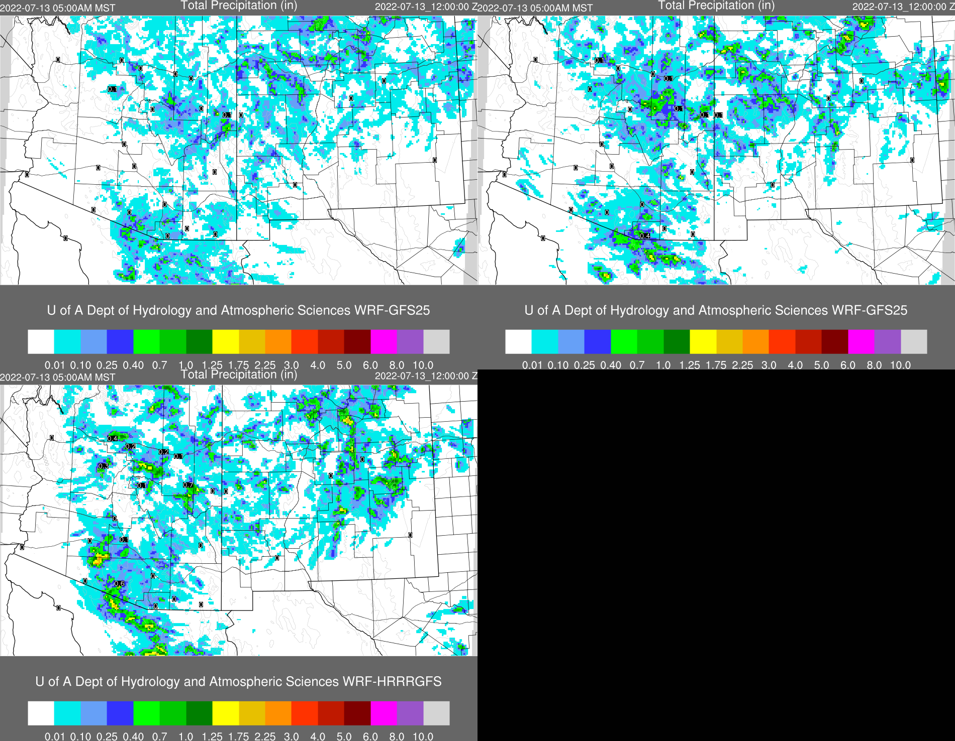
As anticipated, model runs struggled with complicated and poor initializations. The WRFHRRR was able to generate a fair amount of activity west of Tucson but was too active for Phoenix. The later WRFGFS run also had too much activity for Phoenix and not enough in central Pima County.
Discussion
The story so far this July is about the lack of CAPE at lower elevations; another chapter is added today. Once again, Tucson and Phoenix have only a tiny sliver. The vertical wind profile is OK, with 10 knots of southeasterly winds from 700 to 500mb. The GPSIPW trace shows drying over the past 12 hours as the brief outflow-induced has weakened. PW of 48=52mm lurks just south of the border, so it's not far away.


Initializations
Widespread clouds and a few showers were present over SW Arizona this morning, perhaps supported by the ~400 J/kg of elevated CAPE as seen on the Phoenix Skew-T. GOES also sees some CAPE in the Phoenix area. No initialization is bad, but the HRRR doesn't have quite enough clouds and showers, and the 12Z RR, again, is too cloudy and initialized with too much activity. IMO, the errors aren't severe enough to discount those runs.

Day 1
WRF continues to forecast some moisture advection due to a weak surge. During the day, PW increases over western and central Arizona, while subsidence and dry advection continue for far SE Arizona. 850mb dewpoints are OK at 10-12C over central Arizona, and the surge flow is quite deep as 10-15 knot southeasterly winds are widespread at 850mb. It's a bit of a head-scratcher why there isn't more moisture and CAPE.


It's the same old story with CAPE, as most state locations are below 1000 J/kg. It's sufficient to support mid and high-elevation storms but insufficient for much activity at lower elevations. The exception is central and western Pima County, which is relatively high by afternoon.


No comments:
Post a Comment
Note: Only a member of this blog may post a comment.