Previous Forecast
A few showers developed over far SE Arizona, producing gusty winds and little or no precipitation.
Discussion
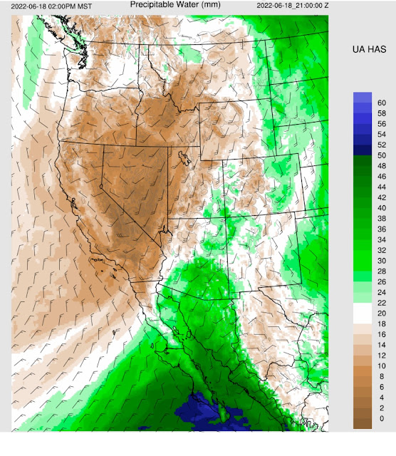
Moisture has increased over southern Arizona but is still not that impressive. Dewpoints are mainly in the 30-40 degree range except along the southern border and in far SE Arizona, around 50 degrees. GPSIPW is primarily in the 20-30mm range but higher in NM and south of the border. Blas is moving WNW and weakening but is close enough to the southern Gulf of California to continue increasing moisture.
A large 500mb anticyclone dominated the CONUS this morning. The west coast trough has deepened since yesterday, resulting in increased wind speed over Arizona, but central and western Arizona are in the unfavorable southwesterly flow.
Initializations
Widespread clouds are present over much of NW Mexico and much of the eastern 1/2 of Arizona. Sattelite animation indicates a weak MCV, moving north over northern Sonora. Clouds are initialized well by the various morning runs. The RR had a broad but weak inverted trough over northern Sonora, while the others had nothing. Nothing stands out to favor any specific initialization today, and all runs are expected to perform well as clouds were well initialized.
Day 1
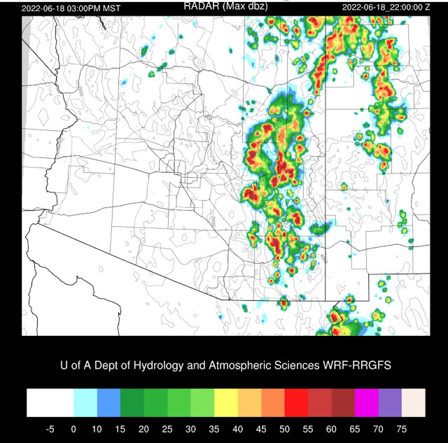
The SSEC TPW and GPSIPW data indicate wet air is just south of Arizona. The various WRF runs consistently advect this moisture into southeastern Arizona throughout the day. Yesterday's runs had the moisture farther to the west. 23Z forecast below.
My favorite forecast indicator for an active day is 850mb dewpoints at or above 10C. Only far SE Arizona has dewpoints approaching 10C by later this afternoon.
Storms are restricted to far SE Arizona during the late afternoon hours.
Moisture and instability increase during the evening hours, resulting in additional storm development, including in the Tucson area. CAPE isn't impressive but sufficient to support some storms. The PBL becomes deeply mixed by early evening, so storms could develop by then. Due to the west coast trough, winds are unidirectional from the SW with little speed shear, so no significant organization is expected.
All morning runs have storms in the Tucson vicinity this evening. Strong winds and blowing dust are the main threats.
Weak storms develop towards the Phoenix area along the outflow boundaries. It appears they don't quite make it into the valley, but widespread blowing dust is likely.
Day 2
Moisture advection continues tomorrow, with impressive (for June) instability and high IPW.


No comments:
Post a Comment
Note: Only a member of this blog may post a comment.