Previous Forecast
Yesterday's forecasts were pretty good as they had only limited activity in Arizona. The forecasts in NM had a bit of trouble with amounts, as WRF couldn't resolve some of the greater than 2" amounts in southcentral NM and into Chihuahua.

Discussion
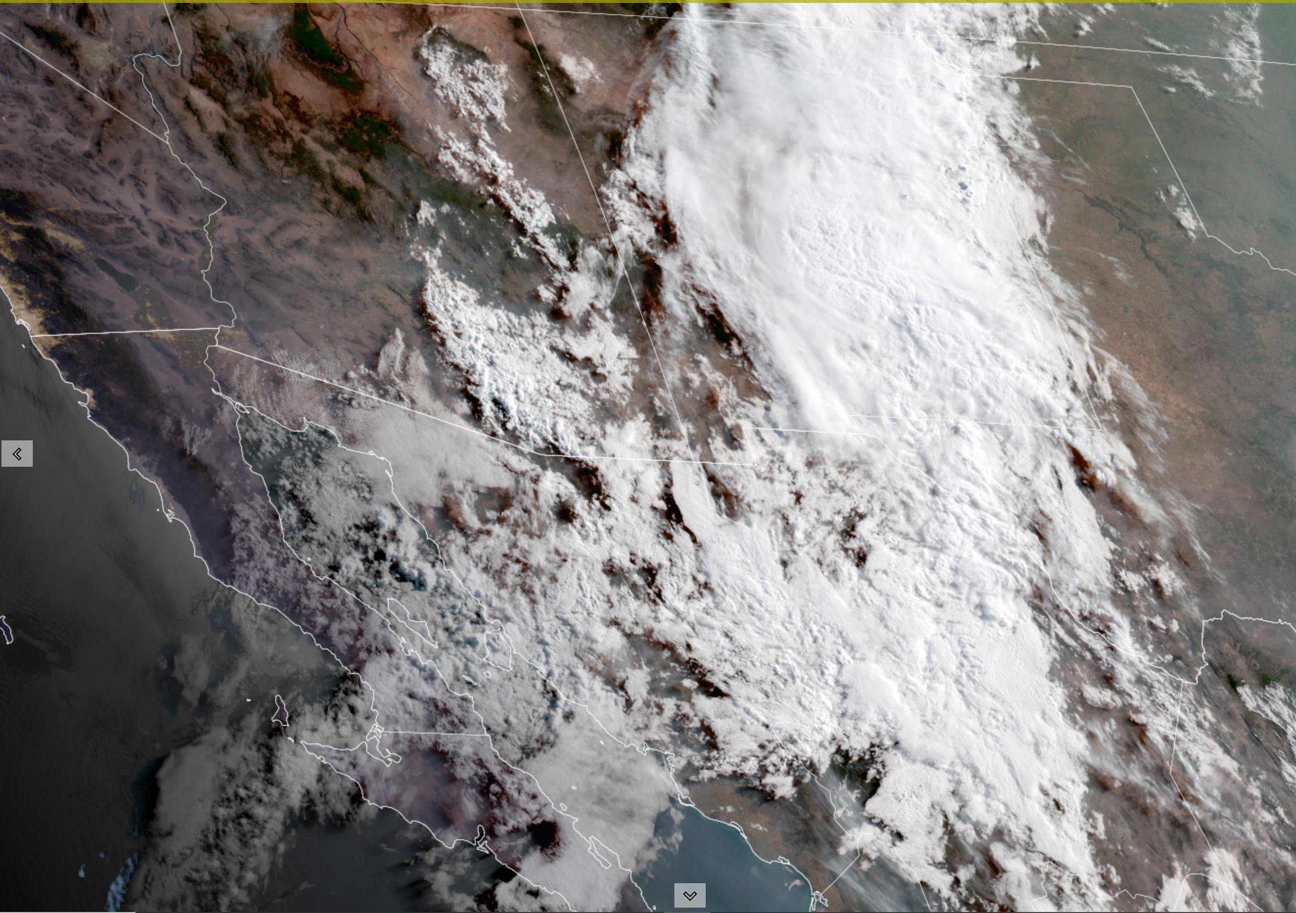
The strong west coast trough, which recently ejected into the NC CONUS, has managed to move the center of the intence 500mb anticyclone to around Memphis, but not before breaking some daily records in the upper Midwest. 101 at Minneapolis and 101 at St Cloud. A weak trough was left behind over the western CONUS, resulting in mostly SW flow over Arizona in the mid and upper levels. While not obvious in the upper air data, satellite imagery reveals a mid/upper cyclone circulation moving northward over southern Baja and into Sonora. Going back a few days, this appears to be the remnant circulation of Blas.


The lower level circulation of Blas is still evident in the SSEC TPW animation, and PW can be seen increasing over northern Sonora and southeastern Arizona. GPSIPW Sonora sensors are in the mid-40 mm range. Strangely, Tucson and Amado haven't seen much of an increase yet. Note the new TS, Celia, off the coast of southern Mexico. It is likely to have a similar track to Blas and will provide another moisture shot into the SW CONUS in a few days.
No moisture increase was seen from the 12Z sounding data from Tucson either. Low to mid-level winds are mainly light and variable, with southwesterly winds dominating above 500mb. Based on the sounding, it certainly doesn't look like much of a day for the Tucson area unless there is a drastic change.
Initializations
Scattered to broken clouds are over SE Arizona and northern Sonora, while dense clouds are over Chihuahua and much of NM. The 6Z and 12ZHRRR and 6Z RR have hardly any cloud over Sonora or SE Arizona and will not be used today. 6Z GFS and the 9 and 12Z RR were better, but I'm concerned clouds will burn off too quickly in the model runs. The 6Z WRFGFS is too wet over southern Arizona this morning by ~6 mm, so this run is also suspect.
Day 1
Moisture increases over much of southeastern Arizona throughout the morning, from an unusual direction, southern New Mexico and the Chiricahua. This direction of moisture transport is infrequent, but studies have shown it can lead to heavy precipitation in southeastern Arizona. Very wet air is present over southern NM with 850mb dewpoints in the 12 to 15C range.
CAPE isn't that high but is more than enough to support some strong storms. Heavy rain appears to be the main threat as the atmosphere is so wet.
Moisture and CAPE slowly increase for Tucson during the afternoon hours. While CAPE isn't too impressive (~500J/kg), the vertical wind profile has good directional shear, resulting in some storm organization.
Just about all runs develop storm activity on a north-south line centered on eastern Pima County by mid-afternoon. I'm not exactly sure why this location seems to be so favored. Maybe the atmosphere to the east is capped?
Low-level flow is quite strong over SE Arizona, and usually, this would be a negative for storm development as it is generally associated with dry air advection and downslope flow. Not today. Outflow boundaries move eastward and trigger stronger storms over Cochise county during the late afternoon/ early evening. Despite every recent run having a similar solution, I'm not too confident this will happen, as it's such a complex situation.
Strong storms continue into the late evening over far southeastern and east-central Arizona. Storms here seem to be assisted by the area under the upper jet's right entrance region. The 250mb forecasts have areas of weak upper divergence over much of eastern Arizona.
The main threat is very heavy rain. Some model runs have areas of over 3 inches for some locations.
Moisture also continues to advect into central and western Arizona during the late afternoon and evening. This results in scattered showers and a few storms. It appears the ejecting mid/upper remnants of Blas seem to be responsible for this activity.
Day 2
Moisture is plentiful over much of the state, and low-level southeasterly moist flow continues from southern NM. Typically, the day after an active day results in a cooled and stabilized atmosphere, resulting in limited activity.
Model runs generally agree that more CAPE will be available tomorrow. We'll see if there is sufficient heating/upper support to allow a repeat.
The west coast cutoff low continues to remain in about the same position, resulting in mid to upper southwesterly flow over Arizona. A weak jet streak also moves through western Arizona, and only weak areas of divergence are present.
The afternoon Tucson vertical profile looks favorable for storms as CAPE is quite good, at 700-1100 J/kg, and there are no significant inversions in the lower troposphere. The wind profile continues to be favorable for some organization of storms.
Some strong to potentially severe storms develop later in the afternoon for parts of southern and southcentral Arizona.


No comments:
Post a Comment
Note: Only a member of this blog may post a comment.