Saturday, July 13, 2019

20190713

Previous Forecast
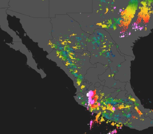
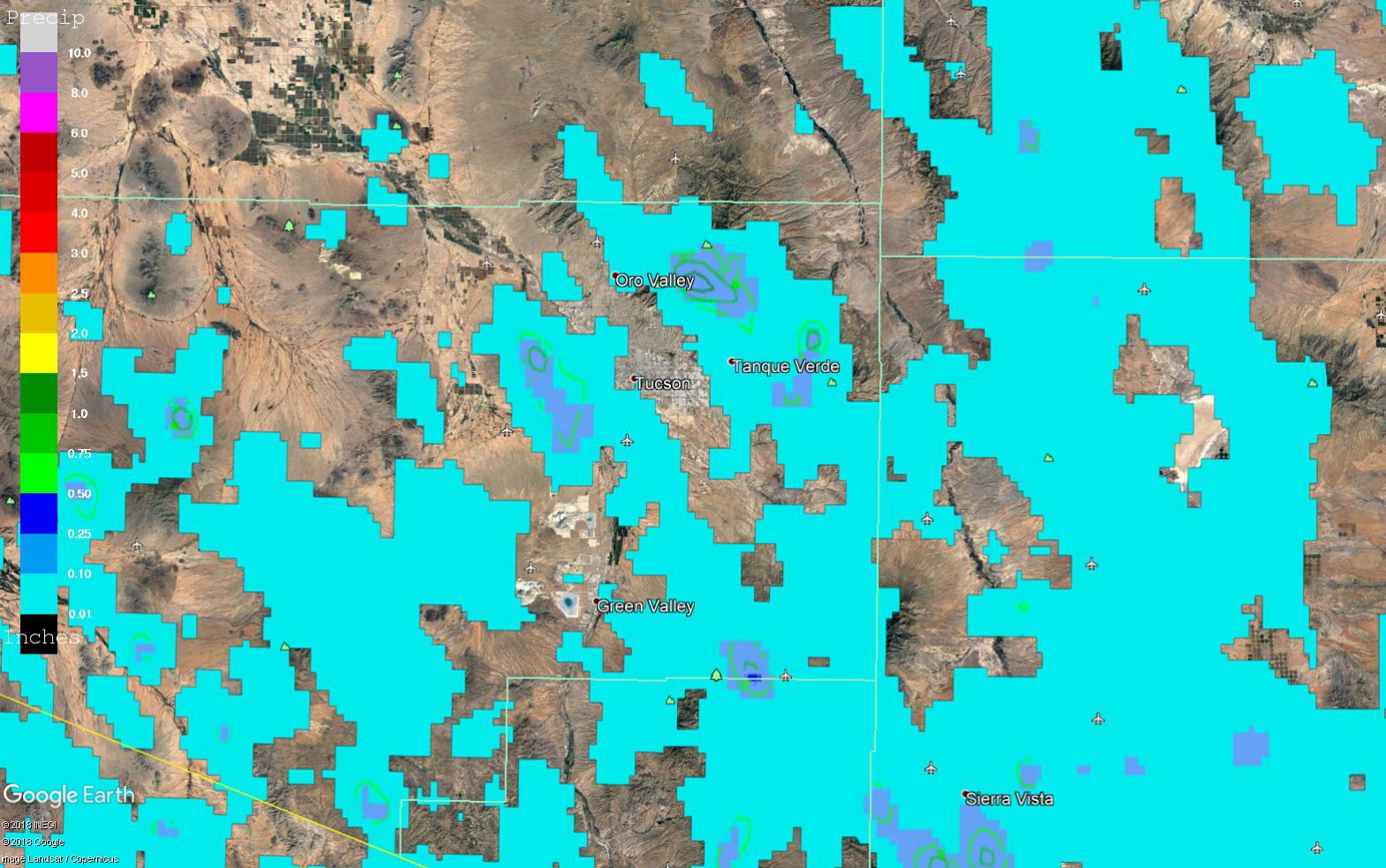
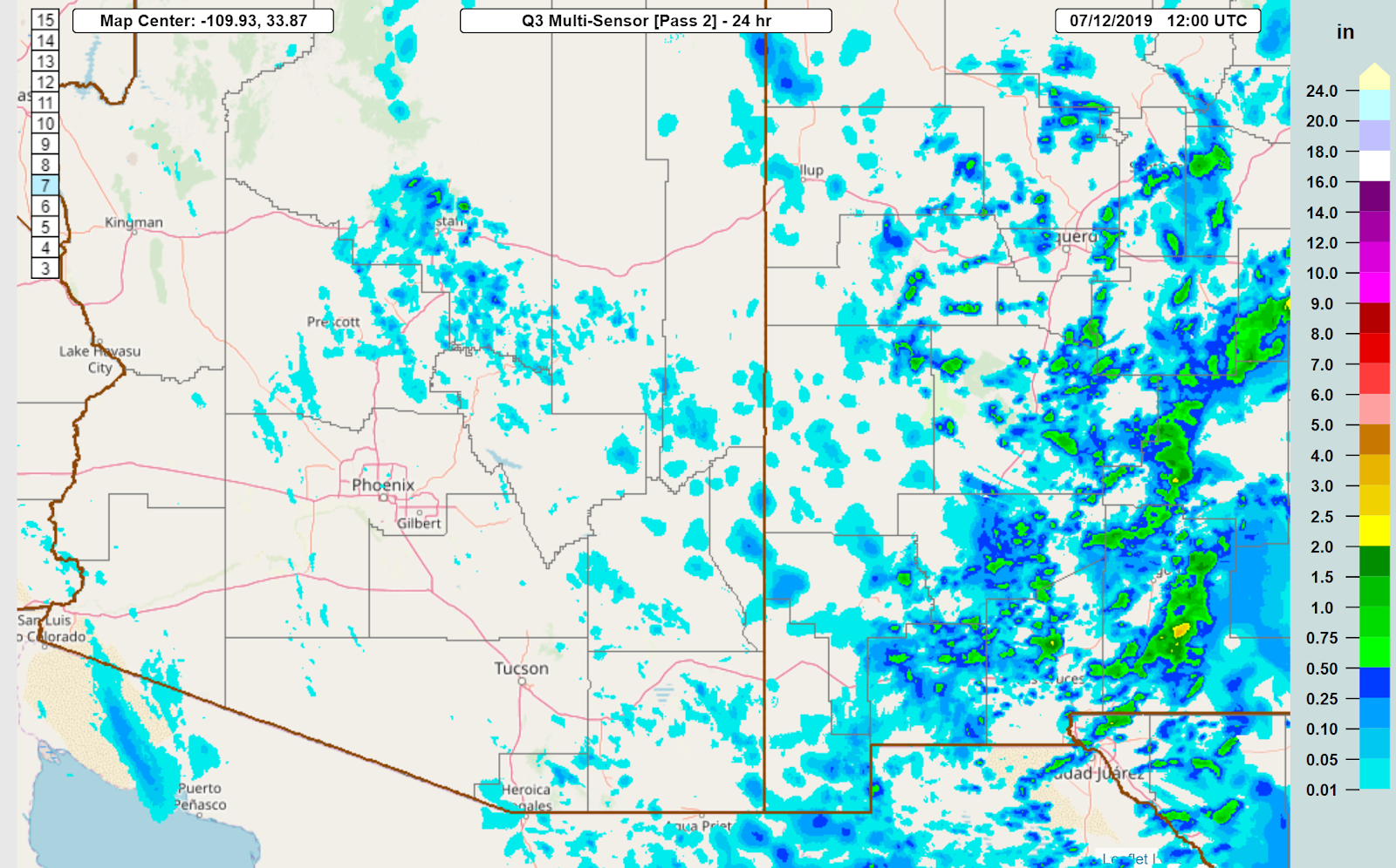
Model forecasts were all pretty good, and the forecast of outflows into the Phoenix area did occur but were weak.  Also, some weak showers/storms formed in Maricopa and Pinal counties which was also forecasted. Below is an image from NSSL’s newest version of MRMS web site which Ken Howard kindly sent me.  This is the Q3 Multi-Sensor product which as you can see, has coverage into Mexico.


Initializations
The morning 500mb map is again similar to the past few days as the 500mb anticyclone continues to be centered near the Four Corners, thus placing Arizona in favorable southeasterly flow.  A broad, but weak inverted trough, is over north-central Mexico, The 12Z runs have a weak trough over the central Gulf of California which I can’t find any evidence of in any data. There a weak MCV and associated clouds and some showers over west-central Sonora which is moving WNW.  Debris clouds from the overnight Mexican MCS are over south-central Arizona. The NAM is missing these clouds while the other two have some, but not enough, thus the WRFNAM will likely be too active. It all depends on how fast the clouds move out and/or dissipate.


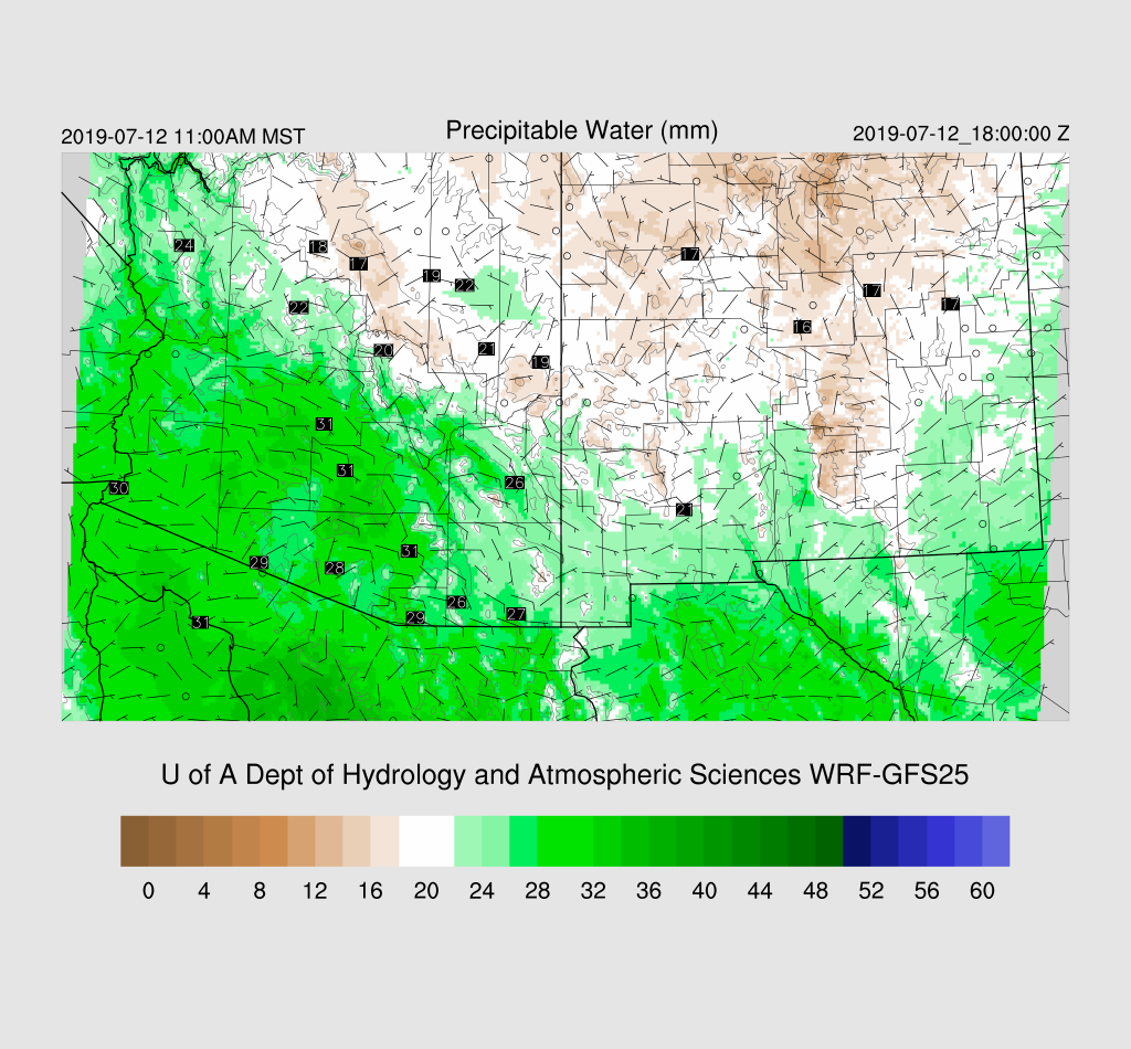
Both the NAM and GFS are generally 2-3 mm too wet over much of Arizona while the RR has only minimal PW errors.   Overall, I think the WRFRR will most likely be the better run and the WRFGFS is OK too as it had the best coverage of clouds.


Day 1
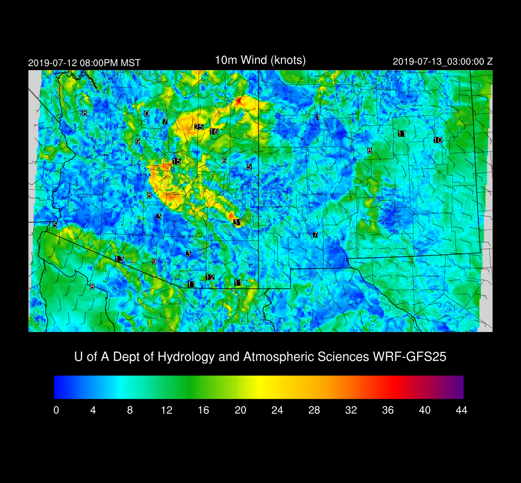
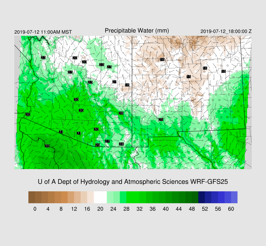
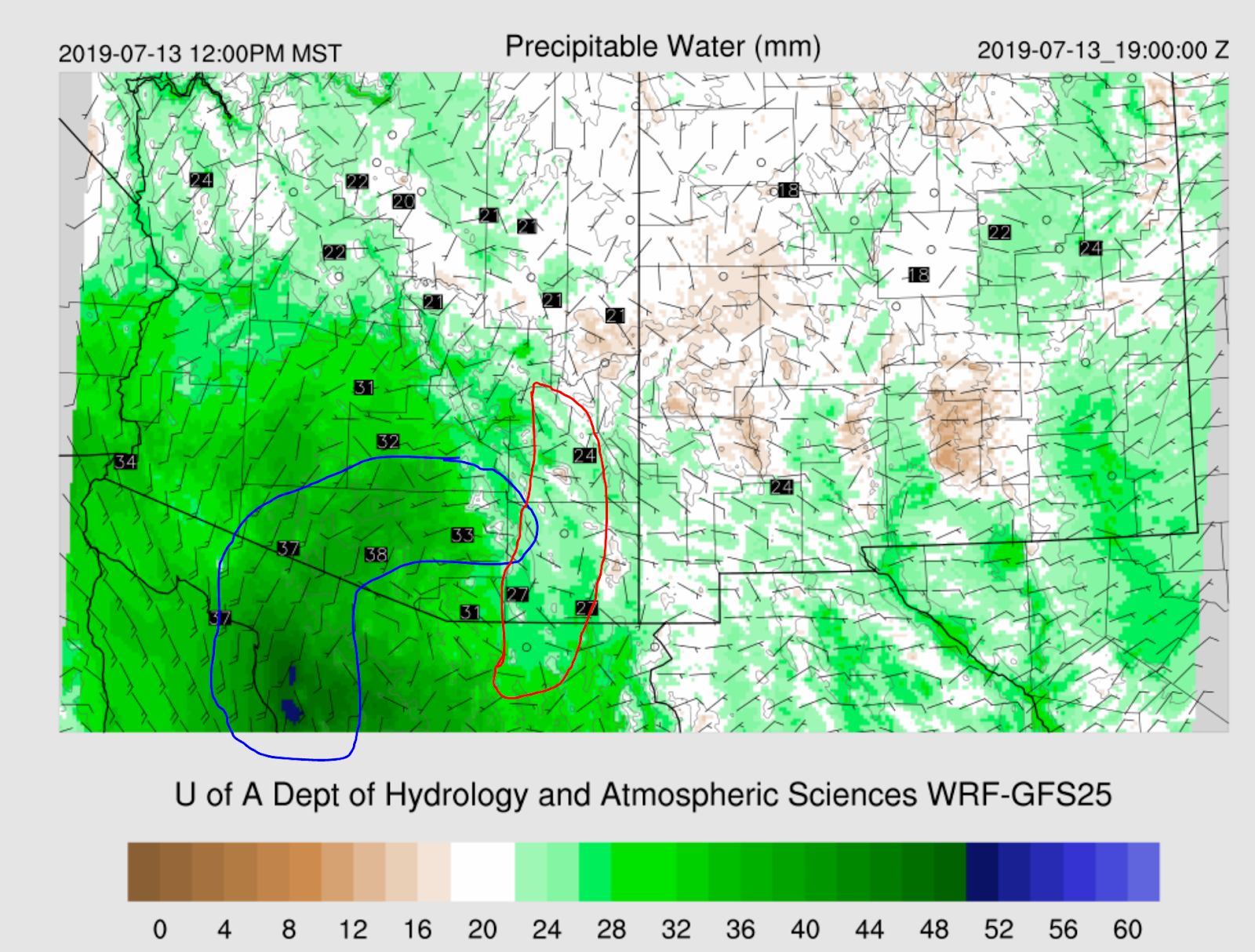
As was being predicted yesterday, a gulf surge is now underway as winds at Yuma are southeasterly at 20 knots and the Td is 68.  It’s shallow as PW has risen only slightly. The surge is an outflow surge from the NW Mexico MCS. Moisture has also increased over far southern AZ as PW has increased to nearly 35mm at Amado and Organ Pipe.   The surge continues during the day today which continues to advect moisture into south-central Arizona. Also, low-level dry air is moving to the west from NM which is setting up a low-level convergence zone along the Pima-Cochise County line.  Note the plume of highest PW curls around into eastern Pima county.

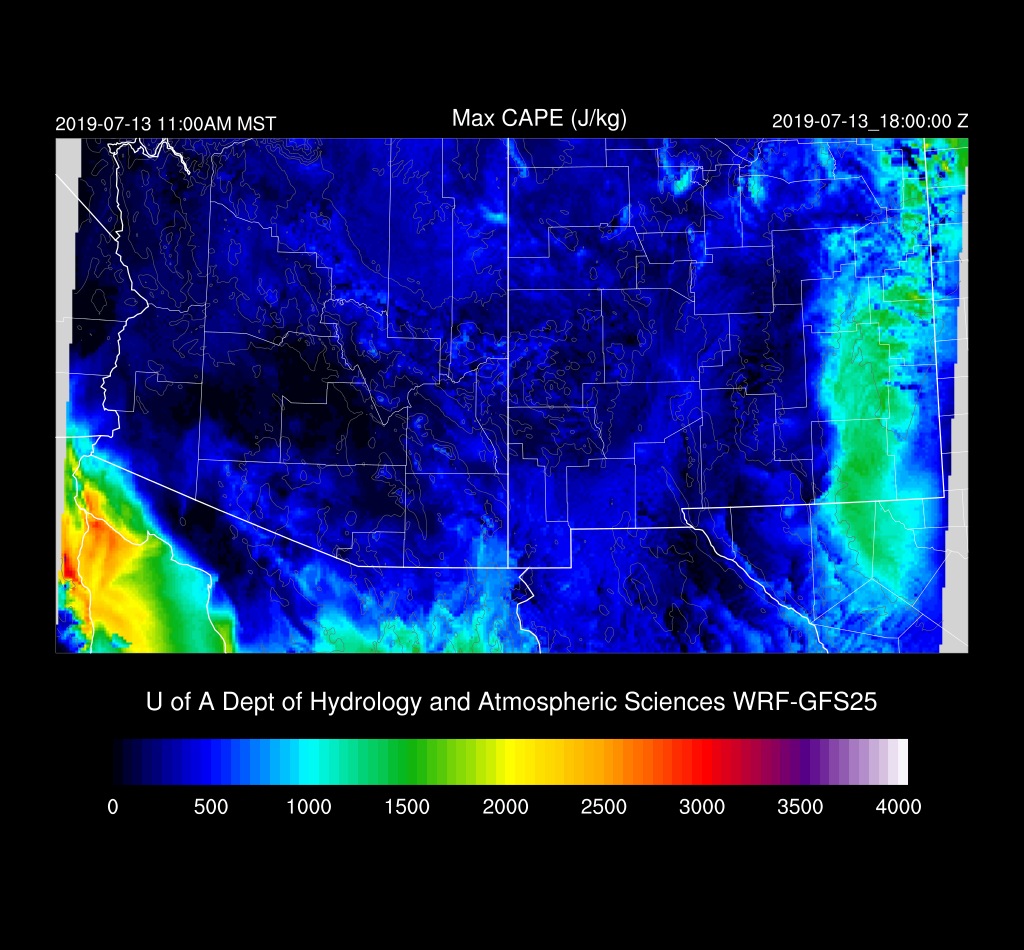
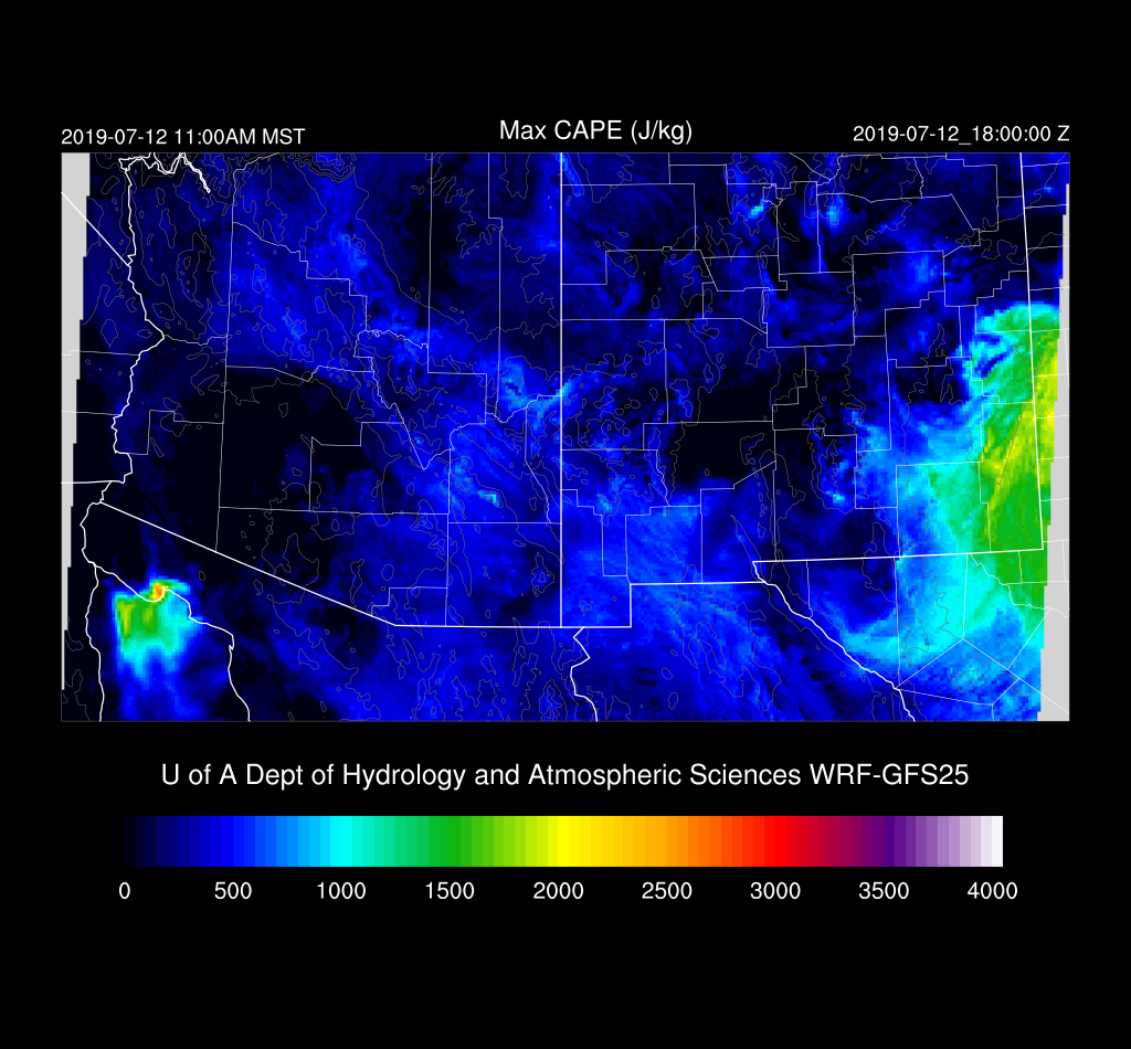
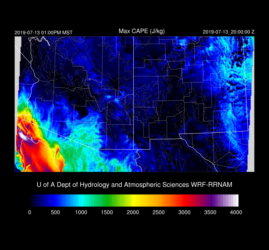
This plume is also seen on the Max CAPE plot with some areas approaching 1500 J/kg.  Those areas in Santa Cruz and central/eastern Pima county is going to be the hot spot for convection this afternoon.

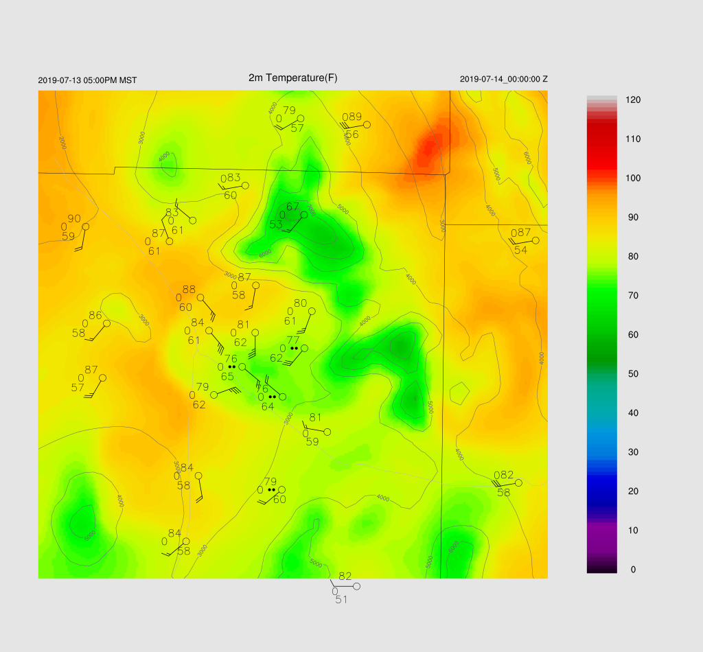
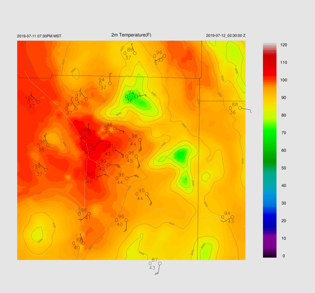
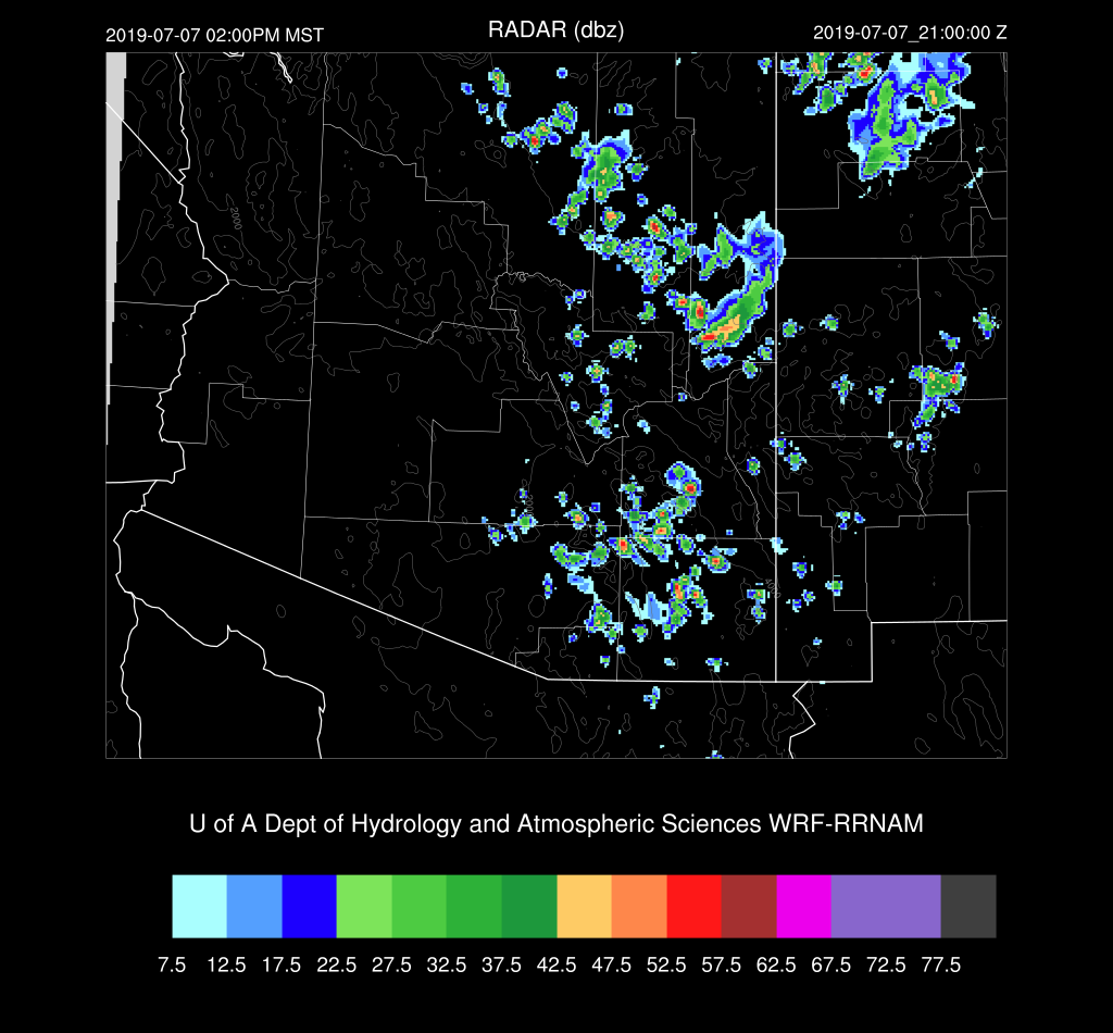
The three 12Z runs don’t agree at all for this afternoon.  The most active is the WRFNAM as it incorrectly has full heating today.  The middle of the road is the WRFRR which is probably still too active due to too much morning heating.  It develops very strong storms right along the border. (checking forecast 2m temperatures at 18Z, I see that the WRFRR is pretty close to observed)


The WRFGFS has hardly any activity.   Looking closely at the PW forecast, I see that the WRFGFS is 5mm too dry at Amado and 3mm at Tucson.  While I think the WRFGFS is not going to be active enough, I can’t entirely discount it. (as of 18Z, it is also too cool over Santa Cruz county)


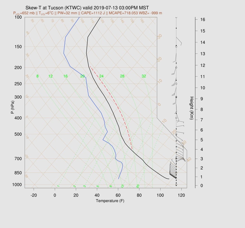
Tucson has quite a bit of CAPE (WRFRR) this afternoon with surface-based CAPE above 1000 J/kg.  I did more or less fix that calculation by moving the location of the “surface” out of the super adiabatic layer for the CAPE calculation.  The wind profile is good with both low-level moist NW flow plus good easterly steering. However, note the weak cap on top of the fairly shallow (for AZ) mixed layer.  Tucson will need a strong outflow to trigger deep convection.

Both the WRFNAM and RR move a strong outflow into the Tucson area by late afternoon.  
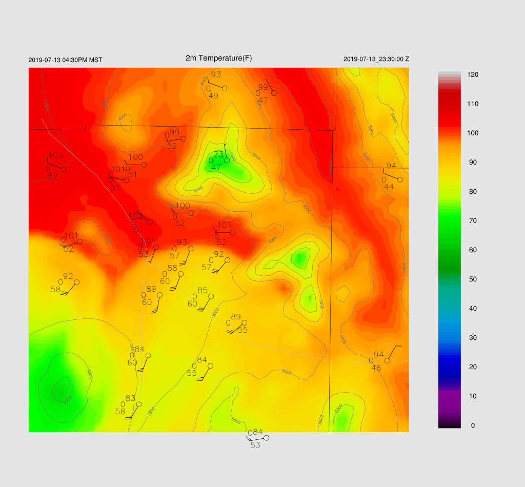

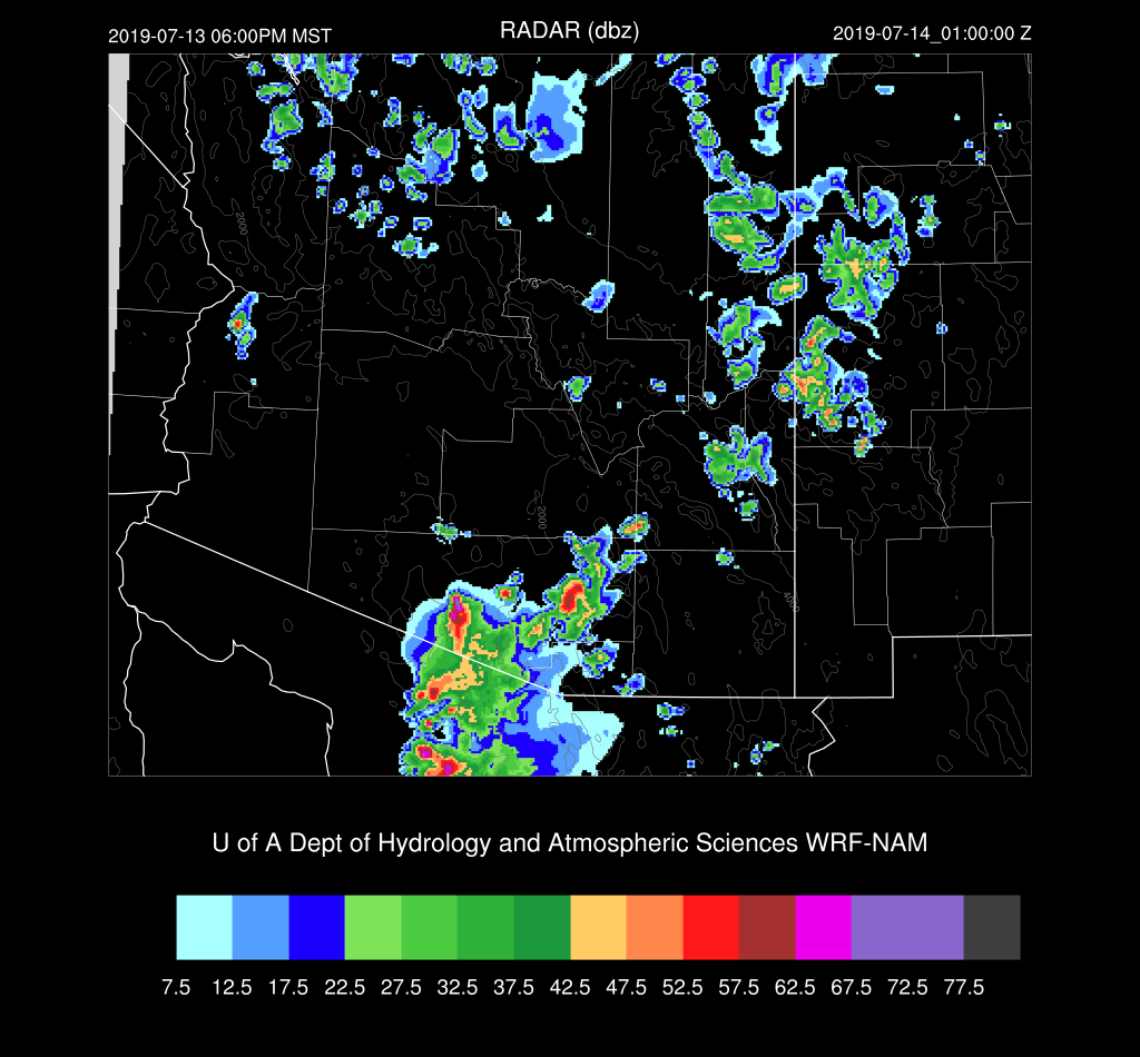
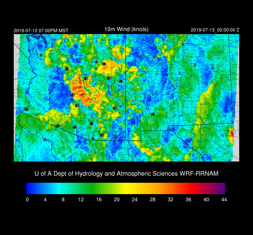
A few storms do pop up around Tucson during the early evening hours but nothing widespread.  The main area of deep convection moves into Mexico.
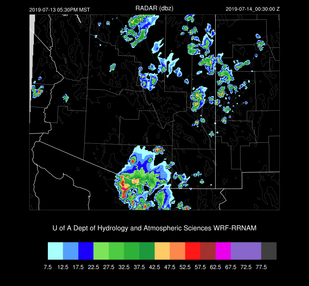

The chances for a significant outflow and resulting dust storm of Pinal and Maricopa Counties is low as only the WRFNAM has this result.
I’ve been waiting for the delayed 15Z WRFRR, and it’s very interesting.  It has a bit more clouds than the other runs but still not enough, but heating is close to observed at 18Z.  It develops very strong storms on the outflow boundary as it moves through Tucson.


This run moves the weakening outflows into Pinal county during the evening and should be strong enough for some blowing dust.
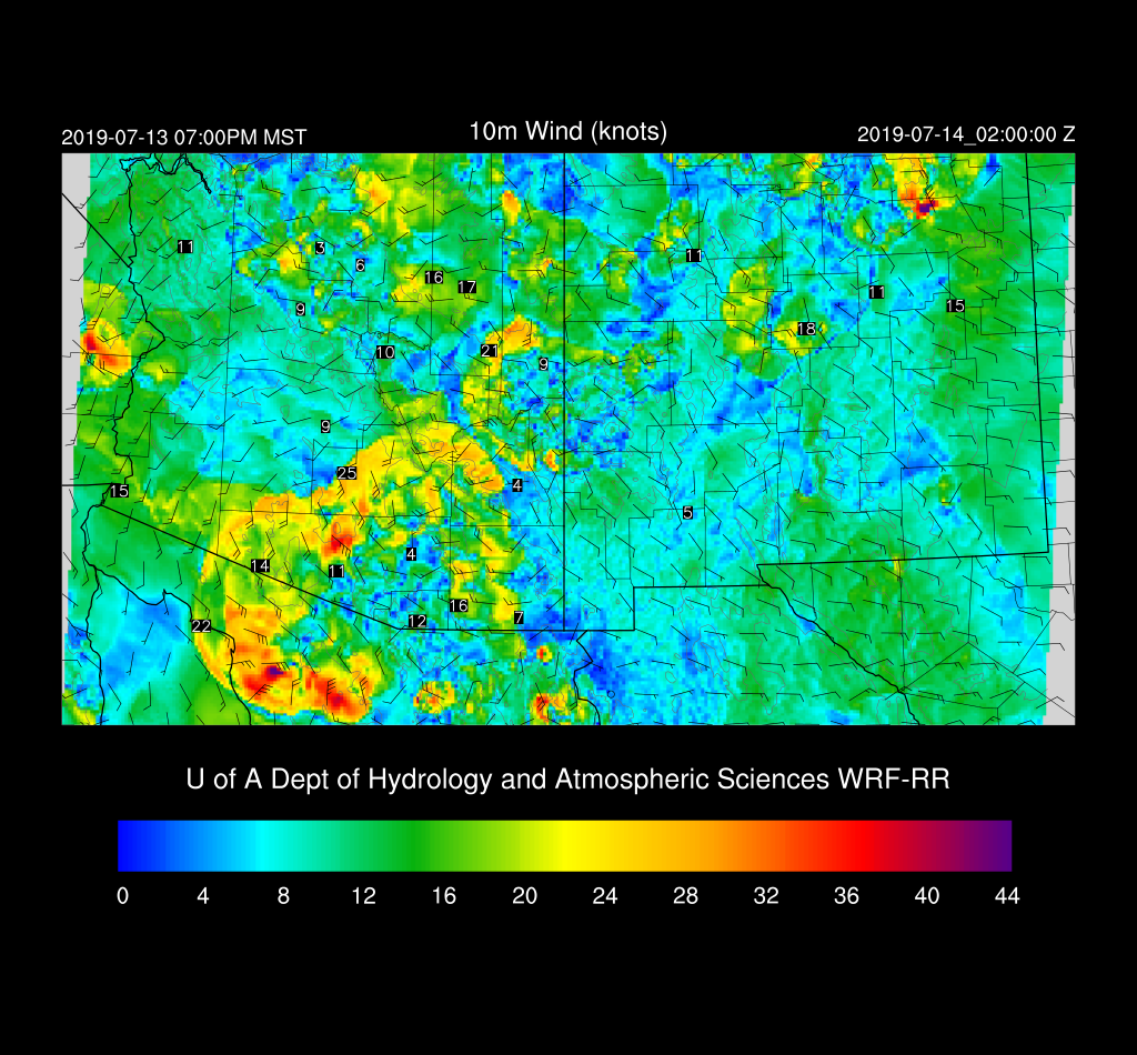

Day 2
Moisture increases over much of central and western Arizona, but the surge weakens.


CAPE increases as well with moderate to high CAPE over south-central and southwestern Arizona.


The Phoenix forecast vertical profile forecast has only a shallow layer of moisture as well as a weak inversion.  It’s likely much of the moisture mixes out during the day and CAPE decreases.


The Tucson forecast has a moderate amount of CAPE, good winds, but the PBL mixed very deeply.


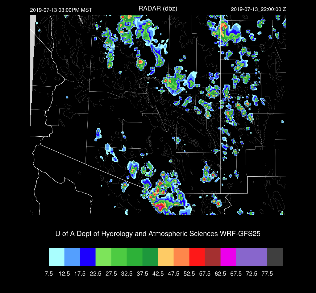
Most afternoon activity stays over the higher terrain near the border and over the Rim/White Mountains.  


The WRFGFS does develop a few storms in southeastern Arizona during the evening hours, but I wouldn’t bet money on it.


Friday, July 12, 2019

20190712

Previous Forecast
Not much activity in Arizona except for a few storms up around Flagstaff.  NM was quite active, and in general, the WRF performed well except not enough activity in SW NM.


Initializations
The 500mb pattern is about the same as yesterday with a ridge centered over the Four Corners.  A weak IT was noted in the upper data over north-central Mexico and another over southeastern California.  Satellite imagery shows another cyclonic circulation (MCV?) moving into far SE Arizona. The larger troughs are initialized well, and both the NAM and GFS have a weak IT in the general area of the MCV. It is quite cloudy over the state due to a combination of the CA IT plus the weak MCV.  Satellite trends indicate clouds are dissipating over SE Arizona, but they are hanging on over central and western Arizona. There are even a few showers in NW Arizona. The 12Z RR has the clouds and showers in western AZ but is missing clouds elsewhere. The 12Z NAM is better as it has some clouds over SE Arizona and the 12Z GFS has also initialized clouds well.  PW initialization errors are minimal. The NAM and GFS appear to have the best initialization.


Day 1
Moisture has continued to increase as wetter air moved in from NM overnight.  Surface dew-points have increased into the upper 40’s and low 50’s and PW is around 25-30mm.  Moisture is forecast to slowly increase throughout the morning, which I do not really see in the GPSIPW as of 16Z.

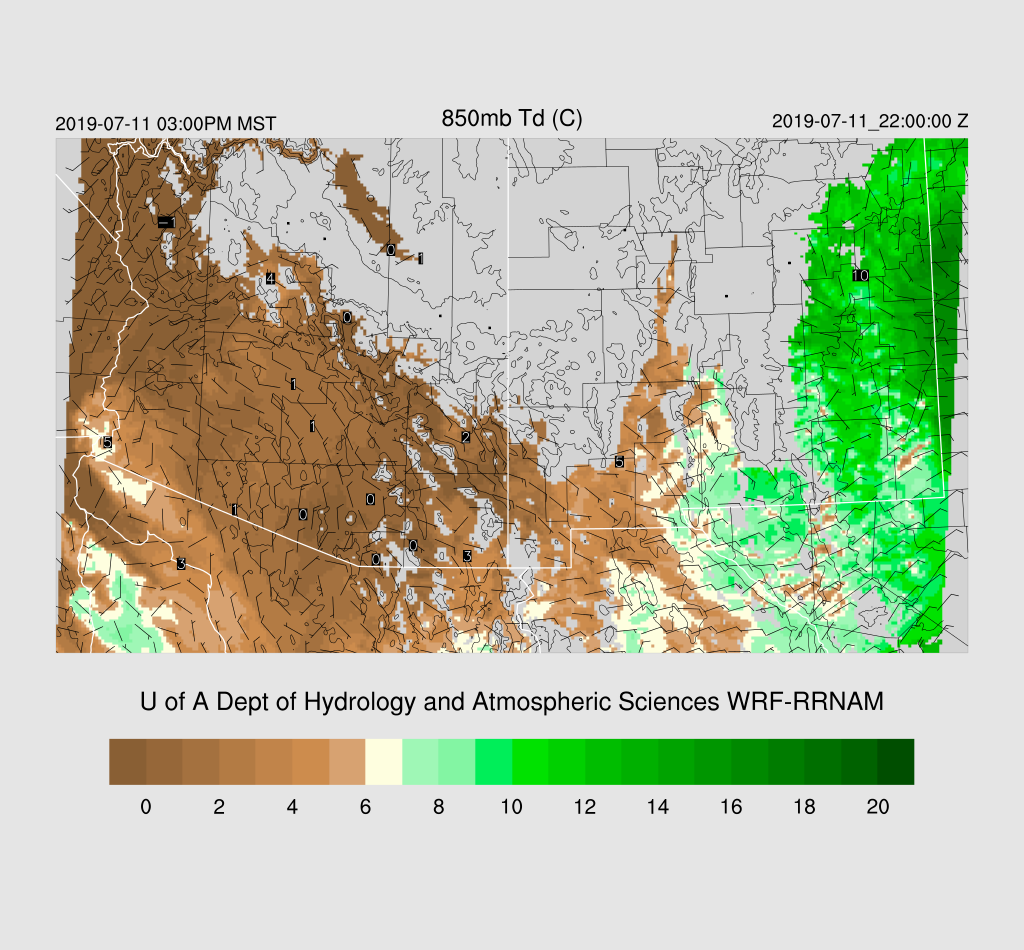
850mb Td has increased in eastern Arizona but is still below 10C so the situation for storms is better compared to yesterday, it’s still not great.


Low to moderate CAPE is present over eastern Arizona and along the Mogollon Rim and the White Mountains thus I’d expect to see some fairly strong storms especially over the high terrain.


Steering flow is mainly southeasterly at 5-15 knots.  Note the IT over Nogales which may increase chances for storms over southern Arizona today.


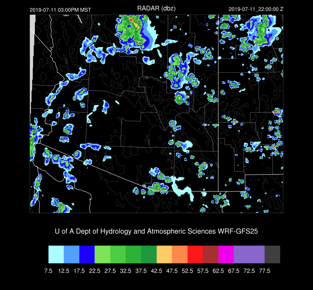
Scattered storms are underway by afternoon over the higher terrain.  The WRFRR has more activity over SE Arizona. It is the odd man out as the other two runs don’t have too much activity at this time.  It will be interesting to see what the 15Z WRFRR has to say later this morning especially as last year it was usually the best performing run.


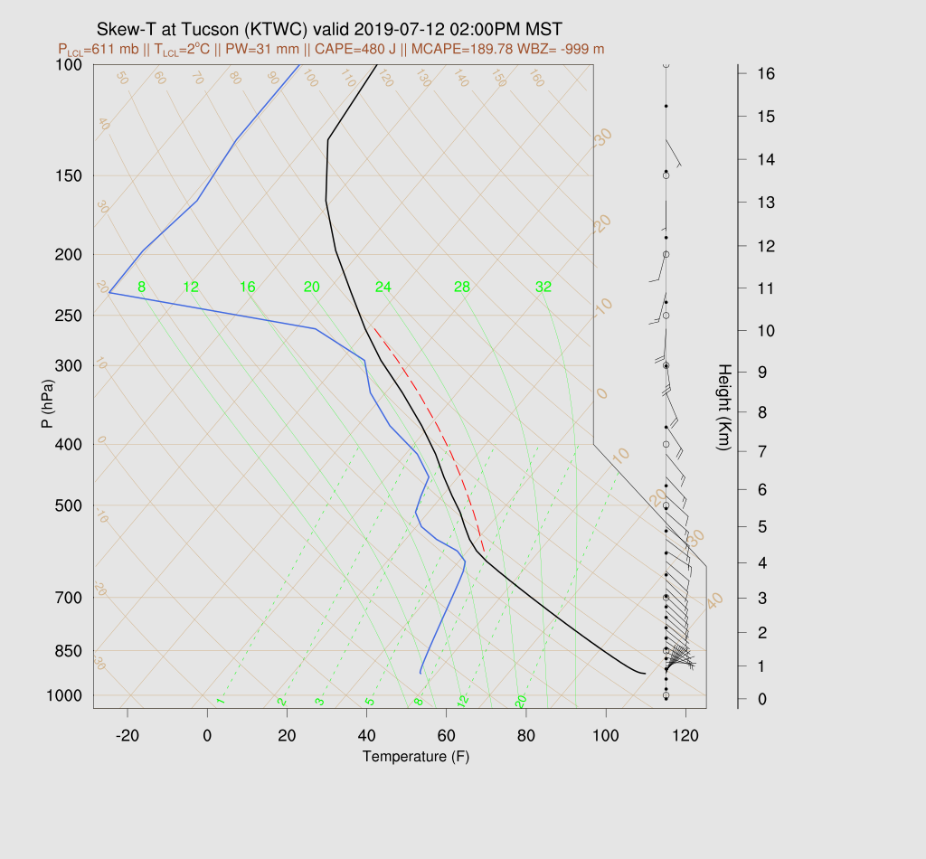
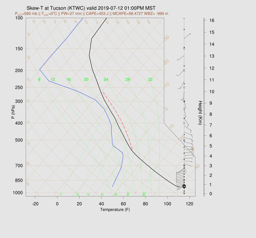
The Tucson forecast Skew-T plot displays a deep mixed layer and good SE steering winds.  However, CAPE is pretty low from 200-400 J/kg but looks to be enough to support some storms.


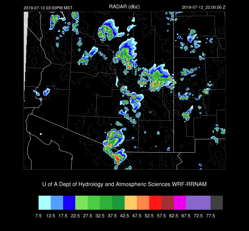
By late afternoon, both the WRFGFS and NAM have only isolated storms over SE Arizona.  Elsewhere, storms develop to the NE of Phoenix. This is the area of interest yesterday as some runs predicted strong thunderstorm outflows for the Phoenix area.


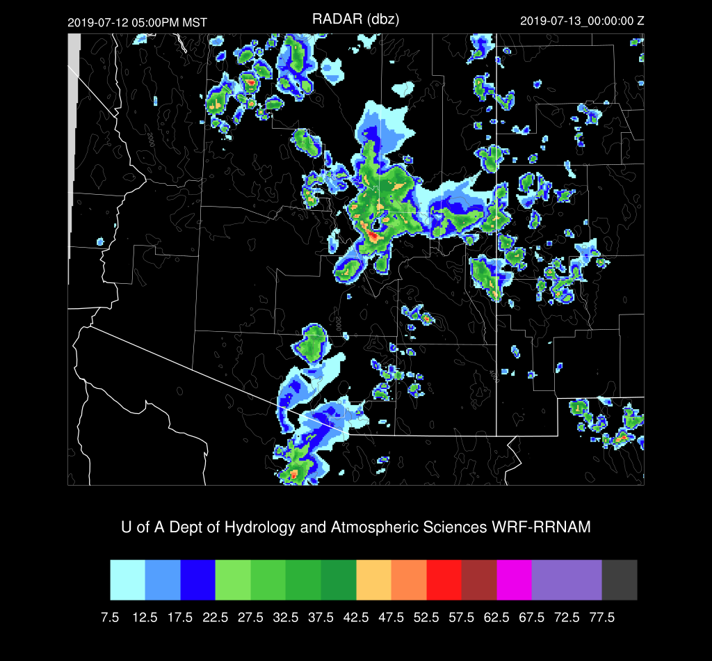
All three of the runs have outflows of varying intensity moving into the Phoenix area this evening. Haboob producing, probably not, but some blowing dust is likely.


A few weak storms may pop up on the edge of the outflow boundary near the Phoenix area.

Day 2
A gulf surge gets underway by tomorrow in increases PW into much of the state.  There is a tropical system quite far south of Baja which moves NW and may be partially responsible.  Weak low-level easterly flow brings drier air into far eastern Arizona.


CAPE is again generally low over much of the state but enough to support higher elevation storms.


Again, just enough CAPE to support mainly higher elevation storms.  Steering flow is good for moving what storms form, but it’s doubtful that they’ll make it into the lower elevations.


Once again, the Rim/White Mountains will see scattered storms.  The only significant area of deep convection looks to be over far southern Arizona where an area of strong storms form as CAPE is higher there.  


Will there be strong storms as far north as Tucson?  Maybe.
 All this southern Arizona activity is likely to generate a big outflow boundary which moves over the dust sources of Pinal County thus possibly generating a big haboob for the Phoenix area.

Thursday, July 11, 2019

20190711

General Discussion

These forecasts discussions sure have been few and far between so far as the monsoon continues to sputter.  It’s just not us as far NW Mexico hasn’t had much activity either, and the outflow from Mesoscale Convective Systems there play an important role by increasing the moisture in Arizona through either direct outflows or northern Gulf of California outflow induced surges.  What storms there have been in NW Mexico have been restricted to far southern Sonora at best and not well organized and stuck over the higher terrain as depicted below in the past 24 hours lightning plot. So, to me, it looks like it’s still going to be some time before the monsoon cranks up.

Model Initializations

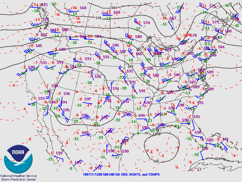
The 500mb plot from 12Z sure looks like a classic monsoon pattern with the anticyclone located near the Four Corners, it sure isn’t turning out that way.  One issue is the strong subsidence around the nearly 6000m high center. There was a substantial area seen over eastern NM in the “low-level WV” GOES channel. No significant inverted troughs were evident in either the 500mb plot or satellite imagery.  An area of clouds is present over western Arizona and south into Mexico which may be the result of a weak trough. Model initializations have a weak inverted trough over southern Baja which may or may not be there. Empalme SON sounding data was missing this morning.  

All three (RR, NAM, and GFS) had only minimal PW initialization errors this morning.  The RR did not have enough clouds initialized in western AZ while the GFS and NAM were very good.  Maybe the 15Z RR will be better. In any case, that error should not matter as no activity is expected for that area.  Generally, all initializations are good, and model confidence is high.

Day 1
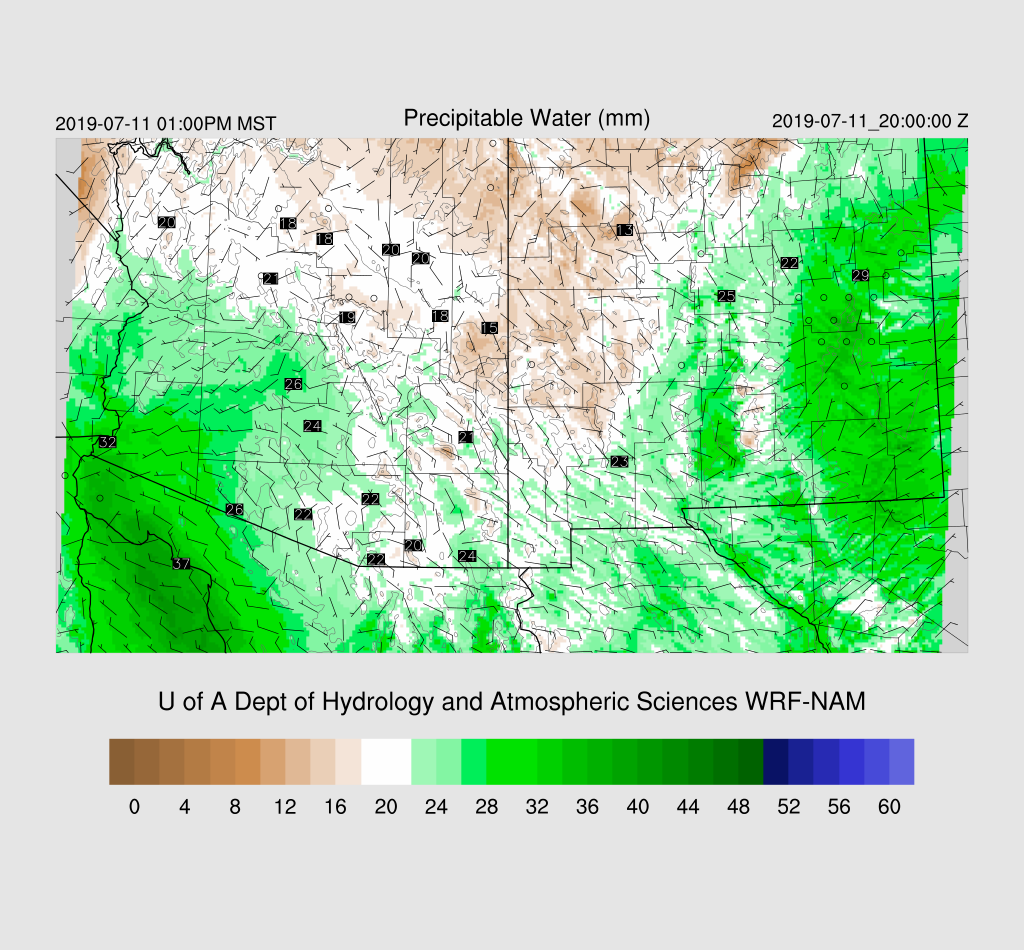
Moderately wet air is present over western Arizona by mid-day while much of eastern Arizona and western NM are quite dry as that area of subsidence in NM moves to the west.  However, quite wet air is moving into central NM and is likely to be a factor for Arizona tomorrow.  

Way too dry at 850mb to support any significant lower elevation activity today or into this evening.
There is a bit of CAPE in the WRFGFS and WRFNAM over far eastern Arizona and along the Rim this afternoon which will support some showers and weak storms which will result in some gusty winds but not much/any rain.

Tucson may see some gusty outflow winds from nearby higher elevation storms this evening.


Day 2
The area of moisture in NM moves into SE Arizona while weak moisture advection continues into western and central Arizona.

Enough CAPE is present to support scattered showers and storms over much of eastern Arizona and along the Rim/White Mountains during the afternoon and evening.  

The forecast Skew-T plot for Tucson indicates there is a little CAPE present and might enough to support a few lower elevation storms.  Please be aware that the Skewt-T CAPE calculation and positive area have been especially wrong this year after transitioning to 43 sigma layers and I’m looking at the problem, again.  The Max CAPE is OK but can’t be used to plot the positive area. Steering flow is suitable for moving storms off the higher terrain.

Storm coverage and intensity are on the upswing, and by afternoon, scattered storms are underway over the higher terrain.  The WRFRR is in the middle of the road of the three runs.

The WRFGFS is more active over far southern Arizona, but it still looks like the stronger activity stays out of Tucson.

 By late in the afternoon, a few storms do move towards the Phoenix area, and you know what this means!

Haboob!  It’s not especially strong nor does it move that far into the western deserts, but at least it’s something.

Saturday, July 6, 2019

20190706

Model Initialization

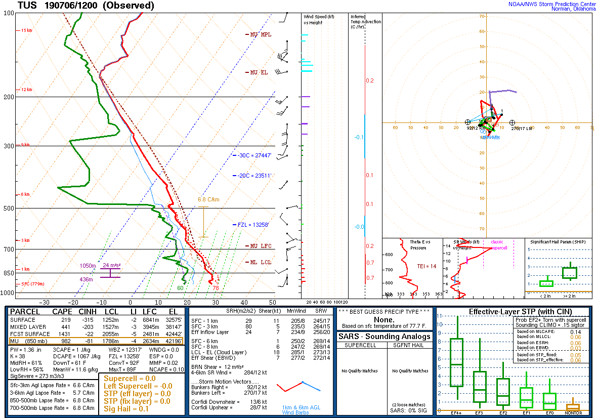
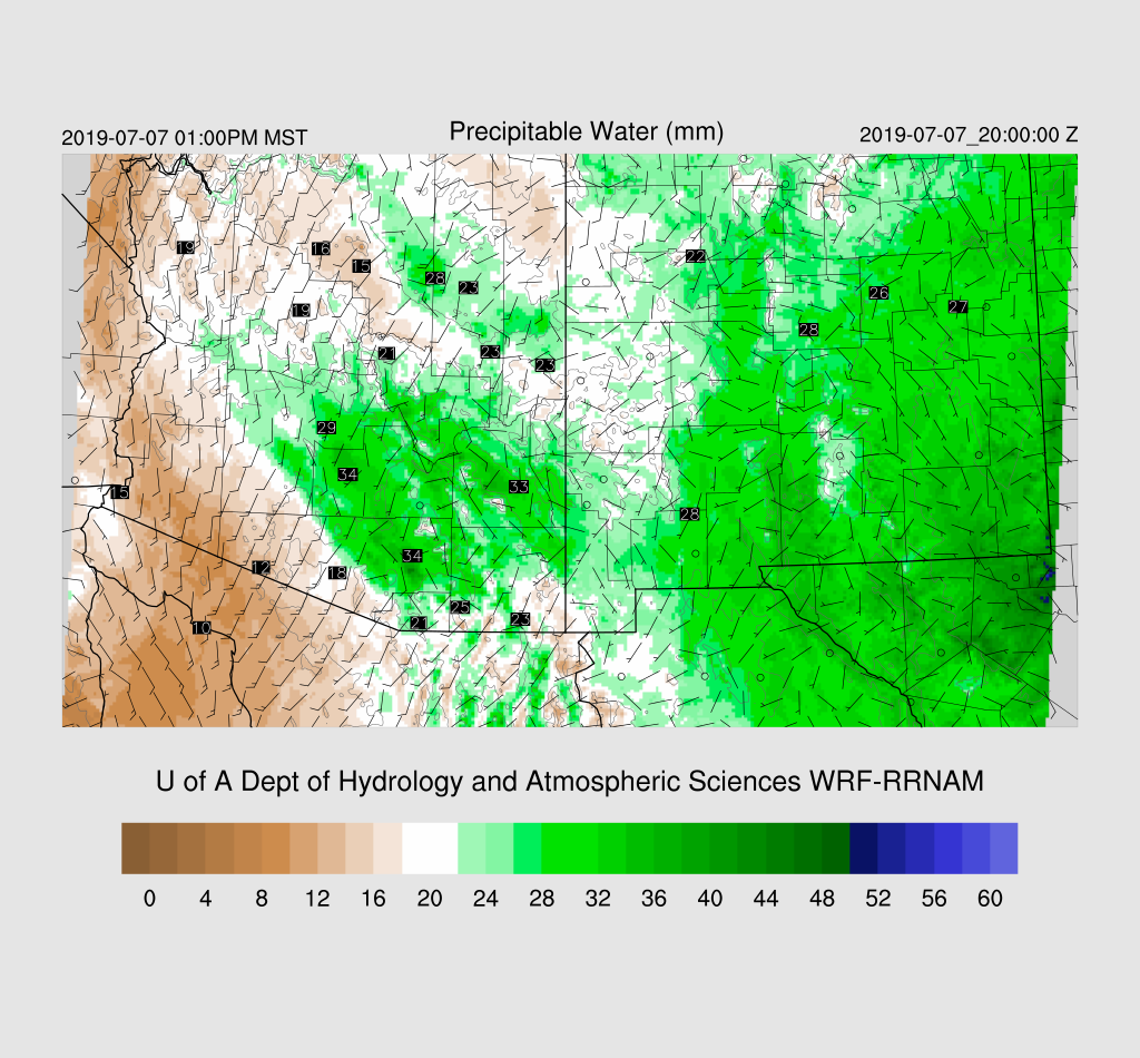
There has been a significant push of moisture into the Tucson area and west of there as a strong outflow boundary moved through last evening.  GPSIPW has increased to 32-34mm across SE Arizona and the 12Z morning sounding from Tucson reported 34 mm plus 441 J/kg of mixed layer CAPE. This is the first decent situation for the Tucson area.  

The 12Z RR and 6Z GFS had only minimal IPW errors while the NAM was a bit worse as it was a bit too dry from SE Arizona into New Mexico but it’s wasn’t too bad.   The 6z WRFGFS run at 12Z didn’t have enough moisture in the lowest 100mb part of the atmosphere.  

Morning clouds are present over parts of SE Arizona with thick clouds over east-central and into NM.  All the initializations do a good job and have clouds depicted well. Of special interest is the obvious cyclonic circulation just south of Nogales.  It looks like an MCV but could just as well be a larger inverted trough. In any case, the 12Z initializations both have this feature while the 6Z WRFGFS does not.  I’m thinking this feature is going to play an important role in organizing storms for SE Arizona later today. The 500mb plot shows that there is a general cyclonic circulation over NW Mexico so maybe it’s actually a weak IT.  Another notable feature on the 500mb plot is the return of the sounding from Empalme Mexico! Great news!

Overall, the 12Z initializations look good and confidence in them is high.

Day 1
First thing I did this morning was to walk outside and I immediately thought it felt like it was going to be an active day.  Who needs fancy models and weather maps to forecast the weather! Well, I better check them to be sure. As mentioned earlier, the situation looks favorable as moisture/CAPE is present as well as a weak IT just to the south.  By late morning, the IT moves over the Tucson area which results in decent SE steering flow.
   

Moisture levels remain about the same into early afternoon and 850mb Td is around 10C which is my minimum requirement for storms.

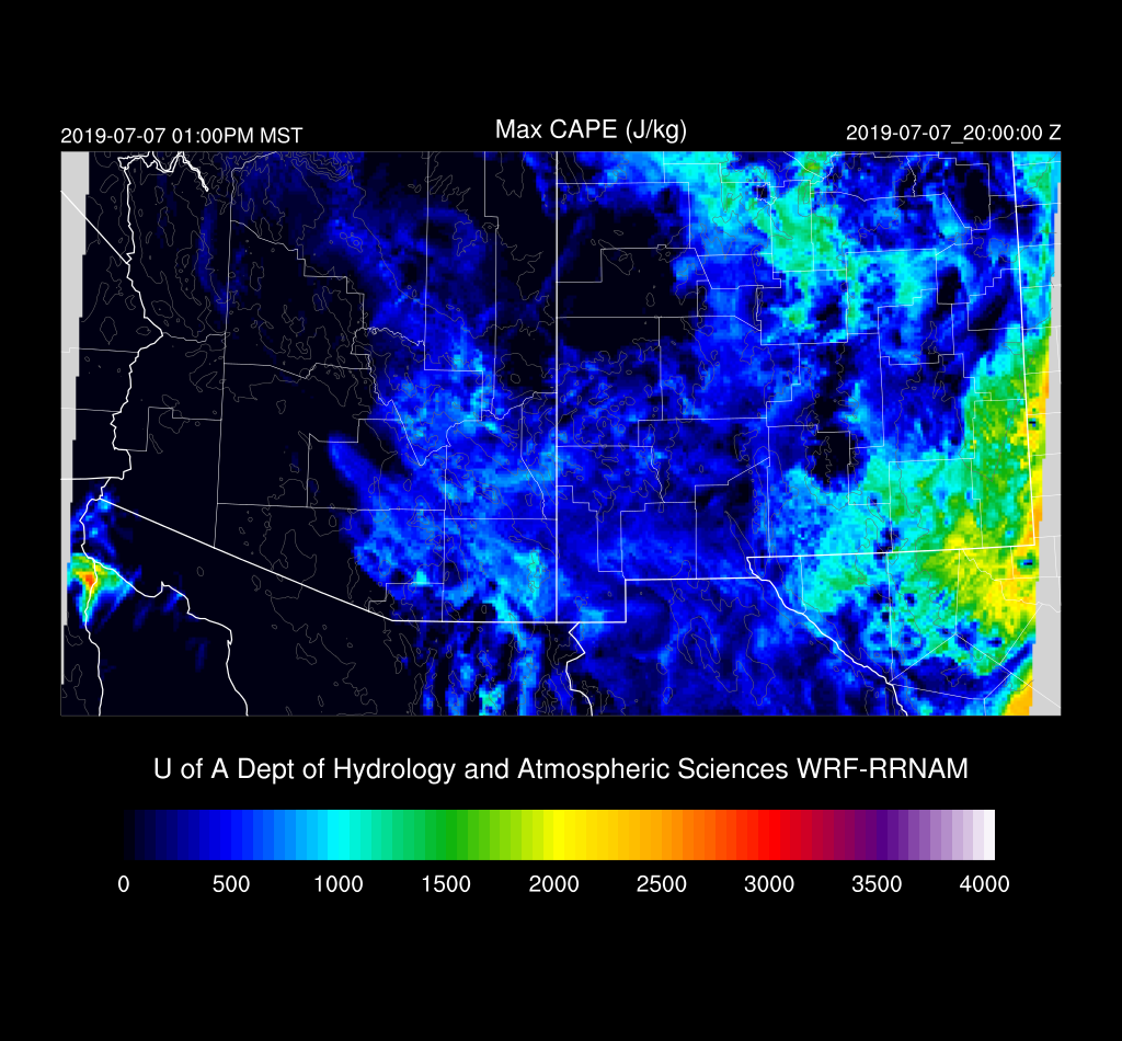
Both the WRFNAM and WRFGFS have areas of low to moderate CAPE over SE Arizona and specifically, over Tucson.  It should be enough to support storms.

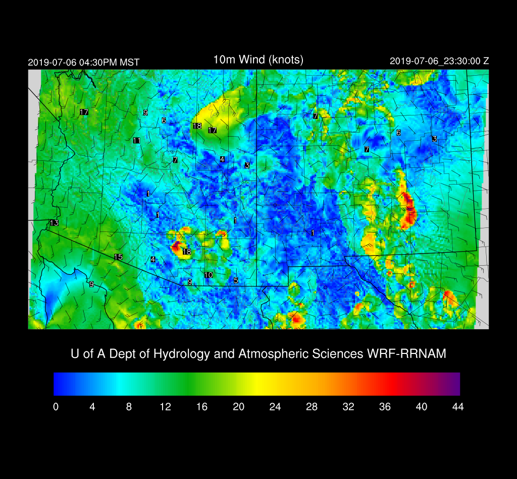
The WRFRR forecast vertical profile looks favorable for storms this afternoon as the PBL becomes deeply mixed with a moderate amount of CAPE, good mid-level steering flow, and some low-level NW flow.  A pronounced inverted V profile is present thus storms are likely to have very strong winds.

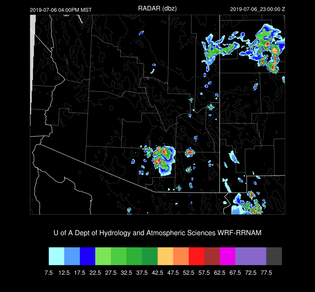
Does all this mean we actually get activity in Tucson?   The WRFRR thinks so as it develops storms over the higher terrain to the SE and these move into the Tucson valley during the late afternoon.

However, the WRFNAM does what is more typical which is to developed storms over the higher terrain east and west of the valley and not actually move them into Tucson.  So, it looks likely that a strong outflow will move into the Tucson valley with maybe a few storms.  

Not much rain is expected out of these storms for the low elevations but some could produce very strong to marginal severe winds.  The ensemble max shows the possibility of up to an inch for the Catalina mountains.
Scattered storms continue into the evening hours over SE Arizona.

Day 2
Well, that didn’t last long.  By early afternoon strong dry air advection is underway over SW Arizona.  Will the wet air stick around long enough for afternoon storms to form? Maybe.

Enough CAPE is present over SE Arizona to support some storm activity.

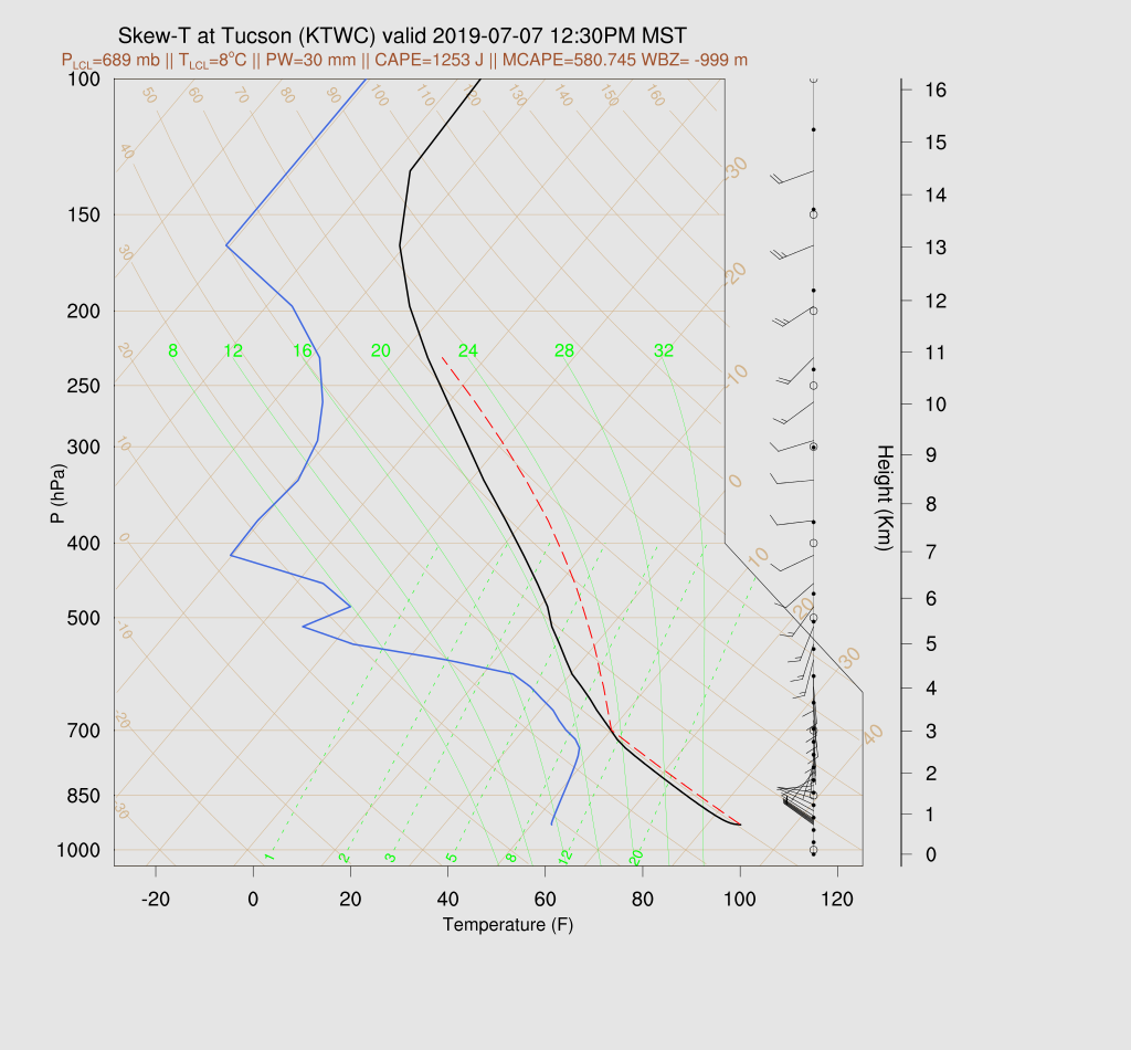
In fact, the Skew-T for Tucson looks pretty good as surface based CAPE is over 1000 J/kg and the other CAPE calculation is almost 600 J/kg. 

Both 12Z runs develop scattered storms during the early afternoon hours over the higher terrain of SE and SC Arizona but rapidly decrease in the Tucson area as the dry air moves in.  It looks like that’s it for a few days.