Previous Forecast
Last night, storms moved off of the Rim and into the lower elevations, south of Phoenix, and managed to go all the way to Yuma County. There is some evidence that they may have come all the way from the Chuska Mountains in NE, Arizona.

I debated about a discussion yesterday but ultimately decided against it as there was no clear model consensus. As seen below, both the WRFRR and GFS(!) predicted this event.


Discussion
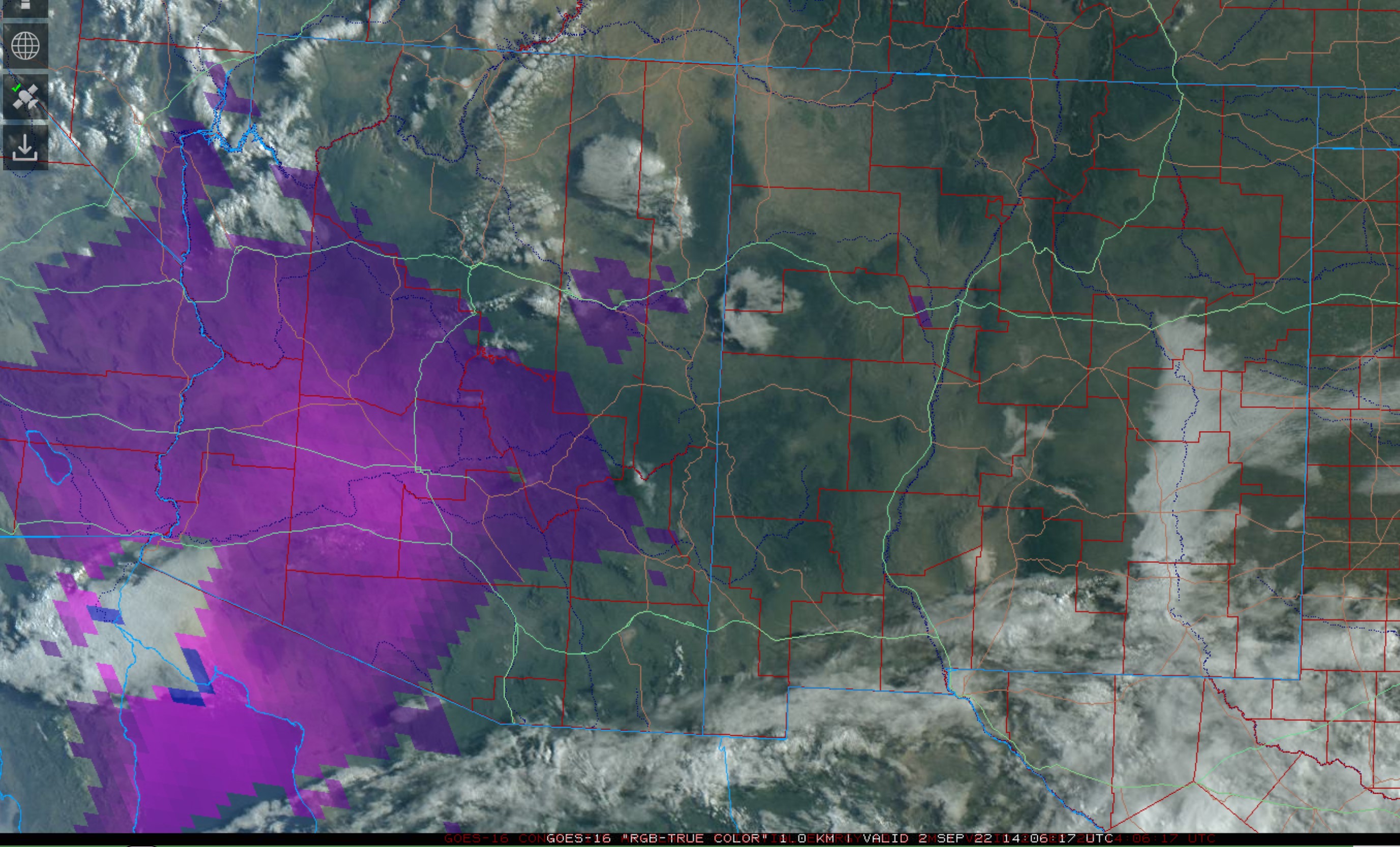
The big news is tropical storm Javier, just to the southwest of southern Baja. Widespread storms continue over the southern and central Gulf of California. Unfortunately, Suominet seems to be down for good as there has been no response to my emails, as almost all stations are now missing. It's sad and pathetic that such an essential and inexpensive data network was allowed to die. Without the high temporal resolution data, it's hard to judge short-term and long-term moisture advection. GOES PW can partially fill the gap, but not where there are clouds.
Phoenix has around 40mm of PW, but MLCAPE is only 553 J/kg. There is quite a bit of elevated CAPE, 1200 J/kg, and this CAPE appears to be the source of the overnight storms. A strong subsidence inversion is present at 500mb and may be trouble for deep convection later today/tonight. Steering flow is good from the ENE at 20-25 knots, but there are any low-level westerlies to provide any shear. This may change as a strong (at least at the surface) Gulf Surge is underway at Yuma. Without Suominet PW data or a Yuma sounding, it is impossible to determine the Surge's depth.


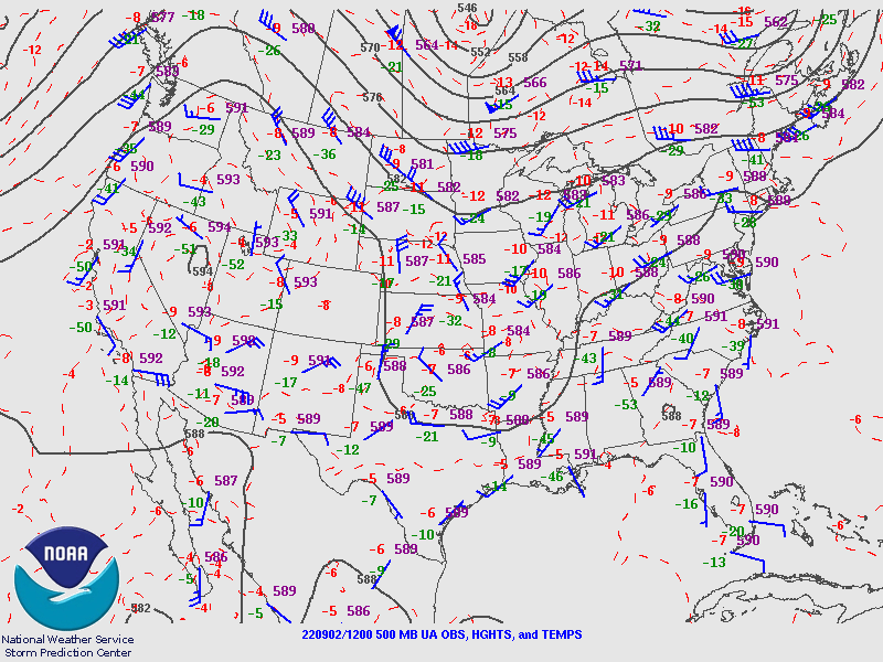
There was a large inverted trough moving across far northern Mexico the past few days, but it's becoming washed out and hard to find on the 500mb map. Satellite imagery shows it to be located somewhere over the northern GofC. A broad ridge dominates the western CONUS. 500mb temperatures are pretty cool over the SW CONUS, but as the soundings from Phoenix and Tucson show, there is a strong inversion at or above 500mb.

Initializations
I took a quick look at the initializations and found no significant problems. Note the decent CAPE from Phoenix and west of there. CAPE was also initialized well.
Day 1
This afternoon, Javier continues to spin off of southern Baja resulting in low-level flow up the Gulf of California and a weak Surge event for Arizona.


As expected, CAPE is moderate to very high with this much moisture at 850mb. SE Arizona is under the influence of downsloping easterly flow, so CAPE is minimal. It is also dry over much of NE Arizona, resulting in limited CAPE. Still, moisture/CAPE has made it into the moderately high terrain north and east of Phoenix, resulting in deep convection later today.

There is excellent model consensus in developing scattered storms in these areas by later in the afternoon.

It will be difficult for Phoenix to break the cap at the top of the mixed layer, plus the PBL is not mixed deeply. Besides that, the forecast Skew-T looks pretty good, with a lot of CAPE, some low-level shear, and 20-25 knot easterly steering flow. While the subsidence inversion is still present, it appears less intense than the morning-sounding data. As usual, it's a difficult call for Phoenix proper.

There is a unanimous consensus that the storms split and go around Phoenix this evening. Some of these storms are likely to produce severe winds.

Morning DCAPE was nearly 1400 J/kg which supports the forecast of a few storms producing severe winds. Storms generally die out as they move to the southwest due to the strong cap at the top of the mixed layer, but one or two might make it to the Colorado River valley.


Day 2
Javier moves slowly to the NW but is close enough to continue a weak surge into southwestern Arizona. However, low-level easterly flow dominates most of the eastern 1/2 of the state.

850mb is especially sad, as significant drying from subsidence/downsloping will occur, even into central Arizona.

West of the dry air, CAPE is still moderate to high but strongly capped.


No comments:
Post a Comment
Note: Only a member of this blog may post a comment.