Previous Forecast
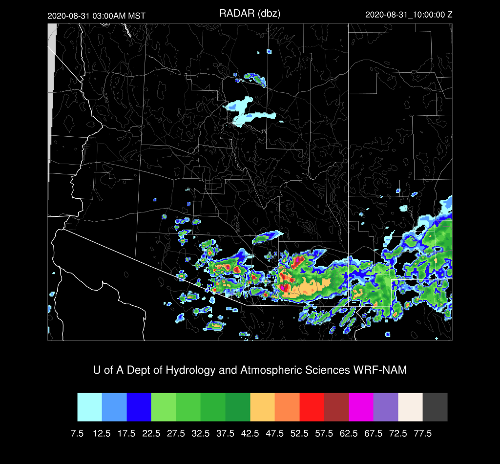
It turned out to be an active afternoon and evening over much of the state with much of the activity just west of Tucson.


It turns out that the Day 2 forecasts from Friday were better, which has typically not been the case this year.


Discussion
All the activity from last evening has significantly altered the air-mass for parts of southern Arizona. PW has decreased over southeastern and southcentral Arizona and the soundings exhibit the worked-over "onion" profile. However, PW continues to increase over western Arizona as Yuma is now over 50mm and Puerto Penasco is 57mm. Hermosillo was as high as 62mm overnight!

CAPE is minimal for both Tucson and Phoenix so the big question is if the atmosphere can recover enough for afternoon and evening thunderstorms. The profiles have less warm air in the upper levels which is positive. Both locations have some speed shear, but not much directional shear.


Initializations
All the initializations have an inverted trough initialized in the area with extensive clouds and some showers. Thick clouds stretch to the northeast across southeastern Arizona and these are initialized well. GFS and RR PW initializations were mostly accurate. The NAM was somewhat too moist at 12Z, but the correction routine should be able to take care of that. Overall, the initializations are not too bad considering the complexity.
Day 1
Well, here goes nothing. Deep southeasterly flow continues to advect very moist air into Arizona, as T.D. Iselle remains mainly stationary.

PW is very high over much of southern Arizona, so the main threat is very heavy rain/flash flooding. There is quite a large difference between the 6 and 12Z runs regarding PW for Tucson and Phoenix as 6Z is about 5mm wetter. I don't think the 6Z initializations were able to correctly predict the drying that occurred after the previous day's activity. The 6Z WRFGFS is running 12mm wetter at 15Z at Phoenix!


And it is, at least at Yuma. The cap isn't quite as strong as I would of thought.

Phoenix doesn't look too bad, but PW is not nearly as high as was being forecast yesterday (~50mm) or even at 6Z. The inversion at the top of the mixed-layer is weak, so the potential for storms is still there. The wind profile isn't as good as it was in previous forecasts, but there is still some speed shear.

Tucson recovers somewhat by late afternoon. The mid-level IT is still located to the south of Tucson resulting in weak easterly flow below 500mb. Normally, this is good for steering storms from the higher terrain, but areas east of Tucson will have minimal deep convection.


All the runs manage to move/develop storms in and around the Phoenix this evening. Nothing like the forecasts were saying yesterday, though.

Confidence in any specific details of any model run is very low as the situation is complex, there is a lot of PW, which could trigger deep convection about any time of the day or night, and there is no model consensus.

Not much happens around the Tucson area during the afternoon and evening except for a few isolated storms as the area never recovers after the activity yesterday, partially because of all the clouds around. However, by the early morning hours, moisture increases and the inverted trough moves towards the area. CAPE is sufficient to support storms, and it won't take much to trigger deep convection. PW is high so storms will produce extremely heavy rain.

Both the WRFGFS and NAM develop scattered early morning activity.
This has the potential to be an extreme rainfall event for somewhere in southern Arizona.

A look at the HRRR is interesting as it keeps the area of thunderstorms near the Sonoran IT going all the way into southern Arizona this afternoon. It's a possibility, as deep convection continues at 17Z over the coastal areas of Sonora, moving northward. The HRRR doesn't move the storms into Tucson, of course. 22Z forecast.

Day 2
Iselle continues to remain stationary off the southern Baja resulting in continuous moisture advection into Arizona for another day. This is quite unusual for 3 days in a row.

PW continues to be very high with 50mm and greater, for much of southwestern Arizona.

CAPE is again moderate to high, and the questions will be how strong is the cap and where/when will it break? This high moisture, high CAPE environment is proving difficult for WRF to forecast correctly.

Ugh, there is quite a cap during the afternoon hours at Phoenix.

Tucson? There is only a minimal inversion, but not much CAPE. The forecast is also dependent on what happens overnight so confidence is very low.

Both the WRFRR and NAM develop intense storms north of Phoenix by late afternoon.

The cap erodes as there appears to be a shortwave that is moving through central Arizona, providing a little synoptic scale lift, and slightly cooler mid-level air.


No comments:
Post a Comment
Note: Only a member of this blog may post a comment.