Previous Forecast
Most thunderstorm activity was restricted from around Flagstaff and westward. Sonora had a large MCS overnight and heavy precipitation was just south of the border.
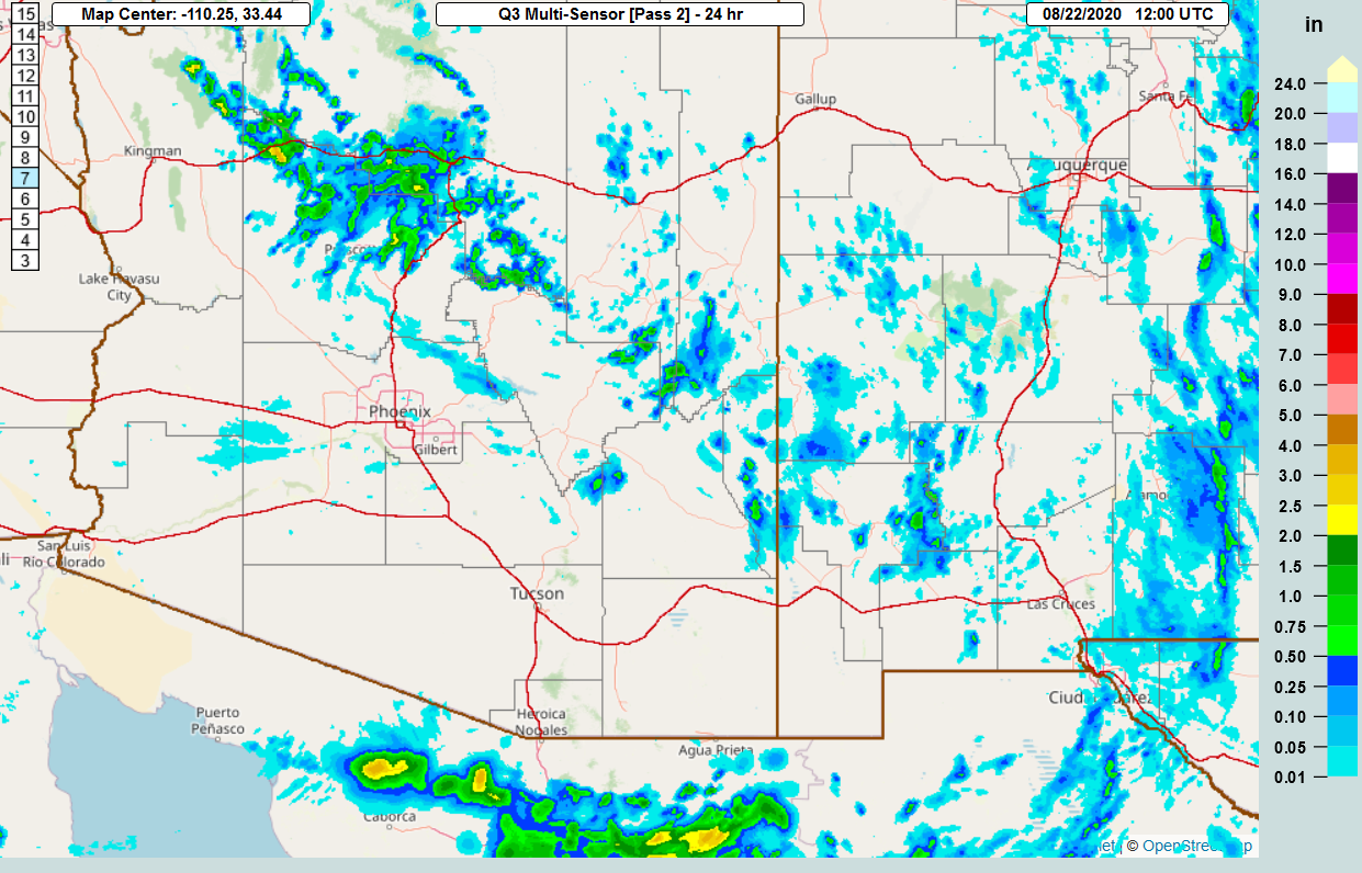
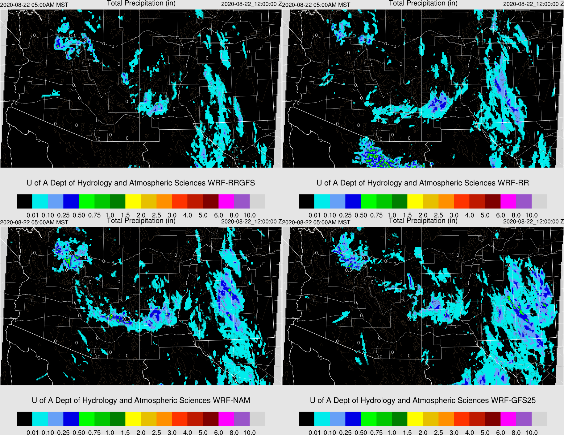
The model accuracy was pretty good for most runs. The WRFNAM predicted early morning activity across southeastern Arizona which never materialized. One of the RR runs was able to predict the Sonoran MCS. I'd give the gold star to the WRFGFS.
Discussion
It is humid out there this morning as surface dewpoints range from the mid 60s to over 70 degrees. PW has also increased and much of southwestern Arizona is over 40mm.

GOES derived CAPE is also high, especially over the Tucson area.

The 500mb pattern is about the same except midlevel steering is better at 25 knots over Arizona.

As discussed yesterday, the high CAPE airmass is strongly capped. It's doubtful this will be broken anywhere over the lower elevations today.

Initializations
The MCV responsible for the debris clouds over southern Arizona is roughly over Puerto Penasco. The initializations struggled a bit with this feature as most had nothing more than a weak IT. Clouds were also not initialized well, but all this shouldn't matter much as it's all moving west.
PW was initialized very poorly by the 6Z NAM, and somewhat better in the 12Z NAM. The 6Z GFS and 12Z RR were OK.
Day 1
I find it interesting how none of this moisture has made it into NE Arizona or western NM. I guess the cap isn't letting it mix up thus it's blocked by the high terrain. Typically, it eventually spreads over much of the state. This isn't a typical year.

CAPE is moderate to high just about everywhere over the low and mid-elevations of the state.


Is the cap weak anywhere? Nogales looks pretty good.

Southeastern Arizona is the only location in the state to see significant activity. Storms develop over the Gila Wilderness in NM and move to the southwest across Cochise County during the evening.

Day 2
PW decreases a little compared to today but is still plenty high. The surge has weakened thus moisture transport has stopped. Dry air continues in NE Arizona and is trying to move into far SE Arizona.

CAPE is still moderate to high over all of the lower elevations.

I'm sure you are all eagerly awaiting to hear about the cap. The good news is that it's quite weak. The bad news is it looks like dry air at 700mb is being entrained into the top of the mixed layer, preventing it from growing. By late afternoon, it's still shallow. Nevertheless, a strong outflow boundary might be able to trigger deep convection.

Scattered storms develop later in the afternoon, mainly over eastern Arizona. As seen above, steering flow is fairly good and will move the storms to the west or southwest and they may be able to make it into the Tucson area.

Phoenix might get into the action too, as steering flow is favorable for moving storms from the east into the area. While the CBL is fairly shallow, the inversion is weak and CAPE is more than enough. Some runs do develop deep convection in and near Phoenix later in the evening.

No comments:
Post a Comment
Note: Only a member of this blog may post a comment.